List of designated places in Alberta

Last updated

Aerial view of the Hamlet of Langdon, Alberta's most populous designated place Langdon, Alberta.JPG
Aerial view of the Hamlet of Langdon, Alberta's most populous designated place

A designated place is a type of geographic unit used by Statistics Canada to disseminate census data. [1] It is usually "a small community that does not meet the criteria used to define incorporated municipalities or Statistics Canada population centres (areas with a population of at least 1,000 and no fewer than 400 persons per square kilometre)." [2] Provincial and territorial authorities collaborate with Statistics Canada in the creation of designated places so that data can be published for sub-areas within municipalities. [2] Starting in 2016, Statistics Canada allowed the overlapping of designated places with population centres. [2]

Contents

At the 2021 Census of Population, Alberta had 311 designated places, an increase from 304 in 2011. [3] Designated place types in Alberta include 18 dissolved municipalities, 10 Métis settlements, and 283 unincorporated places. [4] In 2021, the 311 designated places had a cumulative population of 78,571 and an average population of 253. Alberta's largest designated place is Langdon with a population of 5,497. [4]

List

Total designated places78,57179,189−0.8%6,313.26
Province of Alberta4,262,6354,067,175+4.8%634,658.27

Retired designated places

T & E Trailer Park, located within the City of Grande Prairie, was last recognized as a designated place in the 2006 Census of Canada. [5] [6]

See also

Notes

  1. Different from the Town of Fairview in northwest Alberta.
  2. Also known as Ferrier.
  3. One of two parts of Gift Lake Metis Settlement.
  4. One of two parts of Gift Lake Metis Settlement.
  5. One of two parts of Kikino Metis Settlement.
  6. One of two parts of Kikino Metis Settlement.
  7. Different from the Hamlet of Poplar Ridge in Brazeau County.
  8. Mistakenly spelled Shaftsbury Settlement by Statistics Canada.

Related Research Articles

<span class="mw-page-title-main">Fort Chipewyan</span> Hamlet in Alberta, Canada

Fort Chipewyan, commonly referred to as Fort Chip, is a hamlet in northern Alberta, Canada, within the Regional Municipality (RM) of Wood Buffalo. It is located on the western tip of Lake Athabasca, adjacent to Wood Buffalo National Park, approximately 223 kilometres (139 mi) north of Fort McMurray.

<span class="mw-page-title-main">Crowsnest Pass, Alberta</span> Specialized municipality in Alberta, Canada

The Municipality of Crowsnest Pass is a specialized municipality in southwest Alberta, Canada. Within the Rocky Mountains adjacent to the eponymous Crowsnest Pass, the municipality formed as a result of the 1979 amalgamation of five municipalities – the Village of Bellevue, the Town of Blairmore, the Town of Coleman, the Village of Frank, and Improvement District No. 5, which included the Hamlet of Hillcrest and numerous other unincorporated communities.
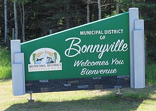
<span class="mw-page-title-main">Municipal District of Bonnyville No. 87</span> Municipal district in Alberta, Canada

The Municipal District of Bonnyville No. 87 is a municipal district (MD) in northeastern Alberta, Canada in Division No. 12. On the east, it is adjacent to the province of Saskatchewan.

<span class="mw-page-title-main">Lac La Biche County</span> Specialized municipality in Alberta, Canada

Lac La Biche County is a specialized municipality within Division No. 12 in northern Alberta, Canada. It was established through the amalgamation of the Town of Lac La Biche and Lakeland County in 2007.

<span class="mw-page-title-main">Big Lakes County</span> Municipal district in Alberta, Canada

Big Lakes County, formerly the Municipal District of Big Lakes, is a municipal district in north-central Alberta, Canada.

<span class="mw-page-title-main">Mackenzie County</span> Specialized municipality in Alberta, Canada

Mackenzie County is a specialized municipality in northern Alberta, Canada. It is located in Census Division 17, along the Mackenzie Highway. Mackenzie County municipal office is located in the Hamlet of Fort Vermilion.

<span class="mw-page-title-main">County of Northern Lights</span> Municipal district in Alberta, Canada

The County of Northern Lights is a municipal district in northwest Alberta, Canada. Located in Census Division 17, its municipal office is located in the Town of Manning.

<span class="mw-page-title-main">Smoky Lake County</span> Municipal district in Alberta, Canada

Smoky Lake County is a municipal district in north-eastern Alberta, Canada. Located in Census Division No. 12, its municipal office is located in the Town of Smoky Lake.

La Crete, also spelled La Crête, is a hamlet in northern Alberta, Canada, within Mackenzie County. It is located on Highway 697, approximately 57 kilometres (35 mi) southeast of High Level and 701 kilometres (436 mi) north of Edmonton.

Robb is a hamlet in west-central Alberta, Canada within Yellowhead County that is recognized as a designated place by Statistics Canada. It is located on Highway 47, approximately 53 kilometres (33 mi) southwest of Edson. It has an elevation of 1,140 metres (3,740 ft).

Marlboro is a hamlet in west-central Alberta, Canada within Yellowhead County. It is located on the Yellowhead Highway, approximately 25 kilometres (16 mi) west of Edson. Sundance Provincial Park is located northwest of the hamlet.

Wanham is a hamlet in northern Alberta, Canada within Birch Hills County. It is located 29 km (18 mi) east of Rycroft along Highway 49 and approximately 106 km (66 mi) north of Grande Prairie, in the farmlands of Peace River Country. Saddle River, a tributary of Peace River, flows immediately north of the community. The origin of the name Wanham could have come from Wanham in England.

<span class="mw-page-title-main">Peavine Metis Settlement</span> Metis Settlement in Alberta, Canada

Peavine Metis Settlement is a Metis settlement in northern Alberta, Canada within Big Lakes County. It is located on Highway 750 to the northeast of High Prairie.

Eaglesham is a hamlet in northern Alberta, Canada within Birch Hills County, located 6 kilometres (3.7 mi) north of Highway 49, approximately 89 kilometres (55 mi) northeast of Grande Prairie.

<span class="mw-page-title-main">Paddle Prairie Metis Settlement</span> Metis settlement in Alberta, Canada

Paddle Prairie Metis Settlement is a Metis settlement in northern Alberta, Canada along the northern boundary of the County of Northern Lights. It is located along the Mackenzie Highway (Highway 35), approximately 72 km (45 mi) south of the Town of High Level. Paddle Prairie Metis Settlement is the largest of eight Metis Settlements in the Province of Alberta. The community is rich in timber, natural resources and agricultural land. The community is also known for constructing solar power generating units for several of its community buildings.

<span class="mw-page-title-main">Gift Lake Metis Settlement</span> Metis Settlement in Alberta, Canada

Gift Lake Metis Settlement is a Metis settlement in northern Alberta, Canada within Big Lakes County. It is located along Highway 750, approximately 203 km (126 mi) northeast of Grande Prairie.

References

  1. "2006 Census Dictionary, Figure 20: Hierarchy of standard geographic units for dissemination, 2006 Census". Statistics Canada. November 20, 2009. Retrieved May 5, 2012.
  2. 1 2 3 "Dictionary, Census of Population, 2016: Designated place (DPL)". Statistics Canada. February 8, 2017. Retrieved September 2, 2021.
  3. "Table 1.1: Geographic areas by province and territory, 2016 Census". Statistics Canada. February 8, 2017. Retrieved August 28, 2021.
  4. 1 2 "Population and dwelling counts: Canada, provinces and territories, census divisions, census subdivisions (municipalities) and designated places (Alberta)". Statistics Canada. February 9, 2022. Retrieved March 13, 2022.
  5. "Population and dwelling counts, for Canada, provinces and territories, and designated places, 2011 and 2006 censuses (Alberta)". Statistics Canada. February 8, 2012. Retrieved February 19, 2012.
  6. "Population and dwelling counts, for Canada, provinces and territories, and designated places, 2006 and 2001 censuses - 100% data (Alberta)". Statistics Canada. January 6, 2010. Retrieved February 19, 2012.