Related Research Articles

Central America is a region of the Americas. It is bordered by Mexico to the north, Colombia to the south, the Caribbean Sea to the east, and the Pacific Ocean to the west. Central America consists of seven countries: Belize, Costa Rica, El Salvador, Guatemala, Honduras, Nicaragua, and Panama. Their combined population is estimated at 44.53 million (2016).
The Global 200 is the list of ecoregions identified by WWF, the global conservation organization, as priorities for conservation. According to WWF, an ecoregion is defined as a "relatively large unit of land or water containing a characteristic set of natural communities that share a large majority of their species dynamics, and environmental conditions". So, for example, based on their levels of endemism, Madagascar gets multiple listings, ancient Lake Baikal gets one, and the North American Great Lakes get none.
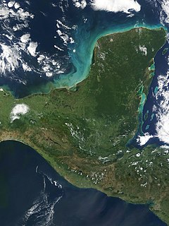
The Yucatán Peninsula is a large peninsula in southeastern Mexico and adjacent portions of Belize and Guatemala. The peninsula extends towards the northeast, separating the Gulf of Mexico to the north and west of the peninsula from the Caribbean Sea to the east. The Yucatán Channel, between the northeastern corner of the peninsula and Cuba, connects the two bodies of water.

The Pantanos de Centla are wooded wetlands along the coast in state of Tabasco in Mexico. They have been protected since 2006 with the establishment of the Pantanos de Centla Biosphere Reserve. It is also a World Wildlife Fund ecoregion.

The Petén–Veracruz moist forests is an ecoregion of the tropical and subtropical moist broadleaf forest biome found in Belize, Guatemala, and Mexico.
The Central America bioregion is a biogeographic region comprising southern Mexico and Central America.

The Central American montane forests are an ecoregion of the tropical and subtropical moist broadleaf forests biome, as defined by the World Wildlife Fund, located in mountains of Central America.

The Motagua Valley thornscrub ecoregion is located in the Motagua valley in eastern Guatemala. Surrounded by mountains and receiving relatively little precipitation, the valley is one of the driest in Central America and is characterized by thorn scrub vegetation. It covers an area of 2330 km2 and belongs to the deserts and xeric shrublands biome, as defined by the World Wildlife Fund.

The Chiapas Depression dry forests form one of the ecoregions that belong to the tropical and subtropical dry broadleaf forests biome, as defined by the World Wildlife Fund, in northwestern Central America.

The Chimalapas montane forests is a tropical moist broadleaf forest ecoregion in southern Mexico. It includes the montane tropical forests of the Chimalapas region on the boundary of Chiapas and Oaxaca.

The Chiapas montane forests is a tropical moist broadleaf forest ecoregion in southern Mexico and extending into western Guatemala. It includes the montane tropical forests on the northern and northeastern slopes of the Chiapas highlands.

The Tehuantepec-El Manchon mangroves ecoregion covers a series of mangrove woodlands along the Pacific Ocean coast of the state of Chiapas, Mexico. The ecoregion is relatively large and continuous, with trees up to 25 meters in height. The region supports stands of a type of yellow mangrove that normally only grown further south. The coast of Mexico here is wet - over 2,500 mm/year of rain. Four RAMSAR wetlands of international important are found in the zone, and a UNESCO Biosphere Reserve. Of particular importance are the wide variety of permanent and migratory birds in the area.
References
- ↑ "Central American Atlantic moist forests". World Wildlife Fund. Retrieved 2013-08-19.
- ↑ "Central American montane forests". World Wildlife Fund. Retrieved 2013-08-19.
- ↑ "Chiapas montane forests". World Wildlife Fund. Retrieved 2013-08-19.
- ↑ "Petén-Veracruz moist forests". World Wildlife Fund. Retrieved 2013-08-19.
- ↑ "Sierra Madre de Chiapas moist forest". World Wildlife Fund. Retrieved 2013-08-19.
- ↑ "Yucatán moist forests". World Wildlife Fund. Retrieved 2013-08-19.
- ↑ "Central American dry forests". World Wildlife Fund. Retrieved 2013-08-19.
- ↑ "Chiapas Depression dry forests". World Wildlife Fund. Retrieved 2013-08-19.
- ↑ "Central American pine-oak forests". World Wildlife Fund. Retrieved 2013-08-19.
- ↑ "Motagua Valley thornscrub". World Wildlife Fund. Retrieved 2013-08-19.
- ↑ "Belizean Coast mangroves". World Wildlife Fund. Retrieved 2013-08-19.
- ↑ "Northern Honduras mangroves". World Wildlife Fund. Retrieved 2013-08-19.
- ↑ "Tehuantepec-El Manchon mangroves". World Wildlife Fund. Retrieved 2013-08-19.
- ↑ "Northern Dry Pacific Coast mangroves". World Wildlife Fund. Retrieved 2013-08-24.
- ↑ "Grijalva - Usumacinta". Freshwater Ecoregions of the World. Archived from the original on 2013-08-19. Retrieved 2013-08-19.
- ↑ "Quintana Roo - Motagua". Freshwater Ecoregions of the World. Archived from the original on 2012-06-02. Retrieved 2013-08-19.
- ↑ "Chiapas - Fonseca". Freshwater Ecoregions of the World. Archived from the original on 2012-06-02. Retrieved 2013-08-19.
- ↑ "Upper Usumacinta". Freshwater Ecoregions of the World. Archived from the original on 2017-01-16. Retrieved 2013-08-19.
- 1 2 "Marine Ecoregions (Spalding 2007). [Map by] GEOMAR, University of Seville, Department of Human Geography". Marine ecoregions. marineplan.es. Archived from the original on 2017-02-12. Retrieved 2013-09-26.
- ↑ "Mesoamerican Reef". World Wildlife Fund. Retrieved 2013-08-19.

!["Marine Ecoregions (Spalding 2007). [Map by] GEOMAR, University of Seville, Department of Human Geography"](https://web.archive.org/web/20170212110426/http://www.marineplan.es/ES/fichas_kml/mapasfichas/ecoregions.jpg)