A National Scenic Byway is a road recognized by the United States Department of Transportation for one or more of six "intrinsic qualities": archeological, cultural, historic, natural, recreational, and scenic. The program was established by Congress in 1991 to preserve and protect the nation's scenic but often less-traveled roads and promote tourism and economic development. The National Scenic Byways Program (NSBP) is administered by the Federal Highway Administration (FHWA).
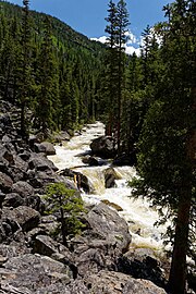
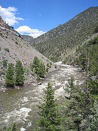
The San Juan Skyway Scenic and Historic Byway is a 236-mile (380 km) All-American Road, National Forest Scenic Byway, and Colorado Scenic and Historic Byway located in Dolores, La Plata, Montezuma, San Juan, and San Miguel counties, Colorado, USA. The byway forms a loop in southwestern Colorado traversing the heart of the San Juan Mountains. The San Juan Skyway reaches its zenith at Red Mountain Pass at elevation 11,018 feet (3,358 m). Mesa Verde National Park was one of the original UNESCO World Heritage Sites. The Silverton Historic District and the Telluride Historic District are National Historic Landmarks.
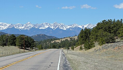
The Mount Evans Scenic Byway is a 49-mile (79 km) National Forest Scenic Byway and Colorado Scenic and Historic Byway located in Clear Creek and Jefferson counties, Colorado, United States. The byway ascends to 14,140 feet (4,310 m) of elevation near the 14,271-foot (4,350 m) summit of Mount Blue Sky, making it the highest paved road in North America The byway visits Echo Lake Park, the Mount Goliath Natural Area, the Dos Chappell Nature Center, and Summit Lake Park on its way to the summit. A fee is charged to travel State Highway 5 to the summit and vehicles over 30 feet (9.1 m) long are not allowed, although they are allowed on State Highway 103 which reaches its highest elevation of 11,020 feet (3,359 m) at Juniper Pass.

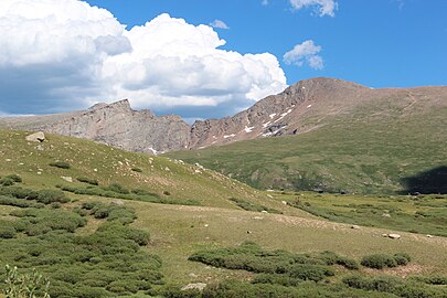
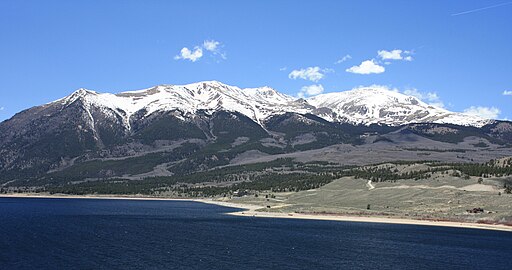
The Guanella Pass Scenic Byway is a National Forest Scenic Byway and Colorado Scenic and Historic Byway located in Clear Creek and Park counties, Colorado, USA. The byway traverses Guanella Pass at elevation 11,670 feet (3,557 m) in Arapaho and Pike national forests. The pass lies above timberline surrounded by Grays Peak at elevation 14,278 feet (4,352 m), Torreys Peak 14,275 feet (4,351 m), Mount Blue Sky 14,271 feet (4,350 m), and Mount Bierstadt 14,065 feet (4,287 m). The byway passes through the Georgetown–Silver Plume Historic District, and provides access to the Georgetown Loop Historic Mining & Railroad Park and the Georgetown Loop Railroad. The byway is renowned for its spectacular autumn colors during aspen color change from September 10 through October 10 each year.

The Lariat Loop National Scenic and Historic Byway is a National Scenic Byway and a Colorado Scenic and Historic Byway located in Jefferson County, Colorado, USA. The byway is a 40-mile (64 km) loop in the Front Range foothills west of Denver through Golden, Lookout Mountain Park, Genesee Park, Evergreen, Morrison, Red Rocks Park, and Dinosaur Ridge. The Lariat Loop connects to the Mount Evans Scenic Byway at Bergen Park.
The Trail Ridge Road/Beaver Meadow National Scenic Byway is a 55-mile (89 km) All-American Road and Colorado Scenic and Historic Byway located in Rocky Mountain National Park in Larimer and Grand counties, Colorado, USA. The byway consists of the 48-mile (77 km) Trail Ridge Road and the connecting 6.9-mile (11 km) Beaver Meadow Road. With a high point at 12,183 feet (3,713 m) elevation, Trail Ridge Road is the highest continuous paved road in North America. The higher portion of Trail Ridge Road is closed from October to May. The Rocky Mountain National Park Administration Building is a National Historic Landmark.
The Dinosaur Diamond is a 486-mile (782 km) scenic and historic byway loop through the dinosaur fossil laden Uinta Basin of the U.S. states of Utah and Colorado. The byway comprises the following two National Scenic Byways:
The Santa Fe Trail Scenic and Historic Byway is a 188-mile (303 km) National Scenic Byway and Colorado Scenic and Historic Byway located in Prowers, Bent, Otero, and Las Animas counties, Colorado, USA. The byway follows the Santa Fe National Historic Trail through southeastern Colorado and connects to the 381-mile (613 km) Santa Fe Trail Scenic Byway in New Mexico at Raton Pass, a National Historic Landmark at elevation 7,834 feet (2,388 m). The byway visits Amache National Historic Site and Bent's Old Fort National Historic Site, both National Historic Landmarks, and winds between the Spanish Peaks and Raton Mesa, both National Natural Landmarks.

The Alpine Loop Back Country Byway is a rugged 63-mile (101 km) Back Country Byway and Colorado Scenic and Historic Byway located in the high San Juan Mountains of Hindale, Ouray, and San Juan counties, Colorado, USA. The byway connects the mountain towns of Lake City, Ouray, and Silverton. The route ranges in elevation from 7,792 feet (2,375 m) in Ouray to 12,800 feet (3,901 m) at Engineer Pass. The byway features high mountain passes, alpine tundra, beautiful mountain meadows, ghost towns, and relics of the silver mining era. While the meadows and tundra are accessible to ordinary passenger vehicles, a high-clearance 4-wheel drive vehicle is required to travel the entire route.
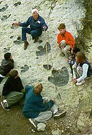
The Trail of the Ancients is a collection of National Scenic Byways located in the U.S. Four Corners states of Utah, Colorado, New Mexico, and Arizona. These byways comprise:
The Peak to Peak Scenic Byway is a 55-mile (89 km) National Forest Scenic Byway and Colorado Scenic and Historic Byway located in Gilpin, Boulder, Larimer counties, Colorado, USA. The Peak to Peak Highway was originally built in 1918 and provides views of the Front Range mountains in the Colorado Rocky Mountains. It was Colorado's first scenic highway. The Central City/Black Hawk Historic District is a National Historic Landmark.
The South Platte River Trail Scenic and Historic Byway is a 19-mile (31 km) Colorado Scenic and Historic Byway located in Sedgwick County, Colorado, USA. The byway follows the historic trails used during westward expansion. The route, which includes County Road 28 (CR 28) and U.S. Highway 138 (US 138), connects Ovid and Julesburg and encircles the South Platte River. It was designated a Colorado Scenic and Historic Byway in 1991.
Minnesota Scenic Byways are a system of roads in the U.S. state of Minnesota which pass through areas of scenic, cultural, or recreational significance. There are currently 22 scenic byways in the system with a total length of 2,948 miles (4,744 km). Eight of these byways are also designated as National Scenic Byways, and the North Shore Scenic Drive is further designated as an All-American Road.
The Highway of Legends National Scenic Byway is an 82-mile (132 km) National Scenic Byway, National Forest Scenic Byway, and Colorado Scenic and Historic Byway located in Huerfano and Las Animas counties, Colorado, USA. The byway explores the Spanish Peaks region of San Isabel National Forest, a National Natural Landmark.
The Cache la Poudre-North Park Scenic Byway is a 101-mile (163 km) National Forest Scenic Byway and Colorado Scenic and Historic Byway located in Jackson and Larimer counties, Colorado, US.
The Pawnee Pioneer Trails Scenic and Historic Byway is a 128-mile (206 km) Colorado Scenic and Historic Byway located in Logan, Morgan, and Weld counties, Colorado, USA. The byway explores the Pawnee Buttes region and Pawnee National Grassland of northeastern Colorado.
The Tracks Across Borders Scenic and Historic Byway is an 89-mile (143 km) Colorado Scenic and Historic Byway located in La Plata and Archuleta counties, Colorado, USA. From Durango, Colorado, the southern terminal of the Durango and Silverton Narrow Gauge Railroad, a National Historic Landmark, the byway follows the roadbed of the historic narrow-gauge Denver and Rio Grande Western Railroad through the Southern Ute Indian Reservation to the New Mexico state line. At the state line, the byway connects with the 9.9-mile (16 km) Narrow-Gauge Scenic Byway which continues on through the Jicarilla Apache Indian Reservation to Dulce, New Mexico. New Mexico plans to continue the byway on to Chama, New Mexico, the southern terminal of the Cumbres and Toltec Scenic Railroad, another National Historic Landmark, reconnecting the historic railway between Antonito, Colorado and Silverton, Colorado.
The Unaweep Tabeguache Scenic Byway is a 133-mile (214 km) Colorado Scenic and Historic Byway located in Mesa, Montrose, and San Miguel counties, Colorado, USA. The byway explores the Colorado Plateau canyon country of far western Colorado.
The West Elk Loop Scenic and Historic Byway is a 205-mile (330 km) National Forest Scenic Byway and Colorado Scenic and Historic Byway located in Delta, Garfield, Gunnison, Montrose, and Pitkin counties Colorado, USA. The byway reaches its zenith at Kebler Pass, elevation 10,007 feet (3,050 m), between Crested Butte and Paonia.