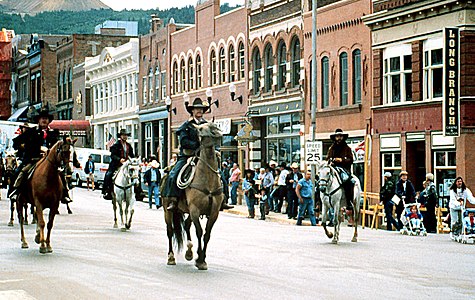
Teller County is a county located in the U.S. state of Colorado. As of the 2020 census, the population was 24,710. The county seat is Cripple Creek, and the most populous city is Woodland Park.

A National Scenic Byway is a road recognized by the United States Department of Transportation for one or more of six "intrinsic qualities": archeological, cultural, historic, natural, recreational, and scenic. The program was established by Congress in 1991 to preserve and protect the nation's scenic but often less-traveled roads and promote tourism and economic development. The National Scenic Byways Program (NSBP) is administered by the Federal Highway Administration (FHWA).
The San Juan Skyway Scenic and Historic Byway is a 236-mile (380 km) All-American Road, National Forest Scenic Byway, and Colorado Scenic and Historic Byway located in Dolores, La Plata, Montezuma, San Juan, and San Miguel counties, Colorado, United States. The byway forms a loop in southwestern Colorado traversing the heart of the San Juan Mountains. The San Juan Skyway reaches its zenith at Red Mountain Pass at elevation 11,018 feet (3,358 m). Mesa Verde National Park was one of the original UNESCO World Heritage Sites. The Silverton Historic District and the Telluride Historic District are National Historic Landmarks.
The Top of the Rockies National Scenic Byway is a National Scenic Byway and Colorado Scenic and Historic Byway located in the high Rocky Mountains of Eagle, Lake, Pitkin, Summit counties, Colorado, United States. The 115-mile (185 km) byway showcases the two highest peaks of the Rocky Mountains: Mount Elbert at elevation 14,440 feet (4,401.2 m) and Mount Massive at elevation 14,428 feet (4,398 m). The byway connects with the Collegiate Peaks Scenic Byway at the junction of Colorado State Highway 82 and U.S. Highway 24.

The Midland Terminal Railway was a short line terminal railroad running from the Colorado Midland Railway near Divide to Cripple Creek, Colorado. The railroad made its last run in February 1949.
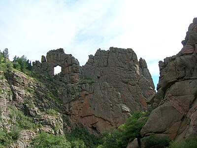
Phantom Canyon is a canyon in Colorado, in the Western United States. The canyon is formed by Eight Mile Creek. The Florence and Cripple Creek Railroad developed it as a route to take gold and supplies in and out of the Cripple Creek and Victor gold mining district.
The Mount Evans Scenic Byway is a 49-mile (79 km) National Forest Scenic Byway and Colorado Scenic and Historic Byway located in Clear Creek and Jefferson counties, Colorado, United States. The byway ascends to 14,140 feet (4,310 m) of elevation near the 14,271-foot (4,350 m) summit of Mount Blue Sky, making it the highest paved road in North America The byway visits Echo Lake Park, the Mount Goliath Natural Area, the Dos Chappell Nature Center, and Summit Lake Park on its way to the summit. A fee is charged to travel State Highway 5 to the summit and vehicles over 30 feet (9.1 m) long are not allowed, although they are allowed on State Highway 103 which reaches its highest elevation of 11,020 feet (3,359 m) at Juniper Pass.
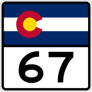
State Highway 67 (SH 67) is a 71-mile-long (114 km) state highway encompassing five distinct segments in south-central Colorado. SH 67's southern terminus is at SH 96 in Wetmore, and the northern terminus is at U.S. Route 85 in Sedalia. It traverses the former route of the Florence and Cripple Creek Railroad through Phantom Canyon as a county road and carrying part of the Gold Belt Byway.

The Lariat Loop National Scenic and Historic Byway is a National Scenic Byway and a Colorado Scenic and Historic Byway located in Jefferson County, Colorado, USA. The byway is a 40-mile (64 km) loop in the Front Range foothills west of Denver through Golden, Lookout Mountain Park, Genesee Park, Evergreen, Morrison, Red Rocks Park, and Dinosaur Ridge. The Lariat Loop connects to the Mount Evans Scenic Byway at Bergen Park.
The Dinosaur Diamond is a 486-mile (782 km) scenic and historic byway loop through the dinosaur fossil laden Uinta Basin of the U.S. states of Utah and Colorado. The byway comprises the following two National Scenic Byways:

The Florence and Cripple Creek Railroad (F&CC) was a 3 ft narrow-gauge railroad running northward from junctions with the Denver & Rio Grande Railroad at the mill towns of Florence and later moved to Cañon City, Colorado, on the banks of the Arkansas River, up steep and narrow Phantom Canyon to the Cripple Creek Mining District, west of Pikes Peak. It was founded in 1893 and went out of business in 1915.

State Highway 72 is a 51-mile-long (82 km) state highway passing through the foothills and the eastern edge of the Front Range. Its southern terminus is at Interstate 70 (I-70) in Wheat Ridge, and its northern terminus is at SH 7 east of Allenspark.
The Trail of the Ancients is a collection of National Scenic Byways located in the U.S. Four Corners states of Utah, Colorado, New Mexico, and Arizona. These byways comprise:

State Highway 119 is a 63.7-mile-long (102.5 km) state highway in north central Colorado. It extends in a southwest to northeast direction, from a junction with U.S. Route 6 in Clear Creek Canyon between Golden and Idaho Springs to a junction with Interstate 25 (I-25) east of Longmont. The southwest portion of the road is a scenic mountain drive providing dramatic vistas of the Front Range, while the northeast portion is a busy interurban thoroughfare. The city of Boulder separates these two vastly different sections of SH 119.
Fourmile Canyon or Four Mile Canyon is a canyon carved by Fourmile Creek. It is located north of Canon City in Fremont County, Colorado.

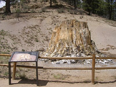
Indian Springs Trace Fossil Natural Area is a 40-acre privately owned site on the Indian Springs Ranch in Fremont County, Colorado. It was designated a National Natural Landmark in 1980.
The Tracks Across Borders Scenic and Historic Byway is an 89-mile (143 km) Colorado Scenic and Historic Byway located in La Plata and Archuleta counties, Colorado, USA. From Durango, Colorado, the southern terminal of the Durango and Silverton Narrow Gauge Railroad, a National Historic Landmark, the byway follows the roadbed of the historic narrow-gauge Denver and Rio Grande Western Railroad through the Southern Ute Indian Reservation to the New Mexico state line. At the state line, the byway connects with the 9.9-mile (16 km) Narrow-Gauge Scenic Byway which continues on through the Jicarilla Apache Indian Reservation to Dulce, New Mexico. New Mexico plans to continue the byway on to Chama, New Mexico, the southern terminal of the Cumbres and Toltec Scenic Railroad, another National Historic Landmark, reconnecting the historic railway between Antonito, Colorado and Silverton, Colorado.