Weld County, Colorado

Last updated

Weld County
Greeley, Colorado Courthouse.JPG
Weld County Courthouse
Map of Colorado highlighting Weld County.svg
Location within the U.S. state of Colorado
Colorado in United States.svg
Colorado's location within the U.S.
Coordinates: 40°32′N104°24′W / 40.54°N 104.4°W / 40.54; -104.4
CountryFlag of the United States.svg United States
StateFlag of Colorado.svg  Colorado
FoundedNovember 3, 1861
Seat Greeley
Largest cityGreeley
Area
  Total4,017 sq mi (10,400 km2)
  Land3,987 sq mi (10,330 km2)
  Water30 sq mi (80 km2)  0.7%
Population
 (2020)
  Total328,981
  Density83/sq mi (32/km2)
Time zone UTC−7 (Mountain)
  Summer (DST) UTC−6 (MDT)
Congressional districts 2nd, 4th, 8th
Website www.weldgov.com

Weld County is a county located in the U.S. state of Colorado. As of the 2020 census, the population was 328,981. [1] The county seat is Greeley. [2]

Contents

Weld County comprises the Greeley, CO Metropolitan Statistical Area, which is included in the DenverAurora, CO Combined Statistical Area. [3]

History

Weld County Courthouse from Lincoln Park. Weld County Courthouse from Lincoln Park.jpg
Weld County Courthouse from Lincoln Park.

On May 30, 1854, the Kansas–Nebraska Act created the Nebraska Territory and the Kansas Territory, divided by the Parallel 40° North (Baseline Road or County Line Road or Weld County Road 2 in the future Weld County). Present-day Weld County, Colorado, lay in the southwestern portion of the Nebraska Territory, bordering the Kansas Territory.

In July 1858, gold was discovered along the South Platte River in Arapahoe County, Kansas Territory. This discovery precipitated the Pike's Peak Gold Rush. Many residents of the mining region felt disconnected from the remote territorial governments of Kansas and Nebraska, so they voted to form their own Territory of Jefferson on October 24, 1859. The following month, the Jefferson Territorial Legislature organized 12 counties for the new territory, including St. Vrain County. St. Vrain County was named in honor of Ceran de Hault de Lassus de St. Vrain, the French trader who established the first trading post on the upper South Platte River. St. Vrain County encompassed much of what is today Weld County.

The Jefferson Territory never received federal sanction, but on February 28, 1861, U.S. President James Buchanan signed an act organizing the Territory of Colorado. [4] On November 1, 1861, the Colorado General Assembly organized 17 counties, including Weld County, for the new Colorado Territory. Weld County was named for Lewis Ledyard Weld, a lawyer and territorial secretary. He died while serving in the Union Army during the Civil War. [5] Until February 9, 1887, Weld County's boundaries included the area now comprising Weld County, Washington County, Logan County, Morgan County, Yuma County, Phillips County, and Sedgwick County.

Weld County was thrust into the media spotlight on the evening of November 1, 1955, when United Airlines Flight 629, a Douglas DC-6B airliner flying from Denver to Portland, Oregon, exploded in midair and crashed, killing all 44 persons on board the plane and scattering bodies, wreckage and debris over a six-square-mile area of the county. The subsequent investigation of the accident revealed that Denver resident John Gilbert Graham had secretly placed a time bomb composed of 25 sticks of dynamite in a suitcase belonging to his mother, who was a passenger on the airplane. Graham was tried and convicted of the crime, and executed in 1957.

In northeastern Weld County, Minuteman III missile silo "N-8", [6] one of the many unmanned silos there, was the target of symbolic vandalism by Catholic peace activists in 2002. [7] [8]

Weld County also holds the distinction of having more confirmed tornado sightings than any other U.S. county from 1950 to 2011, with 252 confirmed reports. [9]

On March 6, 2019, the county declared itself to be a Second Amendment sanctuary. [10]

Secession proposals

In 2013, conservative Weld County commissioners began a campaign to secede from the State of Colorado to create a new state; a state ballot measure regarding the issue was put on the November 2013 ballot. The legality of this initiative has been questioned by local attorneys. [11] On November 5, 2013, 6 out of 11 Colorado counties voted no for secession, including Elbert, Lincoln, Logan, Moffat, Sedgwick, and Weld counties voted no, while Cheyenne, Kit Carson, Phillips, Washington, and Yuma counties voted yes. "Weld County voters said this is an option we shouldn't pursue and we won't pursue it," said Weld County Commissioner Sean Conway, "But we will continue to look at the problems of the urban and rural divide in this state." [12]

The logo of Weld County, WY. Weld County Wyoming Logo.png
The logo of Weld County, WY.

In 2021, a group known as "Weld County, WY" organized a petition to place a measure on the November 2021 ballot for the county to secede from Colorado to join Wyoming, due to a clash between the conservative politics of Weld County and the liberal government of Colorado. [13] Mark Gordon, the Governor of Wyoming, said when asked about the topic, "We would love that." [14] In response to Gordon's comment, Colorado Governor Jared Polis said, "Hands off Weld County." [15]

Geography

Crop fields in western Weld County Weld County Fields.JPG
Crop fields in western Weld County
Rock formation near the Pawnee Buttes Pawnee Grassland Butte.jpg
Rock formation near the Pawnee Buttes

According to the U.S. Census Bureau, the county has a total area of 4,017 square miles (10,400 km2), of which 3,987 square miles (10,330 km2) are land and 30 square miles (78 km2) (0.7%) are water. [16] It is the third-largest county in Colorado by area.

Weld County lies within the relatively flat eastern portion of Colorado; the northeastern portions of the county contain the extensive Pawnee National Grassland and the Pawnee Buttes, which jut 350 feet (110 m) above the surrounding terrain and are surrounded by many small canyons and outcroppings. Along the western border, hilly areas indicate the presence of the foothills of the Rocky Mountains further west.

The county is served by two interstate highways: I-25 (US 87) runs through the southwestern corner and I-76 from the south central edge northeastward to the Morgan county border. Other major roads include US 85 and US 34, which intersect near Greeley, and State Highway 14, which runs through Ault.

Adjacent counties

Major highways

Transit

National protected area

Sunrise over the Pawnee National Grassland in northeastern Weld County. Pawnee Grassland Sunrise.jpg
Sunrise over the Pawnee National Grassland in northeastern Weld County.

State protected area

Trails and byways

Demographics

Historical population
CensusPop.Note
1870 1,636
1880 5,646245.1%
1890 11,736107.9%
1900 16,80843.2%
1910 39,177133.1%
1920 54,05938.0%
1930 65,09720.4%
1940 63,747−2.1%
1950 67,5045.9%
1960 72,3447.2%
1970 89,29723.4%
1980 123,43838.2%
1990 131,8216.8%
2000 180,93637.3%
2010 252,82539.7%
2020 328,98130.1%
2023 (est.)359,442 [19] 9.3%
U.S. Decennial Census [20]
1790-1960 [21] 1900-1990 [22]
1990-2000 [23] 2010-2020 [1]

As of the census [24] of 2000, there were 180,936 people, 63,247 households, and 45,221 families residing in the county. The population density was 45 people per square mile (17 people/km2). There were 66,194 housing units at an average density of 17 units per square mile (6.6 units/km2). The racial makeup of the county was 81.71% White, 0.56% Black or African American, 0.87% Native American, 0.83% Asian, 0.08% Pacific Islander, 13.29% from other races, and 2.65% from two or more races. 27.05% of the population were Hispanic or Latino of any race.

There were 63,247 households, out of which 37.20% had children under the age of 18 living with them, 57.60% were married couples living together, 9.40% had a female householder with no husband present, and 28.50% were non-families. 21.00% of all households were made up of individuals, and 6.90% had someone living alone who was 65 years of age or older. The average household size was 2.78 and the average family size was 3.25.

In the county, the population was spread out, with 28.20% under the age of 18, 13.20% from 18 to 24, 29.70% from 25 to 44, 20.00% from 45 to 64, and 9.00% who were 65 years of age or older. The median age was 31 years. For every 100 females there were 100.60 males. For every 100 females age 18 and over, there were 98.00 males.

The median income for a household in the county was $42,321, and the median income for a family was $49,569. Males had a median income of $35,037 versus $25,757 for females. The per capita income for the county was $18,957. About 8.00% of families and 12.50% of the population were below the poverty line, including 14.60% of those under age 18 and 8.50% of those age 65 or over.

Economy

Weld County is Colorado's leading producer of cattle, grain and sugar beets, and is the richest agricultural county in the United States east of the Rocky Mountains, and the fourth richest overall nationally. It is also becoming more important as a milk producing county, with close to half of the state's cattle. [25] [26] Weld County is also an important area of oil and natural gas production in the Denver-Julesburg Basin.

Communities

A grain elevator in Nunn. Bellmore Farms.jpg
A grain elevator in Nunn.

Cities

Towns

Census-designated places

Unincorporated communities

Ghost towns


‡ means a populated place has portions in an adjacent county or counties

Politics

Similar to the fellow Denver Metropolitan Area county of Douglas, Weld leans Republican. Except for Lyndon Johnson's 1964 landslide win over Barry Goldwater, it has not voted for a Democratic presidential candidate since 1936.

United States presidential election results for Weld County, Colorado [29]
Year Republican Democratic Third party
No.%No.%No.%
2020 96,14557.58%66,06039.56%4,7692.86%
2016 76,65156.60%46,51934.35%12,2609.05%
2012 63,77554.84%49,05042.18%3,4662.98%
2008 56,52653.39%47,29244.67%2,0481.93%
2004 55,59162.71%31,86835.95%1,1941.35%
2000 37,40957.96%23,43636.31%3,6965.73%
1996 26,51849.67%21,32539.94%5,54710.39%
1992 20,95838.79%19,29535.71%13,77625.50%
1988 26,49755.42%20,54842.98%7621.59%
1984 31,29368.51%13,86330.35%5231.14%
1980 23,90158.80%11,43328.13%5,31213.07%
1976 21,97655.35%16,50141.56%1,2253.09%
1972 24,69566.29%11,69031.38%8702.34%
1968 17,10157.26%10,42034.89%2,3447.85%
1964 12,20441.12%17,26858.18%2070.70%
1960 17,55860.99%11,17938.83%530.18%
1956 17,22862.75%10,17037.04%570.21%
1952 18,00266.44%8,89032.81%2040.75%
1948 12,44652.65%10,93446.25%2591.10%
1944 14,54663.01%8,45936.64%810.35%
1940 16,12959.72%10,65339.44%2270.84%
1936 9,60641.23%12,99355.77%6972.99%
1932 10,75446.87%11,18248.73%1,0094.40%
1928 13,71969.58%5,76229.22%2361.20%
1924 10,18562.68%3,40620.96%2,65916.36%
1920 10,26863.78%5,20232.31%6303.91%
1916 5,39537.12%8,60059.18%5383.70%
1912 3,11427.39%4,71341.46%3,54131.15%
1908 5,53751.05%4,65042.87%6596.08%
1904 4,83362.12%2,55532.84%3925.04%
1900 2,78642.95%3,38652.20%3144.84%
1896 87415.54%4,62082.13%1312.33%
1892 1,13841.10%00.00%1,63158.90%
1888 1,94257.56%1,03630.71%39611.74%
1884 1,33253.49%76530.72%39315.78%
1880 80456.26%37326.10%25217.63%

Education

School districts serving Weld County include: [30]

See also

Related Research Articles

<span class="mw-page-title-main">South Platte River</span> River in Colorado and Nebraska, United States

The South Platte River is one of the two principal tributaries of the Platte River. Flowing through the U.S. states of Colorado and Nebraska, it is itself a major river of the American Midwest and the American Southwest/Mountain West. Its drainage basin includes much of the eastern flank of the Rocky Mountains in Colorado, much of the populated region known as the Colorado Front Range and Eastern Plains, and a portion of southeastern Wyoming in the vicinity of the city of Cheyenne. It joins the North Platte River in western Nebraska to form the Platte, which then flows across Nebraska to the Missouri. The river serves as the principal source of water for eastern Colorado. In its valley along the foothills in Colorado, it has permitted agriculture in an area of the Colorado Piedmont and Great Plains that is otherwise arid.

<span class="mw-page-title-main">Douglas County, Colorado</span> County in Colorado, United States

Douglas County is a county located in the U.S. state of Colorado. As of the 2020 Census, the population was 357,978. The county is named in honor of U.S. Senator Stephen A. Douglas. The county seat is Castle Rock.

<span class="mw-page-title-main">Adams County, Colorado</span> County in Colorado, United States

Adams County is a county located in the U.S. state of Colorado. As of the 2020 census, the population was 519,572. The county seat is Brighton, and the largest city is Thornton. The county is named for Alva Adams, an early Governor of the State of Colorado in 1887–1889. Adams County is part of the Denver–Aurora–Lakewood, CO Metropolitan Statistical Area.

<span class="mw-page-title-main">Laramie County, Wyoming</span> County in Wyoming, United States

Laramie County is a county located at the southeast corner of the state of Wyoming. As of the 2020 United States Census, the population was 100,512 or 17.4% of the state's total 2020 population, making it the most populous county in Wyoming, but the least populous county in the United States to be the most populous in its state.

<span class="mw-page-title-main">Logan County, Colorado</span> County in Colorado, United States

Logan County is a county located in the U.S. state of Colorado. As of the 2020 census, the population was 21,528. The county seat is Sterling. The county was named for General John A. Logan.

<span class="mw-page-title-main">Larimer County, Colorado</span> County in Colorado, United States

Larimer County is a county located in the U.S. state of Colorado. As of the 2020 census, the population was 359,066. The county seat and most populous city is Fort Collins. The county was named for William Larimer, Jr., the founder of Denver.

<span class="mw-page-title-main">Boulder County, Colorado</span> County in Colorado, United States

Boulder County is a county located in the U.S. state of Colorado of the United States. As of the 2020 census, the population was 330,758. The most populous municipality in the county and the county seat is Boulder.

<span class="mw-page-title-main">Arapahoe County, Colorado</span> County in Colorado, United States

Arapahoe County is a county located in the U.S. state of Colorado. As of the 2020 census, its population was 655,070, making it the third-most populous county in Colorado. The county seat is Littleton, and the most populous city is Aurora. The county was named for the Arapaho Native American tribe, who once lived in the region.

<span class="mw-page-title-main">Sterling, Colorado</span> City in Colorado, United States

Sterling is a home rule municipality and the county seat and most populous municipality of Logan County, Colorado, United States. Sterling is the principal city of the Sterling, CO Micropolitan Statistical Area. The city population was 13,735 at the 2020 census.

<span class="mw-page-title-main">Evans, Colorado</span> City in Colorado, United States

The City of Evans is a home rule municipality located in Weld County, Colorado, United States. The city population was 22,165 at the 2020 United States Census, a 19.57% increase since the 2010 United States Census. Evans is a part of the Greeley, CO Metropolitan Statistical Area and the Front Range Urban Corridor.

<span class="mw-page-title-main">Firestone, Colorado</span> Town in Colorado, United States

The Town of Firestone is a Statutory Town in southwestern Weld County, Colorado, United States. The town population was 16,381 at the 2020 United States Census, a 61.44% increase since the 2010 United States Census. Firestone is a part of the Greeley, CO Metropolitan Statistical Area and the Front Range Urban Corridor.

<span class="mw-page-title-main">Fort Lupton, Colorado</span> City in Colorado, United States

The City of Fort Lupton is a Statutory City located in southern Weld County, Colorado, United States. The town population was 7,955 at the 2020 United States Census. Fort Lupton is a part of the Greeley, Colorado Metropolitan Statistical Area and the Front Range Urban Corridor.

<span class="mw-page-title-main">Greeley, Colorado</span> City in Colorado, United States

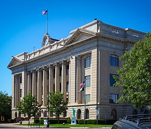
Greeley is the home rule municipality city that is the county seat and the most populous municipality of Weld County, Colorado, United States. The city population was 108,795 at the 2020 United States Census, an increase of 17.12% since the 2010 United States Census. Greeley is the tenth most populous city in Colorado. Greeley is the principal city of the Greeley, CO Metropolitan Statistical Area and is a major city of the Front Range Urban Corridor. Greeley is located in northern Colorado and is situated 49 miles (79 km) north-northeast of the Colorado State Capitol in Denver.

<span class="mw-page-title-main">Platte River</span> River in Nebraska, United States

The Platte River is a major river in the State of Nebraska. It is about 310 mi (500 km) long; measured to its farthest source via its tributary, the North Platte River, it flows for over 1,050 miles (1,690 km). The Platte River is a tributary of the Missouri River, which itself is a tributary of the Mississippi River which flows to the Gulf of Mexico. The Platte over most of its length is a broad, shallow, meandering stream with a sandy bottom and many islands—a braided stream.

<span class="mw-page-title-main">Jefferson Territory</span> Extralegal U.S. Territory of Jefferson that existed from 1859 to 1861

The Provisional Government of the Territory of Jefferson was an extralegal and unrecognized United States territory that existed in the Pike's Peak mining region from October 24, 1859, until it yielded to the new Territory of Colorado on June 6, 1861. The Jefferson Territory, named for Founding Father and third United States president Thomas Jefferson, included land officially part of the Kansas Territory, the Nebraska Territory, the New Mexico Territory, the Utah Territory, and the Washington Territory, but the region was remote from the governments of those five territories.

<span class="mw-page-title-main">Pawnee National Grassland</span> Area of protected federal lands in northeastern Colorado

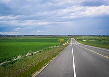
Pawnee National Grassland is a United States National Grassland located in northeastern Colorado on the Colorado Eastern Plains. The grassland is located in the South Platte River basin in remote northern and extreme northeastern Weld County between Greeley and Sterling. It comprises two parcels totaling 193,060 acres (78,130 ha) largely between State Highway 14 and the Wyoming border. The larger eastern parcel lies adjacent to the borders of both Nebraska and Wyoming. It is administered in conjunction with the Arapaho-Roosevelt National Forest from the U.S. Forest Service office in Fort Collins, with a local ranger district office in Greeley.

<span class="mw-page-title-main">Index of Colorado-related articles</span>

This is an alphabetical list of articles related to the U.S. State of Colorado.

St. Vrain's County was a county of the extralegal United States Territory of Jefferson that existed from November 28, 1859, until February 28, 1861.

Saint Vrains is a ghost town in Weld County, Colorado, United States.

<span class="mw-page-title-main">St. Vrain, Colorado</span> Ghost town in Colorado, United States

St. Vrain is a ghost town located in Weld County, Colorado, United States. The town was located adjacent to the frontier trading post of Fort Saint Vrain northeast of the confluence of Saint Vrain Creek and the South Platte River.

References

  1. 1 2 "State & County QuickFacts". United States Census Bureau. Retrieved September 5, 2021.
  2. "Find a County". National Association of Counties. Retrieved June 7, 2011.
  3. "OMB Bulletin No. 10-02: Update of Statistical Area Definitions and Guidance on Their Uses" (PDF). Office of Management and Budget . December 1, 2009. Archived (PDF) from the original on January 21, 2017. Retrieved April 19, 2012 via National Archives.
  4. "An Act to provide a temporary Government for the Territory of Colorado" (PDF). Thirty-sixth United States Congress. February 28, 1861. Archived (PDF) from the original on October 25, 2004. Retrieved November 26, 2007.
  5. "Weld County, Colorado County Information". ePodunk. Archived from the original on July 11, 2014. Retrieved November 5, 2013.
  6. "Warren AFB Minuteman Missile Site Coordinates". Asuwlink.uwyo.edu. Archived from the original on June 25, 2014. Retrieved November 5, 2013.
  7. Archived July 7, 2007, at the Wayback Machine
  8. Archived September 27, 2007, at the Wayback Machine
  9. "Map: U.S. Tornadoes by County, 1950-2011 - U.S. Tornadoes". U.S. Tornadoes. May 22, 2012. Retrieved June 29, 2018.
  10. "Resolution declares Weld County to be a 'Second Amendment sanctuary'". FOX31 Denver. March 6, 2019. Retrieved January 4, 2020.
  11. Romano, Analisa (October 9, 2013). "Greeley Attorneys Question Legality Of Weld Commissioners Advocating For 51st State". The Greeley Tribune (via Huffington Post). Retrieved October 11, 2013.
  12. Whaley, Monte (November 5, 2013). "51st state question answered "no" in 6 of 11 counties contemplating secession". www.denverpost.com. The Denver Post . Retrieved March 6, 2014.
  13. Gstalter, Morgan (January 29, 2021). "Group in Colorado county seeks secession from state to join Wyoming" . Retrieved January 29, 2021.
  14. Reynolds, Nick (February 2, 2021). "Gordon on Weld County secession: 'We would love that'". Casper Star-Tribune. Retrieved February 2, 2021.
  15. Holdman, Raetta (February 4, 2021). "Gov. Jared Polis Tells Wyoming Governor 'Hands Off Weld County'" . Retrieved February 6, 2021.
  16. "US Gazetteer files: 2010, 2000, and 1990". United States Census Bureau. February 12, 2011. Retrieved April 23, 2011.
  17. "Pawnee Pioneer Trails". Colorado Department of Transportation. Retrieved March 2, 2020.
  18. "Cache la Poudre - North Park". Colorado Department of Transportation. Retrieved March 2, 2020.
  19. "Annual Estimates of the Resident Population for Counties: April 1, 2020 to July 1, 2023". United States Census Bureau. Retrieved March 31, 2024.
  20. "U.S. Decennial Census". United States Census Bureau. Retrieved June 11, 2014.
  21. "Historical Census Browser". University of Virginia Library. Retrieved June 11, 2014.
  22. "Population of Counties by Decennial Census: 1900 to 1990". United States Census Bureau. Retrieved June 11, 2014.
  23. "Census 2000 PHC-T-4. Ranking Tables for Counties: 1990 and 2000" (PDF). United States Census Bureau. Archived (PDF) from the original on March 27, 2010. Retrieved June 11, 2014.
  24. "U.S. Census website". United States Census Bureau . Retrieved May 14, 2011.
  25. "Weld County: About Weld". Co.weld.co.us. Retrieved November 5, 2013.
  26. "Welcome to Upstate Colorado Economic Development". Archived from the original on February 13, 2011.
  27. 1 2 3 4 5 6 7 8 9 10 11 12 13 14 15 16 17 18 19 20 21 22 23 24 25 26 27 28 29 30 31 32 33 34 35 36 37 38 39 40 41 42 43 "Ghost Towns in Weld County". history.weldgov.com. Retrieved November 16, 2023.
  28. Hovey, Edmund Otis (November 30, 1925). "A New Meteoric Stone from Johnstown, Weld County, Colorado". American Museum Novitates. New York City: The American Museum of Natural History.
  29. Leip, David. "Dave Leip's Atlas of U.S. Presidential Elections". uselectionatlas.org. Retrieved November 27, 2020.
  30. "2020 CENSUS - SCHOOL DISTRICT REFERENCE MAP: Weld County, CO" (PDF). U.S. Census Bureau. Archived (PDF) from the original on July 19, 2022. Retrieved July 19, 2022. - Text list

40°32′N104°24′W / 40.54°N 104.40°W / 40.54; -104.40