Clear Creek County, Colorado

Last updated

Clear Creek County
DSCN2140 georgetownalpinehose e 600.jpg
Motto: 
Where The Old West Meets New Adventures
Map of Colorado highlighting Clear Creek County.svg
Location within the U.S. state of Colorado
Colorado in United States.svg
Colorado's location within the U.S.
Coordinates: 39°41′N105°38′W / 39.69°N 105.64°W / 39.69; -105.64
CountryFlag of the United States.svg United States
StateFlag of Colorado.svg  Colorado
FoundedNovember 1, 1861
Named for Clear Creek
Seat Georgetown
Largest city Idaho Springs
Area
  Total396 sq mi (1,030 km2)
  Land395 sq mi (1,020 km2)
  Water1.3 sq mi (3 km2)  0.3%
Population
 (2020)
  Total9,397 [1]
  Density24/sq mi (9/km2)
Time zone UTC−7 (Mountain)
  Summer (DST) UTC−6 (MDT)
Congressional district 2nd
Website www.clearcreekcounty.us

Clear Creek County is a county located in the U.S. state of Colorado. As of the 2020 census, the population was 9,397. [1] The county seat is Georgetown. [2]

Contents

History

Clear Creek, ca. 1870 The forks of creek, Clear Creek (NYPL b11707543-G90F028 066ZF).tiff
Clear Creek, ca. 1870
Crystalline gold specimen from the Dixie mine, Lamartine District, SW of Idaho Springs, Colorado. Size: 1.8 x 0.9 x 0.2 cm. Gold-231683.jpg
Crystalline gold specimen from the Dixie mine, Lamartine District, SW of Idaho Springs, Colorado. Size: 1.8 x 0.9 x 0.2 cm.

Clear Creek County was one of the original 17 counties created by the Colorado legislature on November 1, 1861, and is one of only two counties (along with Gilpin) to have persisted with its original boundaries unchanged. It was named after Clear Creek, which runs down from the continental divide through the county. Idaho Springs was originally designated the county seat, but the county government was moved to Georgetown in 1867.

Geography

According to the U.S. Census Bureau, the county has a total area of 396 square miles (1,030 km2), of which 395 square miles (1,020 km2) is land and 1.3 square miles (3.4 km2) (0.3%) is water. [4]

Adjacent counties

Major highways

National protected areas

Scenic trails and byways

Politics

Throughout its history, Clear Creek County tended to be somewhat divided between Republicans and Democrats, but has reliably voted Democratic in recent elections, with George W. Bush having been the most recent Republican to win the county, in 2000, while his father, George H. W. Bush, was the last Republican to win the narrow majority of the county's votes, in 1988. During the 2016 presidential election, Hillary Clinton became the first Democrat since her husband in 1996 to not win the majority of the county's vote, while still winning the county by a plurality.

United States presidential election results for Clear Creek County, Colorado [5]
Year Republican Democratic Third party
No.%No.%No.%
2020 2,75442.06%3,60455.04%1902.90%
2016 2,57543.90%2,72946.52%5629.58%
2012 2,43042.31%3,11954.31%1943.38%
2008 2,30039.88%3,33257.78%1352.34%
2004 2,52244.93%2,98953.25%1021.82%
2000 2,24745.63%2,18844.44%4899.93%
1996 1,74641.97%1,86344.78%55113.25%
1992 1,35630.40%1,74439.10%1,36030.49%
1988 1,82050.11%1,69846.75%1143.14%
1984 2,15165.34%1,08933.08%521.58%
1980 1,78456.22%83726.38%55217.40%
1976 1,47755.36%1,06940.07%1224.57%
1972 1,55762.23%81532.57%1305.20%
1968 1,01152.71%71937.49%1889.80%
1964 67638.26%1,08661.46%50.28%
1960 96458.35%68841.65%00.00%
1956 97364.87%52034.67%70.47%
1952 1,14567.71%54031.93%60.35%
1948 81048.68%83650.24%181.08%
1944 79555.29%63644.23%70.49%
1940 1,01844.15%1,28155.55%70.30%
1936 72034.68%1,34064.55%160.77%
1932 59738.17%93960.04%281.79%
1928 79061.05%48137.17%231.78%
1924 72261.87%28424.34%16113.80%
1920 76558.31%51839.48%292.21%
1916 47426.35%1,28971.65%362.00%
1912 46923.83%1,16659.25%33316.92%
1908 87233.44%1,70265.26%341.30%
1904 1,69156.22%1,25241.62%652.16%
1900 76124.38%2,30973.96%521.67%
1896 1012.92%3,34596.84%80.23%
1892 49422.10%00.00%1,74177.90%
1888 1,24460.62%69633.92%1125.46%
1884 1,39959.36%91538.82%431.82%
1880 1,56760.02%96136.81%833.18%

Demographics

Historical population
CensusPop.Note
1870 1,596
1880 7,823390.2%
1890 7,184−8.2%
1900 7,082−1.4%
1910 5,001−29.4%
1920 2,891−42.2%
1930 2,155−25.5%
1940 3,78475.6%
1950 3,289−13.1%
1960 2,793−15.1%
1970 4,81972.5%
1980 7,30851.6%
1990 7,6194.3%
2000 9,32222.4%
2010 9,088−2.5%
2020 9,3973.4%
2023 (est.)9,147 [6] −2.7%
U.S. Decennial Census [7]
1790-1960 [8] 1900-1990 [9]
1990-2000 [10] 2010-2020 [1]

At the 2000 census there were 9,322 people, 4,019 households, and 2,608 families living in the county. The population density was 24 people per square mile (9.3 people/km2). There were 5,128 housing units at an average density of 13 units per square mile (5.0 units/km2). The racial makeup of the county was 96.37% White, 0.28% Black or African American, 0.73% Native American, 0.36% Asian, 0.03% Pacific Islander, 1.02% from other races, and 1.20% from two or more races. 3.87% of the population were Hispanic or Latino of any race. [11] Of the 4,019 households 28.20% had children under the age of 18 living with them, 54.60% were married couples living together, 6.90% had a female householder with no husband present, and 35.10% were non-families. 27.20% of households were one person and 4.30% were one person aged 65 or older. The average household size was 2.31 and the average family size was 2.81.

The age distribution was 22.60% under the age of 18, 5.60% from 18 to 24, 32.60% from 25 to 44, 32.20% from 45 to 64, and 7.10% 65 or older. The median age was 40 years. For every 100 females, there were 108.80 males. For every 100 females age 18 and over, there were 110.20 males.

The median household income was $50,997 and the median family income was $61,400. Males had a median income of $41,667 versus $30,757 for females. The per capita income for the county was $28,160. About 3.00% of families and 5.40% of the population were below the poverty line, including 6.80% of those under age 18 and 5.60% of those age 65 or over.

Communities

City

Towns

Census-designated places

Ghost towns

Education

The county is served by Clear Creek School District RE-1.

Elementary Schools

Middle School

High School

Charter School

Historic areas

Ski areas

See also

Related Research Articles

<span class="mw-page-title-main">Valley County, Idaho</span> County in Idaho, United States

Valley County is a rural county located in the U.S. state of Idaho. As of the 2020 census, the population was 11,746. The county seat is Cascade, and the largest city is McCall. Established in 1917, it was named after the Long Valley of the North Fork of the Payette River, which extends over 30 miles (50 km) from Payette Lake at McCall south to Cascade to Round Valley. The valley was formerly a summer pasture for livestock from the Boise Valley. Since the completion of the Cascade Dam in 1948, much of the northern valley has been covered by the Cascade Reservoir.

<span class="mw-page-title-main">Teller County, Colorado</span> County in Colorado, United States

Teller County is a county located in the U.S. state of Colorado. As of the 2020 census, the population was 24,710. The county seat is Cripple Creek, and the most populous city is Woodland Park.

<span class="mw-page-title-main">Summit County, Colorado</span> County in Colorado, United States

Summit County is a county located in the U.S. state of Colorado. As of the 2020 census, the population was 31,055. The county seat and largest town is Breckenridge.

<span class="mw-page-title-main">Sedgwick County, Colorado</span> County in Colorado, United States

Sedgwick County is a county located in the U.S. state of Colorado. As of the 2020 census, the population was 2,404. The county seat is Julesburg. The county was named for Fort Sedgwick, a military post along the Platte Trail, which was named for General John Sedgwick. It is located near the state border with Nebraska.

<span class="mw-page-title-main">Saguache County, Colorado</span> County in Colorado, United States

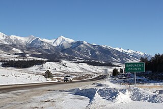
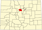
Saguache County is a county located in the U.S. state of Colorado. As of the 2020 census, the population was 6,368. The county seat is Saguache.

<span class="mw-page-title-main">Routt County, Colorado</span> County in Colorado, United States

Routt County is a county located in the U.S. state of Colorado. As of the 2020 census, the population was 24,829. The county seat is Steamboat Springs. Routt County comprises the Steamboat Springs, CO Micropolitan Statistical Area.

<span class="mw-page-title-main">Rio Grande County, Colorado</span> County in Colorado, United States

Rio Grande County is a county located in the U.S. state of Colorado. As of the 2020 census, the population was 11,539. The county seat is Del Norte. The county is named for the Rio Grande, which flows through the county.

<span class="mw-page-title-main">Rio Blanco County, Colorado</span> County in Colorado, United States

Rio Blanco County is a county located in the U.S. state of Colorado. As of the 2020 census, the population was 6,529. The county seat is Meeker. The name of the county is the Spanish name for the White River which runs through it.

<span class="mw-page-title-main">Park County, Colorado</span> County in Colorado, United States

Park County is a county located in the U.S. state of Colorado. As of the 2020 census, the population was 17,390. The county seat is Fairplay. The county was named after the large geographic region known as South Park, which was named by early fur traders and trappers in the area.

<span class="mw-page-title-main">Otero County, Colorado</span> County in Colorado, United States

Otero County is a county located in the U.S. state of Colorado. As of the 2020 census, the population was 18,690. The county seat is La Junta. The county was named for Miguel Antonio Otero, one of the founders of the town of La Junta and a member of a prominent Hispanic family.

<span class="mw-page-title-main">Mineral County, Colorado</span> County in Colorado, United States

Mineral County is a county located in the U.S. state of Colorado. As of the 2020 census, the population was 865, making it the third-least populous county in Colorado, behind San Juan County and Hinsdale County. The county seat and only incorporated municipality in the county is Creede. The county was named for the many valuable minerals found in the mountains and streams of the area.

<span class="mw-page-title-main">Las Animas County, Colorado</span> County in Colorado, United States

Las Animas County is a county located in the U.S. state of Colorado. As of the 2020 census, the population was 14,555. The county seat is Trinidad. The county takes its name from the Mexican Spanish name of the Purgatoire River, originally called El Río de las Ánimas Perdidas en el Purgatorio, which means "River of the Lost Souls in Purgatory."

<span class="mw-page-title-main">Larimer County, Colorado</span> County in Colorado, United States

Larimer County is a county located in the U.S. state of Colorado. As of the 2020 census, the population was 359,066. The county seat and most populous city is Fort Collins. The county was named for William Larimer, Jr., the founder of Denver.

<span class="mw-page-title-main">Lake County, Colorado</span> County in Colorado, United States

Lake County is a county located in the U.S. state of Colorado. As of the 2020 census, the population was 7,436. The county seat and the only municipality in the county is Leadville. The highest natural point in Colorado and the entire Rocky Mountains is the summit of Mount Elbert in Lake County at 14,440 feet elevation.

<span class="mw-page-title-main">Jackson County, Colorado</span> County in Colorado, United States

Jackson County is a county located in the U.S. state of Colorado. As of the 2020 census, the population was 1,379, and it was the fourth least populated in the state. The county is named after the United States President Andrew Jackson. The county seat and only municipality in the county is Walden.

<span class="mw-page-title-main">Grand County, Colorado</span> County in Colorado, United States

Grand County is a county located in the U.S. state of Colorado. As of the 2020 census, the population was 15,717. The county seat is Hot Sulphur Springs.

<span class="mw-page-title-main">Gilpin County, Colorado</span> County in Colorado, United States

Gilpin County is a county located in the U.S. state of Colorado, smallest in land area behind only the City and County of Broomfield. As of the 2020 census, the population was 5,808. The county seat is Central City. The county was formed in 1861, while Colorado was still a territory, and was named after Colonel William Gilpin, the first territorial governor.

<span class="mw-page-title-main">Eagle County, Colorado</span> County in Colorado, United States

Eagle County is a county located in the U.S. state of Colorado. As of the 2020 census, the population was 55,731. The county seat is the Town of Eagle and the most populous community is Edwards. The county is named for the Eagle River.

<span class="mw-page-title-main">Delta County, Colorado</span> County in Colorado, United States

Delta County is a county located in the U.S. state of Colorado. As of the 2020 census, the population was 31,196. The county seat is Delta.

<span class="mw-page-title-main">Chaffee County, Colorado</span> County in Colorado, United States

Chaffee County is a county located in the U.S. state of Colorado. As of the 2020 census, the population was 19,476. The county seat is Salida.

References

  1. 1 2 3 "U.S. Census Bureau QuickFacts". U.S. Census Bureau . Retrieved September 4, 2021.
  2. "Find a County". National Association of Counties. Archived from the original on May 31, 2011. Retrieved June 7, 2011.
  3. Lamartine Mining District at Mindat.org
  4. "US Gazetteer files: 2010, 2000, and 1990". United States Census Bureau. February 12, 2011. Retrieved April 23, 2011.
  5. Leip, David. "Dave Leip's Atlas of U.S. Presidential Elections". uselectionatlas.org. Retrieved December 15, 2020.
  6. "Annual Estimates of the Resident Population for Counties: April 1, 2020 to July 1, 2023". United States Census Bureau. Retrieved March 31, 2024.
  7. "U.S. Decennial Census". United States Census Bureau. Retrieved June 7, 2014.
  8. "Historical Census Browser". University of Virginia Library. Archived from the original on August 11, 2012. Retrieved June 7, 2014.
  9. "Population of Counties by Decennial Census: 1900 to 1990". United States Census Bureau. Retrieved June 7, 2014.
  10. "Census 2000 PHC-T-4. Ranking Tables for Counties: 1990 and 2000" (PDF). United States Census Bureau. Archived (PDF) from the original on March 27, 2010. Retrieved June 7, 2014.
  11. "U.S. Census website". United States Census Bureau . Retrieved May 14, 2011.

39°41′N105°38′W / 39.69°N 105.64°W / 39.69; -105.64