Alamosa, Colorado

Last updated

Alamosa, Colorado
Alamosa, Colorado.JPG
Entering Alamosa from the east
Motto: 
"Gateway to the Great Sand Dunes"
Alamosa County Colorado Incorporated and Unincorporated areas Alamosa Highlighted 0801090.svg
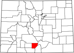
Location of the City of Alamosa in Alamosa County, Colorado
Usa edcp location map.svg
Red pog.svg
Alamosa
Location of the City of Alamosa in the United States.
Coordinates: 37°28′34″N105°52′40″W / 37.47611°N 105.87778°W / 37.47611; -105.87778 [2]
Country United States
State Colorado
County Alamosa County [1]
EstablishedMay 1878
Incorporated August 12, 1878 [3]
Named for The cottonwood trees along the Rio Grande [4]
Government
  Type Home rule municipality [1]
  MayorTy Coleman [5]
Area
[6]
  Total7.97 sq mi (20.65 km2)
  Land7.90 sq mi (20.46 km2)
  Water0.07 sq mi (0.19 km2)
Elevation
[7]
7,543 ft (2,299 m)
Population
 (2020)
  Total9,806
  Density184.0/sq mi (71.03/km2)
   Demonym
Alamosan
Time zone UTC−07:00 (MST)
  Summer (DST) UTC−06:00 (MDT)
ZIP code
81101, 81102 [8]
Area code 719
FIPS code 08-01090
GNIS ID 2409673 [7]
Highways US 160.svg US 160

US 285.svg US 285

Colorado 17.svg SH 17
Website cityofalamosa.org

Alamosa is a home rule municipality and the county seat of Alamosa County, Colorado, United States. [9] [10] The city population was 9,806 in the 2020 United States Census. [11] The city is the commercial center of the San Luis Valley in south-central Colorado, and is the home of Adams State University.

Contents

History

Alamosa was established in May 1878 by the Denver and Rio Grande Railroad and quickly became an important rail center. [12] Alamosa was the terminus of the D&RG until 1881, when the line was extended to Monte Vista. [13] The railroad had an extensive construction, repair, and shipping facility in Alamosa for many years and headquartered its remaining narrow gauge service here with trackage reaching many points throughout southwest Colorado and northern New Mexico. Alamosa is now a notable tourist town with many nearby attractions, including the Great Sand Dunes National Park and Preserve, Colorado Gators Reptile Park , and the Rio Grande Scenic Railroad. The town hosts "Summer Fest on the Rio" which occurs the first weekend in June, the Early Iron car show over the Labor Day weekend, and "Weekends on the Rio" on various Sundays throughout the summer [14] The city takes its name from the Spanish adjective Alamosa, meaning "of cottonwood", for the cottonwood forests which grow along the Rio Grande and throughout town. [4]

Geography

Alamosa is located at the junction of U.S. Routes 160 and 285. At the 2020 United States Census, the city had a total area of 4,910 acres (19.871 km2) including 47 acres (0.192 km2) of water. [11]

Alamosa is located along the Rio Grande in the San Luis Valley, in the highest general agricultural land in the United States. Elevation is about 7,544 feet (2,299 m) in Alamosa with peaks over 14,000 feet (4,300 m) within 23 miles (37 km) of town in the Sangre de Cristo Range.

Alamosa is the gateway city to the Great Sand Dunes National Park and Preserve.

Climate

Alamosa features a cold desert climate (Köppen BWk) with long, cold winters and warm summers, and dry weather year-round. The normal monthly mean temperature ranges from 16.3 °F (−8.7 °C) in January to 64.6 °F (18.1 °C) in July. Annual precipitation is only 7.31 inches (186 mm), with the months of July through September being the wettest. The aridity depresses normal seasonal (July through June of the following year) snowfall to 27.6 inches (70 cm).

The altitude and dryness of the air cause day–night temperature differences to be severe year-round, averaging 35.4 °F (19.7 °C) throughout the year. There was a long-term annual average of 227 days per year with a minimum of 32 °F (0 °C) or less. [15] In the 1981–2010 period, there was an average of 46 nights with minima at or below 0 °F (−18 °C).

On July 10, 2020, Alamosa made weather history by measuring a record low temperature 37 °F (2.8 °C) and a record high temperature 92 °F (33.3 °C) in less than 12 hours. [16]

Climate data for Alamosa, Colorado, 1991–2020 normals, [lower-alpha 1] extremes 1906–present
MonthJanFebMarAprMayJunJulAugSepOctNovDecYear
Record high °F (°C)63
(17)
66
(19)
76
(24)
82
(28)
90
(32)
95
(35)
96
(36)
91
(33)
89
(32)
81
(27)
71
(22)
63
(17)
96
(36)
Mean maximum °F (°C)48.7
(9.3)
53.7
(12.1)
67.0
(19.4)
73.2
(22.9)
81.4
(27.4)
89.2
(31.8)
90.0
(32.2)
87.1
(30.6)
83.2
(28.4)
75.4
(24.1)
63.0
(17.2)
50.5
(10.3)
91.0
(32.8)
Mean daily maximum °F (°C)34.8
(1.6)
41.2
(5.1)
52.7
(11.5)
60.2
(15.7)
69.8
(21.0)
80.2
(26.8)
83.3
(28.5)
80.5
(26.9)
74.4
(23.6)
62.8
(17.1)
48.5
(9.2)
35.4
(1.9)
60.3
(15.7)
Daily mean °F (°C)16.8
(−8.4)
24.3
(−4.3)
35.2
(1.8)
42.6
(5.9)
51.7
(10.9)
60.6
(15.9)
65.3
(18.5)
63.2
(17.3)
55.9
(13.3)
43.8
(6.6)
30.3
(−0.9)
18.1
(−7.7)
42.3
(5.7)
Mean daily minimum °F (°C)−1.1
(−18.4)
7.4
(−13.7)
17.6
(−8.0)
25.0
(−3.9)
33.6
(0.9)
40.9
(4.9)
47.3
(8.5)
45.8
(7.7)
37.3
(2.9)
24.8
(−4.0)
12.1
(−11.1)
0.8
(−17.3)
24.3
(−4.3)
Mean minimum °F (°C)−17.6
(−27.6)
−11.8
(−24.3)
1.2
(−17.1)
10.9
(−11.7)
21.1
(−6.1)
30.7
(−0.7)
38.5
(3.6)
36.9
(2.7)
24.4
(−4.2)
8.2
(−13.2)
−5.0
(−20.6)
−15.0
(−26.1)
−21.6
(−29.8)
Record low °F (°C)−50
(−46)
−35
(−37)
−18
(−28)
−6
(−21)
11
(−12)
23
(−5)
28
(−2)
29
(−2)
15
(−9)
−9
(−23)
−30
(−34)
−42
(−41)
−50
(−46)
Average precipitation inches (mm)0.32
(8.1)
0.28
(7.1)
0.51
(13)
0.57
(14)
0.60
(15)
0.43
(11)
1.04
(26)
1.29
(33)
0.98
(25)
0.65
(17)
0.37
(9.4)
0.35
(8.9)
7.39
(187.5)
Average snowfall inches (cm)4.5
(11)
4.0
(10)
4.3
(11)
3.6
(9.1)
0.9
(2.3)
0.0
(0.0)
0.0
(0.0)
0.0
(0.0)
0.0
(0.0)
1.9
(4.8)
3.5
(8.9)
4.7
(12)
27.4
(69.1)
Average precipitation days (≥ 0.01 in)3.83.94.74.95.64.18.49.96.54.73.74.364.5
Average snowy days (≥ 0.1 in)3.83.73.12.50.80.00.00.00.10.92.54.021.4
Source: NOAA [17] [18]

Demographics

Historical population
CensusPop.Note
1880 802
1890 97321.3%
1900 1,14117.3%
1910 3,013164.1%
1920 3,1715.2%
1930 5,10761.1%
1940 5,6139.9%
1950 5,354−4.6%
1960 6,20515.9%
1970 6,98512.6%
1980 6,830−2.2%
1990 7,57911.0%
2000 7,9605.0%
2010 8,78010.3%
2020 9,80611.7%
U.S. Decennial Census

2020 census

Alamosa Racial Composition [19]
RaceNum.Perc.
White 3,83439.1%
Black or African American 1931.97%
Native American 1511.54%
Asian 1211.23%
Pacific Islander 170.17%
Other/Mixed 2742.79%
Hispanic or Latino 5,21653.19%

As of the 2020 United States Census, there were 9,806 people, 3,828 households, and 1,935 families residing in the city.

2014

According to city-data.com from 2014 there were 9,531 people, 2,974 households, and 1,769 families residing in the city. The population density was 1,995.0 inhabitants per square mile (770.3/km2). There were 3,215 housing units at an average density of 805.8 per square mile (311.1/km2). The racial makeup of the city was 44.5% White, 2.6% Black or African American, 2.20% Native American, 1.7% Asian, 1.3% Pacific Islander, 0.3% from other races, and 0.9% from two or more races. 49.00% of the population were Hispanic or Latino of any race.

There were 2,974 households, out of which 32.0% had children under the age of 18 living with them, 40.5% were married couples living together, 14.6% had a female householder with no husband present, and 40.5% were non-families. 33.7% of all households were made up of individuals, and 11.0% had someone living alone who was 65 years of age or older. The average household size was 2.36 and the average family size was 3.04.

In the city, the population was spread out, with 24.4% under the age of 18, 21.8% from 18 to 24, 24.8% from 25 to 44, 18.1% from 45 to 64, and 10.9% who were 65 years of age or older. The median age was 28 years. For every 100 females, there were 91.4 males. For every 100 females age 18 and over, there were 89.1 males.

The median income for a household in the city was $29,593, and the median income for a family was $33,017. Males had a median income of $27,100 versus $22,671 for females. The per capita income for the city was $15,405. About 18.1% of families and 25.0% of the population were below the poverty line, including 30.4% of those under age 18 and 17.0% of those age 65 or over.

Alamosa City Hall Alamosa City-Hall 2012-10-22.JPG
Alamosa City Hall

Government

Alamosa is a home rule municipality like many other Colorado towns. The city council has six members, four elected from wards and two at large. The council has authority to make, change, and repeal laws and ordinances. The city elects a mayor-at-large on a non-partisan ballot. The current mayor of Alamosa is Ty Coleman.

Education

Alamosa Public Schools are part of the Alamosa School District RE-11J, and include Alamosa Elementary School, Ortega Middle School, and Alamosa High School. Robert Alejo is the Superintendent of Schools. [20]

Adams State University, founded in 1921 as a teacher's college, offers both undergraduate and graduate programs. Graduate level programs emphasize teaching and education, art, history and business. Many courses are available online. In 2015, the college reached an all-time high enrollment of 3,701 students. The university's location in Alamosa, with an elevation of about 7,800 ft above sea level, attracts many athletes (especially runners) to the school's athletic program. In 2014, ASU added a cycling program. [21]

The schools in Alamosa were the subject to the educational segregation lawsuit, Maestas vs. George H. Shone . [22]

Infrastructure

Transportation

Alamosa is on the Rio Grande River, which is crossed by two auto bridges, one pedestrian bridge and one rail bridge in town. Auto traffic is served by U.S. Highway 160 running east and west and U.S. Highway 285 and State Highway 17 running north and south. Alamosa is served by the Colorado Pacific Rio Grande Railroad and Bustang. The local airport is San Luis Valley Regional Airport. Alamosa is part of Colorado's Bustang network. It is on the Alamosa-Pueblo Outrider line. [23]

Train station in Alamosa Alamosa Train-Station 2012-10-22.JPG
Train station in Alamosa

Facilities

Alamosa is the shopping center for the San Luis Valley and has several national and regional stores. There are a number of fast food restaurants, two medical clinics, and a regional hospital, San Luis Valley Regional Medical Center.

Adams State University is located in Alamosa. ASU is a four-year, state-supported university founded in 1921 and offering degrees in several fields including business and education.

Trinidad State College has a campus situated in Alamosa. They offer 2-year degrees in gunsmithing, aquaculture, cosmetology, welding and nursing, as well as traditional arts and sciences classes like English, physics and chemistry.

Notable people

See also

Footnotes

  1. Mean monthly maxima and minima (i.e. the expected highest and lowest temperature readings at any point during the year or given month) calculated based on data at said location from 1991 to 2020.

Related Research Articles

<span class="mw-page-title-main">San Luis Valley</span> High-altitude basin in Colorado and New Mexico in the United States

The San Luis Valley is a region in south-central Colorado with a small portion overlapping into New Mexico. The valley is approximately 122 miles (196 km) long and 74 miles (119 km) wide, extending from the Continental Divide on the northwest rim into New Mexico on the south. It contains 6 counties and portions of 3 others. It is an extensive high-elevation depositional basin of approximately 8,000 square miles (21,000 km2) with an average elevation of 7,664 feet (2,336 m) above sea level. The valley is a section of the Rio Grande Rift and is drained to the south by the Rio Grande, which rises in the San Juan Mountains to the west of the valley and flows south into New Mexico. The San Luis Valley has a cold desert climate but has substantial water resources from the Rio Grande and groundwater.

<span class="mw-page-title-main">Rio Grande County, Colorado</span> County in Colorado, United States

Rio Grande County is a county located in the U.S. state of Colorado. As of the 2020 census, the population was 11,539. The county seat is Del Norte. The county is named for the Rio Grande, which flows through the county.

<span class="mw-page-title-main">Costilla County, Colorado</span> County in Colorado, United States

Costilla County is a county located in the U.S. state of Colorado. As of the 2020 census, the population was 3,499. The county seat is San Luis, the oldest continuously occupied town in Colorado.

<span class="mw-page-title-main">Conejos County, Colorado</span> County in Colorado, United States

Conejos County is a county located in the U.S. state of Colorado. As of the 2020 census, the population was 7,461. The county seat is the unincorporated community of Conejos.

<span class="mw-page-title-main">Alamosa County, Colorado</span> County in Colorado, United States

Alamosa County is a county located in the U.S. state of Colorado. As of the 2020 census, the population was 16,376. The county seat is Alamosa. The county name is the Spanish language word for a grove of cottonwood trees.

<span class="mw-page-title-main">Las Animas, Colorado</span> City in Colorado, United States

Las Animas is the statutory city that is the county seat, the most populous community, and the only incorporated municipality in Bent County, Colorado, United States. The city population was 2,300 at the 2020 United States Census. Las Animas is located on the Arkansas River, just west of its confluence with the Purgatoire River, in southeast Colorado east of Pueblo, near the historic Bent's Fort.

<span class="mw-page-title-main">Buena Vista, Colorado</span> Town in Colorado, United States

Buena Vista is a Statutory Town located in Chaffee County, Colorado, United States. The town population was 2,855 at the 2020 United States Census.

<span class="mw-page-title-main">Salida, Colorado</span> City in Colorado, United States

Salida is the statutory city that is the county seat and the most populous municipality of Chaffee County, Colorado, United States. The population was 5,666 at the 2020 census.

<span class="mw-page-title-main">Antonito, Colorado</span> Town in Colorado, United States

Antonito is a Statutory Town located in Conejos County, Colorado, United States. The town population was 647 at the 2020 United States Census.

<span class="mw-page-title-main">Manassa, Colorado</span> Town in Colorado, United States

Founded in 1851, the Town of Manassa is a Statutory Town and is the most populous municipality in Conejos County, Colorado, United States. The town's population was 947 at the 2020 United States Census.

<span class="mw-page-title-main">Blanca, Colorado</span> Town in Colorado, United States

Blanca is a Statutory Town located in Costilla County, Colorado, United States. The town population was 322 at the 2020 census. Blanca is located in the enormous San Luis Valley.

<span class="mw-page-title-main">Eagle, Colorado</span> Town in Colorado, United States

Eagle is the Statutory Town that is the county seat of Eagle County, Colorado, United States. The town population was 7,511 at the 2020 United States Census, a +15.41% increase since the 2010 United States Census. Eagle is the part of the Edwards, CO Micropolitan Statistical Area.

<span class="mw-page-title-main">Penrose, Colorado</span> Unincorporated community in Fremont County, Colorado, United States

Penrose is a census-designated place (CDP) and post office located in and governed by Fremont County, Colorado, United States. The CDP is a part of the Cañon City, CO Micropolitan Statistical Area. The Penrose post office has the ZIP Code 81240. At the United States Census 2020, the population of the Penrose CDP was 3,685.

<span class="mw-page-title-main">Rifle, Colorado</span> City in Colorado, United States

Rifle is a home rule municipality in and the most populous community of Garfield County, Colorado, United States. The population was 10,437 at the 2020 census. Rifle is a regional center of the cattle ranching industry located along Interstate 70 and the Colorado River just east of the Roan Plateau, which dominates the western skyline of the town. The town was founded in 1882 by Abram Maxfield, and was incorporated in 1905 along Rifle Creek, near its mouth on the Colorado. The community takes its name from the creek.

<span class="mw-page-title-main">Dolores, Colorado</span> Town in Montezuma County, Colorado, United States

Dolores is a Statutory Town located in Montezuma County, Colorado, United States. The town population was 885 at the 2020 United States Census.

<span class="mw-page-title-main">Center, Colorado</span> Town in Saguache and Rio Grande counties in Colorado, United States

The Town of Center is a Statutory Town located in Saguache and Rio Grande counties in Colorado, United States. The town's population was 1,929 at the 2020 United States Census with 1,885 residing in Saguache County and 44 residing in Rio Grande County.

<span class="mw-page-title-main">Del Norte, Colorado</span> Statutory Town in Colorado, United States

Del Norte is a Statutory Town that is the county seat of Rio Grande County, Colorado, United States. The town's name is most commonly pronounced /ˈdɛl nɔɹt/. The town population was 1,458 at the 2020 United States Census.

<span class="mw-page-title-main">Moffat, Colorado</span> Town in Saguache County, Colorado, United States

The Town of Moffat is a statutory town in Saguache County, Colorado, United States. The town population was 108 at the 2020 United States Census.

<span class="mw-page-title-main">Chama, New Mexico</span> Village in New Mexico, United States

Chama is a village in Rio Arriba County, New Mexico, United States. The population was 917 at the 2020 census. The village is located in the Rocky Mountains about 7 miles (11 km) south of the Colorado-New Mexico border.

Hispanic and Latino Coloradans are residents of the state of Colorado who are of Hispanic or Latino ancestry. As of 2020, Hispanics and Latinos of any race made up 21% of the state's population, or 1,269,520 of the state's 5,770,545 residents.

References

  1. 1 2 3 "Active Colorado Municipalities". Colorado Department of Local Affairs . Retrieved October 15, 2021.
  2. "2014 U.S. Gazetteer Files: Places". United States Census Bureau. July 1, 2014. Archived from the original on February 7, 2015. Retrieved January 5, 2015.
  3. "Colorado Municipal Incorporations". State of Colorado, Department of Personnel & Administration, Colorado State Archives. December 1, 2004. Archived from the original on September 27, 2007. Retrieved August 18, 2007.
  4. 1 2 Gannett, Henry (1905). The Origin of Certain Place Names in the United States. U.S. Government Printing Office. pp.  19.
  5. "City Council". The City of Alamosa. 2017. Retrieved September 22, 2019.
  6. "2020 U.S. Gazetteer Files". United States Census Bureau. Retrieved October 31, 2021.
  7. 1 2 U.S. Geological Survey Geographic Names Information System: Alamosa, Colorado
  8. "ZIP Code Lookup". United States Postal Service. August 18, 2007. Archived from the original (JavaScript/HTML) on August 18, 2007. Retrieved August 18, 2007.
  9. "Colorado County Seats". State of Colorado, Department of Public Health and Environment. Archived from the original on January 8, 2008. Retrieved December 31, 2007.
  10. "Find a County". National Association of Counties. Archived from the original on May 31, 2011. Retrieved June 7, 2011.
  11. 1 2 "Decennial Census P.L. 94-171 Redistricting Data". United States Census Bureau, United States Department of Commerce. August 12, 2021. Retrieved September 2, 2021.
  12. Fielder, John (2002). John Fielder's Best of Colorado. Big Earth Publishing. p. 310. ISBN   9781565794290 . Retrieved November 4, 2013.
  13. "Alamosa Historic Marker at 300 Hunt Ave". Historical Marker Database. Retrieved October 31, 2022.
  14. "Weekends on the Rio". Archived from the original on June 30, 2017.
  15. "Mean Number of Days Minimum Temperature 32 Deg. F or Less". Comparative Climatic Data for the United States Through 2012. National Oceanic and Atmospheric Administration: U.S. Dept. of Commerce. 2013. Archived from the original on September 15, 2014.
  16. "Wild Weather: Colorado Town Sets Record Low And High Less Than 12 Hours Apart". July 11, 2020. Retrieved July 14, 2020.
  17. "NowData – NOAA Online Weather Data". National Oceanic and Atmospheric Administration. Retrieved July 11, 2020.
  18. "Station Name: CO ALAMOSA SAN LUIS VALLEY REGIONAL AP". National Oceanic and Atmospheric Administration. Retrieved November 19, 2021.
  19. "Explore Census Data". data.census.gov. Retrieved December 7, 2021.
  20. "Alamosa School District RE-11J". Alamosa School District RE-11J. Archived from the original on June 6, 2014. Retrieved June 1, 2014.
  21. "Academics - Adams State University". www.adams.edu. Archived from the original on April 30, 2018. Retrieved April 30, 2018.
  22. Lobato, Sylvia (May 12, 2018). "School lawsuit from 1914 remembered". Alamosa News. News Media Corporation. Retrieved September 9, 2018.
  23. "Bustang Schedule". RideBustang. CDOT.
  24. Carlson, Jenni (October 28, 2019). "Camille Herron sets another world record, wins another world title". The Oklahoman. Retrieved May 1, 2020.
  25. Weiser, Kathy, ed. (October 2019). "Poker Alice - famous frontier gambler". legendsofamerica.com. Archived from the original on October 26, 2015. Retrieved May 10, 2012.