List of waterfalls in Colorado

Last updated

Bridal Veil Falls near Telluride. Bridal Veil Falls Telluride CO3.jpg
Bridal Veil Falls near Telluride.

This is a list of waterfalls in the U.S. State of Colorado .

Contents

Waterfalls of Colorado

The following list includes all 81 waterfalls in Colorado that have official names according to the United States Geological Survey. There are also numerous unnamed waterfalls in the state.
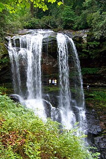
NameWatercourseCountyCoordinatesElev. (ft)Location
Adams Falls [1] East InletGrand 40°14′12″N105°47′47″W / 40.23667°N 105.79639°W / 40.23667; -105.79639 (Adams Falls) 8471 Rocky Mountain National Park
Agnes Vaille Falls [2] Chaffee 38°43′14″N106°14′04″W / 38.72056°N 106.23444°W / 38.72056; -106.23444 (Agnes Vaille Falls) 9278 San Isabel National Forest
Alberta Falls [3] Glacier CreekLarimer 40°18′13″N105°38′17″W / 40.30361°N 105.63806°W / 40.30361; -105.63806 (Alberta Falls) 9406 Rocky Mountain National Park
Apache Falls [4] Huerfano 37°51′17″N104°59′20″W / 37.85472°N 104.98889°W / 37.85472; -104.98889 (Apache Falls) 8776 San Isabel National Forest
Argenta Falls [5] Lake Fork Gunnison River Hinsdale 37°59′21″N107°17′38″W / 37.98917°N 107.29389°W / 37.98917; -107.29389 (Argenta Falls) 8957
Bear Creek Falls [6] Bear CreekOuray 38°00′00″N107°39′37″W / 38.00000°N 107.66028°W / 38.00000; -107.66028 (Bear Creek Falls) 8474
Bedrock Falls [7] Pine CreekChaffee 38°56′40″N106°20′24″W / 38.94444°N 106.34000°W / 38.94444; -106.34000 (Bedrock Falls) 11253 San Isabel National Forest
Bessies Falls [8] Garfield 40°00′02″N107°16′44″W / 40.00056°N 107.27889°W / 40.00056; -107.27889 (Bessies Falls) 9281 White River National Forest
Big Creek Falls [9] South Fork Big CreekJackson 40°54′32″N106°38′18″W / 40.90889°N 106.63833°W / 40.90889; -106.63833 (Big Creek Falls) 9249 Routt National Forest
Boulder Falls [10] North Boulder CreekBoulder 40°00′25″N105°24′21″W / 40.00694°N 105.40583°W / 40.00694; -105.40583 (Boulder Falls) 7050
Bridal Veil Falls [11] Dead Horse CreekGarfield 39°36′06″N107°11′31″W / 39.60167°N 107.19194°W / 39.60167; -107.19194 (Bridal Veil Falls) 7211 White River National Forest
Bridal Veil Falls [12] Cow CreekLarimer 40°26′09″N105°33′04″W / 40.43583°N 105.55111°W / 40.43583; -105.55111 (Bridal Veil Falls) 8907 Rocky Mountain National Park
Bridal Veil Falls [13] Bridal Veil CreekSan Miguel 37°55′09″N107°46′12″W / 37.91917°N 107.77000°W / 37.91917; -107.77000 (Bridal Veil Falls) 10275
Calypso Cascades [14] Cony CreekBoulder 40°11′39″N105°35′26″W / 40.19417°N 105.59056°W / 40.19417; -105.59056 (Calypso Cascades) 9291 Rocky Mountain National Park
Cascade Falls [15] North InletGrand 40°16′16″N105°45′57″W / 40.27111°N 105.76583°W / 40.27111; -105.76583 (Cascade Falls) 8760 Rocky Mountain National Park
Cascade Falls [16] Cascade CreekOuray 38°01′34″N107°39′52″W / 38.02611°N 107.66444°W / 38.02611; -107.66444 (Cascade Falls) 8373 Ouray
Chasm Falls [17] Fall River Larimer 40°25′00″N105°40′21″W / 40.41667°N 105.67250°W / 40.41667; -105.67250 (Chasm Falls) 9055 Rocky Mountain National Park
Columbine Falls [18] Larimer 40°15′39″N105°35′57″W / 40.26083°N 105.59917°W / 40.26083; -105.59917 (Columbine Falls) 11486 Rocky Mountain National Park
Copeland Falls [19] North St. Vrain CreekBoulder 40°12′23″N105°34′07″W / 40.20639°N 105.56861°W / 40.20639; -105.56861 (Copeland Falls) 8524 Rocky Mountain National Park
Cornet Falls [20] Cornet CreekSan Miguel 37°56′35″N107°48′37″W / 37.94306°N 107.81028°W / 37.94306; -107.81028 (Cornet Falls) 9186 Telluride
Crooke Falls [21] Lake Fork Gunnison River Hinsdale 38°00′51″N107°18′42″W / 38.01417°N 107.31167°W / 38.01417; -107.31167 (Crooke Falls) 8724
Crystal Falls [22] Crystal Falls CreekCuster 37°57′42″N105°28′53″W / 37.96167°N 105.48139°W / 37.96167; -105.48139 (Crystal Fall) 9301
Eagle Falls [23] Eagle CreekDolores 37°45′49″N108°05′52″W / 37.76361°N 108.09778°W / 37.76361; -108.09778 (Eagle Falls) 9062 San Juan National Forest
East Fork Falls [24] East Fork Parachute CreekGarfield 39°33′45″N108°00′50″W / 39.56250°N 108.01389°W / 39.56250; -108.01389 (East Fork Falls) 7579
East Middle Fork Falls [25] East Middle Fork Parachute CreekGarfield 39°37′01″N108°03′35″W / 39.61694°N 108.05972°W / 39.61694; -108.05972 (East Middle Fork Falls) 6663
Elk Falls [26] Elk CreekPark 39°30′22″N105°24′49″W / 39.50611°N 105.41361°W / 39.50611; -105.41361 (Elk Falls) 8730 Staunton State Park
Fan Falls [27] Boulder 40°13′46″N105°39′03″W / 40.22944°N 105.65083°W / 40.22944; -105.65083 (Fan Falls) 11099 Rocky Mountain National Park
Fern Falls [28] Fern CreekLarimer 40°20′51″N105°40′04″W / 40.34750°N 105.66778°W / 40.34750; -105.66778 (Fern Falls) 8812 Rocky Mountain National Park
Fish Creek Falls [29] Fish CreekRoutt 40°28′53″N106°46′16″W / 40.48139°N 106.77111°W / 40.48139; -106.77111 (Fish Creek Falls) 7536 Routt National Forest
Glacier Falls [30] Glacier CreekLarimer 40°17′38″N105°38′45″W / 40.29389°N 105.64583°W / 40.29389; -105.64583 (Glacier Falls) 9878 Rocky Mountain National Park
Grace Falls [31] Fern CreekLarimer 40°19′23″N105°41′19″W / 40.32306°N 105.68861°W / 40.32306; -105.68861 (Grace Falls) 10269 Rocky Mountain National Park
Granite Falls [32] Tonauto CreekGrand 40°19′07″N105°46′19″W / 40.31861°N 105.77194°W / 40.31861; -105.77194 (Granite Falls) 9810 Rocky Mountain National Park
Gray Copper Falls [33] Ouray 37°55′20″N107°39′24″W / 37.92222°N 107.65667°W / 37.92222; -107.65667 (Gray Copper Falls) 10859
Hayes Creek Falls [34] Hayes CreekPitkin 39°09′33″N107°15′07″W / 39.15917°N 107.25194°W / 39.15917; -107.25194 (Hayes Creek Falls) 7490
Helen Hunt Falls [35] North Cheyenne Creek El Paso 38°47′19″N104°54′11″W / 38.78861°N 104.90306°W / 38.78861; -104.90306 (Helen Hunt Falls) 7237 North Cheyenne Cañon Park
Horseshoe Falls [36] Roaring River Larimer 40°24′50″N105°38′03″W / 40.41389°N 105.63417°W / 40.41389; -105.63417 (Horseshoe Falls) 8940 Rocky Mountain National Park
Ingram Falls [37] Ingram CreekSan Miguel 37°55′21″N107°45′42″W / 37.92250°N 107.76167°W / 37.92250; -107.76167 (Ingram Falls) 10961
Judd Falls [38] Cooper CreekGunnison 38°57′35″N106°58′43″W / 38.95972°N 106.97861°W / 38.95972; -106.97861 (Judd Falls) 9774
Lost Falls [39] North Fork Big Thompson River Larimer 40°30′13″N105°33′59″W / 40.50361°N 105.56639°W / 40.50361; -105.56639 (Lost Falls) 9859 Rocky Mountain National Park
Lower Disaster Falls [40] Green River Moffat 40°38′38″N108°55′58″W / 40.64389°N 108.93278°W / 40.64389; -108.93278 (Lower Disaster Falls) 5246 Dinosaur National Monument
Lyric Falls [41] Hunters CreekBoulder 40°13′27″N105°35′46″W / 40.22417°N 105.59611°W / 40.22417; -105.59611 (Lyric Falls) 10170 Rocky Mountain National Park
Macey Falls [42] Macey CreekCuster 38°00′16″N105°34′04″W / 38.00444°N 105.56778°W / 38.00444; -105.56778 (Macey Falls) 11329 San Isabel National Forest
Marguerite Falls [43] Fern CreekLarimer 40°20′23″N105°40′29″W / 40.33972°N 105.67472°W / 40.33972; -105.67472 (Marguerite Falls) 9449 Rocky Mountain National Park
McElmo Falls [44] McElmo CreekMontezuma 37°19′10″N108°36′57″W / 37.31944°N 108.61583°W / 37.31944; -108.61583 (McElmo Falls) 5886
Mertensia Falls [45] Boulder 40°12′46″N105°38′28″W / 40.21278°N 105.64111°W / 40.21278; -105.64111 (Mertensia Falls) 10400 Rocky Mountain National Park
Missouri Falls [46] Gilpin 39°49′27″N105°30′33″W / 39.82417°N 105.50917°W / 39.82417; -105.50917 (Missouri Falls) 8596
Morgan Creek Falls [47] Routt 40°32′44″N107°12′17″W / 40.54556°N 107.20472°W / 40.54556; -107.20472 (Morgan Creek Falls) 6391
North Clear Creek Falls [48] North Clear CreekHinsdale 37°50′57″N107°09′01″W / 37.84917°N 107.15028°W / 37.84917; -107.15028 (North Clear Creek Falls) 10013 Rio Grande National Forest
Ouzel Falls [49] Ouzel CreekBoulder 40°11′56″N105°36′04″W / 40.19889°N 105.60111°W / 40.19889; -105.60111 (Ouzel Falls) 9498 Rocky Mountain National Park
Piedra Falls [50] East Fork Piedra RiverMineral 37°29′01″N107°05′42″W / 37.48361°N 107.09500°W / 37.48361; -107.09500 (Piedra Falls) 8409 Weminuche Wilderness
Poudre Falls [51] Cache la Poudre River Larimer 40°38′54″N105°48′48″W / 40.64833°N 105.81333°W / 40.64833; -105.81333 (Poudre Falls) 8602 Roosevelt National Forest
Rainbow Falls [52] Fountain Creek El Paso 38°52′12″N104°55′33″W / 38.87000°N 104.92583°W / 38.87000; -104.92583 (Rainbow Falls) 6621
Red Falls [53] Navajo River Archuleta 37°10′43″N106°40′36″W / 37.17861°N 106.67667°W / 37.17861; -106.67667 (Red Falls) 8812
Ribbon Falls [54] Glacier CreekLarimer 40°16′01″N105°38′25″W / 40.26694°N 105.64028°W / 40.26694; -105.64028 (Ribbon Falls) 10571 Rocky Mountain National Park
Rifle Falls [55] Rifle CreekGarfield 39°40′40″N107°41′55″W / 39.67778°N 107.69861°W / 39.67778; -107.69861 (Rifle Falls) 6604 Rifle Falls State Park
Saguache Falls [56] Middle Fork Saguache CreekSaguache 37°56′30″N106°48′10″W / 37.94167°N 106.80278°W / 37.94167; -106.80278 (Saguache Falls) 10774 La Garita Wilderness
Saint Marys Falls [57] El Paso 38°46′15″N104°55′06″W / 38.77083°N 104.91833°W / 38.77083; -104.91833 (Saint Marys Falls) 8934
Seven Falls [58] South Cheyenne Creek El Paso 38°46′44″N104°52′48″W / 38.77889°N 104.88000°W / 38.77889; -104.88000 (Seven Falls) 6893
Silver Cascade Falls [59] El Paso 38°47′12″N104°54′23″W / 38.78667°N 104.90639°W / 38.78667; -104.90639 (Silver Cascade Falls) 7588 North Cheyenne Cañon Park
Silver Falls [60] [61] Waterfall CreekMineral 37°25′19″N106°46′57″W / 37.42194°N 106.78250°W / 37.42194; -106.78250 (Silver Falls) 10840 San Juan National Forest
Snake River Falls [62] North Fork Snake River Summit 39°38′25″N105°52′54″W / 39.64028°N 105.88167°W / 39.64028; -105.88167 (Snake River Falls) 10571
Snyder Falls [63] Lake CreekLake 39°04′11″N106°26′39″W / 39.06972°N 106.44417°W / 39.06972; -106.44417 (Snyder Falls) 9721 San Isabel National Forest
South Clear Creek Falls [64] South Clear CreekHinsdale 37°49′31″N107°09′21″W / 37.82528°N 107.15583°W / 37.82528; -107.15583 (South Clear Creek Falls) 9649 Rio Grande National Forest
South Fork Falls [65] South Fork White River Garfield 39°50′02″N107°23′15″W / 39.83389°N 107.38750°W / 39.83389; -107.38750 (South Fork Falls) 8619 White River National Forest
The Falls [66] Chaffee 38°46′22″N106°03′45″W / 38.77278°N 106.06250°W / 38.77278; -106.06250 (The Falls) 7949
Thousand Falls [67] Sundance CreekLarimer 40°24′39″N105°39′50″W / 40.41083°N 105.66389°W / 40.41083; -105.66389 (Thousand Falls) 9101 Rocky Mountain National Park
Thunder Falls [68] Boulder 40°13′39″N105°38′23″W / 40.22750°N 105.63972°W / 40.22750; -105.63972 (Thunder Falls) 10892 Rocky Mountain National Park
Timberline Falls [69] Icy BrookLarimer 40°17′06″N105°39′52″W / 40.28500°N 105.66444°W / 40.28500; -105.66444 (Timberline Falls) 10462 Rocky Mountain National Park
Timberline Falls [70] Middle St. Vrain CreekBoulder 40°08′08″N105°33′35″W / 40.13556°N 105.55972°W / 40.13556; -105.55972 (Timberline Falls) 9219 Roosevelt National Forest
Treasure Falls [71] Henson Creek Hinsdale 38°01′10″N107°21′44″W / 38.01944°N 107.36222°W / 38.01944; -107.36222 (Treasure Falls) 9006 Gunnison National Forest
Treasure Falls [72] Fall CreekMineral 37°26′35″N106°52′26″W / 37.44306°N 106.87389°W / 37.44306; -106.87389 (Treasure Falls) 8540 San Juan National Forest
Trinchera Falls [73] Trinchera CreekLas Animas 37°10′04″N104°00′49″W / 37.16778°N 104.01361°W / 37.16778; -104.01361 (Trinchera Falls) 5420
Trio Falls [74] Boulder 40°14′09″N105°38′29″W / 40.23583°N 105.64139°W / 40.23583; -105.64139 (Trio Falls) 11319 Rocky Mountain National Park
Triplet Falls [75] Green River Moffat 40°36′17″N108°56′57″W / 40.60472°N 108.94917°W / 40.60472; -108.94917 (Triplet Falls) 5171 Dinosaur National Monument
Upper Disaster Falls [76] Green River Moffat 40°39′01″N108°56′00″W / 40.65028°N 108.93333°W / 40.65028; -108.93333 (Upper Disaster Falls) 5810 Dinosaur National Monument
Venable Falls [77] Venable CreekCuster 38°04′32″N105°35′45″W / 38.07556°N 105.59583°W / 38.07556; -105.59583 (Venable Falls) 10485 San Isabel National Forest
War Dance Falls [78] Ptarmigan CreekGrand 40°17′18″N105°43′46″W / 40.28833°N 105.72944°W / 40.28833; -105.72944 (War Dance Falls) 9895 Rocky Mountain National Park
West Fork Falls [79] West Fork Parachute CreekGarfield 39°37′46″N108°09′43″W / 39.62944°N 108.16194°W / 39.62944; -108.16194 (West Fork Falls) 7100
Whitnach Falls [80] Fryingpan River Eagle 39°22′34″N107°00′43″W / 39.37611°N 107.01194°W / 39.37611; -107.01194 (Whitnach Falls) 6791
Zapata Falls [81] South Zapata CreekAlamosa 37°37′08″N105°33′11″W / 37.61889°N 105.55306°W / 37.61889; -105.55306 (Zapata Falls) 9409


See also

Related Research Articles

Cullasaja River Stream in North Carolina, USA

The Cullasaja River is a short river located entirely in Macon County, North Carolina. It is a tributary of the Little Tennessee River into which it flows near the county seat of Franklin.

Sauk River (Washington) River in Washington

The Sauk River is a tributary of the Skagit River, approximately 45 miles (72 km) long, in northwestern Washington in the United States. It drains an area of the high Cascade Range in the watershed of Puget Sound north of Seattle. The river is a popular destination for fly fishing. It is a National Wild and Scenic River.

The Black River is a 41.1-mile-long (66.1 km) river on the Upper Peninsula of the U.S. state of Michigan, flowing mostly in Gogebic County into Lake Superior at 46°40′03″N90°02′57″W. Its source at 46°18′54″N90°01′15″W is a boreal wetland on the border with Iron County, Wisconsin. The northern section of the river, 14 miles (23 km) within the boundaries of the Ottawa National Forest, was designated a National Wild and Scenic River in 1992.

Silver Falls State Park United States historic place

Silver Falls State Park is a state park in the U.S. state of Oregon, located near Silverton, about 20 miles (32 km) east-southeast of Salem. It is the largest state park in Oregon with an area of more than 9,000 acres (36 km2), and it includes more than 24 miles (39 km) of walking trails, 14 miles (23 km) of horse trails, and a 4-mile (6.4 km) bike path. Its 8.7-mile (14.0 km) Canyon Trail/Trail of Ten Falls runs along the banks of Silver Creek and by ten waterfalls, from which the park received its name. Four of the ten falls have an amphitheater-like surrounding that allows the trail to pass behind the flow of the falls. The Silver Falls State Park Concession Building Area and the Silver Creek Youth Camp-Silver Falls State Park are separately listed on the U.S. National Register of Historic Places.
South Central Colorado Urban Area Metropolitan area of Colorado

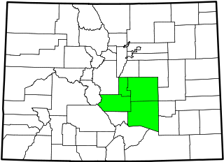
The South Central Colorado Urban Area comprises the Colorado Springs Metropolitan Statistical Area, the Pueblo Metropolitan Statistical Area, and the Cañon City Micropolitan Statistical Area in the central and south central region of the State of Colorado. With the exception of northern Teller County and small portions of northern El Paso County, the entire South Central Colorado Urban Area is drained by the Arkansas River and its tributaries. The South Central Colorado Urban Area is the southernmost of the three primary subregions of the Front Range Urban Corridor.

Mill Creek Falls Waterfall in Prospect State Scenic Viewpoint

Mill Creek Falls, is a waterfall located in the Rogue River Canyon within the Prospect State Scenic Viewpoint in Jackson County, in the U.S. state of Oregon. The waterfall is located at the south end of Mill Creek as it plunges into the Rogue River over a carved cliff surrounded by walls of petrified volcanic ash consequence of Mount Mazama eruption.

Bridal Veil Falls (Washington) Waterfall in Washington (state), United States

Bridal Veil Falls is a 1,328-foot (405 m) waterfall that flows from Lake Serene directly to the South Fork Skykomish River on the creek of the same name in the U.S. state of Washington. It is a perennial 150-foot (46 m) wide drop with four tiers, two of which are clearly visible. It is at 47.78950°N 121.56924°W.

Bridal Veil Falls (Telluride) Waterfall in Telluride, Colorado

Bridal Veil Falls is a 365-foot waterfall at the end of the box canyon overlooking Telluride, Colorado. Hiking and off-road trails pass by the falls and it has a hydroelectric power plant at its top. In winter the frozen shape of the falls forms an imposing challenge to intrepid ice climbers.

The Cascade River is a river in the U.S. state of Washington. It is a tributary of the Skagit River which it joins at the city of Marblemount. It is a National Wild and Scenic River.

Waterfalls in Ricketts Glen State Park Waterfalls in Ricketts Glen State Park in the U.S. state of Pennsylvania

There are 24 named waterfalls in Ricketts Glen State Park in the U.S. state of Pennsylvania along Kitchen Creek as it flows in three steep, narrow valleys, or glens. They range in height from 9 feet (2.7 m) to the 94-foot (29 m) Ganoga Falls. Ricketts Glen State Park is named for R. Bruce Ricketts, a colonel in the American Civil War who owned over 80,000 acres (32,000 ha) in the area in the late 19th and early 20th centuries, but spared the old-growth forests in the glens from clearcutting. The park, which opened in 1944, is administered by the Bureau of State Parks of the Pennsylvania Department of Conservation and Natural Resources (DCNR). Nearly all of the waterfalls are visible from the Falls Trail, which Ricketts had built from 1889 to 1893 and which the state park rebuilt in the 1940s and late 1990s. The Falls Trail has been called "the most magnificent hike in the state" and one of "the top hikes in the East".
Silver Cord Cascade Waterfall in Wyoming, Yellowstone National Park

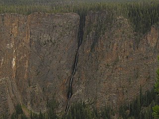
Silver Cord Cascade is a horsetail type waterfall on Surface Creek, a tributary of the Yellowstone River in Yellowstone National Park. Surface Creek flows out of Ribbon Lake off the South rim of the Grand Canyon of the Yellowstone and plunges 1,200 feet (370 m) to the Yellowstone River. It is considered the tallest waterfall in Yellowstone.
Helen Hunt Falls Waterfall in Colorado, United States

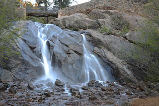
Helen Hunt Falls is a waterfall located on Cheyenne Creek in the North Cheyenne Cañon Park of Colorado Springs, Colorado.

Silver Cascade Falls (Colorado Springs, Colorado) Waterfall in Colorado, United States

Silver Cascade Falls is a waterfall located on St. Mary's Creek in the North Cheyenne Cañon Park of Colorado Springs, Colorado.

Bridal Veil Falls, Leura Waterfall in New South Wales, Australia

The Bridal Veil Falls is a cascade waterfall on the Leura Falls Creek where it spills into the Jamison Valley, located south-east of Leura in the Blue Mountains region of New South Wales, Australia.

References

  1. "Adams Falls". Geographic Names Information System . United States Geological Survey . Retrieved 2013-06-04.
  2. "Agnes Vaille Falls". Geographic Names Information System . United States Geological Survey . Retrieved 2013-06-04.
  3. "Alberta Falls". Geographic Names Information System . United States Geological Survey . Retrieved 2013-06-04.
  4. "Apache Falls". Geographic Names Information System . United States Geological Survey . Retrieved 2013-06-04.
  5. "Argenta Falls". Geographic Names Information System . United States Geological Survey . Retrieved 2013-06-04.
  6. "Bear Creek Falls". Geographic Names Information System . United States Geological Survey . Retrieved 2013-06-04.
  7. "Bedrock Falls". Geographic Names Information System . United States Geological Survey . Retrieved 2013-06-04.
  8. "Bessies Falls". Geographic Names Information System . United States Geological Survey . Retrieved 2013-06-04.
  9. "Big Creek Falls". Geographic Names Information System . United States Geological Survey . Retrieved 2013-06-04.
  10. "Boulder Falls". Geographic Names Information System . United States Geological Survey . Retrieved 2013-06-04.
  11. "Bridal Veil Fall". Geographic Names Information System . United States Geological Survey . Retrieved 2013-06-04.
  12. "Bridal Veil Falls". Geographic Names Information System . United States Geological Survey . Retrieved 2013-06-04.
  13. "Bridal Veil Falls". Geographic Names Information System . United States Geological Survey . Retrieved 2013-06-04.
  14. "Calypso Cascades". Geographic Names Information System . United States Geological Survey . Retrieved 2013-06-04.
  15. "Cascade Falls". Geographic Names Information System . United States Geological Survey . Retrieved 2013-06-04.
  16. "Cascade Falls". Geographic Names Information System . United States Geological Survey . Retrieved 2013-06-04.
  17. "Chasm Falls". Geographic Names Information System . United States Geological Survey . Retrieved 2013-06-04.
  18. "Columbine Falls". Geographic Names Information System . United States Geological Survey . Retrieved 2013-06-04.
  19. "Copeland Falls". Geographic Names Information System . United States Geological Survey . Retrieved 2013-06-04.
  20. "Cornet Falls". Geographic Names Information System . United States Geological Survey . Retrieved 2013-06-04.
  21. "Crooke Falls". Geographic Names Information System . United States Geological Survey . Retrieved 2013-06-04.
  22. "Crystal Falls". Geographic Names Information System . United States Geological Survey . Retrieved 2013-06-04.
  23. "Eagle Falls". Geographic Names Information System . United States Geological Survey . Retrieved 2013-06-04.
  24. "East Fork Falls". Geographic Names Information System . United States Geological Survey . Retrieved 2013-06-04.
  25. "East Middle Fork Falls". Geographic Names Information System . United States Geological Survey . Retrieved 2013-06-04.
  26. "Elk Falls". Geographic Names Information System . United States Geological Survey . Retrieved 2013-06-04.
  27. "Fan Falls". Geographic Names Information System . United States Geological Survey . Retrieved 2013-06-04.
  28. "Fern Falls". Geographic Names Information System . United States Geological Survey . Retrieved 2013-06-04.
  29. "Fish Creek Falls". Geographic Names Information System . United States Geological Survey . Retrieved 2013-06-04.
  30. "Glacier Falls". Geographic Names Information System . United States Geological Survey . Retrieved 2013-06-04.
  31. "Grace Falls". Geographic Names Information System . United States Geological Survey . Retrieved 2013-06-04.
  32. "Granite Falls". Geographic Names Information System . United States Geological Survey . Retrieved 2013-06-04.
  33. "Gray Copper Falls". Geographic Names Information System . United States Geological Survey . Retrieved 2013-06-04.
  34. "Hayes Creek Falls". Geographic Names Information System . United States Geological Survey . Retrieved 2013-06-04.
  35. "Helen Hunt Falls". Geographic Names Information System . United States Geological Survey . Retrieved 2013-06-04.
  36. "Horseshoe Falls". Geographic Names Information System . United States Geological Survey . Retrieved 2013-06-04.
  37. "Ingram Falls". Geographic Names Information System . United States Geological Survey . Retrieved 2013-06-04.
  38. "Judd Falls". Geographic Names Information System . United States Geological Survey . Retrieved 2013-06-04.
  39. "Lost Falls". Geographic Names Information System . United States Geological Survey . Retrieved 2013-06-04.
  40. "Lower Disaster Falls". Geographic Names Information System . United States Geological Survey . Retrieved 2013-06-04.
  41. "Lyric Falls". Geographic Names Information System . United States Geological Survey . Retrieved 2013-06-04.
  42. "Macey Falls". Geographic Names Information System . United States Geological Survey . Retrieved 2013-06-04.
  43. "Marguerite Falls". Geographic Names Information System . United States Geological Survey . Retrieved 2013-06-04.
  44. "McElmo Falls". Geographic Names Information System . United States Geological Survey . Retrieved 2013-06-04.
  45. "Mertensia Falls". Geographic Names Information System . United States Geological Survey . Retrieved 2013-06-04.
  46. "Missouri Falls". Geographic Names Information System . United States Geological Survey . Retrieved 2013-06-04.
  47. "Morgan Creek Falls". Geographic Names Information System . United States Geological Survey . Retrieved 2013-06-05.
  48. "North Clear Creek Falls". Geographic Names Information System . United States Geological Survey . Retrieved 2013-06-04.
  49. "Ouzel Falls". Geographic Names Information System . United States Geological Survey . Retrieved 2013-06-04.
  50. "Piedra Falls". Geographic Names Information System . United States Geological Survey . Retrieved 2013-06-04.
  51. "Poudre Falls". Geographic Names Information System . United States Geological Survey . Retrieved 2013-06-04.
  52. "Rainbow Falls". Geographic Names Information System . United States Geological Survey . Retrieved 2013-06-04.
  53. "Red Falls". Geographic Names Information System . United States Geological Survey . Retrieved 2013-06-04.
  54. "Ribbon Falls". Geographic Names Information System . United States Geological Survey . Retrieved 2013-06-04.
  55. "Rifle Falls". Geographic Names Information System . United States Geological Survey . Retrieved 2013-06-04.
  56. "Saguache Falls". Geographic Names Information System . United States Geological Survey . Retrieved 2013-06-04.
  57. "Saint Marys Falls". Geographic Names Information System . United States Geological Survey . Retrieved 2013-06-04.
  58. "Seven Falls". Geographic Names Information System . United States Geological Survey . Retrieved 2013-06-04.
  59. "Silver Cascade Falls". Geographic Names Information System . United States Geological Survey . Retrieved 2013-06-04.
  60. "Silver Falls". Geographic Names Information System . United States Geological Survey . Retrieved 2013-06-04.
  61. GNIS longitute for Silver Falls is 1062657W, it should be 1064657W
  62. "Snake River Falls". Geographic Names Information System . United States Geological Survey . Retrieved 2013-06-04.
  63. "Snyder Falls". Geographic Names Information System . United States Geological Survey . Retrieved 2013-06-04.
  64. "South Clear Creek Falls". Geographic Names Information System . United States Geological Survey . Retrieved 2013-06-04.
  65. "South Fork Falls". Geographic Names Information System . United States Geological Survey . Retrieved 2013-06-04.
  66. "The Falls". Geographic Names Information System . United States Geological Survey . Retrieved 2013-06-04.
  67. "Thousand Falls". Geographic Names Information System . United States Geological Survey . Retrieved 2013-06-04.
  68. "Thunder Falls". Geographic Names Information System . United States Geological Survey . Retrieved 2013-06-04.
  69. "Timberline Falls". Geographic Names Information System . United States Geological Survey . Retrieved 2013-06-04.
  70. "Timberline Falls". Geographic Names Information System . United States Geological Survey . Retrieved 2013-06-04.
  71. "Treasure Falls". Geographic Names Information System . United States Geological Survey . Retrieved 2013-06-04.
  72. "Treasure Falls". Geographic Names Information System . United States Geological Survey . Retrieved 2013-06-04.
  73. "Trinchera Falls". Geographic Names Information System . United States Geological Survey . Retrieved 2013-06-04.
  74. "Trio Falls". Geographic Names Information System . United States Geological Survey . Retrieved 2013-06-04.
  75. "Triplet Falls". Geographic Names Information System . United States Geological Survey . Retrieved 2013-06-04.
  76. "Upper Disaster Falls". Geographic Names Information System . United States Geological Survey . Retrieved 2013-06-04.
  77. "Venable Falls". Geographic Names Information System . United States Geological Survey . Retrieved 2013-06-04.
  78. "War Dance Falls". Geographic Names Information System . United States Geological Survey . Retrieved 2013-06-04.
  79. "West Fork Falls". Geographic Names Information System . United States Geological Survey . Retrieved 2013-06-04.
  80. "Whitnach Falls". Geographic Names Information System . United States Geological Survey . Retrieved 2013-06-04.
  81. "Zapata Falls". Geographic Names Information System . United States Geological Survey . Retrieved 2013-06-04.


Coordinates: 38°59′50″N105°32′52″W / 38.9972°N 105.5478°W / 38.9972; -105.5478 (State of Colorado)