Yuma, Colorado | |
|---|---|
 Aerial view of Yuma (2022) | |
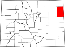
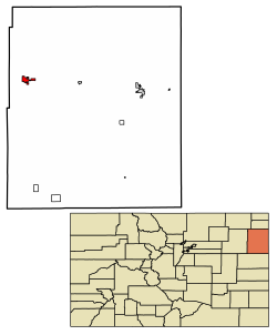 Location within Yuma County and Colorado | |
| Coordinates: 40°7′22″N102°43′30″W / 40.12278°N 102.72500°W [2] | |
| Country | United States |
| State | Colorado |
| County | Yuma [3] |
| Incorporated | March 24, 1887 [4] |
| Named after | Yuma |
| Area | |
• Total | 3.14 sq mi (8.13 km2) |
| • Land | 3.10 sq mi (8.03 km2) |
| • Water | 0.039 sq mi (0.10 km2) |
| Elevation | 4,137 ft (1,261 m) |
| Population | |
• Total | 3,456 |
| • Density | 1,110/sq mi (430/km2) |
| Time zone | UTC−7 (MST) |
| • Summer (DST) | UTC−6 (MDT) |
| ZIP Code | 80759 [7] |
| Area code | 970 |
| FIPS code | 08-86750 [2] |
| GNIS ID | 202920 [2] |
| Major highways | |
| Website | cityofyuma.colorado.gov |
Yuma is a home rule municipality that is the most populous municipality in Yuma County, Colorado, United States. [2] The population was 3,456 at the 2020 census. [6]