Laird, Colorado

Last updated
Laird, Colorado
Yuma County Colorado Incorporated and Unincorporated areas Laird Highlighted 0842000.svg
Location of the Laird CDP in Yuma County, Colorado.
Usa edcp location map.svg
Red pog.svg
Laird
Location of the Laird CDP in the United States.
Coordinates: 40°04′54″N102°06′07″W / 40.0818012°N 102.1018979°W / 40.0818012; -102.1018979 (Laird CDP, Colorado) Coordinates: 40°04′54″N102°06′07″W / 40.0818012°N 102.1018979°W / 40.0818012; -102.1018979 (Laird CDP, Colorado) [1]
Country Flag of the United States.svg  United States
State Flag of Colorado.svg  Colorado
County Yuma County
Government
[2]
  Type unincorporated town
Area
[1]
  Total0.150 sq mi (0.389 km2)
  Land0.150 sq mi (0.389 km2)
  Water0.000 sq mi (0.000 km2)
Elevation
[2]
3,402 ft (1,037 m)
Population
 (2020) [3]
  Total46
  Density310/sq mi (120/km2)
Time zone UTC-7 (MST)
  Summer (DST) UTC-6 (MDT)
ZIP Code [4]
80758
Area code 970
GNIS feature [2] Laird CDP

Laird is an unincorporated community and a census-designated place (CDP) located in and governed by Yuma County, Colorado, United States. The population of the Laird CDP was 46 at the United States Census 2020. [3] The Wray post office (Zip Code 80758) serves Laird postal addresses. [4] Laird has the lowest elevation of any community in Colorado at 3,402 feet (1,037 m).

Contents

Etymology

Laird has the name of James Laird, a Nebraska legislator. [5] "Laird" is the Scots language word for a "lord".

History

The Laird post office began operation in 1887. [6]

Geography

The Laird CDP has an area of 96 acres (0.389 km2), all land. [1]

Demographics

The United States Census Bureau initially defined the Laird CDP for the United States Census 2010.

Laird CDP, Colorado
YearPop.±%
2010 47    
2020 46−2.1%
Source: United States Census Bureau

See also

Related Research Articles

<span class="mw-page-title-main">Derby, Colorado</span> Census Designated Place in Colorado, United States

Derby is an unincorporated community and a census-designated place (CDP) located in and governed by Adams County, Colorado, United States. The CDP is a part of the Denver–Aurora–Lakewood, CO Metropolitan Statistical Area. The population of the Derby CDP was 8,407 at the United States Census 2020. The Commerce City post office serves the area.

<span class="mw-page-title-main">Strasburg, Colorado</span> Census Designated Place in Colorado, United States

Strasburg is an unincorporated town located just 30 minutes east of downtown Denver along the I-70 corridor. It is home to Strasburg School District 31-J, and there are several small businesses, medical clinics, and a post office. Strasburg is a census-designated place (CDP) located in and governed by Adams and Arapahoe counties, Colorado, United States. The CDP is a part of the Denver–Aurora–Lakewood, CO Metropolitan Statistical Area. The Strasburg post office has the ZIP Code 80136. At the United States Census 2020, the population of the Strasburg CDP was 3,307.

<span class="mw-page-title-main">Byers, Colorado</span> Census Designated Place in Colorado, United States

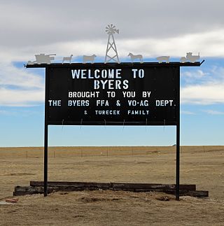
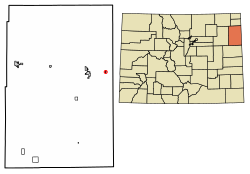
Byers is an unincorporated town, a post office, and a census-designated place (CDP) located in and governed by Arapahoe County, Colorado, United States. The CDP is a part of the Denver–Aurora–Lakewood, CO Metropolitan Statistical Area. The Byers post office has the ZIP Code 80103. At the United States Census 2010, the population of the Byers CDP was 1,160, while the population of the 80103 ZIP Code Tabulation Area was 2,458 including adjacent areas.

<span class="mw-page-title-main">Edwards, Colorado</span> Census Designated Place in Colorado, United States

Edwards is an unincorporated town, a post office, and a census-designated place (CDP) located in and governed by Eagle County, Colorado, United States. Edwards is the principal town of the Edwards, CO Micropolitan Statistical Area. The Edwards post office has the ZIP Code 81632. At the United States Census 2010, the population of the Edwards CDP was 10,266, while the population of the 81632 ZIP Code Tabulation Area was 10,267. The Edwards Metropolitan District provides services.

<span class="mw-page-title-main">Kittredge, Colorado</span> Census Designated Place in Colorado, United States

Kittredge is an unincorporated town, a post office, and a census-designated place (CDP) located in and governed by Jefferson County, Colorado, United States. The CDP is a part of the Denver–Aurora–Lakewood, CO Metropolitan Statistical Area. The Kittredge post office has the ZIP code 80457. At the United States Census 2010, the population of the Kittredge CDP was 1,304, while the population of the 80457 ZIP Code Tabulation Area was 612.

<span class="mw-page-title-main">Padroni, Colorado</span> Census Designated Place in Colorado, United States

Padroni is an unincorporated town, a census-designated place (CDP), and a post office located in and governed by Logan County, Colorado, United States. The CDP is a part of the Sterling, CO Micropolitan Statistical Area. The Padroni post office has the ZIP Code 80745. At the United States Census 2010, the population of the Padroni CDP was 76, while the population of the 80745 ZIP Code Tabulation Area was 156 including adjacent areas.

<span class="mw-page-title-main">Avondale, Colorado</span> Census-designated place in Pueblo County, Colorado, United States

Avondale is a census-designated place (CDP) and post office in and governed by Pueblo County, Colorado, United States. The CDP is a part of the Pueblo, CO Metropolitan Statistical Area. The Avondale post office has the ZIP Code 81022. At the United States Census 2020, the population of the Avondale CDP was 594, while the population of the 81022 ZIP Code Tabulation Area was 1,624 including adjacent areas.

<span class="mw-page-title-main">Conejos, Colorado</span> Census Designated Place in Colorado, United States

Conejos is an unincorporated town, a post office, a census-designated place (CDP), and the county seat of Conejos County, Colorado, United States. The Conejos post office has the ZIP Code 81129. At the United States Census 2020, the population of the Conejos CDP was 46. Conejos is the only unincorporated county seat in the State of Colorado.

<span class="mw-page-title-main">Cope, Colorado</span> Census Designated Place in Colorado, United States

Cope is an unincorporated town, a post office, and a census-designated place (CDP) located in and governed by Washington County, Colorado, United States. The population was 53 at the 2020 census. The Cope post office has the ZIP Code 80812.

<span class="mw-page-title-main">Gardner, Colorado</span> Census-designated place in Huerfano County, Colorado, United States

Gardner is a census-designated place (CDP) and post office in and governed by Huerfano County, Colorado, United States. The Gardner post office has the ZIP Code 81040. At the United States Census 2020, the population of the Gardner CDP was 106.

<span class="mw-page-title-main">Hasty, Colorado</span> Census Designated Place in Colorado, United States

Hasty is an unincorporated town, a post office, and a census-designated place (CDP) located in and governed by Bent County, Colorado, United States. The Hasty post office has the ZIP code 81044. At the United States Census 2020, the population of the Hasty CDP was 182.

<span class="mw-page-title-main">Idalia, Colorado</span> Unincorporated community in Colorado, United States

Idalia is an unincorporated town, a post office, and a census-designated place (CDP) located in Yuma County, Colorado, United States. The Idalia post office has the ZIP Code 80735. At the United States Census 2020, the population of the Idalia CDP was 97.

<span class="mw-page-title-main">Joes, Colorado</span> Census-designated place in Yuma County, Colorado, United States

Joes is a census-designated place (CDP) and post office in and governed by Yuma County, Colorado, United States. The Joes post office has the ZIP Code 80822. At the United States Census 2020, the population of the Joes CDP was 82.

<span class="mw-page-title-main">Kirk, Colorado</span> Unincorporated community in Colorado, United States

Kirk is an unincorporated town, a post office, and a census-designated place (CDP) located in and governed by Yuma County, Colorado, United States. The Kirk post office has the ZIP Code 80824. At the United States Census 2020, the population of the Kirk CDP was 61.

<span class="mw-page-title-main">Lazear, Colorado</span> Census Designated Place in Colorado, United States

Lazear is an unincorporated town, a census-designated place (CDP), and a post office located in and governed by Delta County, Colorado, United States. The Lazear post office has the ZIP Code 81420. The population was 168 at the 2020 census.

<span class="mw-page-title-main">McCoy, Colorado</span> Census Designated Place in Colorado, United States

McCoy is an unincorporated town, a census-designated place (CDP), and a post office located in and governed by Eagle County, Colorado, United States. The CDP is a part of the Edwards, CO Micropolitan Statistical Area. The McCoy post office has the ZIP Code 80463. At the United States Census 2010, the population of the McCoy CDP was 24, while the population of the 80463 ZIP Code Tabulation Area was 136 including adjacent areas.

<span class="mw-page-title-main">Phippsburg, Colorado</span> Census-designated place in Routt County, Colorado, United States

Phippsburg is a census-designated place (CDP) and a post office in and governed by Routt County, Colorado, United States. The population was 234 at the 2020 census. The CDP is a part of the Steamboat Springs, CO Micropolitan Statistical Area. The Phippsburg post office has the ZIP Code 80469.

<span class="mw-page-title-main">Vernon, Colorado</span> Unincorporated community in Colorado, United States

Vernon is an unincorporated town, a post office, and a census-designated place (CDP) located in and governed by Yuma County, Colorado, United States. The Vernon post office has the ZIP Code 80755. At the United States Census 2020, the population of the Vernon CDP was 38.

<span class="mw-page-title-main">Weston, Colorado</span> Census Designated Place in Colorado, United States

Weston is an unincorporated town, a post office, and a census-designated place (CDP) located in and governed by Las Animas County, Colorado, United States. The Weston post office has the ZIP Code 81091. At the United States Census 2010, the population of the Weston CDP was 55, while the population of the 81091 ZIP Code Tabulation Area was 812 including adjacent areas.

<span class="mw-page-title-main">Wolcott, Colorado</span> Census Designated Place in Colorado, United States

Wolcott is an unincorporated town, a post office, and a census-designated place (CDP) located in and governed by Eagle County, Colorado, United States. The CDP is a part of the Edwards, CO Micropolitan Statistical Area. The Wolcott post office has the ZIP Code 81655. At the United States Census 2010, the population of the Wolcott CDP was 15, while the population of the 81655 ZIP Code Tabulation Area was 65 including adjacent areas.

References

  1. 1 2 3 "State of Colorado Census Designated Places - BAS20 - Data as of January 1, 2020". United States Census Bureau . Retrieved December 28, 2020.
  2. 1 2 3 "U.S. Board on Geographic Names: Domestic Names". United States Geological Survey . Retrieved December 28, 2020.
  3. 1 2 United States Census Bureau. "Laird CDP, Colorado" . Retrieved April 11, 2023.
  4. 1 2 "Zip Code 80758 Map and Profile". zipdatamaps.com. 2020. Retrieved December 28, 2020.
  5. Dawson, John Frank. Place names in Colorado: why 700 communities were so named, 150 of Spanish or Indian origin. Denver, CO: The J. Frank Dawson Publishing Co. p. 30.
  6. "Post offices". Jim Forte Postal History. Retrieved 29 June 2016.