Eckley, Colorado

Last updated

Eckley, Colorado
Eckley Co Town Center.JPG
Pedal the Plains rest stop in Eckley in September 2012.
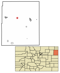
Yuma County Colorado Incorporated and Unincorporated areas Eckley Highlighted 0823025.svg
Location of the Town of Eckley in Yuma County, Colorado.
Usa edcp location map.svg
Red pog.svg
Eckley
Location of the Town of Eckley in the United States.
Coordinates: 40°06′45″N102°29′19″W / 40.112467°N 102.488545°W / 40.112467; -102.488545 [2]
Country Flag of the United States.svg  United States
State Flag of Colorado.svg  Colorado
County Yuma [1]
Incorporated (town) June 16, 1920 [3]
Government
  Type Statutory Town [1]
Area
[4]
  Total0.473 sq mi (1.225 km2)
  Land0.473 sq mi (1.225 km2)
  Water0.000 sq mi (0.000 km2)
Elevation
[5]
3,907 ft (1,191 m)
Population
 (2020) [4]
  Total232
  Density491/sq mi (190/km2)
Time zone UTC−07:00 (MST)
  Summer (DST) UTC−06:00 (MDT)
ZIP code [6]
80727
Area code 970
FIPS code 08-23025
GNIS feature ID0183026
Website townofeckley.colorado.gov

Eckley is a statutory town located in Yuma County, Colorado, United States. [1] The town population was 232 at the 2020 United States Census. [4]

Contents

History

A post office called Eckley has been in operation since the 1880s. [7] The community derives its name from Adam Eckles, a rancher. [8]

Geography

Eckley is located at 40°6′43″N102°29′20″W / 40.11194°N 102.48889°W / 40.11194; -102.48889 (40.111956, -102.488986). [9]

At the 2020 United States Census, the town had a total area of 303 acres (1.225 km2), all of it land. [4]

Climate

According to the Köppen Climate Classification system, Eckley has a semi-arid climate, abbreviated "BSk" on climate maps. [10]

Demographics

Historical population
CensusPop.Note
1920 332
1930 3598.1%
1940 358−0.3%
1950 295−17.6%
1960 207−29.8%
1970 193−6.8%
1980 26235.8%
1990 211−19.5%
2000 27831.8%
2010 257−7.6%
2020 232−9.7%
U.S. Decennial Census

As of the census [11] of 2000, there were 278 people, 100 households, and 66 families residing in the town. The population density was 591.7 inhabitants per square mile (228.5/km2). There were 120 housing units at an average density of 255.4 per square mile (98.6/km2). The racial makeup of the town was 85.25% White, 0.36% African American, 1.80% Native American, 10.79% from other races, and 1.80% from two or more races. Hispanic or Latino of any race were 19.42% of the population.

There were 100 households, out of which 45.0% had children under the age of 18 living with them, 54.0% were married couples living together, 9.0% had a female householder with no husband present, and 34.0% were non-families. 30.0% of all households were made up of individuals, and 13.0% had someone living alone who was 65 years of age or older. The average household size was 2.78 and the average family size was 3.53.

In the town, the population was spread out, with 37.1% under the age of 18, 5.0% from 18 to 24, 29.1% from 25 to 44, 16.9% from 45 to 64, and 11.9% who were 65 years of age or older. The median age was 32 years. For every 100 females, there were 98.6 males. For every 100 females age 18 and over, there were 94.4 males.

The median income for a household in the town was $23,500, and the median income for a family was $26,250. Males had a median income of $27,500 versus $14,375 for females. The per capita income for the town was $11,194. About 17.8% of families and 20.5% of the population were below the poverty line, including 29.9% of those under the age of eighteen and none of those 65 or over.

See also

Related Research Articles

<span class="mw-page-title-main">Yuma County, Colorado</span> County in Colorado, United States

Yuma County is a county located in the U.S. state of Colorado. As of the 2020 census, the population was 9,988. The county seat is Wray.

<span class="mw-page-title-main">Sedgwick County, Colorado</span> County in Colorado, United States

Sedgwick County is a county located in the U.S. state of Colorado. As of the 2020 census, the population was 2,404. The county seat is Julesburg. The county was named for Fort Sedgwick, a military post along the Platte Trail, which was named for General John Sedgwick. It is located near the state border with Nebraska.
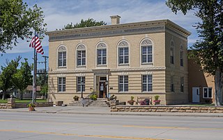
<span class="mw-page-title-main">Baca County, Colorado</span> County in Colorado, United States

Baca County is a county located in the U.S. state of Colorado. As of the 2020 census, the population was 3,506. The county seat is Springfield. Located at the southeast corner of Colorado, the county shares state borders with Kansas, New Mexico, and Oklahoma.

<span class="mw-page-title-main">Jamestown, Colorado</span> Town in Colorado, United States

The historic Town of Jamestown is a Statutory Town in Boulder County, Colorado, United States. The population was 256 at the 2020 United States Census, down from 274 in 2010. It was named for James Smith, an early discoverer of gold. Jamestown was hit hard by the September 2013 Colorado floods when the town was isolated due to road damage from the rains and the flooding of James Creek. Under a mandatory evacuation order, most residents were airlifted to safety under the direction of the Colorado National Guard to nearby Boulder.

<span class="mw-page-title-main">Cheyenne Wells, Colorado</span> Town in Colorado, United States

Cheyenne Wells is the Statutory Town that is the county seat and the most populous municipality of Cheyenne County, Colorado, United States. The town population was 758 at the 2020 United States Census.

<span class="mw-page-title-main">Empire, Colorado</span> Town in Colorado, United States

The historic Town of Empire is a Statutory Town located in Clear Creek County, Colorado, United States. The town population was 345 at the 2020 United States Census, a +22.34% increase since the 2010 United States Census. The town is a former mining settlement that flourished during the Colorado Silver Boom in the late 19th century. Empire is now a part of the Denver–Aurora–Lakewood, CO Metropolitan Statistical Area and the Front Range Urban Corridor.

<span class="mw-page-title-main">Crook, Colorado</span> Town in Colorado, United States

The Town of Crook is a Statutory Town in Logan County, Colorado, United States. The town population was 133 at the 2020 United States Census. Crook is a part of the Sterling, CO Micropolitan Statistical Area.

<span class="mw-page-title-main">Fleming, Colorado</span> Town in Colorado, United States

The Town of Fleming is a Statutory Town in Logan County, Colorado, United States. The town population was 428 at the 2020 United States Census. Fleming is a part of the Sterling, CO Micropolitan Statistical Area.

<span class="mw-page-title-main">Hillrose, Colorado</span> Town in Colorado, United States

The Town of Hillrose is a statutory town located in Morgan County, Colorado, United States. The town population was 312 at the 2020 United States Census, an 18.18% increase since the 2010 United States Census.

<span class="mw-page-title-main">Alma, Colorado</span> Town in Park County, Colorado, United States

Alma is a statutory town in Park County, Colorado, United States. The town population was 296 at the 2020 United States Census. Alma is located West and South of the Denver-Aurora-Lakewood, CO Metropolitan Statistical Area and the Front Range Urban Corridor.
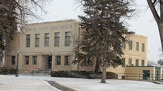
<span class="mw-page-title-main">Holyoke, Colorado</span> City in Colorado, United States

Holyoke is the home rule municipality that is the county seat and the most populous municipality of Phillips County, Colorado, United States. The city population was 2,346 at the 2020 United States Census.
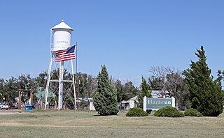
<span class="mw-page-title-main">Hartman, Colorado</span> Town in Prowers County, Colorado, United States

Hartman is a Statutory Town in Prowers County, Colorado, United States. The town population was 56 at the 2020 United States Census. The town is located North of SH-196.

<span class="mw-page-title-main">Wiley, Colorado</span> Town in Prowers County, Colorado, United States

Wiley is a Statutory Town in Prowers County, Colorado, United States. The population was 437 at the 2020 Census.

<span class="mw-page-title-main">Rye, Colorado</span> Town in Colorado, United States

Rye is a Statutory Town in Pueblo County, Colorado, United States. The population was 206 at the 2020 census.

<span class="mw-page-title-main">Akron, Colorado</span> Town in Colorado, United States

Akron is the Statutory Town that is the county seat and the most populous municipality of Washington County, Colorado, United States. The town population was 1,757 at the 2020 United States Census.

<span class="mw-page-title-main">Evans, Colorado</span> City in Colorado, United States

The City of Evans is a home rule municipality located in Weld County, Colorado, United States. The city population was 22,165 at the 2020 United States Census, a 19.57% increase since the 2010 United States Census. Evans is a part of the Greeley, CO Metropolitan Statistical Area and the Front Range Urban Corridor.

<span class="mw-page-title-main">Firestone, Colorado</span> Town in Colorado, United States

The Town of Firestone is a Statutory Town in southwestern Weld County, Colorado, United States. The town population was 16,381 at the 2020 United States Census, a 61.44% increase since the 2010 United States Census. Firestone is a part of the Greeley, CO Metropolitan Statistical Area and the Front Range Urban Corridor.
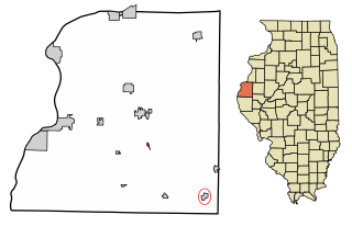
<span class="mw-page-title-main">Bentley, Illinois</span> Town in Illinois, United States

Bentley is an incorporated town in southeast Hancock County, Illinois, United States. The population was 35 at the 2010 census.
<span class="mw-page-title-main">Decatur, Mississippi</span> Town in Mississippi, United States

Decatur is a town in and the county seat of Newton County, Mississippi. The population was 1,841 at the 2010 census. This town is named after war hero Stephen Decatur, Jr.

<span class="mw-page-title-main">Richfield, Pennsylvania</span> Census-designated place in Pennsylvania, United States

Richfield is an unincorporated community and census-designated place (CDP) in Juniata and Snyder counties in Pennsylvania, United States. The population was 549 at the 2010 census.

References

  1. 1 2 3 4 "Active Colorado Municipalities". Colorado Department of Local Affairs . Retrieved October 16, 2021.
  2. "2014 U.S. Gazetteer Files: Places". United States Census Bureau. July 1, 2014. Retrieved January 6, 2015.
  3. "Colorado Municipal Incorporations". State of Colorado, Department of Personnel & Administration, Colorado State Archives. December 1, 2004. Retrieved September 2, 2007.
  4. 1 2 3 4 "Decennial Census P.L. 94-171 Redistricting Data". United States Census Bureau, United States Department of Commerce. August 12, 2021. Retrieved September 7, 2021.
  5. "US Board on Geographic Names". United States Geological Survey. October 25, 2007. Retrieved January 31, 2008.
  6. "ZIP Code Lookup". United States Postal Service. Archived from the original (JavaScript/HTML) on November 4, 2010. Retrieved September 9, 2007.
  7. "Post offices". Jim Forte Postal History. Archived from the original on March 6, 2016. Retrieved June 25, 2016.
  8. Dawson, John Frank. Place names in Colorado: why 700 communities were so named, 150 of Spanish or Indian origin. Denver, CO: The J. Frank Dawson Publishing Co. p. 19.
  9. "US Gazetteer files: 2010, 2000, and 1990". United States Census Bureau. February 12, 2011. Retrieved April 23, 2011.
  10. Climate Summary for Eckley, Colorado
  11. "U.S. Census website". United States Census Bureau . Retrieved January 31, 2008.