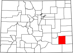
Bent County, Colorado

Last updated

Bent County
Bent County, CO, Courthouse IMG 5719.JPG
Bent County Courthouse in Las Animas
Map of Colorado highlighting Bent County.svg
Location within the U.S. state of Colorado
Colorado in United States.svg
Colorado's location within the U.S.
Coordinates: 37°57′N103°05′W / 37.95°N 103.08°W / 37.95; -103.08
CountryFlag of the United States.svg United States
StateFlag of Colorado.svg  Colorado
FoundedFebruary 6, 1874
Named for William Bent
Seat Las Animas
Largest cityLas Animas
Area
  Total1,541 sq mi (3,990 km2)
  Land1,513 sq mi (3,920 km2)
  Water28 sq mi (70 km2)  1.8%
Population
 (2020)
  Total5,650 [1]
  Density3.7/sq mi (1.4/km2)
Time zone UTC−7 (Mountain)
  Summer (DST) UTC−6 (MDT)
Congressional district 4th
Website www.bentcounty.net

Bent County is a county located in the U.S. state of Colorado. As of the 2020 census, the population was 5,650. [1] The county seat and only incorporated municipality is Las Animas. [2] The county is named in honor of frontier trader William Bent.

Contents

History

As Colorado experienced population growth following the American Civil War, government had to be closer to the people for commerce and justice to be better served in growing communities. Territorial Bent County was created in February 1870, followed by Greenwood County the following month. The June 1, 1870, Federal Census was several months away and there were plans to apply for statehood. On February 2, 1874, Grand County and Elbert County were formed. On February 6, 1874, Greenwood County was dissolved and divided between Bent and Elbert counties. At the time of this annexation, Bent County included a large portion of southeastern Colorado. In 1889, Bent County acquired its current borders when it was partitioned to create Cheyenne, Lincoln, Kiowa, Otero, and Prowers counties.

Geography

According to the U.S. Census Bureau, the county has a total area of 1,541 square miles (3,990 km2), of which 1,513 square miles (3,920 km2) is land and 28 square miles (73 km2) (1.8%) is water. [3]

Adjacent counties

Major highways

State protected area

Trails and byway

Demographics

Historical population
CensusPop.Note
1870 592
1880 1,654179.4%
1890 1,313−20.6%
1900 3,049132.2%
1910 5,04365.4%
1920 9,70592.4%
1930 9,134−5.9%
1940 9,6535.7%
1950 8,775−9.1%
1960 7,419−15.5%
1970 6,493−12.5%
1980 5,945−8.4%
1990 5,048−15.1%
2000 5,99818.8%
2010 6,4998.4%
2020 5,650−13.1%
2023 (est.)5,681 [4] 0.5%
U.S. Decennial Census [5]
1790-1960 [6] 1900-1990 [7]
1990-2000 [8] 2010-2020 [1]

At the 2000 census, there were 5,998 people, 2,003 households, and 1,388 families in the county. The population density was 4 people per square mile (1.5 people/km2). There were 2,366 housing units at an average density of 2 per square mile (0.77/km2). The racial makeup of the county was 79.53% White, 3.65% Black or African American, 2.23% Native American, 0.57% Asian, 10.25% from other races, and 3.77% from two or more races. 30.24% of the population were Hispanic or Latino of any race.

Of the 2,003 households 32.50% had children under the age of 18 living with them, 53.50% were married couples living together, 11.40% had a female householder with no husband present, and 30.70% were non-families. 27.20% of households were one person and 12.20% were one person aged 65 or older. The average household size was 2.53 and the average family size was 3.07.

The age distribution was 23.80% under the age of 18, 9.30% from 18 to 24, 29.20% from 25 to 44, 21.80% from 45 to 64, and 15.90% 65 or older. The median age was 37 years. For every 100 females there were 129.00 males. For every 100 females age 18 and over, there were 138.70 males.

The median household income was $28,125 and the median family income was $34,096. Males had a median income of $22,755 versus $24,261 for females. The per capita income for the county was $13,567. About 16.60% of families and 19.50% of the population were below the poverty line, including 27.40% of those under age 18 and 13.00% of those age 65 or over.

Census-designated places

Politics

Bent is a strongly Republican county, although it is less so than the counties to its east. The last Democrat to carry Bent County was Bill Clinton in 1996, although Michael Dukakis in 1988 was the last to gain a majority.

United States presidential election results for Bent County, Colorado [9]
Year Republican Democratic Third party
No.%No.%No.%
2020 1,50366.09%73232.19%391.72%
2016 1,18861.65%59030.62%1497.73%
2012 1,07555.36%81541.97%522.68%
2008 1,07756.09%79941.61%442.29%
2004 1,33862.09%78536.43%321.48%
2000 1,09655.83%78339.89%844.28%
1996 91741.70%1,04647.57%23610.73%
1992 75933.63%98543.64%51322.73%
1988 1,03247.62%1,08850.21%472.17%
1984 1,31459.75%85939.06%261.18%
1980 1,20651.76%89438.37%2309.87%
1976 1,15646.61%1,26851.13%562.26%
1972 1,52564.29%78733.18%602.53%
1968 1,22847.47%1,12643.53%2339.01%
1964 93734.76%1,73764.43%220.82%
1960 1,67157.54%1,22842.29%50.17%
1956 1,71857.25%1,28342.75%00.00%
1952 1,95059.40%1,31740.12%160.49%
1948 1,29643.43%1,65855.56%301.01%
1944 1,55651.51%1,45648.20%90.30%
1940 1,89951.67%1,75947.86%170.46%
1936 1,29940.84%1,82157.25%611.92%
1932 1,32739.58%1,94858.10%782.33%
1928 1,95772.13%74127.31%150.55%
1924 1,51154.14%80428.81%47617.05%
1920 1,58460.67%93735.89%903.45%
1916 83334.80%1,47361.53%883.68%
1912 42021.76%73037.82%78040.41%
1908 91550.72%81945.40%703.88%
1904 81263.94%41632.76%423.31%
1900 56950.49%54648.45%121.06%
1896 19724.63%59173.88%121.50%
1892 16240.30%00.00%24059.70%
1888 1,33851.58%1,07441.40%1827.02%
1884 38244.26%44651.68%354.06%
1880 17441.23%24257.35%61.42%

Communities

Cities

Unincorporated places

See also

Related Research Articles

<span class="mw-page-title-main">Adams County, Colorado</span> County in Colorado, United States

Adams County is a county located in the U.S. state of Colorado. As of the 2020 census, the population was 519,572. The county seat is Brighton, and the largest city is Thornton. The county is named for Alva Adams, an early Governor of the State of Colorado in 1887–1889. Adams County is part of the Denver–Aurora–Lakewood, CO Metropolitan Statistical Area.

<span class="mw-page-title-main">Kiowa County, Kansas</span> County in Kansas, United States

Kiowa County is a county located in the U.S. state of Kansas. Its county seat and largest city is Greensburg. As of the 2020 census, the county population was 2,460. The county is named after the Kiowa tribe.

<span class="mw-page-title-main">Washington County, Colorado</span> County in Colorado, United States

Washington County is a county located in the eastern side of the U.S. state of Colorado. As of the 2020 census, the population was 4,817, making it the least populous “Washington County” in the United States. The county seat is Akron. The county was named in honor of the United States President George Washington.

<span class="mw-page-title-main">Pueblo County, Colorado</span> County in Colorado, United States

Pueblo County is a county located in the U.S. state of Colorado. As of the 2020 census, the population was 168,162. The county seat is Pueblo. The county was named for the historic city of Pueblo which took its name from the Spanish language word meaning "town" or "village". Pueblo County comprises the Pueblo, CO Metropolitan Statistical Area.

<span class="mw-page-title-main">Prowers County, Colorado</span> County in Colorado, United States

Prowers County is a county located in the U.S. state of Colorado. As of the 2020 census, the population was 11,999. The county seat is Lamar. The county is named in honor of John Wesley Prowers, a leading pioneer in the lower Arkansas River valley region.

<span class="mw-page-title-main">Otero County, Colorado</span> County in Colorado, United States

Otero County is a county located in the U.S. state of Colorado. As of the 2020 census, the population was 18,690. The county seat is La Junta. The county was named for Miguel Antonio Otero, one of the founders of the town of La Junta and a member of a prominent Hispanic family.

<span class="mw-page-title-main">Lincoln County, Colorado</span> County in Colorado, United States

Lincoln County is a county located in the U.S. state of Colorado. As of the 2020 census, the population was 5,675. The county seat is Hugo. The county obtains its name in memory of the United States President Abraham Lincoln. County was formed from portions of Bent and Elbert counties in 1889 from a restructuring of Colorado counties.

<span class="mw-page-title-main">Las Animas County, Colorado</span> County in Colorado, United States

Las Animas County is a county located in the U.S. state of Colorado. As of the 2020 census, the population was 14,555. The county seat is Trinidad. The county takes its name from the Mexican Spanish name of the Purgatoire River, originally called El Río de las Ánimas Perdidas en el Purgatorio, which means "River of the Lost Souls in Purgatory."

<span class="mw-page-title-main">Kiowa County, Colorado</span> County in Colorado, United States

Kiowa County is a county located in the U.S. state of Colorado. As of the 2020 census, the population was 1,446, making it the fifth-least populous county in Colorado. The county seat is Eads. The county was named for the Kiowa Nation of Native Americans.

<span class="mw-page-title-main">Huerfano County, Colorado</span> County in Colorado, United States

Huerfano County is a county located in the U.S. state of Colorado. As of the 2020 census, the population was 6,820. The county seat is Walsenburg. The county, whose name comes from the Spanish huérfano meaning "orphan", was named for the Huerfano Butte, a local landmark. The area of Huerfano County boomed early in the 1900s with the discovery of large coal deposits. After large scale World War II coal demand ended in the 1940s Walsenburg and Huerfano saw a steady economic decline through 2015.

<span class="mw-page-title-main">Gilpin County, Colorado</span> County in Colorado, United States

Gilpin County is a county located in the U.S. state of Colorado, smallest in land area behind only the City and County of Broomfield. As of the 2020 census, the population was 5,808. The county seat is Central City. The county was formed in 1861, while Colorado was still a territory, and was named after Colonel William Gilpin, the first territorial governor.

<span class="mw-page-title-main">Elbert County, Colorado</span> County in the United States

Elbert County is a county located in the U.S. state of Colorado. As of the 2020 census, the population was 26,062. The county seat is Kiowa and the largest town is Elizabeth.

<span class="mw-page-title-main">Cheyenne County, Colorado</span> County in Colorado, United States

Cheyenne County is a county located in the U.S. state of Colorado. The county population was 1,748 at 2020 census. The county seat is Cheyenne Wells.

<span class="mw-page-title-main">Baca County, Colorado</span> County in Colorado, United States

Baca County is a county located in the U.S. state of Colorado. As of the 2020 census, the population was 3,506. The county seat is Springfield. Located at the southeast corner of Colorado, the county shares state borders with Kansas, New Mexico, and Oklahoma.

<span class="mw-page-title-main">Arapahoe County, Colorado</span> County in Colorado, United States

Arapahoe County is a county located in the U.S. state of Colorado. As of the 2020 census, its population was 655,070, making it the third-most populous county in Colorado. The county seat is Littleton, and the most populous city is Aurora. The county was named for the Arapaho Native American tribe, who once lived in the region.

<span class="mw-page-title-main">Bennett, Colorado</span> Town in Colorado, United States

Bennett is a Statutory Town located in Adams and Arapahoe counties, Colorado, United States. The town population was 2,862 at the 2020 United States Census with 2,443 residing in Adams County and 419 residing in Arapahoe County.

<span class="mw-page-title-main">Las Animas, Colorado</span> City in Colorado, United States

Las Animas is the statutory city that is the county seat, the most populous community, and the only incorporated municipality in Bent County, Colorado, United States. The city population was 2,300 at the 2020 United States Census. Las Animas is located on the Arkansas River, just west of its confluence with the Purgatoire River, in southeast Colorado east of Pueblo, near the historic Bent's Fort.

<span class="mw-page-title-main">Elizabeth, Colorado</span> Town in Elbert County, Colorado, United States

Elizabeth is a Statutory Town that is the most populous municipality in Elbert County, Colorado, United States. The town population was 1,675 at the 2020 United States Census, a +23.34% increase since the 2010 United States Census. Elizabeth is a part of the Denver–Aurora–Lakewood, CO Metropolitan Statistical Area and the Front Range Urban Corridor.

<span class="mw-page-title-main">Lamar, Colorado</span> City in Colorado, United States

Lamar is the home rule municipality that is the county seat and the most populous municipality of Prowers County, Colorado. The city population was 7,687 at the 2020 United States Census. The city was named after L.Q.C. Lamar, a slaveholder, Confederate soldier and diplomat who wrote the Mississippi Secession Ordinance, and after the Civil War, went on to serve as Secretary of the Interior and as a Supreme Court Justice. Lamar is the home of Lamar Community College, and is the largest city in southeastern Colorado.

References

  1. 1 2 3 "U.S. Census Bureau QuickFacts". U.S. Census Bureau . Retrieved September 4, 2021.
  2. "Find a County". National Association of Counties. Archived from the original on May 31, 2011. Retrieved June 7, 2011.
  3. "US Gazetteer files: 2010, 2000, and 1990". United States Census Bureau. February 12, 2011. Retrieved April 23, 2011.
  4. "Annual Estimates of the Resident Population for Counties: April 1, 2020 to July 1, 2023". United States Census Bureau. Retrieved March 31, 2024.
  5. "U.S. Decennial Census". United States Census Bureau. Archived from the original on April 26, 2015. Retrieved June 7, 2014.
  6. "Historical Census Browser". University of Virginia Library. Retrieved June 7, 2014.
  7. "Population of Counties by Decennial Census: 1900 to 1990". United States Census Bureau. Retrieved June 7, 2014.
  8. "Census 2000 PHC-T-4. Ranking Tables for Counties: 1990 and 2000" (PDF). United States Census Bureau. Archived (PDF) from the original on March 27, 2010. Retrieved June 7, 2014.
  9. Leip, David. "Dave Leip's Atlas of U.S. Presidential Elections". uselectionatlas.org. Retrieved May 26, 2017.

Notes

    37°57′N103°05′W / 37.95°N 103.08°W / 37.95; -103.08