Summit County, Colorado

Last updated

Summit County
Summit County court house in Colorado.jpg
Summit County court house in Breckenridge
Seal of Summit County, Colorado.png
Map of Colorado highlighting Summit County.svg
Location within the U.S. state of Colorado
Colorado in United States.svg
Colorado's location within the U.S.
Coordinates: 39°38′08″N106°06′08″W / 39.6356°N 106.10235°W / 39.6356; -106.10235
CountryFlag of the United States.svg United States
StateFlag of Colorado.svg  Colorado
FoundedNovember 1, 1861
Named for Continental Divide
Seat Breckenridge
Largest townBreckenridge
Area
  Total619 sq mi (1,600 km2)
  Land608 sq mi (1,570 km2)
  Water11 sq mi (30 km2)  1.8%
Population
 (2020)
  Total31,055
  Density51/sq mi (20/km2)
Time zone UTC−7 (Mountain)
  Summer (DST) UTC−6 (MDT)
Congressional district 2nd
Website www.summitcountyco.gov

Summit County is a county located in the U.S. state of Colorado. As of the 2020 census, the population was 31,055. [1] The county seat and largest town is Breckenridge. [2]

Contents

Summit County comprises the Breckenridge, CO Micropolitan Statistical Area. [3] [4]

History

Summit County was organized as one of the seventeen original Colorado counties by the First Territorial Legislature on November 1, 1861. It was named for the many mountain summits in the county. Until February 2, 1874, its boundaries included the area now comprising Summit County, Grand County, Routt County, Moffat County, Garfield County, Eagle County, and Rio Blanco County.

In 1874, the northern half of the original Summit County was split off to form Grand County; with the creation of Garfield and Eagle counties in 1883, Summit County arrived at its present boundaries. In addition, Summit County has seen two major boom eras.
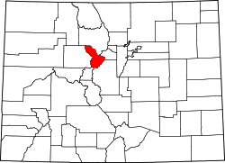
Geography

According to the U.S. Census Bureau, the county has a total area of 619 square miles (1,600 km2), of which 608 square miles (1,570 km2) is land and 11 square miles (28 km2) (1.8%) is water. [5]

The terrain of the county is mountainous with elevations ranging from 7,957 feet (2,425 m) at Green Mountain Reservoir to 14,270 feet (4,350 m) at Grays Peak. The elevation of the county seat of Breckenridge is 9,602 feet (2,927 m), making it one of the highest cities in the state of Colorado and the United States. [6] Much of the county has an Alpine (ET in the Köppen Classification) characterized by tundra vegetation. Breckenridge and other similar elevations in the county have a Subarctic climate (Dfc) characterized by cool summers and abundant snowfall in winter.

Adjacent counties

Major highways

Demographics

Historical population
CensusPop.Note
1870 258
1880 5,4592,015.9%
1890 1,906−65.1%
1900 2,74444.0%
1910 2,003−27.0%
1920 1,724−13.9%
1930 987−42.7%
1940 1,75477.7%
1950 1,135−35.3%
1960 2,07382.6%
1970 2,66528.6%
1980 8,848232.0%
1990 12,28138.8%
2000 23,54891.7%
2010 27,99418.9%
2020 31,05510.9%
2023 (est.)30,465 [7] −1.9%
U.S. Decennial Census [8]
1790-1960 [9] 1900–1990 [10]
1990-2000 [11] 2010-2020 [1]

As of the census [12] of 2000, there were 23,548 people, 9,120 households, and 4,769 families residing in the county. The population density was 39 people per square mile (15 people/km2). There were 24,201 housing units at an average density of 40 per square mile (15/km2). The racial makeup of the county was 91.84% White, 0.68% Black or African American, 0.48% Native American, 0.87% Asian, 0.07% Pacific Islander, 3.96% from other races, and 2.10% from two or more races. 9.79% of the population were Hispanic or Latino of any race.

There were 9,120 households, out of which 24.00% had children under the age of 18 living with them, 44.00% were married couples living together, 4.40% had a female householder with no husband present, and 47.70% were non-families. 21.60% of all households were made up of individuals, and 1.60% had someone living alone who was 65 years of age or older. The average household size was 2.48 and the average family size was 2.86.

In the county, the population was spread out, with 17.40% under the age of 18, 15.70% from 18 to 24, 44.30% from 25 to 44, 19.40% from 45 to 64, and 3.30% who were 65 years of age or older. The median age was 31 years. As of 2014, the life expectancy in Summit County was 86.83 years, the longest average life expectancy of any county in the United States. [13] For every 100 females there were 139.00 males. For every 100 females age 18 and over, there were 144.90 males.

The median income for a household in the county was $56,587, and the median income for a family was $66,914 (these figures had risen to $65,281 and $80,441 respectively as of a 2007 estimate). Males had a median income of $33,741 versus $27,017 for females. The per capita income for the county was $28,676. About 3.10% of families and 9.00% of the population were below the poverty line, including 4.30% of those under age 18 and 3.40% of those age 65 or over.

The 2019 average real estate prices in Summit County were $1,262,929 for a single family home, $559,776 for a condo, townhome or duplex and $344,945 for a vacant piece of land (YTD through December 2019). [14]

Snowmelt runoff fills Lake Dillon in Summit County Reservoir in the Rocky Mountains.jpg
Snowmelt runoff fills Lake Dillon in Summit County

Life expectancy

According to a report in the Journal of the American Medical Association, residents of Summit County had a 2014 life expectancy from birth of 86.83 years in 2014, the longest in the United States. [15] Both men and women live longer in Summit County than in any other county in the United States: 85.5 years for men and 88.0 years for women is the life expectancy at birth. [16] Two contiguous counties, Pitkin and Eagle counties, rank numbers two and three in the nation in life expectancy. Factors contributing to the high life expectancy in Summit County are "high education, high income, high access to medical care, the people are physically active, obesity is lower than anywhere else — so you’re doing it right,” said Dr. Ali Mokdad, one of the study's co-authors. [17]

Education

K-12 Schools

Elementary Schools

  • Breckenridge Elementary School
  • Dillon Valley Elementary School (Dillon)
  • Frisco Elementary School
  • Silverthorne Elementary School
  • Summit Cove Elementary School (Dillon)
  • Upper Blue Elementary School (Breckenridge)

Middle School

  • Summit Middle School (Frisco)

High Schools

  • Snowy Peaks Junior/Senior High School (Frisco)
  • Summit High School (Breckenridge)

Higher Education

Colorado Mountain College operates campuses in Breckenridge and Dillon.

Politics

Summit County is liberal in most elections. As of the 2020 presidential election, Summit County has not voted for the Republican candidate since 1988.

United States presidential election results for Summit County, Colorado [18]
Year Republican Democratic Third party
No.%No.%No.%
2020 5,32228.80%12,63168.35%5262.85%
2016 5,10031.53%9,55759.09%1,5179.38%
2012 5,57136.38%9,34761.04%3942.57%
2008 4,88332.77%9,80265.79%2141.44%
2004 5,37039.10%8,14459.29%2211.61%
2000 4,49740.63%5,30447.92%1,26711.45%
1996 3,26138.73%3,97047.16%1,18814.11%
1992 2,25626.95%3,34439.95%2,77033.09%
1988 2,89351.44%2,59546.14%1362.42%
1984 3,25366.14%1,58832.29%771.57%
1980 2,02746.54%1,28529.51%1,04323.95%
1976 1,82658.15%1,08734.62%2277.23%
1972 1,08259.03%70738.57%442.40%
1968 53657.39%30132.23%9710.39%
1964 34441.55%48358.33%10.12%
1960 42451.27%40048.37%30.36%
1956 42964.61%23535.39%00.00%
1952 44261.90%27137.96%10.14%
1948 29243.26%37856.00%50.74%
1944 32657.60%23741.87%30.53%
1940 47946.78%54052.73%50.49%
1936 26834.85%49664.50%50.65%
1932 22434.78%39761.65%233.57%
1928 36253.16%30644.93%131.91%
1924 35447.52%24132.35%15020.13%
1920 41850.36%38846.75%242.89%
1916 26826.27%71770.29%353.43%
1912 17918.55%60062.18%18619.27%
1908 36631.99%74364.95%353.06%
1904 56148.15%56948.84%353.00%
1900 39428.59%96770.17%171.23%
1896 282.20%1,24397.64%20.16%
1892 27925.60%00.00%81174.40%
1888 70155.63%55744.21%20.16%
1884 60951.92%55647.40%80.68%
1880 1,28948.81%1,32850.28%240.91%

Communities

Towns

Census-designated places

Ghost towns

Recreation

National protected areas

Ski areas

Trails and byways

Lakes

The county has three reservoirs, Lake Dillon, Green Mountain Reservoir, and Clinton Gulch Dam Reservoir that are also popular recreation sites.

Islands

Concert Venues

See also

Related Research Articles

<span class="mw-page-title-main">Mohave County, Arizona</span> County in Arizona, United States

Mohave County is in the northwestern corner of the U.S. state of Arizona. As of the 2020 census, its population was 213,267. The county seat is Kingman, and the largest city is Lake Havasu City. It is the fifth largest county in the United States.

<span class="mw-page-title-main">Paulding County, Georgia</span> County in Georgia, United States

Paulding County is a county located in the northwestern part of the U.S. state of Georgia. Part of the Atlanta metropolitan area, it had an estimated population of 168,661 in 2020. The county seat is Dallas.

<span class="mw-page-title-main">Pitkin County, Colorado</span> County in Colorado, United States

Pitkin County is a county in the U.S. state of Colorado. As of the 2020 census, the population was 17,358. The county seat and largest city is Aspen. The county is named for Colorado Governor Frederick Walker Pitkin.

<span class="mw-page-title-main">Lake County, Colorado</span> County in Colorado, United States

Lake County is a county located in the U.S. state of Colorado. As of the 2020 census, the population was 7,436. The county seat and the only municipality in the county is Leadville. The highest natural point in Colorado and the entire Rocky Mountains is the summit of Mount Elbert in Lake County at 14,440 feet elevation.

<span class="mw-page-title-main">La Plata County, Colorado</span> County in Colorado, United States

La Plata County is a county located in the U.S. state of Colorado. As of the 2020 census, the population was 55,638. The county seat is Durango. The county was named for the La Plata River and the La Plata Mountains. "La plata" means "the silver" in Spanish.

<span class="mw-page-title-main">Grand County, Colorado</span> County in Colorado, United States

Grand County is a county located in the U.S. state of Colorado. As of the 2020 census, the population was 15,717. The county seat is Hot Sulphur Springs.

<span class="mw-page-title-main">Eagle County, Colorado</span> County in Colorado, United States

Eagle County is a county located in the U.S. state of Colorado. As of the 2020 census, the population was 55,731. The county seat is the Town of Eagle and the most populous community is Edwards. The county is named for the Eagle River.

<span class="mw-page-title-main">Delta County, Colorado</span> County in Colorado, United States

Delta County is a county located in the U.S. state of Colorado. As of the 2020 census, the population was 31,196. The county seat is Delta.

<span class="mw-page-title-main">Clear Creek County, Colorado</span> County in Colorado, United States

Clear Creek County is a county located in the U.S. state of Colorado. As of the 2020 census, the population was 9,397. The county seat is Georgetown.

<span class="mw-page-title-main">Deer Trail, Colorado</span> Town in Colorado, United States

The Town of Deer Trail is a Statutory Town located in eastern Arapahoe County, Colorado, United States. The town population was 1,068 at the 2020 United States Census, a +95.60% increase since the 2010 United States Census. Deer Trail is a part of the Denver–Aurora–Lakewood, CO Metropolitan Statistical Area and the Front Range Urban Corridor. The town is situated along Interstate 70, approximately 55 miles (89 km) east of Denver.

<span class="mw-page-title-main">Gypsum, Colorado</span> Town in Colorado, United States

The Town of Gypsum is the home rule municipality that is the most populous municipality in Eagle County, Colorado, United States. The town population was 8,040 at the 2020 United States Census, a +24.13% increase since the 2010 United States Census. Gypsum is a part of the Edwards, CO Micropolitan Statistical Area. Gypsum is the home of an American Gypsum drywall plant and mine.

<span class="mw-page-title-main">Red Cliff, Colorado</span> Town in Colorado, United States

Red Cliff is a statutory town in Eagle County, Colorado, United States. The population was 257 at the 2020 census. The town is a former mining camp situated in the canyon of the upper Eagle River just off U.S. Highway 24 north of Tennessee Pass. The town site is concealed below the highway and is accessible by a side road leading to Shrine Pass in the Sawatch Range.

<span class="mw-page-title-main">Dolores, Colorado</span> Town in Montezuma County, Colorado, United States

Dolores is a Statutory Town located in Montezuma County, Colorado, United States. The town population was 885 at the 2020 United States Census.

<span class="mw-page-title-main">Breckenridge, Colorado</span> Town in Colorado, United States

Breckenridge is the home rule municipality that is the county seat and the most populous municipality of Summit County, Colorado, United States. The town population was 5,078 at the 2020 United States Census. Breckenridge is the principal town of the Breckenridge, CO Micropolitan Statistical Area. The town also has many part-time residents, as many people have vacation homes in the area. The town is located at the base of the Tenmile Range.

<span class="mw-page-title-main">Dillon, Colorado</span> Town in Colorado, United States

The Town of Dillon is a home rule municipality located in Summit County, Colorado, United States. The town population was 1,064 at the 2020 United States Census, a +17.70% increase since the 2010 United States Census. Dillon is a part of the Breckenridge, CO Micropolitan Statistical Area.

<span class="mw-page-title-main">Frisco, Colorado</span> Town in Colorado, United States

Frisco is a home rule municipality located in Summit County, Colorado, United States. The population was 2,913 at the 2020 census. Frisco is a part of the Breckenridge, CO Micropolitan Statistical Area. It is a popular town among skiers from around the world. Four major ski resorts are located in close proximity to Frisco: Copper Mountain, Breckenridge, Keystone, and Arapahoe Basin.

<span class="mw-page-title-main">Keystone, Colorado</span> Home rule municipality in Colorado, United States

Keystone is an unincorporated community and a census-designated place (CDP) located in and governed by Summit County, Colorado, United States. The CDP is a part of the Breckenridge, CO Micropolitan Statistical Area. The population of the Keystone CDP was 1,369 at the United States Census 2020. The Dillon post office (Zip Code 80435) serves Keystone postal addresses. The Keystone CDP includes the Keystone Resort and Keystone village. Keystone residents voted to incorporate in March 2023.

<span class="mw-page-title-main">Danbury, New Hampshire</span> Town in New Hampshire, United States

Danbury is a town in Merrimack County, New Hampshire, United States. The population was 1,250 at the 2020 census.

<span class="mw-page-title-main">Eagle Nest, New Mexico</span> Village in New Mexico, United States

Eagle Nest is a village in Colfax County, New Mexico. The population was 290 at the time of the 2010 census. Located along the Enchanted Circle Scenic Byway, Eagle Nest is a small summer-home and resort destination. Originally named Therma, the village was renamed Eagle Nest in the 1930s. The town is located in the Sangre de Cristo Mountains in northern New Mexico near the Colorado border.

<span class="mw-page-title-main">Dillon Reservoir</span> Fresh water reservoir in Summit County, Col., US

Dillon Reservoir, sometimes referred to as Lake Dillon, is a large fresh water reservoir located in Summit County, Colorado, United States, south of I-70 and bordered by the towns of Frisco, Silverthorne, and Dillon. It is a reservoir for the city of Denver, and its waters are under the control of Denver Water. Popular ski areas are close to the reservoir, including Copper Mountain, Keystone, Arapahoe Basin, and Breckenridge.

References

Gold specimen from the Breckenridge Mining District Gold-221311.jpg
Gold specimen from the Breckenridge Mining District
  1. 1 2 "State & County QuickFacts". United States Census Bureau. Retrieved September 5, 2021.
  2. "Find a County". National Association of Counties. Retrieved June 7, 2011.
  3. "OMB Bulletin No. 10-02: Update of Statistical Area Definitions and Guidance on Their Uses" (PDF). Office of Management and Budget . December 1, 2009. Archived (PDF) from the original on January 21, 2017. Retrieved April 19, 2012 via National Archives.
  4. See the Colorado census statistical areas.
  5. "US Gazetteer files: 2010, 2000, and 1990". United States Census Bureau. February 12, 2011. Retrieved April 23, 2011.
  6. "Elevation distribution for all U.S. cities," http://www.city-data.com/top13.html, accessed August 2, 2017
  7. "Annual Estimates of the Resident Population for Counties: April 1, 2020 to July 1, 2023". United States Census Bureau. Retrieved March 31, 2024.
  8. "U.S. Decennial Census". United States Census Bureau. Retrieved June 11, 2014.
  9. "Historical Census Browser". University of Virginia Library. Retrieved June 11, 2014.
  10. "Population of Counties by Decennial Census: 1900 to 1990". United States Census Bureau. Retrieved June 11, 2014.
  11. "Census 2000 PHC-T-4. Ranking Tables for Counties: 1990 and 2000" (PDF). United States Census Bureau. Archived (PDF) from the original on March 27, 2010. Retrieved June 11, 2014.
  12. "U.S. Census website". United States Census Bureau . Retrieved May 14, 2011.
  13. University of Washington. "US Health Map". Institute for Health Metrics and Evaluation . Retrieved May 8, 2017.
  14. Brewer, Brewer; Ben Brewer (March 6, 2020). "Summit County Real Estate". Breckenridge Real Estate Experts Blog. Ben Brewer. Retrieved March 6, 2020.
  15. Dwyer-Lindgren, Laura (May 8, 2017). "Inequalities in Life Expectancy Among US Counties, 1980 to 2014". JAMA Internal Medicine. 177 (7): 1003–1011. doi:10.1001/jamainternmed.2017.0918. PMC   5543324 . PMID   28492829.
  16. "County Profile: Summit County Colorado," http://www.healthdata.org/sites/default/files/files/county_profiles/US/2015/County_Report_Summit_County_Colorado.pdf, accessed 2 Aug 2017
  17. Achenbach, Joel, "U.S. life expectancy varies more than 20 years from county to county," Washington Post, May 8, 2017
  18. Leip, David. "Dave Leip's Atlas of U.S. Presidential Elections". uselectionatlas.org. Retrieved May 26, 2017.

39°30′N106°03′W / 39.50°N 106.05°W / 39.50; -106.05