Craig, Colorado

Last updated

Craig, Colorado
Craig, Colorado.JPG
Entering Craig from the south on South Ranney Street.
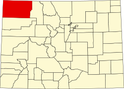
Moffat County Colorado Incorporated and Unincorporated areas Craig Highlighted 0817760.svg
Location of the City of Craig in Moffat County, Colorado
Usa edcp location map.svg
Red pog.svg
Craig
Location of the City of Craig in the United States
Coordinates: 40°31′01″N107°33′19″W / 40.51694°N 107.55528°W / 40.51694; -107.55528 [2]
CountryUnited States
State Colorado
County Moffat County [3]
Incorporated July 15, 1908 [4]
Government
  Type Home rule municipality [1]
Area
[5]
  Total5.073 sq mi (13.138 km2)
  Land5.073 sq mi (13.138 km2)
  Water0.000 sq mi (0.000 km2)
Elevation
[6]
6,195 ft (1,888 m)
Population
 (2020) [5]
  Total9,060
  Density1,786/sq mi (690/km2)
   Metro
13,292
   CSA
38,121
Time zone UTC−07:00 (MST)
  Summer (DST) UTC−06:00 (MDT)
ZIP Codes [7]
81625 & 81626 (PO Box)
Area code 970
FIPS code 08-17760
GNIS feature ID2410255 [6]
Website www.ci.craig.co.us

Craig is a home rule municipality that is the county seat and the most populous municipality of Moffat County, Colorado, United States. [1] The city population was 9,060 at the 2020 United States Census. [5] Craig is the principal city of the Craig, CO Micropolitan Statistical Area.

Contents

History

Founded by William H. Tucker, Craig was incorporated as a city on July 15, 1908. The town was named for one of the town's financial backers, Reverend William Bayard Craig. [8] [9]

Craig became the county seat when Moffat County was created out of the western portion of Routt County on February 27, 1911. In the same area as Craig, at the confluence of the Yampa River (then known as the Bear River) and Fortification Creek, were previous towns known as Yampa (as early as 1885) and Windsor (as early as 1878). In 1878, the area consisted of a number of ranches and at least two businesses: Himley's Ferry (which allowed crossing of the Yampa River) and Peck's Store (a one-room trading post).

In the 1970s and early 1980s, the largest power generation plant in Colorado [10] and several coal mines were constructed near Craig.

Geography

At the 2020 United States Census, the city had a total area of 3,246 acres (13.138 km2), all of which was land. [5]

Climate

Under the Köppen climate classification, Craig has a humid continental climate (Dfb). Summer days are hot with cool nights and very high diurnal temperature variation, while winters are cold and snowy with lows near zero.

The record high temperature is 101 °F (38 °C), which occurred first on July 9, 2021, July 10, 2021, and most recently July 17, 2023, while the record low is −51 °F (−46 °C), which occurred on February 6, 1989.


Climate data for Craig, Colorado, 1991–2020 normals, extremes 1981–present
MonthJanFebMarAprMayJunJulAugSepOctNovDecYear
Record high °F (°C)52
(11)
61
(16)
77
(25)
81
(27)
91
(33)
99
(37)
101
(38)
98
(37)
96
(36)
86
(30)
72
(22)
59
(15)
101
(38)
Mean maximum °F (°C)43.4
(6.3)
47.6
(8.7)
63.1
(17.3)
74.0
(23.3)
81.9
(27.7)
90.9
(32.7)
95.0
(35.0)
92.7
(33.7)
87.7
(30.9)
76.6
(24.8)
63.6
(17.6)
47.9
(8.8)
95.4
(35.2)
Mean daily maximum °F (°C)30.6
(−0.8)
35.7
(2.1)
48.2
(9.0)
58.5
(14.7)
69.1
(20.6)
81.2
(27.3)
89.2
(31.8)
86.5
(30.3)
77.2
(25.1)
62.3
(16.8)
46.6
(8.1)
32.2
(0.1)
59.8
(15.4)
Daily mean °F (°C)16.8
(−8.4)
22.2
(−5.4)
34.0
(1.1)
42.9
(6.1)
51.8
(11.0)
60.9
(16.1)
68.3
(20.2)
66.3
(19.1)
57.1
(13.9)
44.4
(6.9)
31.8
(−0.1)
18.7
(−7.4)
42.9
(6.1)
Mean daily minimum °F (°C)3.0
(−16.1)
8.6
(−13.0)
19.8
(−6.8)
27.3
(−2.6)
34.5
(1.4)
40.6
(4.8)
47.3
(8.5)
46.0
(7.8)
36.9
(2.7)
26.4
(−3.1)
17.1
(−8.3)
5.3
(−14.8)
26.1
(−3.3)
Mean minimum °F (°C)−21.3
(−29.6)
−18.0
(−27.8)
−1.0
(−18.3)
12.8
(−10.7)
22.6
(−5.2)
30.3
(−0.9)
37.4
(3.0)
36.1
(2.3)
24.2
(−4.3)
11.6
(−11.3)
−3.0
(−19.4)
−18.0
(−27.8)
−27.6
(−33.1)
Record low °F (°C)−44
(−42)
−51
(−46)
−24
(−31)
−2
(−19)
12
(−11)
23
(−5)
30
(−1)
25
(−4)
10
(−12)
−14
(−26)
−21
(−29)
−39
(−39)
−51
(−46)
Average precipitation inches (mm)0.91
(23)
0.89
(23)
0.99
(25)
1.67
(42)
1.63
(41)
0.99
(25)
0.93
(24)
0.97
(25)
1.75
(44)
1.48
(38)
0.99
(25)
0.90
(23)
14.10
(358)
Average snowfall inches (cm)15.5
(39)
13.4
(34)
12.2
(31)
5.8
(15)
0.8
(2.0)
0.1
(0.25)
0.0
(0.0)
0.0
(0.0)
0.3
(0.76)
2.9
(7.4)
10.6
(27)
14.6
(37)
76.2
(193.41)
Average extreme snow depth inches (cm)11.2
(28)
9.8
(25)
6.6
(17)
2.9
(7.4)
1.0
(2.5)
0.0
(0.0)
0.0
(0.0)
0.0
(0.0)
0.0
(0.0)
2.3
(5.8)
5.0
(13)
9.2
(23)
12.9
(33)
Average precipitation days (≥ 0.01 in)10.09.510.011.210.16.77.58.97.49.28.29.9108.6
Average snowy days (≥ 0.1 in)8.36.45.62.40.60.10.00.00.11.45.36.937.0
Source 1: NOAA (snow/snow days 19812010) [11] [12]
Source 2: National Weather Service [13]

Demographics

Historical population
CensusPop.Note
1910 392
1920 1,297230.9%
1930 1,4189.3%
1940 2,12349.7%
1950 3,08045.1%
1960 3,98429.4%
1970 4,2055.5%
1980 8,13393.4%
1990 8,091−0.5%
2000 9,18913.6%
2010 9,4643.0%
2020 9,060−4.3%
U.S. Decennial Census

As of the census [14] of 2000, there were 9,189 people, 3,525 households, and 2,432 families residing in the city. The population density was 1,886.6 inhabitants per square mile (728.4/km2). There were 3,851 housing units at an average density of 790.6 per square mile (305.3/km2). The racial makeup of the city was 92.56% White, 0.30% African American, 0.96% Native American, 0.42% Asian, 0.02% Pacific Islander, 3.84% from other races, and 1.89% from two or more races. Hispanic or Latino of any race were 10.80% of the population.

There were 3,525 households, out of which 38.3% had children under the age of 18 living with them, 54.3% were married couples living together, 9.6% had a female householder with no husband present, and 31.0% were non-families. 25.9% of all households were made up of individuals, and 8.9% had someone living alone who was 65 years of age or older. The average household size was 2.53 and the average family size was 3.05.

In the city, the population was spread out, with 28.5% under the age of 18, 9.6% from 18 to 24, 30.1% from 25 to 44, 21.9% from 45 to 64, and 9.9% who were 65 years of age or older. The median age was 34 years. For every 100 females, there were 106.3 males. For every 100 females age 18 and over, there were 103.4 males.

The median income for a household in the city was $41,091, and the median income for a family was $45,504. Males had a median income of $38,038 versus $21,806 for females. The per capita income for the city was $18,140. About 6.9% of families and 8.6% of the population were below the poverty line, including 10.5% of those under age 18 and 6.5% of those age 65 or over.

Transportation

Craig was the terminus of the never-finished Denver and Salt Lake Railway. While the tracks still exist to Craig, the effort to finish this line was abandoned, and the tracks to Craig became a spur route. [15]

U.S. 40 is the primary east–west highway serving Craig, while Colorado State Highway 13 runs south to Interstate 70 and north to the Wyoming border, where it becomes Wyoming State Highway 789 which connects with Interstate 80.

Craig-Moffat Airport serves as the local airfield. Scheduled passenger jet airline service is available at the Yampa Valley Airport, located near the town of Hayden, 15 miles east of Craig.

Steamboat Transit Service (SST) provides three daily departures in the morning in summer and three in winter from Craig that travel through Hayden, Milner and Steamboat II before arriving in Steamboat Springs, CO.

Colorado's Bustang Service also provides transportation to the Front Range of Colorado.

Hunting

Craig is, according to the local chamber of commerce, "Elk Hunting Capital of the World". [16]

Notable people

See also

Related Research Articles

<span class="mw-page-title-main">Routt County, Colorado</span> County in Colorado, United States

Routt County is a county located in the U.S. state of Colorado. As of the 2020 census, the population was 24,829. The county seat is Steamboat Springs. Routt County comprises the Steamboat Springs, CO Micropolitan Statistical Area.

<span class="mw-page-title-main">Moffat County, Colorado</span> County in Colorado, United States

Moffat County is a county located in the U.S. state of Colorado. As of the 2020 census, the population was 13,292. The county seat is Craig. With an area of 4,751 square miles, it is the second-largest county by area in Colorado, behind Las Animas County.

<span class="mw-page-title-main">Brighton, Colorado</span> City in Colorado, United States

Brighton is a home rule municipality city located in Adams and Weld counties, Colorado, United States. Brighton is the county seat of Adams County and a part of the Denver–Aurora–Lakewood, CO Metropolitan Statistical Area and the Front Range Urban Corridor. The city population was 40,083 at the 2020 United States Census with 39,718 residing in Adams County and 365 residing in Weld County.

<span class="mw-page-title-main">Federal Heights, Colorado</span> City in Colorado, United States

The City of Federal Heights is a home rule municipality located in western Adams County, Colorado, United States. The city population was 14,382 at the 2020 United States Census, a +25.42% increase since the 2010 United States Census. Federal Heights is a part of the Denver–Aurora–Lakewood, CO Metropolitan Statistical Area and the Front Range Urban Corridor. The current Mayor is Linda S. Montoya, who was elected to a four-year term in 2019.

<span class="mw-page-title-main">Gypsum, Colorado</span> Town in Colorado, United States

The Town of Gypsum is the home rule municipality that is the most populous municipality in Eagle County, Colorado, United States. The town population was 8,040 at the 2020 United States Census, a +24.13% increase since the 2010 United States Census. Gypsum is a part of the Edwards, CO Micropolitan Statistical Area. Gypsum is the home of an American Gypsum drywall plant and mine.

<span class="mw-page-title-main">Edgewater, Colorado</span> City in Colorado, United States

The City of Edgewater is a home rule municipality located in Jefferson County, Colorado, United States. The city population was 5,005 at the 2020 United States Census. Edgewater is surrounded by Denver to the east, Lakewood to the south and west, and Wheat Ridge to the north. The city is a part of the Denver–Aurora–Lakewood, CO Metropolitan Statistical Area and the Front Range Urban Corridor.

<span class="mw-page-title-main">Burlington, Colorado</span> City in Colorado, United States

Burlington is a home rule municipality and the county seat and most populous community of Kit Carson County, Colorado, United States. The city population was 3,172 at the 2020 United States Census.

<span class="mw-page-title-main">Kim, Colorado</span> Town in Colorado, United States

Kim is a Statutory Town in Las Animas County, Colorado, United States. The population was 63 at the time of the 2020 United States Census.

<span class="mw-page-title-main">Sterling, Colorado</span> City in Colorado, United States

Sterling is a home rule municipality and the county seat and most populous municipality of Logan County, Colorado, United States. Sterling is the principal city of the Sterling, CO Micropolitan Statistical Area. The city population was 13,735 at the 2020 census.

<span class="mw-page-title-main">Collbran, Colorado</span> Town in Mesa County, Colorado, United States

Collbran is a statutory town located in Mesa County, Colorado, United States. The town's population was 369 at the 2020 Census. Collbran is a part of the Grand Junction, CO Metropolitan Statistical Area.

<span class="mw-page-title-main">Dinosaur, Colorado</span> Town in Colorado, United States

Dinosaur is a statutory town in Moffat County, Colorado, United States. As of the 2020 census, the population was 243, down from 339 at the 2010 census.

<span class="mw-page-title-main">Cortez, Colorado</span> City in Colorado, United States

Cortez is a home rule municipality that is the county seat and the most populous municipality of Montezuma County, Colorado, United States. The city population was 8,766 at the 2020 United States Census.

<span class="mw-page-title-main">Brush, Colorado</span> City in Colorado, United States

Brush is a Statutory City located in Morgan County, Colorado, United States. The city population was 5,339 at the 2020 United States Census. Brush is a part of the Fort Morgan, CO Micropolitan Statistical Area.

<span class="mw-page-title-main">Holyoke, Colorado</span> City in Colorado, United States

Holyoke is the home rule municipality that is the county seat and the most populous municipality of Phillips County, Colorado, United States. The city population was 2,346 at the 2020 United States Census.

<span class="mw-page-title-main">Rye, Colorado</span> Town in Colorado, United States

Rye is a Statutory Town in Pueblo County, Colorado, United States. The population was 206 at the 2020 census.

<span class="mw-page-title-main">Hayden, Colorado</span> Town in Colorado, United States

The Town of Hayden is a home rule municipality located in Routt County, Colorado, United States. The town population was 1,941 at the 2020 United States Census. Hayden is a part of the Steamboat Springs, CO Micropolitan Statistical Area. The town sits along U.S. Highway 40 in the Yampa River Valley between Craig and Steamboat Springs. Hayden is located near the Yampa Valley Regional Airport, by which Hayden is one of the smallest communities in the U.S. to have mainline passenger jet service provided by American Airlines, Delta Air Lines, Southwest Airlines and United Airlines on a scheduled basis.

<span class="mw-page-title-main">Steamboat Springs, Colorado</span> City in Colorado, United States

Steamboat Springs is a home rule municipality that is the county seat and the most populous municipality of Routt County, Colorado. The population was 13,224 at the 2020 census. Steamboat Springs is the principal city of the Steamboat Springs Micropolitan Statistical Area, and it is the largest city in northwestern Colorado.

<span class="mw-page-title-main">Moffat, Colorado</span> Town in Saguache County, Colorado, United States

The Town of Moffat is a statutory town in Saguache County, Colorado, United States. The town population was 108 at the 2020 United States Census.

<span class="mw-page-title-main">Evans, Colorado</span> City in Colorado, United States

The City of Evans is a home rule municipality located in Weld County, Colorado, United States. The city population was 22,165 at the 2020 United States Census, a 19.57% increase since the 2010 United States Census. Evans is a part of the Greeley, CO Metropolitan Statistical Area and the Front Range Urban Corridor.

<span class="mw-page-title-main">Eckley, Colorado</span> Town in Colorado, United States

Eckley is a statutory town located in Yuma County, Colorado, United States. The town population was 232 at the 2020 United States Census.

References

  1. 1 2 3 "Active Colorado Municipalities". Colorado Department of Local Affairs . Retrieved October 15, 2021.
  2. "2014 U.S. Gazetteer Files: Places". United States Census Bureau. July 1, 2014. Retrieved January 5, 2015.
  3. "Colorado Counties". State of Colorado, Colorado Department of Local Affairs, Division of Local Government. Retrieved January 26, 2021.
  4. "Colorado Municipal Incorporations". State of Colorado, Department of Personnel & Administration, Colorado State Archives. December 1, 2004. Retrieved September 2, 2007.
  5. 1 2 3 4 "Decennial Census P.L. 94-171 Redistricting Data". United States Census Bureau, United States Department of Commerce. August 12, 2021. Retrieved September 7, 2021.
  6. 1 2 U.S. Geological Survey Geographic Names Information System: Craig, Colorado
  7. "ZIP Code Lookup". United States Postal Service. Archived from the original (JavaScript/HTML) on November 4, 2010. Retrieved September 6, 2007.
  8. "Profile for Craig, Colorado, CO". ePodunk. Archived from the original on April 4, 2012. Retrieved June 22, 2012.
  9. Dawson, John Frank (1954). Place names in Colorado: why 700 communities were so named, 150 of Spanish or Indian origin. Denver, CO: The J. Frank Dawson Publishing Co. p. 15.
  10. 1. Craig, Colorado Chamber of Commerce Website
  11. "U.S. Climate Normals Quick Access – Station: Craig Moffat CO AP, CO (19912020)". National Oceanic and Atmospheric Administration. Retrieved February 9, 2023.
  12. "U.S. Climate Normals Quick Access – Station: Craig 4 SW, CO(19812020)". National Oceanic and Atmospheric Administration. Retrieved February 9, 2023.
  13. "NOAA Online Weather Data – NWS Grand Junction". National Weather Service. Retrieved February 9, 2023.
  14. "U.S. Census website". United States Census Bureau . Retrieved January 31, 2008.
  15. "The Moffat Railroad". Museum of Northwest Colorado. Archived from the original on January 12, 2019. Retrieved March 20, 2016.
  16. "Hunting in Craig and Moffat County, Colorado". Archived from the original on November 1, 2017. Retrieved November 15, 2017.