Hamilton, Colorado | |
|---|---|
 Entering Hamilton from the south on State Highway 13 | |
 Hamilton, Colorado  Hamilton, Colorado | |
| Coordinates: 40°22′02″N107°36′47″W / 40.36722°N 107.61306°W | |
| Country | |
| State | |
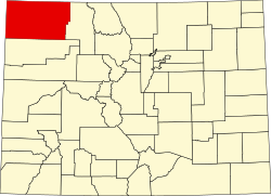
| Counties | Moffat [1] |
| Elevation | 6,244 ft (1,903 m) |
| Time zone | UTC-7 (MST) |
| • Summer (DST) | UTC-6 (MDT) |
| ZIP code [2] | 81638 |
| Area code | 970 |
| GNIS feature ID | 171491 [1] |
Hamilton is an unincorporated community with a U.S. Post Office in Moffat County, Colorado, United States. The Hamilton Post Office has the ZIP Code 81638. [2]