Cheyenne Wells, Colorado

Last updated

Cheyenne Wells, Colorado
Cheyenne Wells, Colorado 2011.jpg
Cheyenne Wells (2011)
Cheyenne County Colorado Incorporated and Unincorporated areas Cheyenne Wells Highlighted 0814175.svg
Location of the Town of Cheyenne Wells in the Cheyenne County, Colorado.
Usa edcp location map.svg
Red pog.svg
Cheyenne Wells
Location of the Town of Cheyenne Wells in the United States.
Coordinates: 38°49′09″N102°21′07″W / 38.819202°N 102.352030°W / 38.819202; -102.352030 [2]
Country Flag of the United States.svg  United States
State Flag of Colorado.svg  Colorado
County Cheyenne County Seat [1]
Incorporated May 14, 1890 [3]
Government
  Type Statutory Town [1]
Area
[4]
  Total1.070 sq mi (2.770 km2)
  Land1.070 sq mi (2.770 km2)
  Water0.000 sq mi (0.000 km2)
Elevation
[5]
4,291 ft (1,308 m)
Population
 (2020) [4]
  Total758
  Density709/sq mi (274/km2)
Time zone UTC−07:00 (MST)
  Summer (DST) UTC−06:00 (MDT)
ZIP Code
80810 [6]
Area code 719
FIPS code 08-14175
GNIS feature ID 0195261
Website townofcheyennewells.com

Cheyenne Wells is the Statutory Town that is the county seat and the most populous municipality of Cheyenne County, Colorado, United States. [1] [7] The town population was 758 at the 2020 United States Census. [4]

Contents

History

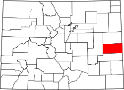
The community was named for the fact Cheyenne Indians maintained water wells near the original town site. [8]

Geography

Cheyenne Wells is located at 38°49′16″N102°21′13″W / 38.82111°N 102.35361°W / 38.82111; -102.35361 (38.821141, -102.353637). [9]

At the 2020 United States Census, the town had a total area of 684 acres (2.770 km2), all of it land. [4]

A small area about 10 miles southwest of Cheyenne Wells is antipodal , or globally opposite, to Île Saint-Paul, an island in the southern Indian Ocean.

Climate

Climate data for Cheyenne Wells 2NE, Colorado (1991–2020 normals, extremes 1897–2020)
MonthJanFebMarAprMayJunJulAugSepOctNovDecYear
Record high °F (°C)78
(26)
82
(28)
91
(33)
95
(35)
105
(41)
108
(42)
109
(43)
107
(42)
102
(39)
96
(36)
89
(32)
88
(31)
109
(43)
Mean daily maximum °F (°C)44.0
(6.7)
47.0
(8.3)
57.1
(13.9)
64.7
(18.2)
74.0
(23.3)
85.7
(29.8)
90.6
(32.6)
88.2
(31.2)
81.6
(27.6)
67.3
(19.6)
54.1
(12.3)
44.2
(6.8)
66.5
(19.2)
Daily mean °F (°C)31.8
(−0.1)
33.9
(1.1)
43.0
(6.1)
50.1
(10.1)
59.9
(15.5)
70.5
(21.4)
75.8
(24.3)
74.0
(23.3)
66.7
(19.3)
53.1
(11.7)
41.1
(5.1)
32.1
(0.1)
52.7
(11.5)
Mean daily minimum °F (°C)19.6
(−6.9)
20.9
(−6.2)
28.8
(−1.8)
35.4
(1.9)
45.7
(7.6)
55.3
(12.9)
61.1
(16.2)
59.8
(15.4)
51.9
(11.1)
38.8
(3.8)
28.1
(−2.2)
20.0
(−6.7)
38.8
(3.8)
Record low °F (°C)−23
(−31)
−31
(−35)
−16
(−27)
−2
(−19)
15
(−9)
31
(−1)
40
(4)
33
(1)
18
(−8)
1
(−17)
−13
(−25)
−24
(−31)
−31
(−35)
Average precipitation inches (mm)0.22
(5.6)
0.38
(9.7)
0.68
(17)
1.40
(36)
2.09
(53)
2.24
(57)
3.72
(94)
2.65
(67)
1.15
(29)
1.15
(29)
0.39
(9.9)
0.29
(7.4)
16.36
(416)
Average snowfall inches (cm)2.9
(7.4)
4.1
(10)
2.9
(7.4)
2.4
(6.1)
0.2
(0.51)
0.0
(0.0)
0.0
(0.0)
0.0
(0.0)
0.2
(0.51)
1.1
(2.8)
2.6
(6.6)
3.1
(7.9)
19.5
(50)
Average precipitation days (≥ 0.01 in)1.92.73.75.17.27.07.76.94.14.02.62.655.5
Average snowy days (≥ 0.1 in)1.72.41.61.30.10.00.00.00.10.61.22.011.0
Source: NOAA [10] [11]

Demographics

Historical population
CensusPop.Note
1910 270
1920 50888.1%
1930 59517.1%
1940 69516.8%
1950 1,15466.0%
1960 1,020−11.6%
1970 982−3.7%
1980 950−3.3%
1990 1,12818.7%
2000 1,010−10.5%
2010 846−16.2%
2020 758−10.4%
U.S. Decennial Census

As of the census [12] of 2000, there were 1,010 people, 417 households, and 261 families residing in the town. The population density was 974.3 inhabitants per square mile (376.2/km2). There were 505 housing units at an average density of 487.2 per square mile (188.1/km2). The racial makeup of the town was 91.19% White, 0.99% African American, 0.79% Native American, 0.10% Asian, 6.44% from other races, and 0.50% from two or more races. Hispanic or Latino of any race were 9.90% of the population.

There were 417 households, out of which 33.3% had children under the age of 18 living with them, 53.5% were married couples living together, 6.5% had a female householder with no husband present, and 37.2% were non-families. 33.3% of all households were made up of individuals, and 13.7% had someone living alone who was 65 years of age or older. The average household size was 2.38 and the average family size was 3.08.

In the town, the population was spread out, with 27.2% under the age of 18, 8.1% from 18 to 24, 27.9% from 25 to 44, 20.8% from 45 to 64, and 15.9% who were 65 years of age or older. The median age was 38 years. For every 100 females, there were 100.0 males. For every 100 females age 18 and over, there were 99.7 males.

The median income for a household in the town was $36,563, and the median income for a family was $45,132. Males had a median income of $32,941 versus $23,077 for females. The per capita income for the town was $18,840. About 7.5% of families and 11.1% of the population were below the poverty line, including 12.4% of those under age 18 and 12.2% of those age 65 or over.

Economy

Tumbleweed Midstream owns the Ladder Creek Helium Plant near Cheyenne Wells. It is only one of fourteen helium plants in the world. [13]

Infrastructure

Transportation

Rail

The Union Pacific Railroad passes through Cheyenne Wells.

Highways

US 40.svg U.S. Highway 40 passes through the community and follows roughly parallel to the railway.

Notable people

Notable individuals who were born in or have lived in Cheyenne Wells include:

See also

Related Research Articles

<span class="mw-page-title-main">Deuel County, Nebraska</span> County in Nebraska, United States

Deuel County is a county located in the U.S. State of Nebraska. As of the 2020 United States Census, the population was 1,838. Its county seat is Chappell. The county was formed in 1889 and named for Harry Porter Deuel, superintendent of the Union Pacific Railroad.

<span class="mw-page-title-main">Cheyenne County, Nebraska</span> County in Nebraska, United States

Cheyenne County is a county in the U.S. state of Nebraska. As of the 2020 United States Census, the population was 9,468. Its county seat is Sidney. The county was formed in 1871 and named for the Cheyenne Native American tribe.

<span class="mw-page-title-main">Yuma County, Colorado</span> County in Colorado, United States

Yuma County is a county located in the U.S. state of Colorado. As of the 2020 census, the population was 9,988. The county seat is Wray.

<span class="mw-page-title-main">Teller County, Colorado</span> County in Colorado, United States

Teller County is a county located in the U.S. state of Colorado. As of the 2020 census, the population was 24,710. The county seat is Cripple Creek, and the most populous city is Woodland Park.

<span class="mw-page-title-main">Sedgwick County, Colorado</span> County in Colorado, United States

Sedgwick County is a county located in the U.S. state of Colorado. As of the 2020 census, the population was 2,404. The county seat is Julesburg. The county was named for Fort Sedgwick, a military post along the Platte Trail, which was named for General John Sedgwick. It is located near the state border with Nebraska.

<span class="mw-page-title-main">Lincoln County, Colorado</span> County in Colorado, United States

Lincoln County is a county located in the U.S. state of Colorado. As of the 2020 census, the population was 5,675. The county seat is Hugo. The county obtains its name in memory of the United States President Abraham Lincoln. County was formed from portions of Bent and Elbert counties in 1889 from a restructuring of Colorado counties.

<span class="mw-page-title-main">Kit Carson County, Colorado</span> County in Colorado, United States

Kit Carson County is a county located in the U.S. state of Colorado. As of the 2020 census, the population was 7,087. The county seat is Burlington. The county was established in 1889 and named for American frontiersman and Indian fighter Kit Carson.

<span class="mw-page-title-main">Kiowa County, Colorado</span> County in Colorado, United States

Kiowa County is a county located in the U.S. state of Colorado. As of the 2020 census, the population was 1,446, making it the fifth-least populous county in Colorado. The county seat is Eads. The county was named for the Kiowa Nation of Native Americans.

<span class="mw-page-title-main">Custer County, Colorado</span> County in Colorado, United States

Custer County is a county located in the U.S. state of Colorado. As of the 2020 census, the population was 4,704. The county seat is Westcliffe.

<span class="mw-page-title-main">Crowley County, Colorado</span> County in Colorado, United States

Crowley County is a county in Colorado. As of the 2020 census, the population was 5,922. The county seat is Ordway.

<span class="mw-page-title-main">Cheyenne County, Colorado</span> County in Colorado, United States

Cheyenne County is a county located in the U.S. state of Colorado. The county population was 1,748 at 2020 census. The county seat is Cheyenne Wells.

<span class="mw-page-title-main">Sherrelwood, Colorado</span> Place in Colorado, United States

Sherrelwood is an unincorporated community and a census-designated place (CDP) located in and governed by Adams County, Colorado, United States. The CDP is a part of the Denver–Aurora–Lakewood, CO Metropolitan Statistical Area. The population was 19,228 at the 2020 census.

<span class="mw-page-title-main">Campo, Colorado</span> Town in Colorado, United States

Campo is a Statutory Town located in Baca County, Colorado, United States. The town population was 103 at the 2020 United States Census. The town is situated on the High Plains, straddling U.S. Route 287/385.

<span class="mw-page-title-main">Eads, Colorado</span> Town in Colorado, United States

Eads is the Statutory Town that is the county seat and the most populous municipality of Kiowa County, Colorado, United States. The town population was 672 at the 2020 United States Census.

<span class="mw-page-title-main">Kim, Colorado</span> Town in Colorado, United States

Kim is a Statutory Town in Las Animas County, Colorado, United States. The population was 63 at the time of the 2020 United States Census.

<span class="mw-page-title-main">Crook, Colorado</span> Town in Colorado, United States

The Town of Crook is a Statutory Town in Logan County, Colorado, United States. The town population was 133 at the 2020 United States Census. Crook is a part of the Sterling, CO Micropolitan Statistical Area.

<span class="mw-page-title-main">Holyoke, Colorado</span> City in Colorado, United States

Holyoke is the home rule municipality that is the county seat and the most populous municipality of Phillips County, Colorado, United States. The city population was 2,346 at the 2020 United States Census.

<span class="mw-page-title-main">Granada, Colorado</span> Town in Colorado, United States

Granada is a Statutory Town in Prowers County, Colorado, United States. The town population was 445 at the 2020 United States Census.

<span class="mw-page-title-main">Hartman, Colorado</span> Town in Prowers County, Colorado, United States

Hartman is a Statutory Town in Prowers County, Colorado, United States. The town population was 56 at the 2020 United States Census. The town is located North of SH-196.

<span class="mw-page-title-main">Boone, Colorado</span> Town in Pueblo County, Colorado, United States

Boone is a Statutory Town located in Pueblo County, Colorado, United States. The town population was 305 at the 2020 United States Census.

References

  1. 1 2 3 4 "Active Colorado Municipalities". Colorado Department of Local Affairs . Retrieved October 15, 2021.
  2. "2014 U.S. Gazetteer Files: Places". United States Census Bureau. July 1, 2014. Retrieved January 5, 2015.
  3. "Colorado Municipal Incorporations". State of Colorado, Department of Personnel & Administration, Colorado State Archives. December 1, 2004. Retrieved September 2, 2007.
  4. 1 2 3 4 "Decennial Census P.L. 94-171 Redistricting Data". United States Census Bureau, United States Department of Commerce. August 12, 2021. Retrieved September 4, 2021.
  5. "US Board on Geographic Names". United States Geological Survey. October 25, 2007. Retrieved January 31, 2008.
  6. "ZIP Code Lookup". United States Postal Service. Archived from the original (JavaScript/HTML) on September 3, 2007. Retrieved September 5, 2007.
  7. "Find a County". National Association of Counties. Archived from the original on May 9, 2015. Retrieved June 7, 2011.
  8. Dawson, John Frank (1954). Place names in Colorado: why 700 communities were so named, 150 of Spanish or Indian origin. Denver, CO: The J. Frank Dawson Publishing Co. p. 13.
  9. "US Gazetteer files: 2010, 2000, and 1990". United States Census Bureau. February 12, 2011. Retrieved April 23, 2011.
  10. "NOWData - NOAA Online Weather Data". National Oceanic and Atmospheric Administration. Retrieved April 6, 2024.
  11. "Summary of Monthly Normals 1991-2020". National Oceanic and Atmospheric Administration. Retrieved April 6, 2024.
  12. "U.S. Census website". United States Census Bureau . Retrieved January 31, 2008.
  13. "Rising on the plains: This Colorado plant is one of a handful in the world to produce helium". The Denver Post. February 15, 2020. Archived from the original on February 23, 2020.
  14. "Nellie M. Payne, ESA Fellow (1940)". Entomological Society of America. Retrieved June 21, 2016.