Mosca, Colorado

Last updated
Mosca, Colorado
Mosca, Colorado.JPG
Mosca and State Highway 17
USA Colorado location map.svg
Red pog.svg
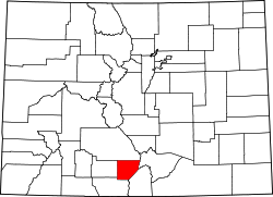
Mosca, Colorado
Location within the state of Colorado Location in Alamosa County and the state of Colorado
Usa edcp location map.svg
Red pog.svg
Mosca, Colorado
Mosca, Colorado (the United States)
Coordinates: 37°38′52″N105°52′27″W / 37.64778°N 105.87417°W / 37.64778; -105.87417
Country Flag of the United States.svg  United States
State Flag of Colorado.svg  Colorado
County Alamosa [1]
Elevation
[1]
7,559 ft (2,304 m)
Time zone UTC-7 (MST)
  Summer (DST) UTC-6 (MDT)
ZIP code [2]
81146
GNIS feature ID 0196391

Mosca (Spanish for fly) is an unincorporated community and a U.S. Post Office in Alamosa County, Colorado, United States. It was named for the nearby Mosca Pass, which was named for the Spanish explorer, Luis de Moscoso Alvarado. [3] The Mosca Post Office has the ZIP Code 81146. [2]

Contents

Geography

Mosca is located at 37°38′52″N105°52′27″W / 37.64778°N 105.87417°W / 37.64778; -105.87417 (37.647675,-105.874043). The elevation of Mosca is 7,559 feet (2,304 meters).

Climate

The climate in this area is characterized by warm to hot, dry summers, and cold to freezing winters. According to the Köppen Climate Classification system, Mosca has a semi-arid climate, abbreviated "BSk" on climate maps. [4]

Nearby attractions

Power Plants

Economy

FairPoint Communications operated the Columbine Telecom Company in the community. [5]

Education

Mosca is served by the Sangre de Cristo School District Re-22J. It is home to Sangre de Cristo Elementary School and Sangre de Cristo Undivided High School.

Related Research Articles

<span class="mw-page-title-main">San Luis Valley</span> High-altitude basin in Colorado and New Mexico in the United States

The San Luis Valley is a region in south-central Colorado with a small portion overlapping into New Mexico. The valley is approximately 122 miles (196 km) long and 74 miles (119 km) wide, extending from the Continental Divide on the northwest rim into New Mexico on the south. It contains 6 counties and portions of 3 others. It is an extensive high-elevation depositional basin of approximately 8,000 square miles (21,000 km2) with an average elevation of 7,664 feet (2,336 m) above sea level. The valley is a section of the Rio Grande Rift and is drained to the south by the Rio Grande, which rises in the San Juan Mountains to the west of the valley and flows south into New Mexico. The San Luis Valley has a cold desert climate but has substantial water resources from the Rio Grande and groundwater.

<span class="mw-page-title-main">Alamosa, Colorado</span> City in Colorado, United States

Alamosa is a home rule municipality and the county seat of Alamosa County, Colorado, United States. The city population was 9,806 at the 2020 United States Census. The city is the commercial center of the San Luis Valley in south-central Colorado, and is the home of Adams State University.

<span class="mw-page-title-main">Alamosa County, Colorado</span> County in Colorado, United States

Alamosa County is a county located in the U.S. state of Colorado. As of the 2020 census, the population was 16,376. The county seat is Alamosa. The county name is the Spanish language word for a "grove of cottonwood trees."

<span class="mw-page-title-main">Hooper, Colorado</span> Town in Colorado, United States

The Town of Hooper is a Statutory Town located in the San Luis Valley in Alamosa County, Colorado, United States. The population was 81 at the 2020 census.

<span class="mw-page-title-main">Salida, Colorado</span> City in Colorado, United States

The City of Salida is the statutory city that is the county seat and the most populous municipality of Chaffee County, Colorado, United States. The population was 5,666 at the 2020 census.

<span class="mw-page-title-main">Manassa, Colorado</span> Town in Colorado, United States

The Town of Manassa is the Statutory Town that is the most populous municipality in Conejos County, Colorado, United States. The town population was 947 at the 2020 United States Census.

<span class="mw-page-title-main">Romeo, Colorado</span> Town in Colorado, United States

Romeo is a Statutory Town in Conejos County, Colorado, United States. The population was 302 at the 2020 census. A post office called Romeo was established in 1901. The community derives its name from the surname Romero.

<span class="mw-page-title-main">Blanca, Colorado</span> Town in Colorado, United States

The Town of Blanca is a Statutory Town located in Costilla County, Colorado, United States. The town population was 322 at the 2020 census. Blanca is located in the enormous San Luis Valley.

<span class="mw-page-title-main">San Luis, Colorado</span> Town in Colorado, United States

San Luis is a statutory town that is the county seat and the most populous town of Costilla County, Colorado, United States. Formerly known as San Luis de la Culebra, it is the oldest continuously occupied town in Colorado. The population was 598 at the 2020 census.

<span class="mw-page-title-main">Moffat, Colorado</span> Town in Saguache County, Colorado, United States

The Town of Moffat is a Statutory Town in Saguache County, Colorado, United States. The town population was 108 at the 2020 United States Census.

<span class="mw-page-title-main">Sangre de Cristo Mountains</span> Mountain range in Colorado and New Mexico, United States

The Sangre de Cristo Mountains are the southernmost subrange of the Rocky Mountains. They are located in southern Colorado and northern New Mexico in the United States. The mountains run from Poncha Pass in South-Central Colorado, trending southeast and south, ending at Glorieta Pass, southeast of Santa Fe, New Mexico. The mountains contain a number of fourteen thousand foot peaks in the Colorado portion, as well as all the peaks in New Mexico which are over twelve thousand feet.

<span class="mw-page-title-main">Blanca Peak</span> Mountain in Colorado, United States

Blanca Peak is the fourth highest summit of the Rocky Mountains of North America and the U.S. state of Colorado. The ultra-prominent 14,351-foot (4,374 m) peak is the highest summit of the Sierra Blanca Massif, the Sangre de Cristo Range, and the Sangre de Cristo Mountains. The fourteener is located 9.6 miles (15.5 km) north by east of the Town of Blanca, on the drainage divide separating Rio Grande National Forest and Alamosa County from the Sangre de Cristo Land Grant and Costilla County. The summit is the highest point of both counties and the entire drainage basin of the Rio Grande. Below the steep North Face of Blanca Peak two live Glaciers once developed, until extinction sometime after 1903. North & South Blanca Glaciers were located at 37° 35N.,longitude 105° 28W. Blanca Peak is higher than any point in the United States east of its longitude.

<span class="mw-page-title-main">Chama, Colorado</span> Unincorporated community in State of Colorado, United States

Chama is an unincorporated community and U.S. Post Office in Costilla County, Colorado, United States. The ZIP Code of the Chama Post Office is 81126.

<span class="mw-page-title-main">Garcia, Colorado</span> Unincorporated community in Colorado, United States

Garcia is an unincorporated community located in Costilla County, Colorado, United States. The San Luis post office (Zip Code 81152) serves Garcia postal addresses.

San Pablo is an unincorporated community located in Costilla County, Colorado, United States. The San Luis post office (Zip Code 81152) serves San Pablo postal addresses. San Pablo is located in the Rio Culebra valley of the Sangre de Cristo Land Grant which was awarded to the family of Carlos Beaubien in 1843.

Ninaview is an unincorporated community in Bent County, Colorado, United States. The U.S. Post Office at Las Animas now serves Ninaview postal addresses.

<span class="mw-page-title-main">San Acacio, Colorado</span> Census Designated Place in Colorado, United States

San Acacio is an unincorporated community and a census-designated place (CDP) located in and governed by Costilla County, Colorado, United States. The population of the San Acacio CDP was 56 at the 2020 United States census. The Sanford post office serves San Acacio postal addresses.

<span class="mw-page-title-main">Sangre de Cristo Ranches, Colorado</span> Unincorporated community in Colorado, United States

Sangre de Cristo Ranches is an unincorporated community located near Fort Garland in Costilla County, Colorado, United States. The U.S. Post Office at Fort Garland serves Sangre de Cristo Ranches postal addresses.

<span class="mw-page-title-main">Mosca Pass</span>

Mosca Pass, elevation 9,714 feet, is a mountain pass in Alamosa and Huerfano counties in the Sangre de Cristo Range in southern Colorado. The pass lies on the eastern border of the Great Sand Dunes National Park and Preserve about 40 miles west of Walsenburg, Colorado. It marks the boundary between the Great Sand Dunes National Preserve to the west and San Isabel National Forest to the east, and it also lies on the border between Alamosa and Huerfano counties.

<span class="mw-page-title-main">San Luis Hills</span>

The San Luis Hills are a group of small mountain ranges in Conejos and Costilla counties in the San Luis Valley in southern Colorado. The individual mountain ranges that make up the San Luis Hills include the Fairy Hills, the Brownie Hills, the Piñon Hills, and the South Piñon Hills. The San Luis Hills' highest point is Flat Top, elevation 9,206 feet

References

  1. 1 2 "Mosca". Geographic Names Information System . United States Geological Survey, United States Department of the Interior.
  2. 1 2 "ZIP Code Lookup". United States Postal Service. January 2, 2007. Archived from the original (JavaScript/HTML) on November 22, 2010. Retrieved January 2, 2007.
  3. Dawson, John Frank. Place names in Colorado: why 700 communities were so named, 150 of Spanish or Indian origin. Denver, CO: The J. Frank Dawson Publishing Co. p. 36.
  4. Climate Summary for Mosca, Colorado
  5. "Local Calling Guide: Area code/prefix search. Accessed February 14, 2012". Localcallingguide.com. Retrieved November 7, 2014.