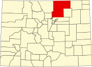
Platteville, Colorado

Last updated

Platteville, Colorado
Town
Platteville, Colorado.JPG
Platteville Town Hall
Motto(s): 
"Small Town Atmosphere, Big Town Vision" [1]
Weld County Colorado Incorporated and Unincorporated areas Platteville Highlighted 0860160.svg
Location of Platteville in Weld County, Colorado.
Coordinates: 40°12′52″N104°49′27″W / 40.21444°N 104.82417°W / 40.21444; -104.82417
CountryFlag of the United States (23px).png  United States
State Flag of Colorado.svg  Colorado
County [2] Weld
Founded1871
Incorporated (town) January 1, 1887 [3]
Government
  Type Statutory Town [2]
   Mayor Adrienne Sandoval
   Town Manager Troy Renken
Area
[4]
  Total3.08 sq mi (7.99 km2)
  Land3.07 sq mi (7.96 km2)
  Water0.01 sq mi (0.03 km2)
Elevation
[5]
4,813 ft (1,467 m)
Population
 (2020) [6]
  Total2,955
  Density960/sq mi (370/km2)
Time zone UTC−7 (Mountain (MST))
  Summer (DST) UTC−6 (MDT)
ZIP code [7]
80651
Area code 970
FIPS code 08-60160
GNIS feature ID 0180790
Website plattevillegov.org

Platteville is a Statutory Town in Weld County, Colorado, United States. The population was 2,955 at the 2020 census. [6] It is adjacent to Fort Vasquez on U.S. Highway 85.

Contents

History

Platteville was founded on May 27, 1871, and was incorporated on January 1, 1887. [8] The town was named for its location on the Platte River. [9]

Geography

Platteville is located at 40°12′52″N104°49′27″W / 40.21444°N 104.82417°W / 40.21444; -104.82417 (40.214468, -104.824070). [10]

The town is situated along the east bank of the South Platte River at the intersection of U.S. Highway 85 and State Highway 66.

The Fort St. Vrain Generating Station, originally a nuclear power plant and now operating as a natural gas powered electricity generating facility operated by Xcel Energy, is approximately one-quarter-mile northwest of Platteville.

According to the United States Census Bureau, Platteville has a total area of 2.527 square miles (6.54 km2), all of it land.

Demographics

Historical population
CensusPop.Note
1890 213
1900 26323.5%
1910 43063.5%
1920 47911.4%
1930 53311.3%
1940 5615.3%
1950 5701.6%
1960 5822.1%
1970 68317.4%
1980 1,662143.3%
1990 1,515−8.8%
2000 2,37056.4%
2010 2,4854.9%
2020 2,95518.9%

At the 2010 census there were 2,485 people, 951 households, and 935 families residing in Platteville. The population density was 1,606.5 inhabitants per square mile (620.3/km2). There were 819 dwelling units at an average density of 555.1 per square mile (214.3/km2). The racial makeup of Platteville was 73.84% White, 0.55% Native American, 0.30% Asian, 0.17% Pacific Islander, 22.24% from other races, and 2.91% from two or more races. Hispanic or Latino of any race were 35.19%. [11]

Of the 786 households 45.4% had children under the age of 18 living with them, 61.6% were married couples living together, 10.1% had a female householder with no husband present, and 24.4% were non-families. 18.1% of households were one person and 5.3% were one person aged 65 or older. The average household size was 3.02 and the average family size was 3.50.

The age distribution was: 32.8% under the age of 18, 9.7% from 18 to 24, 32.3% from 25 to 44, 18.7% from 45 to 64, and 6.5% 65 or older. The median age was 30 years. For every 100 females, there were 103.6 males. For every 100 females age 18 and over, there were 99.5 males.

The median household income was in Platteville was $43,472, and the median family income was $47,574. Males had a median income of $34,048 versus $25,430 for females. The per capita income for Platteville was $15,802. About 6.9% of families and 8.7% of the population were below the poverty line, including 9.6% of those under age 18 and 5.5% of those age 65 or over.

Arts and culture

Annual cultural events

Platteville celebrates the harvest season every August since 1910. The name of the harvest festival has changed many times over the years, and is currently called, simply, Harvest Daze.

See also

Related Research Articles

<span class="mw-page-title-main">Douglas County, Colorado</span> County in Colorado, United States

Douglas County is a county located in the U.S. state of Colorado. As of the 2020 Census, the population was 357,978. The county is named in honor of U.S. Senator Stephen A. Douglas. The county seat is Castle Rock.

<span class="mw-page-title-main">Adams County, Colorado</span> County in Colorado, United States

Adams County is a county located in the U.S. state of Colorado. As of the 2020 census, the population was 519,572. The county seat is Brighton, and the largest city is Thornton. The county is named for Alva Adams, an early Governor of the State of Colorado in 1887–1889. Adams County is part of the Denver–Aurora–Lakewood, CO Metropolitan Statistical Area.
<span class="mw-page-title-main">Platte County, Wyoming</span> County in Wyoming, United States

Platte County is a county located in the U.S. state of Wyoming. As of the 2020 United States Census, the population was 8,605. Its county seat is Wheatland.
<span class="mw-page-title-main">Laramie County, Wyoming</span> County in Wyoming, United States

Laramie County is a county located at the southeast corner of the state of Wyoming. As of the 2020 United States Census, the population was 100,512 or 17.4% of the state's total 2020 population, making it the most populous county in Wyoming, but the least populous county in the United States to be the most populous in its state.

<span class="mw-page-title-main">Weld County, Colorado</span> County in Colorado, United States

Weld County is a county located in the U.S. state of Colorado. As of the 2020 census, the population was 328,981. The county seat is Greeley.
<span class="mw-page-title-main">Washington County, Colorado</span> County in Colorado, United States

Washington County is a county located in the eastern side of the U.S. state of Colorado. As of the 2020 census, the population was 4,817, making it the least populous “Washington County” in the United States. The county seat is Akron. The county was named in honor of the United States President George Washington.

<span class="mw-page-title-main">Sedgwick County, Colorado</span> County in Colorado, United States

Sedgwick County is a county located in the U.S. state of Colorado. As of the 2020 census, the population was 2,404. The county seat is Julesburg. The county was named for Fort Sedgwick, a military post along the Platte Trail, which was named for General John Sedgwick. It is located near the state border with Nebraska.

<span class="mw-page-title-main">Park County, Colorado</span> County in Colorado, United States

Park County is a county located in the U.S. state of Colorado. As of the 2020 census, the population was 17,390. The county seat is Fairplay. The county was named after the large geographic region known as South Park, which was named by early fur traders and trappers in the area.
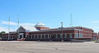
<span class="mw-page-title-main">Morgan County, Colorado</span> County in Colorado, United States

Morgan County is a county located in the U.S. state of Colorado. As of the 2020 census, the population was 29,111. The county seat is Fort Morgan. The county was named after old Fort Morgan, which in turn was named in honor of Colonel Christopher A. Morgan.

<span class="mw-page-title-main">Logan County, Colorado</span> County in Colorado, United States

Logan County is a county located in the U.S. state of Colorado. As of the 2020 census, the population was 21,528. The county seat is Sterling. The county was named for General John A. Logan.

<span class="mw-page-title-main">Jackson County, Colorado</span> County in Colorado, United States

Jackson County is a county located in the U.S. state of Colorado. As of the 2020 census, the population was 1,379, and it was the fourth least populated in the state. The county is named after the United States President Andrew Jackson. The county seat and only municipality in the county is Walden.

<span class="mw-page-title-main">Arapahoe County, Colorado</span> County in Colorado, United States

Arapahoe County is a county located in the U.S. state of Colorado. As of the 2020 census, its population was 655,070, making it the third-most populous county in Colorado. The county seat is Littleton, and the most populous city is Aurora. The county was named for the Arapaho Native American tribe, who once lived in the region.

<span class="mw-page-title-main">Simla, Colorado</span> Town in Elbert County, Colorado, United States

Simla is a statutory town in Elbert County, Colorado, United States. It is 48 miles (77 km) northeast of Colorado Springs. The population was 601 at the time of the 2020 United States Census.

<span class="mw-page-title-main">Sterling, Colorado</span> City in Colorado, United States

Sterling is a home rule municipality and the county seat and most populous municipality of Logan County, Colorado, United States. Sterling is the principal city of the Sterling, CO Micropolitan Statistical Area. The city population was 13,735 at the 2020 census.

<span class="mw-page-title-main">Log Lane Village, Colorado</span> Town in Colorado, United States

Log Lane Village is a statutory town in Morgan County, Colorado, United States. The population was 913 at the 2020 census.

<span class="mw-page-title-main">Ault, Colorado</span> Town in Colorado, United States

Ault is a statutory town located in Weld County, Colorado, United States. The town population was 1,887 at the 2020 United States Census, a +24.23% increase since the 2010 United States Census. Ault is a part of the Greeley, CO Metropolitan Statistical Area and the Front Range Urban Corridor.

<span class="mw-page-title-main">Evans, Colorado</span> City in Colorado, United States

The City of Evans is a home rule municipality located in Weld County, Colorado, United States. The city population was 22,165 at the 2020 United States Census, a 19.57% increase since the 2010 United States Census. Evans is a part of the Greeley, CO Metropolitan Statistical Area and the Front Range Urban Corridor.

<span class="mw-page-title-main">Fort Lupton, Colorado</span> City in Colorado, United States

The City of Fort Lupton is a Statutory City located in southern Weld County, Colorado, United States. The town population was 7,955 at the 2020 United States Census. Fort Lupton is a part of the Greeley, Colorado Metropolitan Statistical Area and the Front Range Urban Corridor.
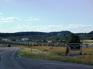
<span class="mw-page-title-main">Guernsey, Wyoming</span> Town in Wyoming, United States

Guernsey is a town in Platte County, Wyoming, United States. The population was 1,147 at the 2010 census.

<span class="mw-page-title-main">Platteville, Wisconsin</span> City in Wisconsin, United States

Platteville is the largest city in Grant County, Wisconsin. The population was 11,836 at the 2020 census, up from 11,224 at the 2010 census. Much of this growth is likely due to the enrollment increase of the University of Wisconsin–Platteville. It is the principal city of the Platteville Micropolitan Statistical area, which has an estimated population of 51,938. Platteville is located atop the greater Platte River valley in the southern Driftless Region of Wisconsin, an area known for its karst topography and rolling hills.

References

  1. "Town of Platteville Colorado". Town f Platteville Colorado. Retrieved September 22, 2012.
  2. 1 2 "Active Colorado Municipalities". State of Colorado, Department of Local Affairs. Archived from the original on December 12, 2009. Retrieved September 1, 2007.
  3. "Colorado Municipal Incorporations". State of Colorado, Department of Personnel & Administration, Colorado State Archives. December 1, 2004. Retrieved September 2, 2007.
  4. "2019 U.S. Gazetteer Files". United States Census Bureau. Retrieved July 1, 2020.
  5. "US Board on Geographic Names". United States Geological Survey. October 25, 2007. Retrieved January 31, 2008.
  6. 1 2 United States Census Bureau. "Platteville town, Colorado" . Retrieved April 19, 2023.
  7. "ZIP Code Lookup" (JavaScript/HTML). United States Postal Service . Retrieved December 15, 2007.
  8. "Platteville, Colorado". City-Data.com. Retrieved September 19, 2012.
  9. Dawson, John Frank. Place names in Colorado: why 700 communities were so named, 150 of Spanish or Indian origin. Denver, CO: The J. Frank Dawson Publishing Co. p. 41.
  10. "US Gazetteer files: 2010, 2000, and 1990". United States Census Bureau. February 12, 2011. Retrieved April 23, 2011.
  11. "U.S. Census website". United States Census Bureau . Retrieved January 31, 2008.