Related Research Articles

The Red Rock Canyon National Conservation Area in Clark County, Nevada, United States, is an area managed by the Bureau of Land Management as part of its National Landscape Conservation System, and protected as a National Conservation Area. It is about 15 miles (24 km) west of Las Vegas. More than three million people visit the area each year.
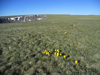
The Powderhorn Wilderness is a 62,050-acre (251.1 km2) wilderness area in Hinsdale and Gunnison counties, Colorado, United States, located 5 miles (8.0 km) northeast of Lake City.
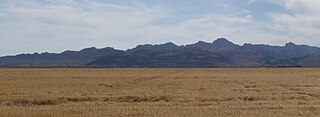
The Chuckwalla Mountains are a mountain range in the transition zone between the Colorado Desert—Sonoran Desert and the Mojave Desert, climatically and vegetationally, in Riverside County of southern California.

The Organ Mountains are a rugged mountain range in southern New Mexico in the Southwestern United States. Organ Mountains–Desert Peaks National Monument was declared a national monument on May 21, 2014. They lie 10 mi (16 km) east of the city of Las Cruces, in Doña Ana County.
The Big Maria Mountains are located in the southeastern part of the U.S. state of California, near the Colorado River and Arizona. The range lies between Blythe and Vidal, and west of U.S. Route 95 in California and east of Midland. The mountains are home to the Eagle Nest Mine and reach an elevation of 1,030 m (3,380 ft). A power line that runs from Parker Dam to Yuma, Arizona runs through the range. A smaller range, the Little Maria Mountains, lie to the west of the Big Marias.

The Black Ridge Canyons Wilderness (BRCW) is located in western Colorado with a small portion extending into eastern Utah, USA, within the arid Colorado Plateau region approximately 15 miles (24 km) west of Grand Junction, Colorado. The wilderness lies on the northwest flank of the Uncompahgre Plateau. It is characterized by the high, east-west trending Black Ridge dissected by seven major canyon systems, draining into the Colorado River in Ruby Canyon. Elevations range from 4,700 feet (1,400 m) above sea level along the river to 6,800 feet (2,070 m). Canyons vary in length from several miles to twelve miles in length and may contain interesting side canyons. Geological features in these canyons include spires, windows, giant alcoves and desert varnish. Canyons may reach a depth of almost 1,000 feet (300 m), forming spectacular red rock cliffs. Spring runoff and summer thunderstorms create glistening waterfalls and plunge pools. Rattlesnake Canyon contains the second largest concentration of natural arches in the country. Mee Canyon is even more remote, and contains Arch Tower.

Canyons of the Ancients National Monument is a national monument protecting an archaeologically significant landscape located in the southwestern region of the U.S. state of Colorado. The monument's 176,056 acres (712.47 km2) are managed by the Bureau of Land Management, as directed in the presidential proclamation which created the site on June 9, 2000. Canyons of the Ancients National Monument is part of the National Landscape Conservation System, better known as the National Conservation Lands. This system comprises 32,000,000 acres (130,000 km2) managed by the Bureau of Land Management to conserve, protect, and restore these nationally significant landscapes recognized for their outstanding cultural, ecological, and scientific values. Canyons of the Ancients encompasses and surrounds three of the four separate sections of Hovenweep National Monument, which is administered by the National Park Service. The monument was proclaimed in order to preserve the largest concentration of archaeological sites in the United States, primarily Ancestral Puebloan ruins. As of 2022, over 8,500 individual archeological sites had been documented within the monument.

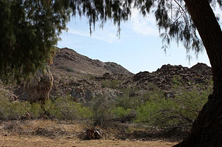
The Big Morongo Canyon Preserve is a 31,000-acres (130 km2) native plants habitat and wildlife preserve located in the Little San Bernardino Mountains of the Transverse Ranges, in the transition zone between the higher Mojave Desert and lower elevation Colorado Desert section of the Sonoran Desert. Due to its location within this transition zone, the area is especially high in natural diversity. The natural spring fed desert oasis found here is one of the 10 largest Cottonwood and Willow riparian habitats in California. It is also identified by the Audubon Society as one of the most important avian habitat areas in California.

San Benito Mountain is the highest mountain in the Diablo Range of California. The summit is at an elevation of 5,267 feet (1,605 m). The rock is composed of asbestos (chrysotile), an ultramafic rock. It weathers to produce serpentine soils with characteristically low levels of nutrients like nitrogen, phosphorus, potassium, and calcium, and high levels of magnesium and heavy metals including nickel and chromium. This means little vegetation grows in the area though there are some plants that only grow on such soils like the local endemic San Benito evening primrose. The Clear Creek Management Area includes the San Benito Mountain Research Natural Area, recognized for its unique pine and incense cedar forest assemblage. The Mediterranean climate is punctuated by cool, wet winters and hot, dry summers.

The Kiavah Wilderness is a federally designated wilderness area located in the Mojave Desert, Scodie Mountains, and southern Sierra Nevada in Kern County, California, United States. California State Route 178 connects the town of Lake Isabella to State Highway 14 in the east, crossing Walker Pass at the north boundary of the wilderness.

Areas of Critical Environmental Concern (ACEC) is a conservation ecology program in the Western United States, managed by the Bureau of Land Management (BLM). The ACEC program was conceived in the 1976 Federal Lands Policy and Management Act (FLPMA), which established the first conservation ecology mandate for the BLM. The FLPMA mandate directs the BLM to protect important riparian corridors, threatened and endangered species habitats, cultural and archeological resources, as well as unique scenic landscapes that the agency assesses as in need of special management attention.
The Sylvania Mountains Wilderness is a federally designated wilderness area located 30 miles (48 km) east of Bishop in the state of California. The wilderness is 18,677acres in size and is managed by the Bureau of Land Management (BLM). The California Desert Protection Act of 1994 created the Sylvania Mountains Wilderness and was added to the National Wilderness Preservation System. The wilderness is bordered by Nevada stateline on the east, Piper Mountain Wilderness on the west and Death Valley National Park to the south.
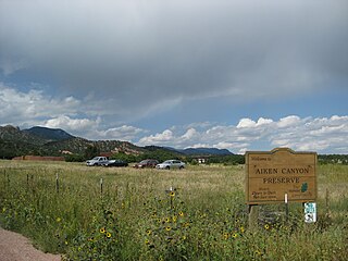
Aiken Canyon Preserve is a 1,621-acre (6.56 km2) Nature Conservancy-managed state property in Colorado. It was first observed and named after Charles Aiken, a 19th-century U.S. surveyor, pioneer, and ornithologist who first surveyed the region in the 1870s and identified more than 75 bird species. The preserve consists of foothills, shrub and woodland ecosystems and is 12.4 miles (20.0 km) southeast from Colorado Springs located on the eastern slope of the Rampart Range which is within a smaller foothill system of the Front Range. The surrounding mountain ranges of the Rampart Range and Palmer Divide created the nature preserves sustainable ecosystem. There is also a four-mile (6 km)-loop hiking trail on the preserve.
Sleeping Giant Wilderness Study Area is a non-motorized recreation area located on the west side of the Missouri River and Holter Lake located about 30 miles (48 km) north of Helena, Montana. Designated as a wilderness study area in 1981, the Sleeping Giant Wilderness Study Area contains approximately 6,666 acres (2,698 ha) of nearly roadless land, about half of which is forested. A portion of the Lewis and Clark National Historic Trail is contained inside the study area.

The South Fork Eel River Wilderness is a 12,868-acre (5,207 ha) wilderness area located in Mendocino County, California. The wilderness was added to the National Wilderness Preservation System when the United States Congress passed the Northern California Coastal Wild Heritage Wilderness Act in 2006. The Department of the Interior's Bureau of Land Management (BLM) is the agency in charge.

Horse Rock Ridge is a ridgetop located on the western edge of the Cascade Range near Crawfordsville, Oregon, US. The site is recognized for its considerable diversity of plant species that includes both Willamette Valley plants as well as plants more often found in the mountain zone of the Cascade Range. There are also several plant species more often found east of the Cascade Range.

Little Finland is a scenic red rock area, located in a remote section of Clark County, Nevada, south of Mesquite, known for its red rock scenery and strangely-shaped, delicate rock formations. The landscape is similar to Valley of Fire State Park, which is about 20 miles (32 km) to the west, across Lake Mead. The rock formations are composed of red Aztec Sandstone, fossil sand dunes. Many of the features are small erosional fins, hence the name.

The Palisade is a three-mile (4.9-km) long butte in Mesa County, Colorado, located slightly north of the town of Gateway. Its elevation is 6,591 feet . It is the most prominent geologic feature in both the eponymously named The Palisade Area of Critical Environmental Concern and The Palisade Wilderness Study Area. The region is a diverse area spanning vertical cliffs, mesas, deep rugged canyons and flat desert valley bottoms. The area is protected for peregrine falcon and golden eagle breeding areas as well as Gunnison sage-grouse habitat. It is also managed for the preservation of sensitive plant species.
Cold Spring Mountain is a summit in Moffat County, Colorado. It was also known as O-WI-YU-KUTS Plateau. It is on the United States Geological Survey (USGS) topographic maps of Sparks, Beaver Basin, Willow Creek Butte, Big Joe Basin, and Irish Canyon.
References
- ↑ U.S. Geological Survey Geographic Names Information System: Irish Canyon Natural Area
- 1 2 3 4 5 6 "Irish Canyon ACEC, Bureau of Land Management". www.blm.gov. Retrieved May 22, 2021.
- ↑ "Colorado Nature Areas Program, Triennal Report to Governor Polis" (PDF). Colorado Parks and Wilderness. 2020. pp. 9, 11.