This is a list of floods in Sheffield, South Yorkshire , England.

This is a list of floods in Sheffield, South Yorkshire , England.
Sheffield is located on the confluence of five major rivers (Don, Porter, Loxley, Rivelin, and the Sheaf), and is nestled in several hills. As a result, it is prone to flooding.

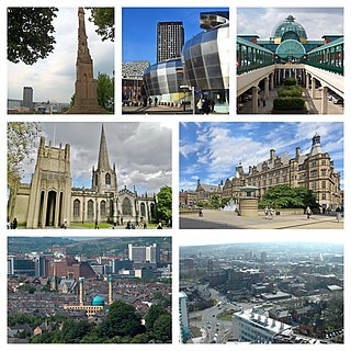
Sheffield is a city in South Yorkshire, England, whose name derives from the River Sheaf which runs through it. The city serves as the administrative centre of the City of Sheffield. It is historically part of the West Riding of Yorkshire and some of its southern suburbs were transferred from Derbyshire to the city council. It is the largest settlement in South Yorkshire.

The River Don is a river in South Yorkshire and the East Riding of Yorkshire, England. It rises in the Pennines, west of Dunford Bridge, and flows for 69 miles (111 km) eastwards, through the Don Valley, via Penistone, Sheffield, Rotherham, Mexborough, Conisbrough, Doncaster and Stainforth. It originally joined the Trent, but was re-engineered by Cornelius Vermuyden as the Dutch River in the 1620s, and now joins the River Ouse at Goole. Don Valley is a UK parliamentary constituency near the Doncaster stretch of the river.

The River Sheaf in Sheffield, South Yorkshire, England, flows northwards, past Dore, through Abbeydale and north of Heeley. It then passes into a culvert, through which it flows under the centre of Sheffield before joining the River Don. This lower section of the River Sheaf, together with the River Don between the Blonk Street and Lady's Bridges, formed two sides of the boundary of Sheffield Castle.

Meadowhall is an indoor shopping centre in Sheffield, South Yorkshire, England. It lies 3 miles (5 km) north-east of Sheffield city centre, and 2 miles (3 km) from Rotherham town centre. It is the largest shopping centre in Yorkshire, and currently the twelfth-largest in the United Kingdom. As of 2021, plans for an extension are currently under consideration, for completion in the 2020s, which would make Meadowhall the 11th biggest shopping centre in the United Kingdom.

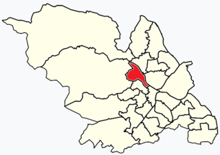
Hillsborough is an electoral ward which includes the districts of Malin Bridge, Owlerton, Wadsley and Wisewood. It is one of the 28 electoral wards in City of Sheffield, England. It is located in the northwestern part of the city and covers an area of 4.6 km2. The population of this ward in 2011 was 18,605 people in 8,012 households.

The Great Sheffield Flood was a flood that devastated parts of Sheffield, England, on 11 March 1864, when the Dale Dyke Dam broke as its reservoir was being filled for the first time. At least 240 people died and more than 600 houses were damaged or destroyed by the flood. The immediate cause was a crack in the embankment, the cause of which was never determined. The dam's failure led to reforms in engineering practice, setting standards on specifics that needed to be met when constructing such large-scale structures. The dam was rebuilt in 1875.

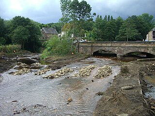
The River Loxley is a river in the City of Sheffield, South Yorkshire, England. Its source is a series of streams which rise some 10 miles (16 km) to the north-west of Sheffield on Bradfield Moors, flowing through Bradfield Dale to converge at Low Bradfield. It flows easterly through Damflask Reservoir and is joined by Storrs Brook at Storrs, near Stannington, and the River Rivelin at Malin Bridge, before flowing into the River Don at Owlerton, in Hillsborough. The Loxley valley provided the initial course of the Great Sheffield Flood, which happened after the Dale Dyke Dam collapsed shortly before its completion in March 1864.
Owlerton is a suburb of the city of Sheffield, England, 2.2 miles (3.5 km) northwest of the city centre near the confluence of the River Don and River Loxley. Owlerton was a small rural village from the Early Middle Ages; it became part of Sheffield in the early 1900s as the city expanded. Owlerton is just east of Hillsborough and within the Hillsborough ward. Hillsborough Stadium, Hillsborough Leisure Centre and Hillsborough College are in Owlerton.

Loxley is a village and a suburb of the city of Sheffield, England. It is a long linear community which stretches by the side of the River Loxley and along the B6077 for almost 2.5 miles (4 km). Loxley extends from its borders with the suburbs of Malin Bridge and Wisewood westward to the hamlet of Stacey Bank near Damflask Reservoir. The centre of the suburb is situated at the junction of Rodney Hill and Loxley Road where the old village green stands and this is located 3 miles (5 km) north west of Sheffield city centre. The suburb falls within the Stannington ward of the City of Sheffield.

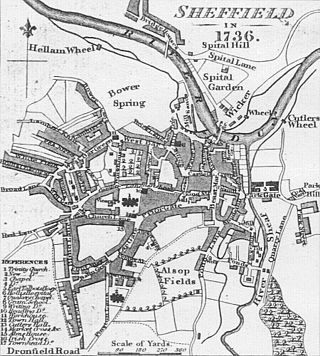
The history of Sheffield, a city in South Yorkshire, England, can be traced back to the founding of a settlement in a clearing beside the River Sheaf in the second half of the 1st millennium AD. The area now known as Sheffield had seen human occupation since at least the last ice age, but significant growth in the settlements that are now incorporated into the city did not occur until the Industrial Revolution.
Catcliffe is a village and civil parish on the north-west bank of the River Rother in South Yorkshire, England. The population of the civil parish at the 2011 census was 2,108. It is in the Metropolitan Borough of Rotherham, approximately 2.5 miles (4 km) south of the town of Rotherham and 4.3 miles (7 km) east of Sheffield City Centre.
Sheffield is a geographically diverse city in England. It nestles in the eastern foothills of the Pennines and the confluence of five rivers: Don, Sheaf, Rivelin, Loxley and Porter. As such, much of the city is built on hillsides, with views into the city centre or out to the countryside. The city is roughly one third urban, one third rural and one third in the Peak District. At its lowest point the city stands just 29 metres above sea level at Blackburn Meadows on the Rotherham border, rising up to over 500 m in some parts of the city to a peak of 548m at High Stones on the Derbyshire border; however, 89% of the housing in the city is between 100 and 200 metres above sea level. Over 95% of the population resides in the main urban area.
The Totley Brook is a stream in Sheffield, South Yorkshire, England. It rises on a millstone grit ridge some 7 miles (11 km) to the south-west of the centre of Sheffield. Over its course it drops from 740 feet (230 m) to 430 feet (130 m) near its junction with the Old Hay Brook close to Baslow Road. The streams form the River Sheaf once they have joined.

Dale Dike Reservoir or Dale Dyke Reservoir is a reservoir in the north-east Peak District, in the City of Sheffield, South Yorkshire, England, a mile (1.6 km) west of Bradfield and eight miles (13 km) from the centre of Sheffield, on the Dale Dike, a tributary of the River Loxley.

A series of large floods occurred in parts of the United Kingdom during the summer of 2007. The worst of the flooding occurred across Scotland on 14 June; East Yorkshire and the Midlands on 15 June; Yorkshire, the Midlands, Gloucestershire, Herefordshire and Worcestershire on 25 June; and Gloucestershire, Herefordshire, Worcestershire, Oxfordshire, Berkshire and South Wales on 28 July 2007.

The 2012 Great Britain and Ireland floods were a series of weather events that affected parts of Great Britain and Ireland periodically during the course of 2012 and on through the winter into 2013. The beginning of 2012 saw much of the United Kingdom experiencing droughts and a heat wave in March. A series of low pressure systems steered by the jet stream brought the wettest April in 100 years, and flooding across Britain and Ireland. Continuing through May and leading to the wettest beginning to June in 150 years, with flooding and extreme events occurring periodically throughout Britain and parts of Atlantic Europe.

In June 2016, parts of the United Kingdom were struck by serious flash floods. Starting on 7 June, thunderstorms caused intense rainfall in many locations across the country, particularly in the north of England and in London, causing repeated flash floods in several locations on a daily basis.

Between November 2019 and February 2020, severe winter flooding occurred across the United Kingdom. The first wave of flooding occurred in November 2019, mainly affecting Yorkshire and the Humber, the East Midlands and the West Midlands. Further isolated flooding incidents were reported in December and January, before the second main wave of flooding, caused by Storms Ciara and Dennis, occurred in February 2020. The excessive rainfall resulted in the wettest February since records began, in 1766, in England and Wales with an average of 169.6 millimetres (6.68 in) falling across the regions, beating the record from 1833.

In July 2019, parts of the Yorkshire Dales, in North Yorkshire, England, were subjected to above average rainfall for the time of year. The flash-flooding that followed affected many communities destroying bridges, sweeping roads away, causing landslips on railway lines and resulting in at least one public event being cancelled. The flooding even inundated the fire station in the town of Leyburn, in Wensleydale, whilst the crew were out helping those in need. The recovery took many weeks and months, with immediate help by the rescue services being bolstered by British Army personnel who assisted with the clean up.