List of impact structures in Europe

Last updated

World map in equirectangular projection of the craters on the Earth Impact Database as of November 2017 (in the SVG file, hover over a crater to show its details) Earth Impact Database world map.svg
World map in equirectangular projection of the craters on the Earth Impact Database as of November 2017 (in the SVG file, hover over a crater to show its details)
Map all coordinates using: OpenStreetMap

This list includes all 41 confirmed impact structures in Europe as listed in the Earth Impact Database (EID). These features were caused by the collision of large meteorites or comets with the Earth. For eroded or buried craters, the stated diameter typically refers to an estimate of original rim diameter, and may not correspond to present surface features. By EID convention, Russian and Asian craters are grouped together in the List of impact craters in Asia and Russia.

Contents

Confirmed impact structures

Europe Europe (orthographic projection).svg
Europe
NameLocationDiameter (km)Age (years)Coordinates
Boltysh Ukraine 2465.17 ± 0.64 million 48°45′N32°10′E / 48.750°N 32.167°E / 48.750; 32.167 (Boltysh)
Dellen Sweden 1989.0 ± 2.7 million 61°51′N16°42′E / 61.850°N 16.700°E / 61.850; 16.700 (Dellen)
Dobele Latvia 4.5290 ± 35 million 56°35′N23°15′E / 56.583°N 23.250°E / 56.583; 23.250 (Dobele)
Gardnos Norway 5500 ± 10 million 60°39′N9°0′E / 60.650°N 9.000°E / 60.650; 9.000 (Gardnos)
Granby Sweden 3470 million (approx.) 58°25′N14°56′E / 58.417°N 14.933°E / 58.417; 14.933 (Granby)
Ilumetsa Estonia 0.086600 (at least) 57°58′N27°25′E / 57.967°N 27.417°E / 57.967; 27.417 (Ilumetsa)
Hummeln structure Sweden 1.2443-470 million (approx.) 57°22′N16°15′E / 57.367°N 16.250°E / 57.367; 16.250
Ilyinets Ukraine 8.5378 ± 5 million 49°7′N29°6′E / 49.117°N 29.100°E / 49.117; 29.100 (Ilyinets)
Iso-Naakkima Finland 31000 million (at least) 62°11′N27°9′E / 62.183°N 27.150°E / 62.183; 27.150 (Iso-Naakkima)
Kaali Estonia 0.11 km (largest of 9)3000-5000 58°22′N22°40′E / 58.367°N 22.667°E / 58.367; 22.667 (Kaali)
Kärdla Estonia 4455 million (approx.) 59°1′N22°46′E / 59.017°N 22.767°E / 59.017; 22.767 (Kärdla)
Karikkoselkä Finland 1.4230 million (approx.) 62°13′N25°15′E / 62.217°N 25.250°E / 62.217; 25.250 (Karikkoselkä)
Keurusselkä Finland 301800 million (at most) 62°8′N24°36′E / 62.133°N 24.600°E / 62.133; 24.600 (Keurusselkä)
Lappajärvi Finland 2377.85 ± 0.78 million 63°12′N23°42′E / 63.200°N 23.700°E / 63.200; 23.700 (Lappajärvi)
Lockne Sweden 7.5458 million (approx.) 63°0′N14°49′E / 63.000°N 14.817°E / 63.000; 14.817 (Lockne)
Logoisk Belarus 1542.3 ± 1.1 million 54°12′N27°48′E / 54.200°N 27.800°E / 54.200; 27.800 (Logoisk)
Lumparn Finland 91000 million (approx.) 60°9′N20°6′E / 60.150°N 20.100°E / 60.150; 20.100 (Lumparn)
Målingen Sweden 1458 million (approx.) 62°55′N14°33′E / 62.917°N 14.550°E / 62.917; 14.550
Mien Sweden 9121.0 ± 2.3 million 56°25′N14°52′E / 56.417°N 14.867°E / 56.417; 14.867 (Mien)
Mizarai Lithuania 5500 ± 20 million 54°1′N23°54′E / 54.017°N 23.900°E / 54.017; 23.900 (Mizarai)
Mjølnir Barents Sea, Norway 40142.0 ± 2.6 million 73°48′N29°40′E / 73.800°N 29.667°E / 73.800; 29.667 (Mjølnir)
Morasko Poland 0.10 km (largest of 7)10000 52°29′N16°54′E / 52.483°N 16.900°E / 52.483; 16.900 (Morasko)
Neugrund Estonia 8470 million (approx.) 59°20′N23°40′E / 59.333°N 23.667°E / 59.333; 23.667 (Neugrund)
Nördlinger Ries Germany 2514.8 million 48°53′N10°34′E / 48.883°N 10.567°E / 48.883; 10.567 (Nördlinger Ries)
Obolon' Ukraine 20169 ± 7 million 49°35′N32°55′E / 49.583°N 32.917°E / 49.583; 32.917 (Obolon')
Paasselkä Finland 101800 million (at most) 62°9′N29°25′E / 62.150°N 29.417°E / 62.150; 29.417 (Paasselkä)
Ritland crater Norway 2.7520 ± 20 million 59°14′N6°26′E / 59.233°N 6.433°E / 59.233; 6.433
Rochechouart France 23206.92 ± 0.32 million [1] 45°49′N0°47′E / 45.817°N 0.783°E / 45.817; 0.783 (Rochechouart)
Rotmistrovka Ukraine 2.7120 ± 10 million 49°0′N32°0′E / 49.000°N 32.000°E / 49.000; 32.000 (Rotmistrovka)
Saarijärvi Finland 1.5600 million (at least) 65°17′N28°23′E / 65.283°N 28.383°E / 65.283; 28.383 (Saarijärvi)
Siljan Sweden 52376.8 ± 1.7 million 61°2′N14°52′E / 61.033°N 14.867°E / 61.033; 14.867 (Siljan)
Steinheim Germany 3.815 ± 1 million 48°41′N10°4′E / 48.683°N 10.067°E / 48.683; 10.067 (Steinheim)
Suvasvesi North Finland 41000 million (at most) 62°42′N28°10′E / 62.700°N 28.167°E / 62.700; 28.167 (Suvasvesi North)
Suvasvesi South Finland 3.8250 million (approx.) 62°36′N28°13′E / 62.600°N 28.217°E / 62.600; 28.217 (Suvasvesi South)
Sääksjärvi Finland 6560 million (approx.) 61°24′N22°24′E / 61.400°N 22.400°E / 61.400; 22.400 (Sääksjärvi)
Söderfjärden Finland 6.6600 million (approx.) 63°0′N21°34′E / 63.000°N 21.567°E / 63.000; 21.567 (Söderfjärden)
Ternovka Ukraine 11280 ± 10 million 48°08′N33°31′E / 48.133°N 33.517°E / 48.133; 33.517 (Ternovka)
Tvären Sweden 2455 million (approx.) 58°46′N17°25′E / 58.767°N 17.417°E / 58.767; 17.417 (Tvären)
Vepriai Lithuania 8160 ± 10 million (at least) 55°5′N24°35′E / 55.083°N 24.583°E / 55.083; 24.583 (Vepriai)
Zapadnaya Ukraine 3.2165 ± 5 million 49°44′N29°0′E / 49.733°N 29.000°E / 49.733; 29.000 (Zapadnaya)
Zeleny Gai Ukraine 3.580 ± 20 million 48°4′N32°45′E / 48.067°N 32.750°E / 48.067; 32.750 (Zeleny Gai)

Unconfirmed impact structures

The following structures are officially considered "unconfirmed" because they are not listed in the Earth Impact Database. Due to stringent requirements regarding evidence and peer-reviewed publication, newly discovered craters or those for which it is difficult to collect evidence are generally known for some time before becoming listed. However, entries on the unconfirmed list could still have an impact origin disproven.

NameLocationDiameterAgeCoordinates
Guarda Portugal 30200 million (approx.) 40°38′N07°06′W / 40.633°N 7.100°W / 40.633; -7.100 (Guarda)
Silverpit North Sea near England 20 [2] 60 ± 15 million 54°14′N1°51′E / 54.233°N 1.850°E / 54.233; 1.850 (Silverpit)
Sirente Italy largest 140 x 115 m1700 (approx.) 42°10′38″N13°35′45″E / 42.17722°N 13.59583°E / 42.17722; 13.59583 (Sirente)
Ullapool Loch Broom, Scotland 501.2 billion 57°53′28″N5°09′54″W / 57.891°N 5.165°W / 57.891; -5.165 (Ullapool)
Zerelia East [3] Thessaly, Greece 150 m7000 (at least) 39°09′43″N22°42′51″E / 39.16194°N 22.71417°E / 39.16194; 22.71417 (Zerelia East)
Zerelia West [3] Thessaly, Greece 250 m7000 (at least) 39°09′48″N22°42′32″E / 39.16333°N 22.70889°E / 39.16333; 22.70889 (Zerelia West)

See also

Related Research Articles

<span class="mw-page-title-main">Impact crater</span> Circular depression in a solid astronomical body formed by the impact of a smaller object

An impact crater is a circular depression in the surface of a solid astronomical object formed by the hypervelocity impact of a smaller object. In contrast to volcanic craters, which result from explosion or internal collapse, impact craters typically have raised rims and floors that are lower in elevation than the surrounding terrain. Lunar impact craters range from microscopic craters on lunar rocks returned by the Apollo program and small, simple, bowl-shaped depressions in the lunar regolith to large, complex, multi-ringed impact basins. Meteor Crater is a well-known example of a small impact crater on Earth.

<span class="mw-page-title-main">Impact event</span> Collision of two astronomical objects

An impact event is a collision between astronomical objects causing measurable effects. Impact events have physical consequences and have been found to regularly occur in planetary systems, though the most frequent involve asteroids, comets or meteoroids and have minimal effect. When large objects impact terrestrial planets such as the Earth, there can be significant physical and biospheric consequences, as the impacting body is usually traveling at several kilometres a second, though atmospheres mitigate many surface impacts through atmospheric entry. Impact craters and structures are dominant landforms on many of the Solar System's solid objects and present the strongest empirical evidence for their frequency and scale.

<span class="mw-page-title-main">Manicouagan Reservoir</span> Lake in Quebec, Canada

Manicouagan Reservoir is an annular lake in central Quebec, Canada, covering an area of 1,942 km2 (750 sq mi). The lake island in its centre is known as René-Levasseur Island, and its highest point is Mount Babel. The structure was created 214 (±1) million years ago, in the Late Triassic, by the impact of a meteorite 5 km (3 mi) in diameter. The lake and island are clearly seen from space and are sometimes called the "eye of Quebec". The lake has a volume of 137.9 km3 (33.1 cu mi).

<span class="mw-page-title-main">Ilumetsa crater</span> Impact craters in Estonia

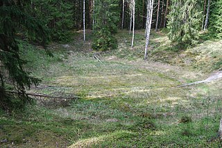
Ilumetsa is a set of two probable meteorite craters in Estonia.

<span class="mw-page-title-main">Liverpool crater</span> Impact crater in Northern Territory, Australia

Liverpool is a meteorite impact crater situated in Arnhem Land within the Northern Territory, Australia. It was named after the nearby Liverpool River. Liverpool is remote and difficult to access. The crater has a raised, near-circular rim averaging about 1.6 km in diameter. It was first noticed by geologists during reconnaissance geological mapping in the 1960s, and although an impact origin was considered possible, this was not confirmed until a more detailed study was undertaken in 1970.

<span class="mw-page-title-main">Popigai impact structure</span> Impact crater in Siberia, Russia

The Popigai impact structure is the eroded remnant of an impact crater in northern Siberia, Russia. It is tied with the Manicouagan structure as the fourth largest verified impact structure on Earth. A large bolide impact created the 100-kilometre (62 mi) diameter crater approximately 35 million years ago during the late Eocene epoch. It might be linked to the Eocene–Oligocene extinction event.

<span class="mw-page-title-main">Rochechouart impact structure</span> Asteroid impact structure in France

Rochechouart impact structure or Rochechouart astrobleme is an impact structure in France. Erosion has over the millions of years mostly destroyed its impact crater, the initial surface expression of the asteroid impact leaving highly deformed bedrock and fragments of the crater's floor as evidence of it.

<span class="mw-page-title-main">Vredefort impact structure</span> Largest verified impact structure on Earth, about 2 billion years old

The Vredefort impact structure is one of the largest verified impact structures on Earth. The crater, which has since been eroded away, has been estimated at 170–300 kilometres (110–190 mi) across when it was formed. The remaining structure, comprising the deformed underlying bedrock, is located in present-day Free State province of South Africa. It is named after the town of Vredefort, which is near its centre. The structure's central uplift is known as the Vredefort Dome. The impact structure was formed during the Paleoproterozoic Era, 2,023 million years ago. It is the second-oldest known impact structure on Earth, after Yarrabubba.

<span class="mw-page-title-main">Woodleigh crater</span> Impact crater in Western Australia

Woodleigh is a large meteorite impact crater (astrobleme) in Western Australia, centred on Woodleigh Station east of Shark Bay, Gascoyne region. A team of four scientists at the Geological Survey of Western Australia and the Australian National University, led by Arthur J. Mory, announced the discovery in the 15 April 2000 issue of Earth and Planetary Science Letters.

<span class="mw-page-title-main">Kebira Crater</span> Circular feature in the Sahara

Kebira Crater is the name given to a circular topographic feature that was identified in 2007 by Farouk El-Baz and Eman Ghoneim using satellite imagery, Radarsat-1, and Shuttle Radar Topography Mission (SRTM) data in the Sahara desert. This feature straddles the border between Egypt and Libya. The name of this feature is derived from the Arabic word for "large", and also from its location near the Gilf Kebir region in southwest Egypt. Based solely on their interpretations of the remote sensing data, they argue that this feature is an exceptionally large, double-ringed, extraterrestrial impact crater. They suggest that the crater's original appearance has been obscured by wind and water erosion over time. Finally, they speculated that this feature might be the source of the yellow-green silica glass fragments, known as "Libyan desert glass", that can be found across part of Egypt's Libyan Desert. They neither conducted any fieldwork at this feature nor studied any samples collected from it. However, the Kebira Crater is currently not listed in the Earth Impact Database. Field trips to investigate the feature have found no supporting evidence. The "central uplift" clearly retains the horizontal bedding of the surrounding sandstone tableland, providing clear evidence against a possible impact origin.

<span class="mw-page-title-main">Ramgarh crater</span> Impact crater in the country of India

Ramgarh crater, also known as Ramgarh structure, Ramgarh Dome and Ramgarh astrobleme, is a meteor impact crater of 3.5 kilometres (2.2 mi) diameter in Kota plateau of Vindhya range located adjacent to Ramgarh village in Mangrol tehsil of Baran district in Rajasthan state of India. When formally accepted as the third crater in India, its diameter size would be between the two already confirmed craters in India - Dhala in Madhya Pradesh with 14 km diameter and Lonar in Buldhana district of Maharashtra with 1.8 km diameter.

As of June 2018, 12 confirmed impact craters have been found in Finland. They are listed below, sorted by original diameter.

References

  1. Cohen, Benjamin E.; Mark, Darren F.; Lee, Martin R.; Simpson, Sarah L. (2017-08-01). "A new high-precision 40Ar/39Ar age for the Rochechouart impact structure: At least 5 Ma older than the Triassic–Jurassic boundary". Meteoritics & Planetary Science. 52 (8): 1600–1611. Bibcode:2017M&PS...52.1600C. doi: 10.1111/maps.12880 . hdl: 10023/10787 . ISSN   1945-5100.
  2. Stewart SA, Allen PJ (2002). "A 20-km-diameter multi-ringed impact structure in the North Sea". Nature . 418 (6897): 520–3. Bibcode:2002Natur.418..520S. doi:10.1038/nature00914. PMID   12152076.
  3. 1 2 Dietrich, V. J.; Lagios, E.; Reusser, E.; Sakkas, V.; Gartzos, E.; Kyriakopoulos, K. (2013). "The enigmatic Zerelia twin-lakes (Thessaly, Central Greece): two potential meteorite impact Craters". Solid Earth Discussions. 5 (2): 1511–1573. Bibcode:2013SolED...5.1511D. doi: 10.5194/sed-5-1511-2013 . S2CID   56034694.