
Saser Kangri is a mountain in India. It is the highest peak in the Saser Muztagh, the easternmost subrange of the Karakoram range. Sasir Kangri is located within Ladakh, the northernmost union territory in India.

Noshaq, also called Noshak or Nowshak, is the second highest peak in the Hindu Kush Range after Tirich Mir at 7,492 m (24,580 ft). It lies on the border between Afghanistan and Pakistan. The north and west sides of the mountain are in Afghanistan whereas the south and eastern sides are in Pakistan. Noshaq is Afghanistan's highest mountain and is located in the northeastern corner of the country along the border with Pakistan. It is the westernmost 7,000 m (22,966 ft) peak in the world. Easiest access to Noshaq is from Wakhan Afghanistan.
K12 is the second highest peak in the Saltoro Mountains, a subrange of the Karakoram range in the Siachen region of Ladakh. Its name comes from its designation given during the original survey of the Karakoram range. In 1984, an Indian army expedition under Colonel Prem Chand took hold of this peak, from the side of Siachen glacier by traversing from the west.

The Trans-Karakoram Tract, also known as the Shaksgam Tract, is a disputed area of approximately 5,200 km2 (2,000 sq mi) north of the Karakoram watershed, including the Shaksgam valley. The tract is administered by China as part of its Taxkorgan and Yecheng counties in the Xinjiang Uyghur Autonomous Region. Although the Shaksgam tract was never under the control of Pakistan since 1947, in the 1963 Sino-Pakistan Agreement, Pakistan recognized Chinese sovereignty over the Shaksgam tract, while China recognized Pakistani sovereignty over the Gilgit Agency, and a border based on actual ground positions was recognized as the international border by China and Pakistan. It, and the entire Kashmir region, is claimed by India.
Namcha Barwa or Namchabarwa is a mountain peak lying in Tibet in the region of Pemako. The traditional definition of the Himalaya extending from the Indus River to the Brahmaputra would make it the eastern anchor of the entire mountain chain, and it is the highest peak of its own section as well as Earth's easternmost peak over 7,600 metres (24,900 ft). It lies in the Nyingchi Prefecture of Tibet. It is the highest peak in the 180 km long Namcha Barwa Himal range, which is considered the easternmost syntaxis/section of the Himalaya in southeastern Tibet and northeastern India where the Himalaya are said to end, although high ranges actually continue another 300 km to the east.
Saltoro Kangri, previously known as Peak 36, stands as the highest peak within the Saltoro Mountains subrange, which is part of the larger Karakoram range. This subrange is also referred to as the Saltoro Range and is situated within the Karakoram region. The term "Saltoro Kangri" typically encompasses both of its twin peaks, Saltoro Kangri I and Saltoro Kangri II, which are connected by a saddle. When comparing heights, the generic term "Saltoro Kangri" is used for the taller of the two peaks, Saltoro Kangri I. This peak ranks as the 31st highest mountain globally and is located in the remote reaches of the Karakoram. It lies on the Actual Ground Position Line, dividing Indian-controlled territory in the Siachen region from Pakistani-controlled territory to the west of the Saltoro Range.

Harish Kapadia is a Himalayan mountaineer, author and long-time editor of the Himalayan Journal from India. He has been awarded the Patron's Medal of the Royal Geographical Society, the Life Time Achievement Award for Adventure by the President of India and the King Albert Mountain Award presented by The King Albert I Memorial Foundation. He has written numerous books and articles on the Indian Himalayas. Harish was awarded the Piolets d'Or Asia Life Time Achievement Award in 2017 for his mountaineering and exploratory endeavors.

Operation Meghdoot was the codename for the Indian Army operation to take full control of the Siachen Glacier in Ladakh). Executed on the morning of 13 April 1984 in the highest battlefield in the world, Meghdoot was the first military offensive of its kind. This operation preempted Pakistan's Operation Ababeel; and was a success. Resulting in Indian forces gaining control of the Siachen Glacier in its entirety.
The Rimo Muztagh is one of the most remote subranges of the Karakoram range. The southern part of Rimo Muztagh is in the Ladakh portion of far northwestern India, also claimed by Pakistan. The northern half, including the Rimo massif, is in the Siachen area. It is far from major towns, and close to the militarily sensitive Siachen Glacier, so it has seen little exploration or climbing activity compared to, for example, the nearby Baltoro Muztagh. The highest peak is Mamostong Kangri, 7,516 metres.
The Siachen Muztagh is a remote subrange of the eastern Karakoram Range. Close to 60% is in area controlled by China, 40% in area controlled by India. Pakistan claims the Indian-controlled portion as part of the Siachen Conflict. India claims the Chinese-controlled portion. India administers its portion as part of the Union Territory of Ladakh. China administers its portion as part of Xinjiang province.
Rimo I is the main summit of the Rimo massif with an elevation of 7,385 metres (24,229 ft).
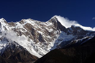
Mamostong Kangri or Mamostang Kangri, surveyed as K35, is the highest peak in the remote Rimo Muztagh, a subrange of the Karakoram range in Ladakh union territory of India. It is located about 30 km east-southeast of the snout of the Siachen Glacier. It is the 48th-highest independent peak in the world.
The Teram Kangri group is a mountain massif in the remote Siachen Muztagh, a subrange of the Karakoram range. The high point of the group, and of the Siachen Muztagh, is Teram Kangri I. The peak lies on the boundary between disputed China controlled Trans-Karakoram Tract and the disputed Siachen Glacier section controlled by India. The northeast side of the peak is in Chinese-controlled territory, the southwest side is controlled by India. Teram Kangri I was first climbed on August 10, 1975, by a Japanese expedition led by H. Katayama, which obtained a permit from the Government of Pakistan and made the long approach via Bilafond La. They climbed the SW ridge of Teram Kangri II and then took the East ridge to the top. Teram Kangri II was climbed on August 12 and 13 by six Japanese climbers.
The Depsang Plains, a high-altitude gravelly plain in the northwest portion of the disputed Aksai Chin region of Kashmir, divided into Indian and Chinese administered portions by a Line of Actual Control. India controls the western portion of the plains as part of Ladakh, while the eastern portion is controlled by China and claimed by India. The Line of Control with Pakistan-administered Gilgit-Baltistan is 80 kilometres (50 mi) west of the Depsang Plains, with the Siachen Glacier in-between. Ladakh's traditional trade route to Central Asia passed through the Depsang Plains, with the Karakoram Pass lying directly to its north.

Siachen Base Camp, 12,000 feet above sea level at Partapur, is a base camp of 102 Infantry Brigade of XIV Corps of Indian Army which protects 110 km long Actual Ground Position Line (AGPL) with at least 108 forward military outposts and artillery observation posts in the disputed region of Siachen Glacier in Ladakh Union Territory of India. It is approximately 6 hours drive north from the town of Leh via one of the highest vehicle-accessible passes in the world, Khardung La at 17,582 feet. Bana Top (20,500 ft) is the highest post in the region, which requires 80 km and 20 day trek for troops. Pahalwan Post and posts near Indira Col are other high posts. Kumar Post or Kumar Base, named after the Colonel Narendra "Bull" Kumar, serves as the battalion head quarter located 60 km from the Siachen base towards Indira Col. The Siachen Brigade consists of five to eight battalions of Ladakh Scouts supported by artillery, air defence, engineer and other logistic units. Pakistan has not been able to scale the crest of the Saltoro Range occupied by India. The temperature goes down to minus 86 °C during winters with icy 300 kmph blizzards. The average temperature is between minus 25 °C during day and minus 55 °C during the night.

The Actual Ground Position Line (AGPL) divides current positions of Indian and Pakistani military posts and troops along the entire 110 kilometres (68 mi) long frontline in the disputed region of Siachen Glacier. AGPL generally runs along the Saltoro Mountains range, beginning from the northernmost point of the (LOC) at Point NJ 9842 and ending in the north on the Indira Ridge at the India-China-Pakistan LAC tripoint near Sia Kangri about 4 km (2.5 mi) northwest of Indira Col West, with peaks in excess of 7,000 m (23,000 ft) and temperatures ranging to around −55 °C (−67 °F). India gained control of 1,000 square miles (2,600 km2) of disputed territory in 1984 because of its military operations in Siachen. A cease-fire was announced in 2003.
Apsarasas Kangri is a mountain in the Siachen subrange of the Karakoram mountain range. With an elevation of 7,245 m (23,770 ft) it is the 96th highest mountain in the world. Apsarasas Kangri is located within the broader Kashmir region disputed between India, Pakistan and China. It is situated on the border between the areas controlled by China as part of the Xinjiang autonomous region, and the Siachen Glacier controlled by India as part of Ladakh.
Thangman Kangri is one of highest peak in the remote Rimo Muztagh, a subrange of the Karakoram range in Ladakh union territory of India.
