This article needs additional citations for verification .(November 2020) |
This article lists open, former and demolished places of worship situated within the boundaries of the City of Wakefield.
This article needs additional citations for verification .(November 2020) |
This article lists open, former and demolished places of worship situated within the boundaries of the City of Wakefield.
| Name | Image | Location | Denomination | Grade | Opened | Notes |
|---|---|---|---|---|---|---|
| All Saints' Church | 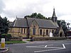 | Ackworth Moor Top | Church of England | |||
| St Cuthbert's Church | 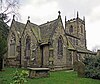 | Ackworth | Church of England | II* |
| Name | Image | Location | Denomination | Grade | Opened | Notes |
|---|---|---|---|---|---|---|
| St Mary's Church |  | Badsworth | Church of England | I |
| Name | Image | Location | Denomination | Grade | Opened | Notes |
|---|---|---|---|---|---|---|
| All Saints' Church (Castleford town centre) | 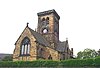 | Albion Street, Castleford town centre | Church of England | II | ||
| All Saints' Church (Hightown) |  | Hightown | Church of England | |||
| Cutsyke Christian Church | Leeds Road, Cutsyke, Castleford WF10 5HA [1] | |||||
| Gospel Hall | 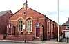 | Pontefract Road | Gospel | Formerly Pontefract Road Primitive Methodist Church | ||
| Holy Cross Church | 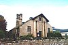 | Airedale | Church of England | Serves the Airedale estate | ||
| St Edmund's Church | 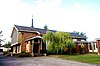 | Queens Park Drive, Airedale | Roman Catholic | Serves the Airedale estate | ||
| St Joseph's Church | 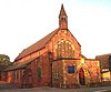 | Pontefract Road | Roman Catholic | |||
| St Michael's Church | 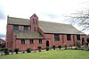 | Smawthorne Lane | Church of England | |||
| St Paul the Apostle |  | Pontefract Road, Glasshoughton | Church of England | |||
| Smawthorne Community Church |  | Beancroft Road | Evangelical | |||
| Trinity Methodist Church |  | Powell Street, Castleford town centre | Methodist | 1964 | ||
| Townville Methodist Church |  | Townville | Methodist |
| Name | Image | Location | Denomination | Grade | Opened | Notes |
|---|---|---|---|---|---|---|
| Featherstone Methodist Church |  | Featherstone | Methodist | |||
| St Gerald Majella |  | Featherstone | Roman Catholic | |||
| St Thomas |  | Featherstone | Church of England | |||
| South Featherstone Gospel Hall |  | Station Lane, Featherstone |
For details of current and former places of worship in Horbury, see Horbury#Religion
| Name | Image | Location | Denomination | Grade | Opened | Notes |
|---|---|---|---|---|---|---|
| Elim Pentecostal Church |  | Tithe Barn Road | Pentecostal | |||
| Knottingley United Reformed Church |  | Knottingley | United Reformed Church | |||
| Salvation Army Church |  | Weeland Road | Salvation Army | |||
| St Botolph's Church |  | Knottingley | Church of England | II |
| Name | Image | Location | Denomination | Grade | Opened | Notes |
|---|---|---|---|---|---|---|
| St John the Baptist | Newland Lane Normanton WF6 1BA [2] | Roman Catholic | The land where the church is built was formerly owned by the Knights of St John of Jerusalem. [3] |
| Name | Image | Location | Denomination | Grade | Opened | Notes |
|---|---|---|---|---|---|---|
| Christ Church |  | Ossett | Church of England | II | 1851 | Commissioners' church |
| Holy Trinity Church |  | Ossett | Church of England | II | ||
| The King's Way Church |  | Ossett | Methodist | |||
| Mount Zion Chapel |  | Queen Street | Methodist | |||
| St Ignatius |  | Storrs Hill Road | Roman Catholic | |||
| South Ossett Baptist Church |  | Junction Lane | Baptist |
| Name | Image | Location | Denomination | Grade | Opened | Notes |
|---|---|---|---|---|---|---|
| All Saints' Church |  | North Bailey Gate, Pontefact | Church of England | II* | The outer church was destroyed in the English Civil War, a new church was built within having been completed in 1967 | |
| Central Methodist Church | 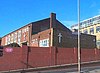 | Jubilee Way, Pontefract | Methodist | |||
| Pontefract Congregational Church |  | Finkle Street, Pontefract | Congregational | |||
| The Evangelical Church |  | Finkle Street, Pontefract | Evangelical | |||
| Holy Family Church |  | Carleton Crest, Chequerfield Estate, Pontefract | Roman Catholic | |||
| Kingdom Hall of the Jehovah's Witnesses | 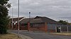 | Orchard Head Lane | Jehovah's Witnesses | |||
| Chapel of The Church of Jesus Christ of Latter-day Saints | 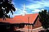 | Park Villas Drive, Pontefract | Latter-day Saints | |||
| Micklegate Methodist Church | 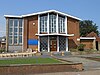 | Micklegate, Pontefract | Methodist | 1969 | This replaced the former Tanshelf Methodist Church which burned down in 1965 | |
| Salvation Army Hall |  | Maud's Yard, Pontefract | Salvation Army | |||
| St Giles' Church |  | Market Place, Pontefract | Church of England | II* | ||
| St Joseph's Church | | Back Street, Pontefract | Roman Catholic |
| Name | Image | Location | Denomination | Grade | Opened | Notes |
|---|---|---|---|---|---|---|
| Wakefield Cathedral (Cathedral Church of All Saints') |  | Kirkgate, Wakefield City Centre | Church of England | I | ||
| Destiny Church | 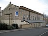 | Chaloner Grove | II | 1859 | A former theatre | |
| Evangelical Free Church |  | Eastmoor | Evangelical | |||
| First Church of Christ Scientist |  | Wentworth Street | First Church of Christ Scientist | |||
| Church of Jesus Christ and the Latter Day Saints |  | Horbury Road | Mormon | |||
| Light ^ Life Church |  | Clarion Street, Belle Vue | Non-denominational | |||
| New Life Christian Centre | 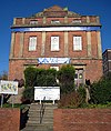 | George Street | Pentecostal | II | ||
| Outwood Methodist Church |  | Outwood | Methodist | |||
| Quaker Meeting House |  | Thornhill Street, Wakefield City Centre | Quaker | |||
| St Andrew's Church |  | Peterson Road, Wakefield | Church of England | II | Serves the East end of Wakefield and Eastmoor | |
| St Anne's Church |  | Wrenthorpe | Church of England | Serves the Wrenthorpe district | ||
| St Austin's Church | 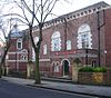 | Wentworth Terrace | Roman Catholic | II | Serves North Wakefield | |
| St Catherine's Church |  | Doncaster Road | Church of England | |||
| St George's Church | 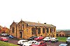 | St George's Road, Lupset | Church of England | |||
| St Helen's Church |  | Sandal Magna | Church of England | II* | Serves the Sandal district | |
| St James Church | 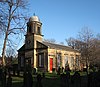 | Denby Dale Road, Thornes | Church of England | II | ||
| St John's Church | 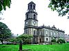 | St John's Square, Wakefield City Centre | Church of England | II* | 1895 | Serves the areas to the north of Wakefield City Centre |
| Chantry Chapel of St Mary the Virgin | 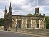 | Wakefield Bridge, Wakefield City Centre | Church of England | I | c. 1350 | Forms part of the structure of Wakefield Bridge |
| St Mary Magdalene's Church |  | Outwood WF1 2DT | Church of England | 1858 [4] | Part of the benefice of North Wakefield | |
| St Michael's Church | 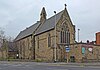 | Westgate End, Wakefield | Church of England | Serves the west end of Wakefield | ||
| St Paul's Church | 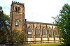 | St Paul's Drive, Alverthorpe, Wakefield | Church of England | II | Serves Alverthorpe | |
| St Peter and St Paul Church | 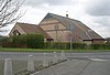 | Standbridge Lane | Roman Catholic | Serves South Wakefield | ||
| Sandal Methodist Church |  | Sandal Magna | Methodist | |||
| Trinity Methodist Church | 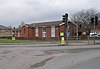 | Stanley Road | Methodist | Serves North Wakefield | ||
| Wakefield Baptist Church | 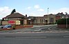 | Barnsley Road | Baptist | |||
| Wakefield Citadel |  | Frederick Street, Wakefield City Centre | Salvation Army | |||
| Wakefield Spiritualist Church |  | Peterston Road, Wakefield | Spiritualist | |||
| Westgate Unitarian Chapel | 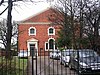 | Westgate, Wakefield City Centre | Unitarian | |||
| West Wakefield Methodist Church |  | Thornes Road, Wakefield | Methodist |
| Name | Image | Location | Denomination | Grade | Opened | Notes |
|---|---|---|---|---|---|---|
| St Bartholomew's Chapel | Yorkshire Sculpture Park, WF4 4LG | Church of England | Now used for art and sculpture display purposes and known as YSP Chapel [6] |

Edenbridge is a town and civil parish in the Sevenoaks district of Kent, England. Its name derives from Old English Eadhelmsbrigge. It is located on the border of Kent and Surrey, on the upper floodplain of the River Medway and takes its name from that river's tributary, the River Eden. The town had a population of 7,808 in 2011.

Horbury is a town in the City of Wakefield in West Yorkshire, England. Historically in the West Riding of Yorkshire, it is situated north of the River Calder about three miles (5 km) south west of Wakefield and two miles (3 km) to the south of Ossett. It includes the outlying areas of Horbury Bridge and Horbury Junction. At the 2001 census the Horbury and South Ossett ward of Wakefield Metropolitan District Council had a population of 10,002. At the 2011 census the population was 15,032. Old industries include woollens, engineering and building wagons for the railways. Horbury forms part of the Heavy Woollen District.

Wakefield, also known as the City of Wakefield, is a local government district with city status and a metropolitan borough in West Yorkshire, England. Wakefield, the largest settlement, is the administrative centre of the district. The population of the City of Wakefield at the 2011 Census was 325,837.

Featherstone is a town and civil parish in the City of Wakefield, West Yorkshire, England, two miles south-west of Pontefract. Historically part of the West Riding of Yorkshire, in 2011 it had a population of 15,244. Featherstone railway station is on the Pontefract Line.
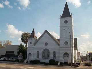
The black church is the faith and body of Christian denominations and congregations in the United States that predominantly minister to, and are also led by African Americans, as well as these churches' collective traditions and members. The term "black church" may also refer to individual congregations, including in traditionally white-led denominations.
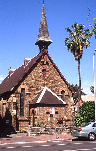
The Bridge Church (Kirribilli) is the Kirribilli location of The Bridge Church, meeting at an Anglican church at 7–9 Broughton Street, Kirribilli, on the Lower North Shore of Sydney, New South Wales, Australia. The Bridge Church (Kirribilli) meets in St John the Baptist Church and is part of 'The Bridge Church', which encompasses 3 locations, being Kirribilli, Neutral Bay and Macquarie Park.

Christ Church Cathedral is a heritage-listed Anglican cathedral complex at Duke Street, Grafton, Clarence Valley Council, New South Wales, Australia. The cathedral was designed by John Horbury Hunt and built from 1874 to 1884 by Reynold Brothers (brickwork) and G. J. T. Lawson (woodwork). It is also known as Cathedral Church of Christ the King and Grafton Anglican Cathedral. The property is owned by the Anglican Diocese of Grafton. It was added to the New South Wales State Heritage Register on 14 March 2003.