Related Research Articles

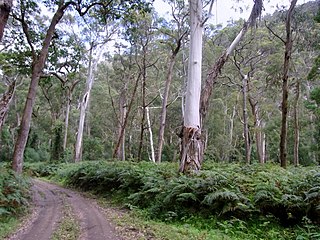
Goobang is a national park located in New South Wales, Australia, 296 kilometres (184 mi) northwest of Sydney. It protects the largest remnant forest and woodland in the central west region of the state, where interior and coastal New South Wales flora and fauna species overlap. Originally named Herveys Range by John Oxley in 1817, the area was reserved in 1897 as state forest because of its importance as a timber resource, and was designated a national park in 1995.

The Cumberland Plain, an IBRA biogeographic region, is a relatively flat region lying to the west of Sydney CBD in New South Wales, Australia. Cumberland Basin is the preferred physiographic and geological term for the low-lying plain of the Permian-Triassic Sydney Basin found between Sydney and the Blue Mountains, and it is a structural sub-basin of the Sydney Basin.

Hampton is an interim Australian bioregion located in southeastern coastal Western Australia, with a small portion (4%) extending into adjacent South Australia. It has an area of 1,088,198 hectares. The Hampton bioregion is part of the Coolgardie woodlands ecoregion.

Western Australia occupies nearly one third of the Australian continent. Due to the size and the isolation of the state, considerable emphasis has been made of these features; it is the second largest administrative territory in the world, after Yakutia in Russia, despite the fact that Australia is only the sixth largest country in the world by area, and no other regional administrative jurisdiction in the world occupies such a high percentage of a continental land mass. It is also the only first level administrative subdivision to occupy the entire continental coastline in one cardinal direction.

The Brigalow Belt is a wide band of acacia-wooded grassland that runs between tropical rainforest of the coast and the semi-arid interior of Queensland, Australia. The Interim Biogeographic Regionalisation for Australia (IBRA) divides the Brigalow Belt into two IBRA regions, or bioregions, Brigalow Belt North (BBN) and Brigalow Belt South (BBS). The North and South Brigalow Belt are two of the 85 bioregions across Australia and the 15 bioregions in Queensland. Together they form most of the Brigalow tropical savanna ecoregion.

The Eastern Australian temperate forests is a broad ecoregion of open forest on uplands starting from the east coast of New South Wales in the South Coast to southern Queensland, Australia. Although dry sclerophyll and wet sclerophyll eucalyptus forests predominate within this ecoregion, a number of distinguishable rainforest communities are present as well.

The Mulga Lands are an interim Australian bioregion of eastern Australia consisting of dry sandy plains with low mulga woodlands and shrublands that are dominated by Acacia aneura (mulga). The Eastern Australia mulga shrublands ecoregion is coterminous with the Mulga Lands bioregion.

The Southeast Australia temperate savanna ecoregion is a large area of grassland dotted with eucalyptus trees running north–south across central New South Wales, Australia.

The Coolgardie woodlands is an ecoregion in southern Western Australia. The predominant vegetation is woodlands and mallee scrub. The ecoregion is a transitional zone between the Mediterranean-climate forests, woodlands, and shrublands of Southwest Australia and the deserts and dry scrublands of the Australian interior.
The Queanbeyan Nature Reserve is a protected nature reserve that is located in the Southern Tablelands region of New South Wales, in eastern Australia. The 67-hectare (170-acre) reserve is situated approximately 4 kilometres (2.5 mi) west-south-west of the City of Queanbeyan.
The Cooks River/Castlereagh Ironbark Forest (CRCIF) is a 1,101-hectare (2,721-acre) area of dry sclerophyll open-forest to low woodland which occurs predominantly in the Cumberland subregion of the Sydney basin bioregion, between Castlereagh and Holsworthy, as well as around the headwaters of the Cooks River. The majority of the community is found in the north-west section of the Cumberland Subregion in the Castlereagh area between Penrith and Richmond. Other significant patches occur in the Kemps Creek and Holsworthy areas. Smaller remnants occur in the eastern section of the Cumberland Subregion.

The Cumberland Plain Woodland is one of six main indigenous woodland communities of Sydney, New South Wales, Australia, that comprises an open tree canopy, a groundcover with grasses and herbs, usually with layers of shrubs and/or small trees. Situated in the Cumberland Plain, it is made up of dry sclerophyll woodlands, grasslands and/or forests, reminiscent of Mediterranean forests and temperate grasslands, therefore making it an ecotone.

The ecology of Sydney, located in the state of New South Wales, Australia, is diverse for its size, where it would mainly feature biomes such as grassy woodlands and some sclerophyll forests, with a few pockets of mallee shrublands, subtropical and temperate rainforests (evergreen), heathlands, and wetlands. The combination of climate, topography, moisture, and soil influence the dispersion of these ecological communities across a height gradient from 0 to 200 metres. There are many hiking trails, paved and unpaved roads for exploring the many different biomes and ecosystems.
The Southeast Australia temperate forests is a temperate broadleaf and mixed forests ecoregion of south-eastern Australia. It includes the temperate lowland forests of southeastern Australia, at the southern end of the Great Dividing Range. Vegetation ranges from wet forests along the coast to dry forests and woodlands inland.
The Weeping Myall Woodlands is an endangered ecological community, under the EPBC Act of the Commonwealth of Australia. It is found in inland Queensland and inland New South Wales, on alluvial plains west of the Great Dividing Range. It takes its name from Acacia pendula, the weeping myall.
References
- ↑ "Threatened ecological communities in New South Wales and the ACT".
- ↑ "Blue Gum High Forest of the Sydney Basin Bioregion". Department of Agriculture, Water and the Environment. Retrieved 4 August 2021.
{{cite web}}: CS1 maint: url-status (link) - ↑ "Brigalow (Acacia harpophylla dominant and co-dominant)". Species Profile and Threats Database. Retrieved 15 June 2022.
- ↑ "Coastal Upland Swamps in the Sydney Basin Bioregion". Species Profile and Threats Database. Retrieved 15 June 2022.
- ↑ "Coolibah – Black Box Woodlands of the Darling Riverine Plains and the Brigalow Belt South Bioregions". Species Profile and Threats Database. Retrieved 15 June 2022.
- ↑ "Cumberland Plain Shale Woodlands and Shale-Gravel Transition Forest". Species Profile and Threats Database.
- ↑ "Eastern Suburbs Banksia Scrub of the Sydney Region". Species Profile and Threats Database. Retrieved 15 June 2022.
- ↑ "Grey Box (Eucalyptus microcarpa) Grassy Woodlands and Derived Native Grasslands of South-eastern Australia". Species Profile and Threats Database. Retrieved 15 June 2022.
- ↑ "Hunter Valley Weeping Myall (Acacia pendula) Woodland". Species Profile and Threats Database. Retrieved 15 June 2022.
- ↑ "Littoral Rainforest and Coastal Vine Thickets of Eastern Australia". Species Profile and Threats Database. Retrieved 15 June 2022.
- ↑ "Threatened ecological communities in the Northern Territory" . Retrieved 4 August 2021.
{{cite web}}: CS1 maint: url-status (link) - ↑ "Threatened ecological communities in Queensland" . Retrieved 4 August 2021.
- ↑ "Threatened ecological communities in South Australia" . Retrieved 4 August 2021.
- ↑ "Threatened ecological communities in Tasmania" . Retrieved 4 August 2021.
- ↑ "Threatened ecological communities in Victoria" . Retrieved 4 August 2021.
- ↑ "Threatened ecological communities in Western Australia" . Retrieved 4 August 2021.