Cumberland Plain Woodland

Last updated

Cumberland Plain Woodland
Cumberland Plain Savanna.jpg
Grassy plain with scattered eucalypts
Ecology
Realm Australasia
Biome Tropical and subtropical grasslands, savannas, and shrublands
Borders
Geography
CountryAustralia
Elevation10–100 metres (33–328 ft)
Coordinates 33°50′59″S150°54′40″E / 33.84972°S 150.91111°E / -33.84972; 150.91111
Geology Sandstone, shale, laminite and siltstone
Climate type Humid subtropical climate (Cfa)
Soil types Clay, sand (podsol, entisols, lithosols), loam

The Cumberland Plain Woodland, also known as Cumberland Plain Bushland [1] and Western Sydney woodland, [2] is a grassy woodland community found predominantly in Western Sydney, New South Wales, Australia, that comprises an open tree canopy, a groundcover with grasses and herbs, usually with layers of shrubs and/or small trees. [3]

Contents

Situated in the Cumberland Plain, the Cumberland Plain Woodland (CPW) is a savanna that features dry sclerophyll woodlands, grasslands and/or forests, reminiscent of Mediterranean forests. According to Office of Environment and Heritage, the community falls predominantly within the Coastal Valley Grassy Woodlands region, [4] which are part of the Grassy Woodlands formation found in the eastern corridor of New South Wales. [5]

Currently, less than 6% of the Woodlands remain in small parts distributed across the western suburbs of Sydney, totaling only around 6400 hectares. [6] Cumberland Plain Woodland was listed as an Endangered Ecological Community under the Threatened Species Conservation Act 1995 in June 1997. The greatest threats to the Cumberland Plain Woodland include land clearing for agriculture, urban sprawl and the introduction of harmful weed species. [7]

Geography

The Cumberland Plain Woodland region lies far-west of Sydney CBD. Sydney suburbs geocover.png
The Cumberland Plain Woodland region lies far-west of Sydney CBD.

In 1877, Cumberland Plain Woodlands covered 107,000 hectares and filled around 30% of the Sydney Basin. At the time of European land exploration of Australia European settlement, the Cumberland Plain contained 1,070 km² of woodlands and forests. The westward expansion of Sydney over the plain has placed enormous pressure on the woodlands and other local ecological communities, only 6% of which remain uncleared. [8] The ecoregion contains clay soils derived from Wianamatta Shale to the west of Sydney CBD, where it receives 750–900 mm of annual rainfall.

The soils of the plain are infertile by world standards, but are not so by Australian standards. The plain is made up of eucalypt woodland with a grassy undergrowth and sclerophyllous (hard-leaved) shrub stratum, demarcating with the heath and forest communities of the sandstone plateaus that surround the plain. [9] The biotic community is mostly found on flat or hilly terrains up to about 350 m in elevation, but it may also be present on locally precipitous sites and at slightly higher elevations. Some parts of the community may have a forest structure. The Woodland features an open tree canopy, groundcover prevailed by grasses and herbs, sometimes with layers of shrubs and small trees. [10]

Locations

Spanning through the cities of Fairfield, Liverpool, Blacktown, Cumberland, Campbelltown, Camden and Penrith, with the cities of Canterbury-Bankstown, Hawkesbury, Parramatta and Wollondilly being on the peripheries, they contain approximately 2000 ha (one-fifth) of the remaining Cumberland Plain Woodland. Its range does not extend to slightly wetter Sydney Turpentine-Ironbark Forest, or high-rainfall ridges (such as Blue Gum High Forest in the upper North Shore), which are geologically on the Hornsby Plateau. [11]

Examples of the remnants can be seen at Defence Establishment Orchard Hills, Scheyville National Park, Rosford Street Reserve, Brenan Park, Central Gardens Nature Reserve, Fairfield Park Precinct, Prospect Hill, Prospect Nature Reserve, Western Sydney Regional Park, Wetherill Park Nature Reserve and Chipping Norton Lake, among other places. [12]

Western Sydney Airport

The Western Sydney Airport, currently under construction at Badgerys Creek, New South Wales, will require the clearing of a large area of Cumberland Plain Woodland. Environmental offsets have been announced to ensure the protection, restoration and preservation of the woodland. The Biodiversity Offset Delivery Plan was announced on 24 August 2018 and included:

Ecological communities

Moist Shale Woodlands Cumberlain Plain Woodland6.jpg
Moist Shale Woodlands
Shale Hills Woodlands Cumberlain Plain Woodland4.jpg
Shale Hills Woodlands
Shale Plains Woodlands Cumberland Plains Woodlands, Prestons - 2.jpg
Shale Plains Woodlands

The Cumberland Plain Woodland, classed under Coastal Valley Grassy Woodlands, includes these ecological communities, with some overlapping and others plainly being sub-regions of the Woodland: [15]

Vegetation

Selected tree and shrub species
Eucalyptusbaueriana.jpg
The Blue Box is a large tree found in the Cumberland Plain.
Hardenbergia violacea plant11 ANBG ST - Flickr - Macleay Grass Man.jpg
Purple coral peas are shrubby climbers found in the woodlands.
Acacia longifolia (6061248531).jpg
The Golden Wattle is usually a part of sclerophyll woodland communities
Gardenology.org-IMG 1046 rbgs10dec.jpg
River Oaks are abundant in the riparian zones within the Cumberland Plain Woodland.
Melaleuca decora habit.jpg
White feather honeymyrtle with lance-shaped leaves that is covered with creamy-coloured flowers.

The vegetation of the ecoregion includes grasslands, savanna, open woodlands, and some patches of sclerophyll forest lying on a nutrient-poor alluvium that was deposited by the Nepean River from sandstone and shale bedrock in the Blue Mountains. Despite this, they support a tremendous regional biodiversity. [25]

The grassy woodland is dominated by Grey Box ( Eucalyptus moluccana ) and Forest Red Gum (E. tereticornis), with Narrow-leaved Ironbark ( Eucalyptus crebra ), Spotted Gum ( Corymbia maculata ) and Thin-leaved Stringybark ( Eucalyptus eugenioides ) occurring sporadically. The ecoregion may have an open layer of small trees that would include such species of Acacia decurrens , Acacia parramattensis , Acacia implexa and Exocarpos cupressiformis . [26] The shrub layer is mainly contains Bursaria spinosa , indigofera australis , Hardenbergia violacea , Daviesia ulicifolia , Lespedeza cuneata , Dillwynia , Dodonaea viscosa , with plenty grasses such as Kangaroo Grass ( Themeda australis ) and Weeping Meadow Grass ( Microlaena stipoides ). [27]

Eucalyptus species:

Non-eucalyptus trees:

Shrubs:

Grasses and sedge:

Wildlife

Bird species in the woodland include (which are mostly vulnerable and/or endangered): [28]

Mammals: [29]

Historical description

In April 1788, Governor Arthur Phillip describes the land west of Parramatta: [2]

Parramatta in 1820s with grassy slopes and scattered trees. Joseph Lycett - Residence of John Macarthur Esq near Parramatta N.S.W. - Google Art Project.jpg
Parramatta in 1820s with grassy slopes and scattered trees.

The country through which they travelled was singularly fine, level, or rising in small hills of a very pleasing and picturesque appearance. The soil excellent, except in a few small spots where it was stony. The trees growing at a distance of from 20 to 40 feet [6–12 metres] from each other, and in general entirely free from brushwood, which was confined to the stony and barren spots.

In 1818, author and settler James Atkinson describes the plain as: [2]

One immense tract of forest land extends, with little interruption, from below Windsor, on the Hawkesbury to Appin, a distance of 50 miles...Forest means land more or less furnished with timber trees, and invariably covered with grass underneath, and destitute of underwood...The whole of this tract, and indeed all the forest in this county, was thick forest land, covered with very heavy timber, chiefly iron and stringy bark, box, blue and other gums, and mahogany.

In 1819, British explorer William Wentworth describes Cumberland Plain's natural landscape between Liverpool and Nepean River: [30]

In 1820s, Peter Miller Cunningham described Cumberland Plain Woodland as "a fine timbered country, perfectly clear of bush...without any impediment in the shape of rocks, scrubs, or close forest". W.C. Piguenit - Near Liverpool, New South Wales - Google Art Project.jpg
In 1820s, Peter Miller Cunningham described Cumberland Plain Woodland as "a fine timbered country, perfectly clear of bush...without any impediment in the shape of rocks, scrubs, or close forest".

The soil changes to a thin layer of vegetable mould, resting on a stratum of yellow clay, which is again supported by a deep bed of schistus. The trees of the forest are here of the most stately dimensions. Full sized gums and iron barks, along side of which the loftiest trees in this country would appear as pigmies, with the beefwood tree, or as it is generally termed, the forest oak, which is of much humbler growth, are the usual timber.

The forest is extremely thick, but there is little or no underwood. A poor sour grass, which is too effectually sheltered from the rays of the sun, to be possessed of any nutritive and fattening properties, shoots up in the intervals. This description of country, with a few exceptions, however, which deserve not to be particularly noticed, forms another girdle of about 10 miles (16 km) in breadth: so that, generally speaking, the colony for about 16 miles (26 km) into the interior, may be said to possess a soil, which has naturally no claim to fertility, and will require all the skill and industry of its owners to render it even tolerably productive.

At this distance, however, the aspect of the country begins rapidly to improve. The forest is less thick, and the trees in general are of another description; the iron barks, yellow gums, and forest oaks disappearing, and the stringy barks, blue gums, and box trees, generally usurping their stead. When you have advanced about 4 miles (6.4 km) further into the interior, you are at length gratified with the appearance of a country truly beautiful. An endless variety of hill and dale, clothed in the most luxuriant herbage, and covered with bleating flocks and lowing herds, at length indicate that you are in regions fit to be inhabited by civilized man. The soil has no longer the stamp of barrenness. A rich loam resting on a substratum of fat red clay, several feet in depth, is found even on the tops of the highest hills, which in general do not yield in fertility to the valleys.

The timber, strange as it may appear, is of inferior size, though still of the same nature, i. e. blue gum, box, and stringy bark. There is no underwood, and the number of trees upon an acre do not upon an average exceed thirty. They are, in fact, so thin, that a person may gallop without difficulty in every direction. Coursing the kangaroo is the favourite amusement of the colonists, who generally pursue this animal at full speed on horseback, and frequently manage, notwithstanding its extraordinary swiftness, to be up at the death; so trifling are the impediments occasioned by the forest.

See also

Related Research Articles

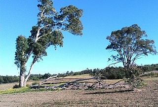
The greater Brisbane area of Queensland Australia, has many species of indigenous flora. This article links the flora to its geography with:

<span class="mw-page-title-main">Cumberland Plain</span> Plain in Australia

The Cumberland Plain, an IBRA biogeographic region, is a relatively flat region lying to the west of Sydney CBD in New South Wales, Australia. Cumberland Basin is the preferred physiographic and geological term for the low-lying plain of the Permian-Triassic Sydney Basin found between Sydney and the Blue Mountains, and it is a structural sub-basin of the Sydney Basin.

<span class="mw-page-title-main">Avon Wheatbelt</span> Bioregion in Western Australia

The Avon Wheatbelt is a bioregion in Western Australia. It has an area of 9,517,104 hectares. It is considered part of the larger Southwest Australia savanna ecoregion.

<span class="mw-page-title-main">Sydney Turpentine-Ironbark Forest</span>

The Sydney Turpentine-Ironbark Forest (STIF) is wet sclerophyll forest community of Sydney, New South Wales, Australia, that is typically found in the Inner West and Northern region of Sydney. It is also among the three of these plant communities which have been classified as Endangered, under the New South Wales government's Threatened Species Conservation Act 1995, with only around 0.5% of its original pre-settlement range remaining.

<span class="mw-page-title-main">Eastern Australian temperate forests</span> Ecoregion in Australia

The Eastern Australian temperate forests is a broad ecoregion of open forest on uplands starting from the east coast of New South Wales in the South Coast to southern Queensland, Australia. Although dry sclerophyll and wet sclerophyll eucalyptus forests predominate within this ecoregion, a number of distinguishable rainforest communities are present as well.

The Burrinjuck Nature Reserve is a protected nature reserve on the south west slopes of New South Wales, Australia. The 5,250-hectare (13,000-acre) reserve is located adjacent to the Burrinjuck Dam, with 5,118 hectares of the reserve located on the northern side of the reservoir, and the remaining 89 hectares located on the southern side of the reservoir to the northeast of Black Andrew Nature Reserve. It includes land formerly managed as the Burrinjuck State Forest and Burrinjuck State Recreation Area.

The Black Andrew Nature Reserve is a protected nature reserve located on the south west slopes of New South Wales, Australia. The 1,559-hectare (3,850-acre) reserve is situated on the southern shore of Burrinjuck Dam on the Murrumbidgee River, an important reservoir for the Murrumbidgee Irrigation Area.

<i>Dichelachne crinita</i> Species of grass

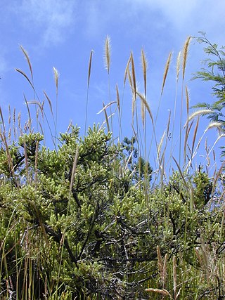
Dichelachne crinita , commonly known as the longhair plume grass, is a type of grass found in Australia, New Zealand and islands of the Pacific Ocean. It is often seen on sandy soils near the sea as well as woodlands. The flowering panicles are open and feathery at maturity. The grass may grow up to 1.5 metres (5 ft) tall. Crinita, the specific epithet, is derived from Latin (hairy).

<span class="mw-page-title-main">Western Sydney Parklands</span>

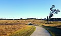
The Western Sydney Parklands is an urban park system and a nature reserve located in Sydney, New South Wales, Australia. The NSW government has spent around $400 million for the park. The park is governed by the NSW National Parks and Wildlife Service and is listed under the National Parks and Wildlife Act 1974. The Parklands begin in the north in the City of Blacktown, cross the City of Fairfield, and end in the City of Liverpool.

<span class="mw-page-title-main">Western Sydney Regional Park</span> Park in Sydney

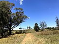
Western Sydney Regional Park is a large urban park and a nature reserve situated in Western Sydney, Australia within the suburbs of Horsley Park and Abbotsbury. A precinct of Western Sydney Parklands, a park system, and situated within the heart of the Cumberland Plain Woodland, the regional park features several picnic areas, recreational facilities, equestrian trails, and walking paths within the Australian bush.

<span class="mw-page-title-main">Cooks River/Castlereagh Ironbark Forest</span>

The Cooks River/Castlereagh Ironbark Forest (CRCIF) is a scattered, dry sclerophyll, open-forest to low woodland and scrubland which occurs predominantly in the Cumberland subregion of the Sydney basin bioregion, between Castlereagh and Holsworthy, as well as around the headwaters of the Cooks River. The Cooks River Clay Plain Scrub Forest is a component of this ecological community, though both belong to a larger occurring community called the Temperate Eucalyptus fibrosa/Melaleuca decora woodland.

<span class="mw-page-title-main">Prospect Nature Reserve</span>

Prospect Nature Reserve is a nature reserve and recreational area that is situated in the western suburbs of Sydney, New South Wales, Australia, which incorporates the Prospect Reservoir, and also features picnic spots, lookouts, walking tracks and BBQ areas within the Australian bush. It is located within the Blacktown City local government area, but is also close to the boundaries of Cumberland Council and the City of Fairfield.

<span class="mw-page-title-main">Ecology of Sydney</span> Geographic aspect of Sydney, Australia

The ecology of Sydney, located in the state of New South Wales, Australia, is diverse for its size, where it would mainly feature biomes such as grassy woodlands or savannas and some sclerophyll forests, with some pockets of mallee shrublands, riparian forests, heathlands, and wetlands, in addition to small temperate rainforest fragments.

<span class="mw-page-title-main">Gippsland Plains Grassy Woodland</span> Ecological community in southern Victoria

The Gippsland Plains Grassy Woodland is an ecological temperate grassland community located in the Gippsland region in southern Victoria, Australia. Stretching from Bairnsdale in the east to the eastern portion of Melbourne in the west, they typify one of Victoria's most threatened and disconnected indigenous ecosystems. The Gippsland Red Gum Grassy Woodland is the most prominent community in the system situated in the centre.

<span class="mw-page-title-main">New England Peppermint Grassy Woodland</span> Ecological community in New South Wales

The New England Peppermint Grassy Woodland is a grassy-woodland community primarily situated in the New England and Northern Tablelands regions in northern New South Wales, Australia. Named after the Eucalyptus nova-anglica, it is listed as a critically endangered ecological communities (TECs) under the Environment Protection and Biodiversity Conservation Act 1999.

<span class="mw-page-title-main">Southern Highlands Shale Forest and Woodland</span> Ecological community in New South Wales

The Southern Highlands Shale Forest and Woodland is a mixed grassy woodland and sclerophyll-temperate forest community situated within the Southern Highlands region of New South Wales, Australia. An ecotone featuring clay soils derived from Wianamatta Group, it is listed as an endangered ecological community by the Environment Protection and Biodiversity Conservation Act 1999 as less than 5% of the original extent remains today. Three varieties of the Shale Woodland exist: ‘typical’, ‘tall wet’ and ‘short dry’.

<span class="mw-page-title-main">Shale Sandstone Transition Forest</span> Indigenous woodland community in Sydney, Australia

The Shale Sandstone Transition Forest, also known as Cumberland Shale-Sandstone Ironbark Forest, is a transitory ecotone between the grassy woodlands of the Cumberland Plain Woodlands and the dry sclerophyll forests of the sandstone plateaus on the edges of the Cumberland Plain in Sydney, Australia.

<span class="mw-page-title-main">Grey Box Reserve</span> Nature reserves in Australia

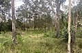
The Grey Box Reserve, or Greystanes Grey Box Reserve, is a small nature reserve situated in the suburb of Greystanes, New South Wales in Western Sydney, Australia. A remnant bushland of the Cumberland Plain Woodland, it mainly features native vegetation. The reserve is so-named because of its abundance of Eucalyptus moluccana, reflecting the pre-European cultural landscape of the area.

References

  1. Recovering bushland on the Cumberland Plain: best practice guidelines for the management and restoration of bushland Sydney, N.S.W.: Dept. of Environment and Conservation (NSW), 2005 [4], 94 p. : ill., maps (some col.). Ruth Burton. National Library of Australia. 2 August 2005. Retrieved 25 March 2022.
  2. 1 2 3 Western Sydney woodland Royal Botanic Gardens, Sydney, NSW Government. Retrieved 4 September 2022.
  3. Benson DH, Howell J (2002) Cumberland Plain Woodland ecology then and now: interpretations and implications from the work of Robert Brown and others. Cunninghamia 7, 631-650.
  4. Coastal Valley Grassy Woodlands NSW Office of Environment and Heritage
  5. Grassy woodlands NSW Office of Environment and Heritage
  6. "Cumberland Plain Woodland - Woodlands vanishing from Sydney's outskirts". NSW Department of the Environment & Energy. Retrieved 22 February 2018.
  7. Threatened Species Conservation Act 1995 Archived 2017-07-31 at the Wayback Machine (NSW Act of Parliament, online edition).
  8. Benson DH, Howell J (1990a) ‘Taken for granted: the bushland of Sydney and its suburbs.’ Kangaroo Press and the Royal Botanic Gardens, Sydney.
  9. Tozer M. (2003). ‘The native vegetation of the Cumberland Plain, western Sydney: systematic classification and field identification of communities’. Cunninghamia. 8, 1: 1–75.
  10. Benson DH (1992) The natural vegetation of the Penrith 1:100 000 map sheet. Cunninghamia 2, 541-596.
  11. Benson DH, Howell J (1990b) Sydney’s vegetation 1788-1988: utilization, degradation and rehabilitation. Proceedings of the Ecological Society of Australia 16, 115-127.
  12. Clarke PJ (2000) Plant population processes in temperate woodlands in eastern Australia – premises for management. Pp 248-270 in (Eds. R J Hobbs and C J Yates) Temperate eucalypt woodlands in Australia: biology, conservation, management and restoration (Surrey Beatty & Sons: Chipping Norton).
  13. NSW Government. "Biodiversity Offsets Scheme". NSW Department of Planning and Environment. Retrieved 13 June 2023.
  14. "Biodiversity Offset Delivery Plan". Department of Infrastructure, Transport, Regional Development, Communication and the Arts. Retrieved 13 June 2023.
  15. Keith DA (2004) ‘Ocean shores to desert dunes: the native vegetation of New South Wales and the ACT.’ NSW Department of Environment and Conservation, Sydney.
  16. Keith D, Pellow B, Tozer M (2005) Can’t see the biodiversity for the trees? Implications of alternative landscape models for conservation of Cumberland Plain Woodlands. P6 in (Eds. B Pellow, C. Morris, M Bedward, S. Hill, J Sanders, J Clark) The ecology and management of Cumberland Plain habitats: a symposium (University of Western Sydney: Campbelltown).
  17. James T, Benson DH, Howell J (1999) Rare plants of western Sydney. Royal Botanic Gardens, Sydney.
  18. Fairley A and Waterhouse D 2005, West Sydney Wild – Exploring Nature in Sydney’s Western Suburbs. Rosenberg Publishing Pty Ltd, Dural, NSW.
  19. Bankstown City Council 2002, Bushland Plan of Management – Reserves at Lansdowne including Mirambeena Reserve, Lansdowne Reserve, Bogabilla Reserve and Amaroo Reserve. Unpublished report prepared for Bankstown City Council.
  20. James, T., McDougall, L. & Benson, D. (1999) Rare Bushland plants of Western Sydney. (Royal Botanic Gardens Sydney).
  21. Cumberland Plain Shale Woodlands and Shale-Gravel Transition Forest Department of the Environment. Retrieved 16 September 2022.
  22. Cumberland Plain Shale Woodlands and Shale-Gravel Transition Forest Department of Climate Change, Energy, the Environment and Water. Retrieved 16 September 2022.
  23. Knox KJE, Clarke PJ (2006) Fire season and intensity affect shrub recruitment in temperate sclerophyllous woodlands. Oecologia 149, 730-739.
  24. Biodiversity Report Commonwealth land at Badgerys Creek Prepared for Western Sydney Unit Department of Infrastructure and Regional Development Western Sydney Airport. October 2014. Retrieved 16 September 2022.
  25. Earth Resource Analysis PL 1998, Cumberland Plains Woodland: Trial Aerial Photographic interpretation of remnant woodlands, Sydney. Unpublished report prepared for NSW National Parks and Wildlife Service – Sydney Zone.
  26. Nichols PWB (2005) Evaluation of restoration: a grassy woodland. PhD thesis. University of Western Sydney, Hawkesbury.
  27. Cooke J, Willis T, Groves R (2005) Impacts of woody weeds on Cumberland Plain Woodland biodiversity. P7 in (Eds. B Pellow, C. Morris, M Bedward, S. Hill, J Sanders, J Clark) The ecology and management of Cumberland Plain habitats: a symposium (University of Western Sydney: Campbelltown).
  28. Keast A (1995) Habitat loss and species loss: the birds of Sydney 50 years ago and now. Australian Zoologist 30, 3-25.
  29. Pellow B (2008) Assessment of the extent, quality and rehabilitation potential of the Endangered Ecological Community ‘Cumberland Plain Woodland’ at the Ingleburn Defence Site. Janet Cosh Herbarium, Wollongong.
  30. Statistical, Historical, and Political Description of NSW by William Charles Wentworth, 1819
  31. Kohen, J. (September 1996). "The Impact of Fire: An Historical Perspective". Australian Plants Online. Society for Growing Australian Plants.