
Sclerophyll is a type of vegetation that is adapted to long periods of dryness and heat. The plants feature hard leaves, short internodes and leaf orientation which is parallel or oblique to direct sunlight. The word comes from the Greek sklēros (hard) and phyllon (leaf). The term was coined by A.F.W. Schimper in 1898, originally as a synonym of xeromorph, but the two words were later differentiated.

The geography of Sydney is characterised by its coastal location on a basin bordered by the Pacific Ocean to the east, the Blue Mountains to the west, the Hawkesbury River to the north and the Woronora Plateau to the south. Sydney lies on a submergent coastline on the east coast of New South Wales, where the ocean level has risen to flood deep river valleys (rias) carved in the Sydney sandstone. Port Jackson, better known as Sydney Harbour, is one such ria.

The Cumberland Plain, an IBRA biogeographic region, is a relatively flat region lying to the west of Sydney CBD in New South Wales, Australia. Cumberland Basin is the preferred physiographic and geological term for the low-lying plain of the Permian-Triassic Sydney Basin found between Sydney and the Blue Mountains, and it is a structural sub-basin of the Sydney Basin.

The Sydney Turpentine-Ironbark Forest (STIF) is dry sclerophyll forest community of Sydney, New South Wales, Australia, that is typically found in the Inner West and Northern region of Sydney. It is also among the three of these plant communities which have been classified as Endangered, under the New South Wales government's Threatened Species Conservation Act 1995, with only around 0.5% of its original pre-settlement range remaining.

The Eastern Australian temperate forests is a broad ecoregion of open forest on uplands starting from the east coast of New South Wales in the South Coast to southern Queensland, Australia. Although dry sclerophyll and wet sclerophyll eucalyptus forests predominate within this ecoregion, a number of distinguishable rainforest communities are present as well.

The Southern Sydney sheltered forest is a vegetation community found in Sydney, Australia. An open forest composition grading into woodland or scrub, the community is normally associated with sheltered heads and upper inclines of gullies on transitional zones where sandstone outcropping may be present.

Western Sydney Regional Park is a large urban park and a nature reserve situated in Western Sydney, Australia within the suburbs of Horsley Park and Abbotsbury. A precinct of Western Sydney Parklands, a park system, and situated within the heart of the Cumberland Plain Woodland, the regional park features several picnic areas, recreational facilities, equestrian trails, and walking paths within the Australian bush.
The Cooks River/Castlereagh Ironbark Forest (CRCIF) is a 1,101-hectare (2,721-acre) area of dry sclerophyll open-forest to low woodland which occurs predominantly in the Cumberland subregion of the Sydney basin bioregion, between Castlereagh and Holsworthy, as well as around the headwaters of the Cooks River. The majority of the community is found in the north-west section of the Cumberland Subregion in the Castlereagh area between Penrith and Richmond. Other significant patches occur in the Kemps Creek and Holsworthy areas. Smaller remnants occur in the eastern section of the Cumberland Subregion.

The Cumberland Plain Woodland, or Western Sydney woodland, is a grassy woodland community found predominantly in Western Sydney, New South Wales, Australia, that comprises an open tree canopy, a groundcover with grasses and herbs, usually with layers of shrubs and/or small trees.

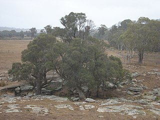
The Sydney Sandstone Ridgetop Woodland, also known as Coastal Sandstone Ridgetop Woodland, is a shrubby woodland and mallee community situated in northern parts of Sydney, Australia, where it is found predominantly on ridgetops and slopes of the Hornsby Plateau, Woronora Plateau and the lower Blue Mountains area. It is an area of high biodiversity, existing on poor sandstone soils, with regular wildfires, and moderate rainfall.

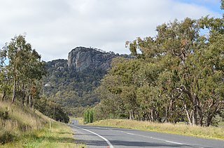
The ecology of Sydney, located in the state of New South Wales, Australia, is diverse for its size, where it would mainly feature biomes such as grassy woodlands and some sclerophyll forests, with a few pockets of mallee shrublands, subtropical and temperate rainforests (evergreen), heathlands, and wetlands. The combination of climate, topography, moisture, and soil influence the dispersion of these ecological communities across a height gradient from 0 to 200 metres. There are many hiking trails, paved and unpaved roads for exploring the many different biomes and ecosystems.
The New England Peppermint Grassy Woodland is a grassy-woodland community primarily situated in the New England and Northern Tablelands regions in northern New South Wales, Australia. Named after the Eucalyptus nova-anglica, it is listed as a critically endangered ecological communities (TECs) under the Environment Protection and Biodiversity Conservation Act 1999.
The Southern Highlands Shale Forest and Woodland is a mixed grassy woodland and sclerophyll-temperate forest community situated within the Southern Highlands region of New South Wales, Australia. An ecotone featuring clay soils derived from Wianamatta Group, it is listed as an endangered ecological community by the Environment Protection and Biodiversity Conservation Act 1999 as less than 5% of the original extent remains today. Three varieties of the Shale Woodland exist: ‘typical’, ‘tall wet’ and ‘short dry’.

The Blue Mountains and Southern Highlands Basalt Forests are a sclerophyll temperate forest community that stretch from the northern fringes of the Blue Mountains to the Southern Highlands. Featuring both wet and dry sclerophyll forests, as well as small rainforest pockets, the community features tall (30m+) and open eucalypt forests and woodlands that lie on igneous rock.

The Elderslie Banksia Scrub Forest is a critically endangered scrubby woodland situated in southwestern Sydney, New South Wales, Australia. Listed under the Environment Protection and Biodiversity Conservation Act 1999, it is a variety of stunted forest or woodland found on sandy substrates associated with deep Tertiary sand deposits, which has been reduced in extent of at least 90% of its original pre-European extent.

The Castlereagh Scribbly Gum and Agnes Banks Woodlands is an endangered sclerophyll woodland community found in western Sydney, New South Wales, Australia. Vegetation comprises low woodlands with sclerophyllous shrubs and an uneven ground layer of graminoids and forbs.
The Western Sydney Dry Rainforest and Moist Woodland is a dry rainforest found in small pockets in south-western Sydney, New South Wales, Australia. Mostly featuring sclerophyll vegetation, it is listed as critically endangered under Australia's national environment law, the Environment Protection and Biodiversity Conservation Act 1999 as more than 70 per cent of its original extent has been reduced as a result of clearing, logging, weed invasion and heavy grazing.

The Lowland Grassy Woodland, or the Illawarra and South Coast Lowland Grassy Woodland is a grassland-savannah community mostly found in the South Coast region of New South Wales, Australia. Stretching from the southern parts of the Illawarra in the north to the South East Corner in the south, it is an endangered ecological community that lies in a rain shadow area.
