
The Brisbane Water National Park is a protected national park that is located in the Central Coast region of New South Wales, in eastern Australia. The 11,506-hectare (28,430-acre) national park is situated 47 kilometres (29 mi) north of Sydney, 10 kilometres (6.2 mi) west of Woy Woy, and 12 kilometres (7.5 mi) southwest of Gosford.

New England is a vaguely defined region in the north of the state of New South Wales, Australia, about 60 km inland from the Tasman Sea. The area includes the Northern Tablelands and the North West Slopes regions. As of 2006, New England had a population of 202,160, with over a quarter of the people living in the area of Tamworth Regional Council.

The Northern Tablelands, also known as the New England Tableland, is a plateau and a region of the Great Dividing Range in northern New South Wales, Australia. It includes the New England Range, the narrow highlands area of the New England region, stretching from the Moonbi Range in the south to the Queensland border in the north. The region corresponds generally to the Bureau of Meteorology forecast area for the Northern Tablelands which in this case includes Inverell although it is significantly lower in elevation.
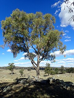
Eucalyptus nova-anglica, commonly known as the New England peppermint or black peppermint, is a species of small to medium-sized tree endemic to eastern Australia. It has thick, rough, fibrous bark on the trunk and larger branches, lance-shaped adult leaves, flower buds in groups of seven, white flowers and hemispherical or conical fruit.

Eucalyptus caliginosa, commonly known as broad-leaved stringybark or New England stringybark, is a tree that is endemic to eastern Australia. It has stringy bark, lance-shaped or curved adult leaves, flower buds in groups of seven or nine, white flowers and more or less hemispherical fruit. It is common on the Northern Tablelands and North West Slopes of New South Wales and adjacent areas of Queensland.

The Eastern Australian temperate forests is a broad ecoregion of open forest on uplands starting from the east coast of New South Wales in the South Coast to southern Queensland, Australia. Although dry sclerophyll and wet sclerophyll eucalyptus forests predominate within this ecoregion, a number of distinguishable rainforest communities are present as well.
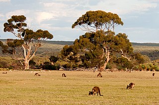
The Mount Lofty woodlands, or the Peppermint Box Grassy Woodland of South Australia is an ecoregion in South Australia, which includes woodlands, shrublands, and grasslands in the Mount Lofty Ranges, Fleurieu Peninsula, and Kangaroo Island.

Eucalyptus aggregata, commonly known as black gum, is a medium-sized tree that is endemic to southeastern Australia. It has rough, flaky bark, sometimes smooth on the branches, lance-shaped leaves, green to yellow flower buds in group of seven, white flowers and more or less cup-shaped fruit. It is a component of grassy woodland, often in low-lying or swampy areas, much of which has been cleared and it is under threat.
The Black Andrew Nature Reserve is a protected nature reserve located on the south west slopes of New South Wales, Australia. The 1,559-hectare (3,850-acre) reserve is situated on the southern shore of Burrinjuck Dam on the Murrumbidgee River, an important reservoir for the Murrumbidgee Irrigation Area.

New England Tablelands, an interim Australian bioregion, is located mainly in New South Wales, comprising 3,002,213 hectares, of which 2,860,758 hectares or 95.23 per cent of the bioregion lies within New South Wales; and the residual within Queensland. This bioregion is one of the smaller bioregions in NSW, occupying 3.57 per cent of the state.
The Little Llangothlin Nature Reserve is a protected wetland nature reserve that is located on the Northern Tablelands in the New England region of New South Wales, in eastern Australia. The 257-hectare (640-acre) reserve is situated approximately 10 kilometres (6.2 mi) north-east of the rural locality of Llangothlin, and some 20 kilometres (12 mi) north-east of Guyra.
The Queanbeyan Nature Reserve is a protected nature reserve that is located in the Southern Tablelands region of New South Wales, in eastern Australia. The 67-hectare (170-acre) reserve is situated approximately 4 kilometres (2.5 mi) west-south-west of the City of Queanbeyan.

The Cumberland Plain Woodland, or Western Sydney woodland, is a grassy woodland community found predominantly in Western Sydney, New South Wales, Australia, that comprises an open tree canopy, a groundcover with grasses and herbs, usually with layers of shrubs and/or small trees.

The ecology of Sydney, located in the state of New South Wales, Australia, is diverse for its size, where it would mainly feature biomes such as grassy woodlands and some sclerophyll forests, with a few pockets of mallee shrublands, subtropical and temperate rainforests (evergreen), heathlands, and wetlands. The combination of climate, topography, moisture, and soil influence the dispersion of these ecological communities across a height gradient from 0 to 200 metres. There are many hiking trails, paved and unpaved roads for exploring the many different biomes and ecosystems.
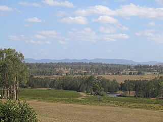
The Central Hunter Valley eucalypt forest and woodland is a grassy woodland community situated in the Hunter Valley, New South Wales, Australia. It was listed in May 2015 as critically endangered under Australia’s national environment law. The Warkworth Sands Woodland of the Hunter Valley, situated in the area, was gazetted as an endangered ecological community in New South Wales on 13 December 2002 under the NSW Threatened Species Conservation Act 1995 and now under the Biodiversity Act of 2016.
The Southern Highlands Shale Forest and Woodland is a mixed grassy woodland and sclerophyll-temperate forest community situated within the Southern Highlands region of New South Wales, Australia. An ecotone featuring clay soils derived from Wianamatta Group, it is listed as an endangered ecological community by the Environment Protection and Biodiversity Conservation Act 1999 as less than 5% of the original extent remains today. Three varieties of the Shale Woodland exist: ‘typical’, ‘tall wet’ and ‘short dry’.

The Lowland Grassy Woodland, or the Illawarra and South Coast Lowland Grassy Woodland is a grassland-savannah community mostly found in the South Coast region of New South Wales, Australia. Stretching from the southern parts of the Illawarra in the north to the South East Corner in the south, it is an endangered ecological community that lies in a rain shadow area.

The River-flat eucalypt forest or Coastal floodplain eucalypt forest is a critically endangered threatened ecological community that is primarily found in southeastern Australia, from southeastern Queensland, through New South Wales, to eastern Victoria, on alluvial soils of the coastal floodplains. The name chiefly refers to its riparian and floodplain landscape location and the predominant tree canopy being Eucalyptus, Angophora and/or Corymbia, which may exceed 40 m in height.

