Related Research Articles
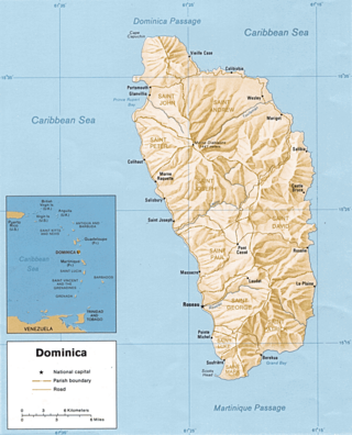
Dominica is an island in the Caribbean Sea, located about halfway between the French islands of Guadeloupe and Martinique. Its coordinates are 15 25 N, 61 20 W. It is known as "The Nature Island of the Caribbean" due to its spectacular, lush, and varied flora and fauna, which is protected by an extensive natural park system. It is the fourth largest island in the Eastern Caribbean with a population of people mainly of African descent.
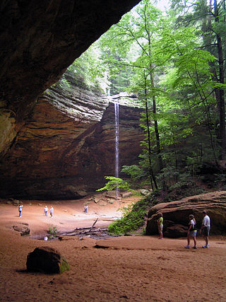
Hocking Hills State Park is a state park in the Hocking Hills region of Hocking County, Ohio, United States. In some areas the park adjoins the Hocking State Forest. Within the park are over 25 miles (40 km) of hiking trails, rock formations, waterfalls, and recess caves. The trails are open from dawn to dusk, all year round, including holidays.

Ladder Bay is an anchorage on the leeward side of the Caribbean island of Saba. The bay sits on the west side of the island, directly under a set of 800 steps hand carved into the rocks locally known as "The Ladder". Until the construction of Saba's first pier in the 1970s, Ladder Bay was a primary point of entry for supplies to the island. An abandoned customs house sits on the lip of a cliff overlooking the bay.

Taughannock Falls State Park is a 750-acre (3.0 km2) state park located in the town of Ulysses in Tompkins County, New York in the United States. The park is northwest of Ithaca near Trumansburg.

The Boiling Lake is a flooded fumarole located in Morne Trois Pitons National Park, a World Heritage Site on the island of Dominica. The lake, located 6.5 miles (10.5 km) east of Dominica's capital Roseau, is filled with bubbling greyish-blue water that is usually enveloped in a cloud of vapour. The Boiling Lake is approximately 200 to 250 feet across and is the second-largest hot lake in the world after Frying Pan Lake, located in Waimangu Valley near Rotorua, New Zealand.

Morne Trois Pitons National Park is a national park in Dominica established in July 1975, the first to be legally established in the country. It became a World Heritage Site in 1997. The park is named after its highest mountain, Morne Trois Pitons, meaning mountain of three peaks. The park is an area of significant volcanic activity. Features within the park include the Valley of Desolation, a region of boiling mud ponds and small geysers; the Boiling Lake; Titou Gorge; and Emerald Pool. The mountain is the second-highest peak in Dominica, being exceeded only by Morne Diablotins.

Mount Scenery is a dormant volcano in the Caribbean Netherlands. Its lava dome forms the summit of the Saba island stratovolcano. At an elevation of 887 m (2,910 ft), it is the highest point in both the Kingdom of the Netherlands, and, since the dissolution of the Netherlands Antilles on 10 October 2010, the highest point in the Netherlands proper.

Cabrits National Park is on a peninsula at the north end of the Caribbean island of Dominica, north of Portsmouth. The park protects tropical forest, coral reefs and wetlands. There are hiking trails and an English garrison called Fort Shirley.

Scotts Head is a village on the southwest coast of Dominica, in Saint Mark Parish. In 2001, its population was 721. Predominantly a fishing village, Scotts Head overlooks Soufrière Bay, which is protected as the Soufrière Scotts Head Marine Reserve. It is also a popular snorkeling and diving site for tourists.

Laudat is a small village in the interior of Dominica, located between 3 mountains: Morne Watt, Morne Micotrine, and Morne Trois Pitons. With a population of just above 300 people, Laudat is referred to as a "gateway" because it is the sole entry point to many of the islands sights, including the Boiling Lake, Fresh Water Lake, and Titou Gorge. Perched about 1200 feet above sea level Laudat has a cool climate and views of the Caribbean Sea. It is located approximately 20 minutes from the capital, Roseau and is at the end of the road. The road to Laudat used to be a hair-raising ride up the mountains, around blind hairpin turns with sharp drop-offs into the jungle canopy; however, the road has been improved and may be completed by the time of this writing. Laudat has seen many changes over the past years, including the aerial tram taking visitors from the village up into the high mountains--making possible what was previously a journey by foot. Titou Gorge was also altered over the last decade, and is now smaller and more developed. It is still a swimming place, and small waterfalls of hot and cold water stream into the gorge. There are some overnight accommodations available in the village. Laudat receives some of the highest rainfalls in the Caribbean, about 900 cm a year. The air is often misty and cool - a change from the heat of lower-lying areas.

Dominica, officially the Commonwealth of Dominica, is an island country in the Caribbean. It is part of the Windward Islands chain in the Lesser Antilles archipelago in the Caribbean Sea. The capital, Roseau, is located on the western side of the island. Dominica's closest neighbours are two constituent territories of the European Union, the overseas departments of France, Guadeloupe to the northwest and Martinique to the south-southeast. Dominica comprises a land area of 750 km2 (290 sq mi), and the highest point is Morne Diablotins, at 1,447 m (4,747 ft) in elevation. The population was 71,293 at the 2011 census.

The following outline is provided as an overview of and topical guide to Dominica:
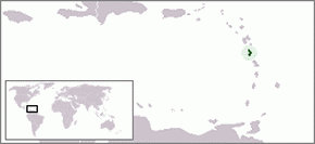
The following is an alphabetical list of topics related to the nation of Dominica.

Morne Diablotin National Park is a national park in the northern mountain ranges of Dominica, an island nation in the Caribbean. The park comprises 3,335.3 hectares, amounting to 4.4% of the nation's area. It was established in January 2000, primarily to protect the habitat of the endangered sisserou parrot, an endemic bird species that is a national symbol of Dominica.
Tourism in Dominica consists mostly of hiking in the rain forest and visiting cruise ships.
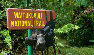
The Waitukubuli National Trail is a hiking trail spanning the island of Dominica. It is the longest hiking trail in the Caribbean, at 115 miles (185 km) long. Its name comes from the original Kalinago name of the island, Waitukubuli, meaning "tall is her body". The trails’s management falls under Dominica's Forestry Division.
Morne Nicholls is a mountain in Dominica named after Dominican Sir Henry Alfred Alford Nicholls. The mountain is located on a hiking trail leading to the Valley of Desolation and Boiling Lake.

Fort Cachacrou was a historic military fortification and signal station on the island of Dominica. The fort was built by the British in the 1760s in present-day Scotts Head. During the American Revolutionary War, it was the site of the first battle in the French Invasion of Dominica. Remains of Fort Cachacrou include portions of the original walls and a canon. The site is accessible via the Waitukubuli National Trail.

The Syndicate Nature Trail is a hiking trail in Dominica. It is one of two nature trails in Morne Diablotin National Park. It is located in the foothills of Morne Diablotin, Dominica's tallest mountain, near the edge of the Picard River Gorge.
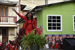
DeniseCharles is a politician from Dominica, who in 2019 was appointed Minister for Tourism, International Transport and Maritime Initiatives for the Government of Dominica. Key issues for her ministry to address is the recovery of the country's tourism sector after the impact of COVID-19, as well as the impact of climate change.
References
- ↑ "Dominica's Boiling Lake - The Lake, the Hike, the Trail. In-depth information about the Boiling Lake | a virtual Dominica" . Retrieved 2024-01-07.
- ↑ "The Boiling Lake | a virtual Dominica" . Retrieved 2024-01-07.
- ↑ "Emerald Pool Nature Trail: A Novice Traveler's Guide - Purely Dominica". 2023-12-12. Retrieved 2024-01-07.
- ↑ "Emerald Pool | a virtual Dominica" . Retrieved 2024-01-07.
- ↑ "Emerald Pool Nature Trail". U.S. News and World Report.
- ↑ "Freshwater Lake to Boeri Lake Trail". AllTrails.com. Retrieved 2024-01-07.
- ↑ "Boeri Lake - Ministry of Tourism". tourism.gov.dm. Retrieved 2024-01-07.
- ↑ "Middleham Falls - Ministry of Tourism". tourism.gov.dm. Retrieved 2024-01-07.
- ↑ "Perdu Temps Trail". Discover Dominica, the Nature Island. Retrieved 2024-01-07.
- ↑ "Perdu Temps Trail | a virtual Dominica" . Retrieved 2024-01-07.
- 1 2 "Canyoning Titou Gorge". AllTrails.com. Retrieved 2024-01-07.
- 1 2 "Titou Gorge | a virtual Dominica" . Retrieved 2024-01-07.
- 1 2 "Titou Gorge". AFAR Media. Retrieved 2024-01-07.
- ↑ "Milton (Syndicate) Falls | a virtual Dominica" . Retrieved 2024-01-07.
- 1 2 "Syndicate Nature Trail". forestry.gov.dm. Dominica Division of Forestry, Wildlife and National Parks. Retrieved 2024-01-06.
- ↑ "Syndicate Nature Trail - Ministry of Tourism". tourism.gov.dm. Dominica Ministry of Tourism. Retrieved 2024-01-06.
- ↑ "Discover Dominica [brochure]" (PDF). Discover Dominica. Discover Dominica Authority (Dominica Tourism).
- ↑ "Glasse Point Trail". Wikiloc | Trails of the World. Retrieved 2024-01-07.
- ↑ "Glassy Trail | a virtual Dominica" . Retrieved 2024-01-07.
- ↑ "Commonwealth of Dominica: Glassy Pool/Trail". www.new.oecs.int. Retrieved 2024-01-07.
- ↑ "Jaco Flats/Steps - Interior". Discover Dominica, the Nature Island. Retrieved 2024-01-07.
- ↑ "Jacko Steps". Atlas Obscura. Retrieved 2024-01-07.
- ↑ "Spanny (Penrice) Falls Dominica | Purely Dominica - Purely Dominica". Dominica Weekly. 2010-11-22. Retrieved 2024-01-08.
- ↑ "Spanny's Falls | a virtual Dominica" . Retrieved 2024-01-08.
- ↑ "Jack's Walk | a virtual Dominica" . Retrieved 2024-01-07.
- ↑ "Jack's walk trail". Wikiloc | Trails of the World. Retrieved 2024-01-08.
- ↑ "Trafalgar Falls". AFAR Media. Retrieved 2024-01-07.
- ↑ "Trafalgar Falls". Discover Dominica, the Nature Island. Retrieved 2024-01-07.
- ↑ "Trafalgar Falls". U.S. News and World Report .
- ↑ "Trafalgar Falls Trail". AllTrails.com. Retrieved 2024-01-07.
- ↑ "Trafalgar Falls [brochure]" (PDF). Dominica Ministry of Tourism.
- ↑ "Waitukubuli Trail | the Caribbean\'s 1st Long Distance Hiking Trail". Archived from the original on December 10, 2015. Retrieved October 31, 2015.
- ↑ "Dominica's Waitukubuli National Trail ( WNT )". A Virtual Dominica. Retrieved 2024-01-04.
- ↑ Tedesco, Lianna (2022-03-24). "A Tough Hike Leads To Dominica's Most Beautiful Black Sand Beach". TheTravel. Retrieved 2024-01-07.
- ↑ Lane, Lea. "Lush Dominica In The Eastern Caribbean Offers Festivals, Fun, In (Very) Merry May". Forbes. Retrieved 2024-01-07.
- ↑ "Wavine Cyrique (Secret Beach)". Atlas Obscura. Retrieved 2024-01-07.
- ↑ "Caribbean's 'first sea kayaking route' graces NatGeo's The Cool List 2024". Caribbean News Now!. 2023-11-09. Retrieved 2024-01-07.
- ↑ Canino, Rachell Cowan (2023-12-04). "Caribbean's 'first Sea Kayaking Route' Graces NatGeo's The Cool List 2024". Travel Trade Caribbean. Retrieved 2024-01-07.