List of volcanoes in Japan

Last updated

This is a list of active and extinct volcanoes in Japan. An Orange background indicates a volcano considered active by the Japan Meteorological Agency.

Contents

Hokkaido

NameElevation (m)Elevation (ft) Coordinates Last eruption
Akaigawa Caldera 7252379 43°04′59″N140°49′01″E / 43.083°N 140.817°E / 43.083; 140.817 (Akaigawa Caldera) 1.3 Ma BP [† 1]
Daisetsuzan Volcanic Group 22907513 43°39′47″N142°51′14″E / 43.663°N 142.854°E / 43.663; 142.854 (Taisetsu Volcano Group) AD 1739 [† 1]
Mount Eniwa 13204331 42°47′35″N141°17′06″E / 42.793°N 141.285°E / 42.793; 141.285 (Mount Eniwa) AD 1707 [† 1]
Mount E 6132028 41°48′14″N141°09′58″E / 41.804°N 141.166°E / 41.804; 141.166 (Mount Esan) AD 1874 [† 1]
Mount Iō 5121680 43°36′36″N144°26′17″E / 43.610°N 144.438°E / 43.610; 144.438 (Mount Atosanupuri) Not known [† 1]
Akan Caldera  [ ja ]-- 43°27′04″N144°06′36″E / 43.451°N 144.110°E / 43.451; 144.110 (Akan Caldera) 0.25 Ma BP [† 1]
Mount Meakan 14994916 43°23′10″N144°00′29″E / 43.386°N 144.008°E / 43.386; 144.008 (Mount Meakan) AD 2008 [† 1]
Mount Oakan 13704495 43°27′11″N144°09′47″E / 43.453°N 144.163°E / 43.453; 144.163 (Mount Oakan) 5 ka BP [† 1]
Mount Iō 15635128 44°07′52″N145°09′54″E / 44.131°N 145.165°E / 44.131; 145.165 (Mount Iō) AD 1936 [† 1]
Kussharo Caldera --  43°37′16″N144°20′10″E / 43.621°N 144.336°E / 43.621; 144.336 (Lake Kussharo) 2.3 ka BP [† 1]
Kuttara Caldera 5811906 42°29′56″N141°10′30″E / 42.499°N 141.175°E / 42.499; 141.175 (Kuttara Caldera) 40 ka BP [† 1]
Mashū Caldera 8552805 43°34′12″N144°33′54″E / 43.570°N 144.565°E / 43.570; 144.565 (Mashū Caldera) 1 ka BP [† 1]
Nigorigawa Caldera 3561168 42°07′N140°27′E / 42.12°N 140.45°E / 42.12; 140.45 (Nigorigawa) 15 ka BP [† 1]
Nipesotsu-Maruyama Volcanic Group 20136604 43°27′11″N143°02′10″E / 43.453°N 143.036°E / 43.453; 143.036 (Nipesotsu-Maruyama) AD 1898 [† 2]
Niseko Volcanic Group 13094295 42°53′N140°38′E / 42.88°N 140.63°E / 42.88; 140.63 (Niseko Volcanic Group) 6 ka BP [† 1]
Mount Onnebetsu 13304364 43°59′35″N145°00′47″E / 43.993°N 145.013°E / 43.993; 145.013 (Mount Onnebetsu) 0.2 Ma BP [† 1]
Oshima-Ōshima 7372418 41°30′N139°22′E / 41.50°N 139.37°E / 41.50; 139.37 (Oshima Oshima) AD 1759 [† 1]
Mount Rausu 16615449 44°04′30″N145°07′19″E / 44.075°N 145.122°E / 44.075; 145.122 (Mount Rausu) 150 BP [† 1]
Mount Rishiri 17215646 45°11′N141°15′E / 45.18°N 141.25°E / 45.18; 141.25 (Mount Rishiri) 7.78 ka BP [† 1]
Shikaribetsu Volcano Group 14304692 43°18′43″N143°05′46″E / 43.312°N 143.096°E / 43.312; 143.096 (Shikaribetsu Volcano Group) 20 ka BP [† 1]
Shikotsu Caldera 13204331 42°45′11″N141°19′37″E / 42.753°N 141.327°E / 42.753; 141.327 (Shikotsu Caldera) AD 1978 [† 1]
Mount Shiribetsu 11073632 42°46′01″N140°54′58″E / 42.767°N 140.916°E / 42.767; 140.916 (Mount Shiribetsu) Not known [† 1]
Tōya Caldera -- 42°36′07″N140°51′04″E / 42.602°N 140.851°E / 42.602; 140.851 (Lake Tōya) AD 2000 [† 1]
Mount Hokkaidō-Komagatake 11313711 42°03′47″N140°40′37″E / 42.063°N 140.677°E / 42.063; 140.677 (Mount Hokkaidō-Koma) AD 2000 [† 1]
Mount Shari 15475075 43°45′54″N144°43′01″E / 43.765°N 144.717°E / 43.765; 144.717 (Mount Shari) 0.25 Ma BP [† 1]
Mount Shiretoko 12544114 44°14′06″N145°16′23″E / 44.235°N 145.273°E / 44.235; 145.273 (Mount Shiretoko) 0.2 Ma BP [† 1]
Mount Tarumae 10413416 42°41′24″N141°22′34″E / 42.690°N 141.376°E / 42.690; 141.376 (Mount Tarumae) AD 1981 [† 1]
Mount Tenchō  [ ja ]10463432 44°02′38″N145°05′10″E / 44.044°N 145.086°E / 44.044; 145.086 (Mount Tenchō) 1.9 ka BP [† 1]
Tokachi-Mitsumata Caldera -- 43°30′58″N143°09′00″E / 43.516°N 143.150°E / 43.516; 143.150 (Tokachi -Mitsumata Caldera) 1 Ma BP [† 1]
Tomuraushi-Chubetsu Volcano Group 21417024 43°31′37″N142°50′56″E / 43.527°N 142.849°E / 43.527; 142.849 (Tomuraushi-Chubetsu Volcano Group) 0.1 Ma BP [† 1]
Mount Unabetsu 14194656 43°52′34″N144°52′34″E / 43.876°N 144.876°E / 43.876; 144.876 (Mount Unabetsu) 0.5 Ma BP [† 1]
Mount Usu 7372418 42°32′35″N140°50′20″E / 42.543°N 140.839°E / 42.543; 140.839 (Mount Usu) AD 2000 [† 1]
Mount Yōtei 18986227 42°49′34″N140°48′40″E / 42.826°N 140.811°E / 42.826; 140.811 (Mount Yōtei) 2.5 ka BP [† 1]

Honshū

NameElevation (m)Elevation (ft) Coordinates Last eruption
Abu Volcano Group -- 34°30′N131°36′E / 34.50°N 131.60°E / 34.50; 131.60 (Abu Volcano Group) Mt. Kasayama (ja): 8.8 ka BP [† 1]
Mount Adatara 17185635 37°37′N140°17′E / 37.62°N 140.28°E / 37.62; 140.28 (Mount Adatara) AD 1900 [† 1]
Mount Akagi 18285997 36°32′N139°11′E / 36.53°N 139.18°E / 36.53; 139.18 (Mount Akagi) AD 1251? [† 3]
Mount Akandana 21096919 36°12′00″N137°34′19″E / 36.200°N 137.572°E / 36.200; 137.572 (Mount Akandana) 10–6.5 ka [† 4]
Mount Akita-Komagatake 16375371 39°45′N140°48′E / 39.75°N 140.80°E / 39.75; 140.80 (Mount Akita-Koma) AD 1971 [† 1]
Mount Akita-Yakeyama 13664482 39°57′50″N140°45′25″E / 39.964°N 140.757°E / 39.964; 140.757 (Mount Akita-Yakeyama) AD 1997 [† 1]
Mount Amagi 14064613 34°51′43″N139°00′07″E / 34.862°N 139.002°E / 34.862; 139.002 (Mount Amagi) 0.2 Ma BP [† 1]
Aonoyama Volcano Group  [ ja ]-- 34°27′40″N131°47′28″E / 34.461°N 131.791°E / 34.461; 131.791 (Aonoyama Volcano Group) 70 ka BP [† 1]
Mount Asakusa  [ ja ]15855200 37°20′35″N139°14′02″E / 37.343°N 139.234°E / 37.343; 139.234 (Mount Asakusa) 1.6 Ma BP [† 1]
Mount Asama 25448340 36°24′18″N138°31′19″E / 36.405°N 138.522°E / 36.405; 138.522 (Mount Asama) AD 2019 [† 5]
Mount Ashitaka 15044934 35°13′08″N138°48′00″E / 35.219°N 138.800°E / 35.219; 138.800 (Mount Ashitaka) 80 ka BP [† 1]
Mount Azuma 17055594 37°44′N140°15′E / 37.73°N 140.25°E / 37.73; 140.25 (Mount Azuma) AD 1977 [† 1]
Mount Azumaya 23547723 36°32′31″N138°24′47″E / 36.542°N 138.413°E / 36.542; 138.413 (Mount Azumaya) 0.3 Ma BP [† 1]
Mount Bandai 18195968 37°36′N140°05′E / 37.60°N 140.08°E / 37.60; 140.08 (Mount Bandai) AD 1888 [† 1]
Mount Chōkai 22377326 39°05′N140°02′E / 39.08°N 140.03°E / 39.08; 140.03 (Mount Chōkai) AD 1974 [† 1]
Mount Daisen 17295673 35°22′16″N133°32′24″E / 35.371°N 133.54°E / 35.371; 133.54 (Mount Daisen) 17 ka BP [† 1]
Mount Daruma  [ ja ]9823222 34°57′18″N138°50′20″E / 34.955°N 138.839°E / 34.955; 138.839 (Mount Druma) 0.5 Ma BP [† 1]
Eboshi Volcano Group22277306 36°25′59″N138°23′13″E / 36.433°N 138.387°E / 36.433; 138.387 (Eboshi Volcano Group) 0.3 Ma BP [† 1]
Mount Fuji 377612388 35°21′29″N138°43′52″E / 35.358°N 138.731°E / 35.358; 138.731 (Mount Fuji) AD 1707 [† 1]
Mount Futamata (ja)15485079 37°14′46″N139°58′01″E / 37.246°N 139.967°E / 37.246; 139.967 (Mount Futamata) 90 ka BP [† 1]
Mount Gassan 19846509 38°32′56″N140°01′37″E / 38.549°N 140.027°E / 38.549; 140.027 (Mount Gassan) 0.3 Ma BP [† 1]
Mount Hachimantai 16145295 39°57′N140°51′E / 39.95°N 140.85°E / 39.95; 140.85 (Mount Hachimantai) 7.3 ka BP [† 1]
Hakkōda Caldera -- 40°41′35″N140°55′48″E / 40.693°N 140.930°E / 40.693; 140.930 (Hakkōda Caldera) 0.4 Ma BP BP [† 1]
Mount Hakkōda 15855200 40°39′22″N140°52′52″E / 40.656°N 140.881°E / 40.656; 140.881 (Mount Hakkōda) 600-400 BP [† 1]
Mount Hakone 14384720 35°13′N139°01′E / 35.22°N 139.02°E / 35.22; 139.02 (Mount Hakone) AD 2015 [† 1]
Mount Haku 27028865 36°09′N136°47′E / 36.15°N 136.78°E / 36.15; 136.78 (Mount Haku) AD 1659 [† 1]
Mount Haruna 14494754 36°28′N138°53′E / 36.47°N 138.88°E / 36.47; 138.88 (Mount Haruna) AD 525-550 [† 6]
Hijiori Caldera 5161693 38°36′29″N140°09′40″E / 38.608°N 140.161°E / 38.608; 140.161 (Hijiori Caldera) 12 ka BP [† 1]
Mount Hiuchigatake 23567730 36°57′N139°17′E / 36.95°N 139.28°E / 36.95; 139.28 (Mount Hiuchi) AD 1544 [† 1]
Mount Hotaka (ja)21587080 36°48′18″N139°07′55″E / 36.805°N 139.132°E / 36.805; 139.132 (Mount Hotaka) 1 Ma BP [† 1]
Mount Ibuki 13774518 35°15′N136°14′E / 35.25°N 136.24°E / 35.25; 136.24 (Mount Ibuki) Over 10 million years ago [† 1]
Ikarigaseki Caldera -- 40°29′56″N140°37′12″E / 40.499°N 140.620°E / 40.499; 140.620 (Ikarigaseki Caldera) 1.3 Ma BP [† 1]
Mount Iiji  [ ja ]11123648 36°57′22″N138°49′59″E / 36.956°N 138.833°E / 36.956; 138.833 (Mount Iiji) 0.2 Ma BP [† 1]
Mount Iizuna 19176289 36°44′20″N138°08′10″E / 36.739°N 138.136°E / 36.739; 138.136 (Mount Iizuna) 0.15 Ma BP [† 1]
Mount Iwaki 16255331 40°39′N140°18′E / 40.65°N 140.30°E / 40.65; 140.30 (Mount Iwaki) AD 1863 [† 1]
Izu-Tōbu volcano Group 14064613 34°55′N139°07′E / 34.92°N 139.12°E / 34.92; 139.12 (Izu-Tōbu volcano Group) Teishi Knoll (ja): 1989 [† 1]
Mount Iwate 20416696 39°51′00″N141°00′14″E / 39.850°N 141.004°E / 39.850; 141.004 (Mount Iwate) AD 1919 [† 1]
Kannabe Volcano Group -- 35°30′25″N134°40′30″E / 35.507°N 134.675°E / 35.507; 134.675 (Kannabe Volcano Group) Mt.Kannabe: 20-10 ka BP [† 1]
Mount Kanpū  [ ja ]3551165 39°56′N139°53′E / 39.93°N 139.88°E / 39.93; 139.88 (Mount Kanpū) 10 ka BP [† 1]
Mount Kirigamine 19256316 36°06′11″N138°11′46″E / 36.103°N 138.196°E / 36.103; 138.196 (Mount Kirigamine) 0.75 Ma BP [† 1]
Mount Komochi 12964252 36°35′28″N138°59′53″E / 36.591°N 138.998°E / 36.591; 138.998 (Mount Komochi) 0.2 Ma BP [† 1]
Mount Kurohime 20536736 36°49′01″N138°07′12″E / 36.817°N 138.120°E / 36.817; 138.120 (Mount Kurohime) 50 ka BP [† 1]
Kurofuji Volcano Group 16425387 35°48′11″N138°32′10″E / 35.803°N 138.536°E / 35.803; 138.536 (Kurofuji Volcano Group) 0.5 Ma BP [† 1]
Mount Kurikoma 16285341 38°57′N140°47′E / 38.95°N 140.78°E / 38.95; 140.78 (Mount Kurikoma) AD 1944 [† 7]
Mount Kusatsu-Shirane 21607123 36°37′08″N138°32′06″E / 36.619°N 138.535°E / 36.619; 138.535 (Mount Kusatsu-Shirane) AD 2018 [† 8]
Mount Onoko  [ ja ]12083963 36°34′52″N138°56′13″E / 36.581°N 138.937°E / 36.581; 138.937 (Mount Komochi) 1.2 Ma BP [† 1]
Mount Madarao 13824534 36°50′13″N138°16′26″E / 36.837°N 138.274°E / 36.837; 138.274 (Mount Madarao) 0.5 Ma BP [† 1]
Mount Minakami  [ ja ]6592162 36°33′14″N138°13′19″E / 36.554°N 138.222°E / 36.554; 138.222 (Mount Minakami) 0.3 Ma BP [† 1]
Megata 291955 39°57′N139°44′E / 39.95°N 139.73°E / 39.95; 139.73 (Megata) 20-29 ka BP [† 1]
Mount Moriyoshi 14544770 39°58′37″N140°32′38″E / 39.977°N 140.544°E / 39.977; 140.544 (Mount Moriyoshi) 0.5 Ma BP [† 1]
Mukaimachi Caldera -- 38°45′N140°31′E / 38.75°N 140.51°E / 38.75; 140.51 (Mukaimachi Caldera) 0.6 Ma BP [† 1]
Mount Mutsu-Hiuchi 7812562 41°26′20″N141°03′07″E / 41.439°N 141.052°E / 41.439; 141.052 (Mount Mutsu-Hiuchi) 0.5 Ma BP [† 1]
Mount Myōkō 24468025 36°53′28″N138°06′47″E / 36.891°N 138.113°E / 36.891; 138.113 (Mount Myōkō) 3 ka BP [† 9]
Mount Naeba 21457037 36°50′10″N138°41′02″E / 36.836°N 138.684°E / 36.836; 138.684 (Mount Naeba) 0.2 Ma BP [† 1]
Mount Nanashigure 10633488 40°04′08″N141°06′22″E / 40.069°N 141.106°E / 40.069; 141.106 (Mount Nanashigure) 0.9 Ma BP [† 1]
Mount Nantai 24848148 36°46′05″N139°29′10″E / 36.768°N 139.486°E / 36.768; 139.486 (Mount Nantai) 7 ka BP [† 1]
Narugo Caldera 4621542 38°44′N140°44′E / 38.73°N 140.73°E / 38.73; 140.73 (Narugo Caldera) AD 837 [† 10]
Mount Nasu 19176283 37°07′N139°58′E / 37.12°N 139.97°E / 37.12; 139.97 (Mount Nasu) Mt. Chausu (ja): AD 1963 [† 1]
Mount Nekoma 14044606 37°36′54″N140°00′58″E / 37.615°N 140.016°E / 37.615; 140.016 (Mount Nekoma) 0.8 Ma BP [† 1]
Mount Niigata-Yakeyama 24007874 36°55′12″N138°02′10″E / 36.920°N 138.036°E / 36.920; 138.036 (Mount Niigata-Yakeyama) 2016 [† 1]
Mount Nikkō-Shirane 25788458 36°47′53″N139°22′34″E / 36.798°N 139.376°E / 36.798; 139.376 (Mount Nikkō-Shirane) AD 1890 [† 1]
Nodai Caldera -- 41°16′01″N140°52′01″E / 41.267°N 140.867°E / 41.267; 140.867 (Nodai Caldera) 1.9 Ma BP [† 1]
Mount Nyohō 24838146 36°48′40″N139°32′10″E / 36.811°N 139.536°E / 36.811; 139.536 (Nyōhō-Akanagi) 80 ka BP [† 11]
Mount Norikura 30269928 36°06′22″N137°33′00″E / 36.106°N 137.55°E / 36.106; 137.55 (Mount Norikura) 2 ka BP [† 1]
Numazawa (volcano) 11003609 37°27′14″N139°34′19″E / 37.454°N 139.572°E / 37.454; 139.572 (Numazawa) 5.4 ka BP [† 1]
Oki-Dōgo 151495 36°10′52″N133°19′26″E / 36.181°N 133.324°E / 36.181; 133.324 (Oki-Dōgo) 0.42 Ma BP [† 1]
Okiura Caldera -- 40°34′01″N140°43′59″E / 40.567°N 140.733°E / 40.567; 140.733 (Okiura Caldera) 1.5 Ma BP [† 1]
Mount Omanago  [ ja ]23767795 36°47′46″N139°30′25″E / 36.796°N 139.507°E / 36.796; 139.507 (Mount Omanago) 0.47 Ma [† 12]
Mount Ontake 306310049 35°53′24″N137°28′48″E / 35.890°N 137.48°E / 35.890; 137.48 (Mount Ontake) AD 2020 [† 13]
Onikobe Caldera  [ ja ]-- 38°50′N140°41′E / 38.83°N 140.69°E / 38.83; 140.69 (Onikobe Caldera) 0.2 Ma BP [† 1]
Mount Osore 8792884 41°19′N141°05′E / 41.32°N 141.08°E / 41.32; 141.08 (Mount Osore) 20 ka BP or 1787 [† 1]
Mount Sanbe 11263694 35°08′N132°37′E / 35.13°N 132.62°E / 35.13; 132.62 (Mount Sanbe) 1.4-1.3 ka BP [† 1]
Mount Shiga  [ ja ]20416696 36°42′N138°31′E / 36.70°N 138.52°E / 36.70; 138.52 (Mount Shiga) 10 ka BP [† 1]
Mount Sukai 21447034 36°41′20″N139°20′13″E / 36.689°N 139.337°E / 36.689; 139.337 (Mount Sukai) 0.9 Ma BP [† 1]
Mount Takahara  [ ja ]17955889 36°54′N139°47′E / 36.90°N 139.78°E / 36.90; 139.78 (Mount Takahara) 6.5 ka BP [† 1]
Mount Takara 3501148 35°20′46″N134°55′08″E / 35.346°N 134.919°E / 35.346; 134.919 (Mount Takara) 0.3 Ma BP [† 1]
Mount Takayashiro  [ ja ]13514432 36°47′56″N138°24′11″E / 36.799°N 138.403°E / 36.799; 138.403 (Mount Takayashiro) 0.2 Ma BP [† 1]
Midagahara
(A.K.A. Tateyama)
-- 36°34′N137°36′E / 36.57°N 137.60°E / 36.57; 137.60 (Midagahara) AD 1836 (AD 1949?) [† 1]
Tazawako Caldera -- 39°43′19″N140°39′40″E / 39.722°N 140.661°E / 39.722; 140.661 (Tazawa Caldera) 1.4 Ma BP [† 1]
Tokachidake Volcano Group 20776814 43°25′05″N142°41′10″E / 43.418°N 142.686°E / 43.418; 142.686 (Tokachidake Volcano Group) 2004 [† 1]
Towada Caldera 11593802 40°28′N140°55′E / 40.47°N 140.92°E / 40.47; 140.92 (Towada Caldera) AD 915 [† 1]
Washiba-Kumontaira 29249593 36°24′29″N137°35′38″E / 36.408°N 137.594°E / 36.408; 137.594 (Washiba-Kumontaira) 4000 BC
Mount Yake 24558054 36°13′34″N137°35′13″E / 36.226°N 137.587°E / 36.226; 137.587 (Mount Yake) AD 1963 [† 1]
Mount Yakeishi 15485079 39°09′50″N140°49′44″E / 39.164°N 140.829°E / 39.164; 140.829 (Mount Yakeishi) 0.2 Ma BP [† 1]
Kita-Yatsugatake
(Northern Yatsugatake Volcanic Group)
-- 36°05′17″N138°19′12″E / 36.088°N 138.32°E / 36.088; 138.32 (Northern Yatsugatake Volcanic Group) Mt.Yokodake  [ ja ]: 0.9-0.7 ka BP [† 1]
Minami-Yatsugatake
(Southern Yatsugatake Volcanic Group)
-- 35°58′16″N138°22′12″E / 35.971°N 138.37°E / 35.971; 138.37 (Southern Yatsugatake Volcanic Group) 0.1 Ma BP [† 1]
Mount Tateshina (Part of Northern Yatsugatake Volcanic Group)25308300 36°06′N138°18′E / 36.10°N 138.30°E / 36.10; 138.30 (Mount Tateshina)
Mount Zaō 18416040 38°09′N140°27′E / 38.15°N 140.45°E / 38.15; 140.45 (Mount Zaō) AD 1940 [† 1]

Izu Islands

NameElevation (m)Elevation (ft) Coordinates Last eruption
Aogashima 4231388 32°27′N139°46′E / 32.45°N 139.77°E / 32.45; 139.77 (Aogashima) AD 1785 [† 1]
Bayonnaise Rocks 1136 31°53′17″N139°55′05″E / 31.888°N 139.918°E / 31.888; 139.918 (Bayonnaise Rocks) AD 1970 [† 14]
Hachijōjima 8542802 33°08′N139°46′E / 33.13°N 139.77°E / 33.13; 139.77 (Hachijojima) AD 1605 [† 1]
Izu-Ōshima 7582507 34°43′34″N139°23′38″E / 34.726°N 139.394°E / 34.726; 139.394 (Izu-Ōshima) Mt. Mihara: AD 1990 [† 1]
Kōzushima 5741877 34°13′N139°09′E / 34.22°N 139.15°E / 34.22; 139.15 (Kozushima) AD 838 [† 1]
Kurose -110-361 33°24′N139°41′E / 33.40°N 139.68°E / 33.40; 139.68 (Kurose Hole) Caldera: older than 20 ka BP [† 15]
Mikurajima 8512792 33°52′16″N139°36′18″E / 33.871°N 139.605°E / 33.871; 139.605 (Mikurajima) 6.3 ka BP [† 1]
Miyakejima 8132674 34°05′10″N139°31′34″E / 34.086°N 139.526°E / 34.086; 139.526 (Miyakejima) AD 2013 [† 16]
Myōjinshō (A.K.A. Myojin Reef)-50-164 31°55′05″N140°01′16″E / 31.918°N 140.021°E / 31.918; 140.021 (Myōjinshō) AD 1970 [† 1]
Niijima 4321417 34°22′N139°16′E / 34.37°N 139.27°E / 34.37; 139.27 (Niijima) Mt. Mukaiyama: 887 [† 1]
Sofugan (A.K.A. Lot's Wife)99325 29°47′35″N140°20′31″E / 29.793°N 140.342°E / 29.793; 140.342 (Sofugan (Lot's Wife)) (Discolored water: AD 1975) [† 1]
Sumisujima (A.K.A. Smith Rocks)136446 31°26′20″N140°03′00″E / 31.439°N 140.05°E / 31.439; 140.05 (Sumisujima (Smith Rocks)) AD 1916 [† 1]
Toshima 5081667 34°31′N139°17′E / 34.52°N 139.28°E / 34.52; 139.28 (Toshima) 9.1-4.0 ka BP [† 1]
Torishima (A.K.A. Izu-Torishima)3941293 30°29′02″N140°18′07″E / 30.484°N 140.302°E / 30.484; 140.302 (Torishima) AD 2002 [† 1]

Ogasawara Archipelago

The Ogasawara Archipelago include the Bonin Islands and Volcano Islands.

NameElevation (m)Elevation (ft) Coordinates Last eruption
Nishinoshima 142466 27°16′26″N140°52′37″E / 27.274°N 140.877°E / 27.274; 140.877 (Nishinoshima) AD 2017
Fukutoku-Okanoba -25-82 24°16′48″N141°29′06″E / 24.28°N 141.485°E / 24.28; 141.485 (Fukutoku-Okanoba) AD 2021 [† 17]
Funka Asane -20-67 25°27′18″N141°14′17″E / 25.455°N 141.238°E / 25.455; 141.238 (Funka Asane) AD 1945 [† 1]
Kita-Iōjima (North Iwo Jima)7922598 25°26′N141°17′E / 25.43°N 141.28°E / 25.43; 141.28 (Kita-Iōjima (North Iwo Jima)) 0.14 Ma BP [† 1]
Iōjima (Iwo Jima)161528 24°46′52″N141°18′54″E / 24.781°N 141.315°E / 24.781; 141.315 (Iōjima (Iwo Jima)) AD 2015 [† 1]
Kaitoku Seamount -103-338 26°07′37″N141°05′53″E / 26.127°N 141.098°E / 26.127; 141.098 (Kaitoku Seamount) AD 1984 [† 18]
Kaikata Seamount -165-541 26°40′01″N140°55′44″E / 26.667°N 140.929°E / 26.667; 140.929 (Kaikata Seamount) (Submarine hydrothermal activity: AD 1988) [† 1]
Kita-Fukutokutai -55-180 24°24′50″N141°25′08″E / 24.414°N 141.419°E / 24.414; 141.419 (Kita-Fukutokutai) AD 1988? [† 1]
Minami-Hiyoshi Seamount -30-98 23°30′00″N141°56′06″E / 23.5°N 141.935°E / 23.5; 141.935 (Minami-Hiyoshi Seamount) AD 1976 [† 19]
Nikkō Seamount -612-2008 23°04′59″N142°18′00″E / 23.083°N 142.3°E / 23.083; 142.3 (Nikkō Seamount) (Discolored water: AD 1979) [† 1]
Mokuyō Seamount -920-3018 28°19′01″N140°33′58″E / 28.317°N 140.566°E / 28.317; 140.566 (Mokuyo Seamount) (Submarine hydrothermal activity: AD 1990) [† 1]
Suiyo Seamount -1418-4652 28°36′00″N140°37′59″E / 28.6°N 140.633°E / 28.6; 140.633 (Suiyō Seamount) (Submarine hydrothermal activity: AD 1991) [† 1]

Kyūshū

NameElevation (m)Elevation (ft) Coordinates Last eruption
Aira Caldera -- 31°39′22″N130°42′18″E / 31.656°N 130.705°E / 31.656; 130.705 (Aira Caldera) 2017 [† 1]
Ata Caldera -- 31°21′32″N130°40′59″E / 31.359°N 130.683°E / 31.359; 130.683 (Ata Caldera) 0.11 Ma BP [† 1]
Wakamiko Caldera  [ ja ]-- 31°39′58″N130°46′59″E / 31.666°N 130.783°E / 31.666; 130.783 (Wakamiko Caldera) 19 ka BP [† 1]
Mount Aso
(A.K.A. Aso Caldera)
15925223 32°52′52″N131°06′22″E / 32.881°N 131.106°E / 32.881; 131.106 (Mount Aso) AD 2021 [1]
Fukue Volcano Group 3151033 32°39′11″N128°51′40″E / 32.653°N 128.861°E / 32.653; 128.861 (Fukue Volcano Group) unknown volcano: 2.4 ka BP [† 1]
Mount Futago (ja)7202362 33°34′59″N131°36′04″E / 33.583°N 131.601°E / 33.583; 131.601 (Mount Futago) 1.1 Ma BP [† 1]
Ibusuki Volcanic Field  [ ja ]9223025 31°13′N130°34′E / 31.22°N 130.57°E / 31.22; 130.57 (Ibusuki Volcanic Field) 30 ka BP [† 1]
Ikeda (Part of Ibusuki Volcanic Field)256840 31°14′06″N130°33′50″E / 31.235°N 130.564°E / 31.235; 130.564 (Ikeda) Mt. Nabeshima 4.9 ka BP [† 1]
Imuta 5091670 31°49′19″N130°27′40″E / 31.822°N 130.461°E / 31.822; 130.461 (Imuta) 0.35 Ma BP [† 1]
Mount Kaimon 9223025 31°10′48″N130°31′41″E / 31.180°N 130.528°E / 31.180; 130.528 (Mount Kaimon) AD 885 [† 1]
Kakuto Caldera -- 32°02′44″N130°45′50″E / 32.0455°N 130.764°E / 32.0455; 130.764 (Kakuto Caldera) 0.35-0.30 Ma BP [† 1]
Mount Kinbō (Kinpō)6652182 32°48′50″N130°38′20″E / 32.814°N 130.639°E / 32.814; 130.639 (Mount Kinbō) 0.2 Ma BP [† 1]
Mount Kirishima 17005577 31°55′52″N130°51′50″E / 31.931°N 130.864°E / 31.931; 130.864 (Mount Kirishima) Mt. Shinmoedake: AD 2018 [† 1]
Kobayashi Caldera -- 31°59′24″N130°58′34″E / 31.99°N 130.976°E / 31.99; 130.976 (Kobayashi Caldera) 0.4 Ma BP [† 1]
Mount Kujū 17915876 33°04′59″N131°15′04″E / 33.083°N 131.251°E / 33.083; 131.251 (Mount Kuju) AD 1996 [† 1]
Sakurajima 11173665 31°35′06″N130°39′25″E / 31.585°N 130.657°E / 31.585; 130.657 (Sakurajima) AD 2022 [† 20]
Ojikajima Volcano Group 111364 33°12′04″N129°03′47″E / 33.201°N 129.063°E / 33.201; 129.063 (Ojikajima Volcano Group) 0.3 Ma BP [† 1]
Lake Sumiyoshi  [ ja ]-- 31°46′16″N130°35′28″E / 31.771°N 130.591°E / 31.771; 130.591 (Lake Sumiyoshi) 8.2 ka BP [† 21]
Yonemaru  [ ja ]-- 31°46′30″N130°33′50″E / 31.775°N 130.564°E / 31.775; 130.564 (Yonemaru) 8.1-8 ka BP [† 21]
Mount Takasaki  [ ja ]6282060 33°15′07″N131°31′26″E / 33.252°N 131.524°E / 33.252; 131.524 (Mount Takasaki) 0.5 Ma BP [† 21]
Mount Tara  [ ja ]10763530 32°58′26″N130°04′16″E / 32.974°N 130.071°E / 32.974; 130.071 (Mount Tara) 0.4 Ma BP [† 1]
Mount Tsurumi and Mount Garan15845197 33°16′48″N131°25′55″E / 33.28°N 131.432°E / 33.28; 131.432 (Mount Tsurumi) AD 867 [† 1]
Mount Unzen 15004921 32°45′25″N130°17′38″E / 32.757°N 130.294°E / 32.757; 130.294 (Mount Unzen) AD 1996 [† 1]
Mount Yufu 15835194 33°16′55″N131°23′24″E / 33.282°N 131.390°E / 33.282; 131.390 (Mount Yufu) 2.0-1.9 ka BP [† 1]

Ryūkyū Islands

NameElevation (m)Elevation (ft) Coordinates Last eruption
Akusekijima 5861923 29°27′N129°36′E / 29.45°N 129.60°E / 29.45; 129.60 (Akusekijima) Late Pleistocene [† 1]
Gajajima 4971631 29°54′11″N129°32′28″E / 29.903°N 129.541°E / 29.903; 129.541 (Gajajima) 0.2 Ma BP [† 1]
Kogajajima 301988 29°52′44″N129°37′30″E / 29.879°N 129.625°E / 29.879; 129.625 (Kogajajima) 30-20 ka BP [† 1]
Submarine Volcano NNE of Iriomotejima -- 24°33′29″N124°00′00″E / 24.558°N 124.00°E / 24.558; 124.00 (Submarine Volcano NNE of Iriomotejima) AD 1924 [† 1]
Iōtorishima 212696 27°52′37″N128°13′26″E / 27.877°N 128.224°E / 27.877; 128.224 (Iōtorishima) AD 1968 [† 1]
Kikai Caldera 7042310 30°47′20″N130°18′29″E / 30.789°N 130.308°E / 30.789; 130.308 (Kikai Caldera) Satsuma-Iōjima: AD 2013 [† 1]
Kuchinoshima 6282060 29°58′01″N129°55′26″E / 29.967°N 129.924°E / 29.967; 129.924 (Kuchinoshima) 0.84-0.78 ka BP [† 1]
Kuchinoerabujima 6492129 30°26′N130°13′E / 30.43°N 130.22°E / 30.43; 130.22 (Kuchinoerabujima) AD 2020
Nakanoshima 9793212 29°51′32″N129°51′22″E / 29.859°N 129.856°E / 29.859; 129.856 (Nakanoshima) Mt. Otake: AD 1914 [† 1]
Suwanosejima 7992621 29°38′17″N129°42′50″E / 29.638°N 129.714°E / 29.638; 129.714 (Suwanosejima) AD 2021 [† 1]
Yokoatejima 4951624 28°47′56″N128°59′46″E / 28.799°N 128.996°E / 28.799; 128.996 (Yokoatejima) younger than 10 ka BP [† 1]

See also

Notes and references

Notes

  1. "Kumamoto's Mount Aso erupts as alert level raised". The Japan Times. October 20, 2021.

Related Research Articles

<span class="mw-page-title-main">Kikai Caldera</span> Mostly-submerged caldera in the Ōsumi Islands of Kagoshima Prefecture, Japan

Kikai Caldera is a massive, mostly submerged caldera up to 19 kilometres (12 mi) in diameter in the Ōsumi Islands of Kagoshima Prefecture, Japan.

<span class="mw-page-title-main">Hakkōda Mountains</span> Volcanic complex in Aomori Prefecture, Japan

The Hakkōda Mountains are an active volcanic complex in south-central Aomori Prefecture, Japan, in Towada-Hachimantai National Park. Often called Mount Hakkōda or simply Hakkōda (八甲田), the mountains are collectively listed as one of the 100 Famous Japanese Mountains. Its highest peak, Mount Ōdake, lies 21.3 kilometers (13.2 mi) southeast of central Aomori and 28 kilometers (17 mi) west of central Towada and has an elevation of 1,585 meters (5,200 ft). The Hakkōda Mountains are a part Ōu Mountains which make up part of the Northeastern Japan Arc, a segment of the Pacific Ring of Fire. The volcanic complex consists of fourteen stratovolcanoes and lava domes arranged into two volcanic groups. The Northern Hakkōda Volcanic Group emerges from the rim of an 8-kilometer-wide (5.0 mi) caldera that dates back to the Pleistocene. The Southern Hakkōda Volcanic Group predates the caldera.

<span class="mw-page-title-main">Mount Ontake</span> Volcanic mountain on the island of Honshu, Japan

Mount Ontake, also referred to as Mount Kiso Ontake, is the 14th highest mountain and second highest volcano in Japan at 3,067 m (10,062 ft). It is included in Kyūya Fukada's 1964 100 Famous Japanese Mountains.

<span class="mw-page-title-main">Mount Usu</span> Active volcano in Hokkaido, Japan

Mount Usu is an active stratovolcano in the Shikotsu-Tōya National Park, Hokkaido, Japan. It has erupted four times since 1900: in 1910, 1944–45, August 7, 1977, and on March 31, 2000. To the north lies Lake Tōya. Mount Usu formed on the southern rim of the caldera containing the lake.

<span class="mw-page-title-main">Naruko (volcano)</span> Stratovolcano on the island of Honshu, Japan

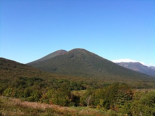
Naruko is a stratovolcano located in Ōsaki, Miyagi Prefecture, Japan. The volcano consists of a 7 km wide caldera with several lava domes. The summit of the 470 m high Mt. Kurumigatake is one of the four lava domes located in the center of the caldera. The volcano is well known because of its relationship to the Naruko Hot Springs Villages. However, its lack of well-defined features makes it difficult to recognize for a casual observer. The Japan Metrological Agency considers Naruko to be an active volcano.

<span class="mw-page-title-main">Mount Rausu</span> Stratovolcano on the island of Hokkaido, Japan

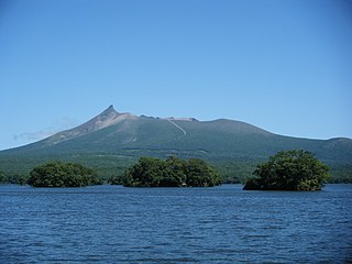
Mount Rausu is a stratovolcano on the Shiretoko Peninsula in Hokkaidō, Japan. It sits on the border between the towns of Shari and Rausu. Mount Rausu is the northeasternmost Holocene volcano on Hokkaidō. It is one of the 100 famous mountains in Japan.

<span class="mw-page-title-main">Tokachi Volcanic Group</span> Volcanic group in Hokkaidō, Japan

Tokachi Volcanic Group is a volcanic group of mainly stratovolcanoes arrayed along a southwest–northeast axis in Hokkaidō, Japan.

<span class="mw-page-title-main">Mount Nantai</span> Stratovolcano on the island of Honshu, Japan

Mount Nantai is a stratovolcano in the Nikkō National Park in Tochigi Prefecture, in central Honshū, the main island of Japan. The mountain is 2,486 metres (8,156 ft) high. A prominent landmark, it can be seen on clear days from as far as Saitama, a city 100 km (62 mi) away.

<span class="mw-page-title-main">Fukutoku-Okanoba</span> Submarine volcano in Bonin Islands, Japan

Fukutoku-Okanoba (福徳岡ノ場) is a submarine volcano that is part of the Volcano Islands in the Bonin Islands of Japan. It is located five kilometers (3.1 mi) northeast of the island of South Iwo Jima.

<span class="mw-page-title-main">Hokkaido Koma-ga-take</span> Andesitic stratovolcano on the island of Hokkaido

Hokkaidō Koma-ga-take, also Oshima Koma-ga-take (渡島駒ヶ岳), Oshima Fuji (渡島富士), or just Koma-ga-take (駒ヶ岳) is a 1,131 metres (3,711 ft) andesitic stratovolcano on the border between Mori, Shikabe, and Nanae, all within the Oshima Subprefecture of Hokkaidō, Japan.

<span class="mw-page-title-main">Hiuchigatake</span> Mountain in Japan

Mount Hiuchi, also Hiuchigatake is a 2,356 m tall stratovolcano in Oze National Park, and located in Hinoemata Village, Minami-Aizu gun, Fukushima Prefecture, Japan. This is the highest mountain in Tōhoku region. The volcano rises in the north of Lake Ozenuma. It is one of the 100 Famous Japanese Mountains.

<span class="mw-page-title-main">Mount Kirishima</span> Volcanic group on the island of Kyushu

Kirishima Mountains are a 1700 meter high active volcano group in Kagoshima Prefecture and Miyazaki Prefecture, Kyushu, Japan. Numerous eruptions have been recorded since 742. Very strong eruptions happened in 788, 1716 and 1717. Augite-hypersthene andesite is the dominant rock type.

<span class="mw-page-title-main">Nishinoshima (Ogasawara)</span> Active volcanic island belonging to the Volcano Islands arc

Nishi-no-shima is a volcanic island located around 940 km (584 mi) south-southeast of Tokyo, that is part of the Volcano Islands arc. Nishinoshima is located about 130 km to the west of the nearest of the Ogasawara islands, hence the name, but the other Ogasawara island groups are aligned north-south. The nearest of the other Volcano islands is over 270 km away, but Nishinoshima is on the alignment of the Volcano islands.

<span class="mw-page-title-main">Ebino Plateau</span>

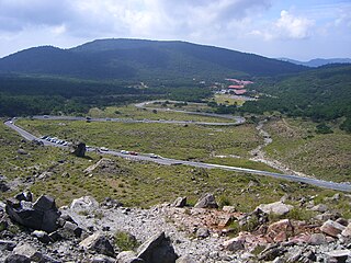
Ebino Plateau is a basin within the Mount Kirishima mountain ranges, situated in southern Kyushu, Japan. It is surrounded by the Mount Shiratori, Mount Karakuni, Mount Ebino and Mount Koshiki mountain peaks.

<span class="mw-page-title-main">2018 Hokkaido Eastern Iburi earthquake</span> Earthquake in Japan

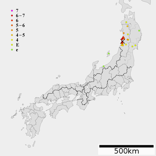
An earthquake measuring 6.6 Mw on the moment magnitude scale struck Iburi Subprefecture in southern Hokkaido, Japan, on 6 September 2018 at 3:08 a.m. JST. The earthquake's epicenter was near Tomakomai and occurred at a depth of 35.0 kilometers (21.7 mi). The Japan Meteorological Agency (JMA) registered a magnitude of 6.7 Mj and a maximum intensity of 7 on the shindo scale. Shaking from the earthquake was felt strongly in Hokkaido and Aomori Prefecture, and shaking was felt as far away as the Kantō region. Long period ground motion (LPGM) during the earthquake reached maximum of class 4 on the JMA LPGM intensity scales. The earthquake disrupted electrical service throughout Hokkaido, leaving 5.3 million residents without power. Forty-one people were confirmed dead and six hundred and ninety-one were injured. The event is officially known as Heisei san-jū-nen Hokkaidō Iburi tōbu jishin.

<span class="mw-page-title-main">1741 eruption of Oshima–Ōshima and the Kampo tsunami</span> Volcanic eruption and tsunami disaster off the coast of Hokkaido.

The devastating eruption of Oshima–Ōshima began on 18 August 1741 and ended on 1 May the next year. Eleven days into the eruption, the Kampo tsunami with estimated maximum heights of over 90 meters swept across neighboring islands in Japan and the Korean Peninsula.

<span class="mw-page-title-main">Tenmei eruption</span> 1783 eruption of Mount Asama in Japan

The Tenmei eruption was a large eruption of Mount Asama that occurred in 1783. This eruption was one of the causes of the Tenmei famine. It is estimated that about 1,500–1,624 people were killed in the eruption. The event is known in Japanese as The Burning of Asama in Tenmei.

<span class="mw-page-title-main">Mount Nyohō</span> Mountain in Nikko, Japan

Mount Nyohō is a mountain in Japan located in Nikkō, on the island of Honshū, north of the Tokyo metropolitan area. This 2,483-metre (8,146 ft) stratovolcano is part of the Nikkō Mountains volcanic complex in Nikkō National Park. It emerged from the floor of Japan's volcanic arc about 560,000 years ago, when the formation of the Nikkō Mountains began, and ceased all volcanic activity 86,000 years ago. The Nyohō volcano has been the object of Shinto worship since time immemorial, and in the 7th century, in connection with the nearby Mount Nantai, it also became a sacred mountain of Buddhism by the will of the Buddhist monk Shōdō Shōnin, a mountain ascetic and propagator of the Buddha's teachings in the ancient province of Shimotsuke. The clerics of Futarasan jinja, a World Heritage Site, maintain it as a place of pilgrimage.

<span class="mw-page-title-main">1804 Kisakata earthquake</span>

The 1804 Kisakata earthquake struck Dewa Province, Japan on July 10, 1804 with a magnitude of 7.0. The earthquake killed approximately 300–500 people. Nearby Mount Chokai erupted at about the same time as the earthquake. Lake Kisakata was uplifted by the earthquake, so Kisakata, featured in Bashō's Oku no Hosomichi, became new land and a swamp. A 1 m tsunami flooded 300 homes in Kisakata and Sakata.

References

  1. 1 2 3 4 5 6 7 8 9 10 11 12 13 14 15 16 17 18 19 20 21 22 23 24 25 26 27 28 29 30 31 32 33 34 35 36 37 38 39 40 41 42 43 44 45 46 47 48 49 50 51 52 53 54 55 56 57 58 59 60 61 62 63 64 65 66 67 68 69 70 71 72 73 74 75 76 77 78 79 80 81 82 83 84 85 86 87 88 89 90 91 92 93 94 95 96 97 98 99 100 101 102 103 104 105 106 107 108 109 110 111 112 113 114 115 116 117 118 119 120 121 122 123 124 125 126 127 128 129 130 131 132 133 134 135 136 137 138 139 140 141 142 143 144 145 146 147 148 149 150 151 152 153 154 155 Quaternary Volcanoes of Japan (2016) - Geological Survey of Japan
  2. 丸山 有史以降の火山活動 - Japan Meteorological Agency
  3. Akagisan - Japan Meteorological Agency
  4. 焼岳火山群 Yakedake Volcano Group - Geological Survey of Japan
  5. "火山活動の状況". www.data.jma.go.jp.
  6. Harunasan - Japan Meteorological Agency
  7. 栗駒山 有史以降の火山活動 - Japan Meteorological Agency
  8. Quaternary Volcanoes of Japan (2019) - Geological Survey of Japan
  9. Myokosan - Japan Meteorological Agency
  10. Narugo - Japan Meteorological Agency
  11. 栃木県北部,日光火山群女峰赤薙火山で約12-15万年前に起きた大規模山体崩壊 - 橘英彰
  12. 東北日本・日光火山群の地質および岩石学 [ permanent dead link ] - 佐々木実 Minoru Sasaki
  13. 御嶽山 有史以降の火山活動 - Japan Meteorological Agency
  14. ベヨネース列岩 有史以降の火山活動 - Japan Meteorological Agency
  15. 海域火山データベース Hachijyoujima - Japan Coast Guard
  16. 三宅島 有史以降の火山活動 - Japan Meteorological Agency
  17. 海域火山データベース Fukutoku-Oka-no-Ba - Japan Coast Guard
  18. Kaitoku Seamount - Japan Meteorological Agency
  19. 南日吉海山 有史以降の火山活動 - Japan Meteorological Agency
  20. 噴火警報、噴火予報の発表状況 - Japan Meteorological Agency
  21. 1 2 3 Yonemaru and Sumiyoshiike: National catalogue of the active volcanoes in Japan - Japan Meteorological Agency