Related Research Articles

The Ring of Fire is a region around much of the rim of the Pacific Ocean where many volcanic eruptions and earthquakes occur. The Ring of Fire is a horseshoe-shaped belt about 40,000 km (25,000 mi) long and up to about 500 km (310 mi) wide.

The Sunda Arc is a volcanic arc that produced the volcanoes that form the topographic spine of the islands of Sumatra, Nusa Tenggara, and Java, the Sunda Strait and the Lesser Sunda Islands. The Sunda Arc begins at Sumatra and ends at Flores, and is adjacent to the Banda Arc. The Sunda Arc is formed via the subduction of the Indo-Australian Plate beneath the Sunda and Burma plates at a velocity of 63–70 mm/year.

Tofua is a volcanic island in Tonga. Located in the Haʻapai island group, it is a steep-sided composite cone with a summit caldera. It is part of the highly active Kermadec-Tonga subduction zone and its associated volcanic arc, which extends from New Zealand north-northeast to Fiji, and is formed by the subduction of the Pacific Plate under the Indo-Australian Plate. It lies about 100 km (62 mi) above a very active seismic zone. It is connected to the nearby island of Kao by a submarine ridge.

James Healy Seamount is a submarine volcano located among the South Kermadec Ridge Seamounts south of New Zealand's Kermadec Islands. It consists of a volcanic cone that reaches a depth of 1,150 metres (3,770 ft) below sea level, two 2–2.5 kilometres (1.2–1.6 mi) and 1.3 kilometres (0.81 mi) wide calderas and a parasitic cone that reaches a depth of 950 metres (3,120 ft) below sea level. The flanks of the volcano are covered with pumice and volcanic rocks, and hydrothermal venting occurs inside the caldera.

The volcanism of New Zealand has been responsible for many of the country's geographical features, especially in the North Island and the country's outlying islands.

Hunga Tonga–Hunga Haʻapai is a submarine volcano in the South Pacific located about 30 km (19 mi) south of the submarine volcano of Fonuafoʻou and 65 km (40 mi) north of Tongatapu, Tonga's main island. It is part of the highly active Kermadec-Tonga subduction zone and its associated volcanic arc, which extends from New Zealand north-northeast to Fiji, and is formed by the subduction of the Pacific Plate under the Indo-Australian Plate. It lies about 100 km (62 mi) above a very active seismic zone.

West Mata, located in the far northern portion of the Tofua volcanic arc in Tonga, is an active submarine volcano. It was recently discovered in 2008 along with another group of volcanoes nearby. Compared to the other Mata group volcanoes, West Mata is the most hydrothermally active one and its activity is not disputed.

This timeline of volcanism on Earth includes a list of major volcanic eruptions of approximately at least magnitude 6 on the Volcanic explosivity index (VEI) or equivalent sulfur dioxide emission during the Quaternary period. Other volcanic eruptions are also listed.
The 1953 Suva earthquake occurred on 14 September at 00:26 UTC near Suva, Fiji, just off the southeast shore of Viti Levu. This earthquake had an estimated magnitude of Ms 6.8 and Mw 6.4. The earthquake triggered a coral reef platform collapse and a submarine landslide that caused a tsunami. Eight people were reported killed; a wharf, bridges, and buildings were severely damaged in Suva.
Volcanoes of the World is a book that was published in three editions in 1981, 1994, and 2010 as a collaboration between volcanologists around the world, and the Smithsonian Institution's Global Volcanism Program (GVP).

The Tonga-Kermadec Ridge is an oceanic ridge in the south-west Pacific Ocean underlying the Tonga-Kermadec island arc. It is the most linear, fastest converging, and most seismically active subduction boundary on Earth, and consequently has the highest density of submarine volcanoes.

The Rarotonga hotspot is a volcanic hotspot in the southern Pacific Ocean. The hotspot is claimed to be responsible for the formation of Rarotonga and some volcanics of Aitutaki but an alternative explanation for these islands most recent volcanics has not be ruled out. Recently alternatives to hotspot activity have been offered for several other intra-plate volcanoes that may have been associated with the Rarotonga hotspot hypothesis.

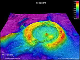
Niuatahi or also called Volcano O is a submarine volcano located in the far northern territory of Tonga. Since the cone in the middle is named Motutahi, the volcano is sometimes referred to as Niuatahi-Motutahi. Despite not having any record of any eruption, Niuatahi does have a record of recent hydrothermal activity.
Volcano F is a submarine volcano in the Tonga Islands of the South Pacific Ocean. It is located 50 km (31 mi) northwest of Vavaʻu, between Late and Fonualei on the Tofua ridge. It is part of the highly active Kermadec-Tonga subduction zone and its associated volcanic arc, which extends from New Zealand north-northeast to Fiji, and is formed by the subduction of the Pacific Plate under the Indo-Australian Plate.

Curtis Island is an island in the southwest Pacific. It is a volcanic island which, together with neighbouring Cheeseman Island, belongs to the Kermadec Islands, an outlying island group of New Zealand. It is a volcanic island with a fumarolically active crater, while vegetated slopes are nested by seabirds. There are uncertain reports of eruptions and the island has been uplifted by about 18 m (59 ft) during the past 200 years.

The South Kermadec Ridge Seamounts are a continuation of the volcanic island arc, formed at the convergent boundary where the Pacific Plate subducts under the Indo-Australian Plate. The subducting Pacific Plate created the Kermadec Trench, the second deepest submarine trench, to the east of the islands. The seamounts lie along the western aspect of the undersea Kermadec Ridge, which runs southwest from the Kermadec Islands towards the North Island of New Zealand and northeast towards Tonga.
References
- Peate, David W.; Kokfelt, Thomas F.; Hawkesworth, Chris J.; van Calsteren, Peter W.; Hergt, Janet M.; Pearce, Julian A. (2001). "U-series Isotope Data on Lau Basin Glasses: the Role of Subduction-related Fluids during Melt Generation in Back-arc Basins". Journal of Petrology . 42 (8): 1449–1470. doi: 10.1093/petrology/42.8.1449 . See especially Figure 1.
- Global Volcanism Program (GVP)
- D. Stanley; South Pacific handbook
- Government of Tonga, official 1962 land survey
- ↑
- Siebert L, Simkin T (2002–present). Volcanoes of the World: an Illustrated Catalog of Holocene Volcanoes and their Eruptions. Smithsonian Institution, Global Volcanism Program Digital Information Series, GVP-3 (http://www.volcano.si.edu).
- ↑ Wendt J. I.; Regelous M.; Collerson K. D.; Ewart A. (1997). "Evidence for a contribution from two mantle plumes to island-arc lavas from northern Tonga". Geology. 25 (7): 611–614. doi:10.1130/0091-7613(1997)025<0611:EFACFT>2.3.CO;2.