
Windermere is a town in the civil parish of Windermere and Bowness, in the Westmorland and Furness district in the ceremonial county of Cumbria, England; it is within the Lake District National Park. The town lies about half a mile (1 km) east of the lake, Windermere, from which it takes its name. In 2021 it had a population of 4,826.
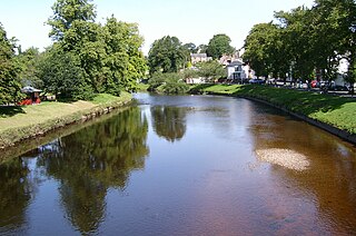
The River Eden is a river that flows through Cumbria, England. It rises on Black Fell Moss, near the village of Outhgill, and runs in a generally north-westerly direction through the Vale of Eden and Solway Plain before reaching the sea at the Solway Firth.

Teesdale is a dale, or valley, located principally in County Durham, North East England. It is one of the Durham Dales, which are themselves part of the North Pennines, the northernmost part of the Pennine uplands.
The Howgill Fells are uplands in Northern England between the Lake District and the Yorkshire Dales, lying roughly within a triangle formed by the town of Sedbergh and the villages of Ravenstonedale and Tebay. The name Howgill derives from the Old Norse word haugr meaning a hill or barrow, plus gil meaning a narrow valley.
Orton is a village and civil parish in Cumbria, England. It lies 15 miles (24 km) south of Penrith, 8 miles (13 km) from Appleby-in-Westmorland and 1.5 miles (2.4 km) from the M6 motorway. The village is in the upper Lune Valley, at the foot of Orton Scar in the Orton Fells. The Lake District is nearby. The parish includes a wide area outside the village, and had a population of 594 in 2001, decreasing to 588 at the 2011 Census.
Urswick is a civil parish that includes the villages of Great Urswick and Little Urswick. It is located in the Furness area of Cumbria, England. The villages are situated to the south-west of the town of Ulverston. In the 2001 census the parish had a population of 351, decreasing at the 2011 census to 1,397.

Coniston is a village and civil parish in the Westmorland and Furness district of Cumbria, England. In the 2001 census the parish had a population of 1,058, decreasing at the 2011 census to 928. Within the boundaries of the historic county of Lancashire, it is in the southern part of the Lake District National Park, between Coniston Water, the third longest lake in the Lake District, and Coniston Old Man.

Asby is a civil parish in the Westmorland and Furness district of Cumbria, England. Historically part of Westmorland, it includes the villages of Great Asby and Little Asby. According to the 2001 census the parish had a population of 280, and this had increased to 309 at the 2011 Census.
Natland is a village and civil parish about two miles (3 km) south of Kendal in the South Lakeland district of Cumbria, England, close to the village of Oxenholme. In the 2001 census the parish had a population of 747, increasing at the 2011 census to 796.

Pate Hole is a solutional cave located adjacent to Asby Gill 1 kilometre (0.62 mi) south of Great Asby in Cumbria, England. It is 970 metres (3,180 ft) long and has a vertical range of 33 metres (108 ft). The entrance is normally dry, but in flood it becomes an impressive resurgence. Its name derives from the north country word for badger.

Brampton is a village in the Westmorland and Furness district, in the county of Cumbria, England. Before 1974 it was in the county of Westmorland; the nearest town is Appleby-in-Westmorland.

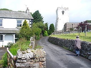
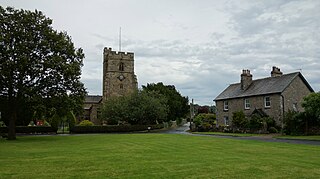
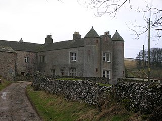
Great Asby is a village in Cumbria, England. Historically part of Westmorland, it is located approximately 15 miles (24 km) south east of Penrith and approximately 5 miles (8.0 km) south of Appleby-in-Westmorland. Its name is said to be derived from the Old Norse: askr, meaning ash and by, meaning farm.
Smardale is a small village and former civil parish, now in the parish of Waitby, in the Eden district, in Cumbria, England. In 1891 the parish had a population of 36.

Scout Scar, also called Underbarrow Scar, is a hill in the English Lake District, west of Kendal, Cumbria and above the village of Underbarrow. It reaches 771 feet (235 m). Scout Scar is the subject of a chapter of Wainwright's book The Outlying Fells of Lakeland, but the summit he describes is a lower summit at 764 feet (233 m), 270m south of the highest point. Wainwright's anticlockwise recommended route also includes Cunswick Scar at 679 feet (207 m). The higher summit of Scout Scar has a topographic prominence of 109m and is thus classified as a HuMP, a hill with a prominence of at least 100m.

A Dales High Way is a long-distance footpath in northern England. It is 90 miles (140 km) long and runs from Saltaire in West Yorkshire to Appleby-in-Westmorland, Cumbria, roughly parallel to the line of the Settle and Carlisle Railway.

The Orton Fells is an upland area in Northern England, mostly consisting of limestone hills, plateaus and moorlands. Historically in Westmorland, the area lies within the modern county of Cumbria and is bounded by the Lake District to the west, the Eden Valley to the north and east, and the Yorkshire Dales and Howgill Fells to the south. The area mostly falls within the boundaries of the Yorkshire Dales National Park while a small part of the western fells is in the Lake District National Park. The fells are one of 159 National Character Areas defined by Natural England.

Great Asby Scar is a Site of Special Scientific Interest (SSSI) and National Nature Reserve in Cumbria, UK. It is an area of limestone pavement, south of the village of Great Asby.
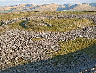
Castle Folds or Castlesteads was a Romano-British walled settlement on Great Asby Scar – an area of limestone pavement in the parish of Asby, Cumbria, England. In medieval times, it was used as a shieling – a temporary summer shelter. It is now in ruins but is protected as a scheduled monument.


