William Butterfield was a Gothic Revival architect and associated with the Oxford Movement. He is noted for his use of polychromy.

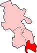
Burnham is a large village and civil parish that lies north of the River Thames in Buckinghamshire, between the towns of Maidenhead and Slough, about 24 miles west of Charing Cross, London. It is probably best known for the nearby Burnham Beeches woodland.
Hartwell is a village and former civil parish, now in the parish of Stone with Bishopstone and Hartwell, in the Aylesbury Vale district, in central Buckinghamshire, England. It is to the south of Aylesbury, by the village of Stone. In 1961 the civil parish had a population of 100.
Ickford is a village and civil parish in the Aylesbury Vale district of Buckinghamshire, England. It is on the boundary with Oxfordshire, about 4 miles (6.4 km) west of the market town of Thame.

Pitchcott is a village and civil parish in the Aylesbury Vale district of Buckinghamshire, England. It is about 3 miles (5 km) northeast of Waddesdon, slightly less than 4 miles (6.4 km) south of Winslow and slightly more than 4 miles (6.4 km) north of Aylesbury. It is in the civil parish of Oving.

Slapton is a village and also a civil parish within Aylesbury Vale district in Buckinghamshire, England. It is located between the Grand Union Canal and the border with Bedfordshire, about three miles south of Leighton Buzzard, three miles west of Edlesborough.

Turweston is a village and civil parish in north-west Buckinghamshire, England. The village is beside the River Great Ouse, which bounds the parish to the north, west and south. Turweston is the most northwesterly parish in Buckinghamshire: the Ouse here forms the county boundary with Northamptonshire to the north and west and Oxfordshire to the south. Across the river, the Northamptonshire market town of Brackley is just west of Turweston, with the town centre about 1 mile (1.6 km) west of the village. The parish has an area of 1,295 acres (524 ha) and had a population of 211 at the 2011 Census.

Wooburn is a village in Buckinghamshire, England. It is located off the A4094 road between Wooburn Green and Bourne End in the very south of the county near the River Thames, about two miles south west of Beaconsfield and four miles east of Marlow. Wooburn is one of the two principal settlements within Wooburn, a civil parish in Wycombe district.

Hellidon is a village and civil parish about 5 miles (8 km) south-west of Daventry in Northamptonshire, England. The parish area is about 1,600 acres (650 ha). The village lies 520 feet (160 m)–590 feet (180 m) above sea level on the north face of an ironstone ridge. Its highest point is 670 feet (200 m) above sea level, at Windmill Hill about 0.5 miles (800 m) south-east of the village. The Leam and several streams feeding it rise in the parish. The 2011 Census recorded a parish population of 256. The Jurassic Way long-distance footpath linking Banbury, Oxfordshire and Stamford, Lincolnshire passes through.

Gunthorpe is a village and a civil parish in the English county of Norfolk. The village is 8.6 miles east north east of the town of Fakenham, 14.9 miles west south west of Cromer and 122 miles north north east of London. The nearest railway station is at Sheringham for the Bittern Line which runs between Sheringham, Cromer and Norwich. The nearest airport is Norwich International Airport.

Tawstock is a village, civil parish and former manor in North Devon in the English county of Devon, England. The parish is surrounded clockwise from the north by the parishes of Barnstaple, Bishop's Tawton, Atherington, Yarnscombe, Horwood, Lovacott and Newton Tracey and Fremington. In 2001 it had a population of 2,093. The estimated population in June 2019 was 2,372.

St James' Church is in the village of Christleton, Cheshire, England. The church is recorded in the National Heritage List for England as a designated Grade II* listed building. It is an active Anglican parish church in the diocese of Chester, the archdeaconry of Chester and the deanery of Chester. It is the only Cheshire church designed by William Butterfield.

St Mary's Chapel is a former Anglican parish church in the village of High Legh, Cheshire, England. It is recorded in the National Heritage List for England as a designated Grade II* listed building.

Charlton-All-Saints is a hamlet in the civil parish of Downton, in South Wiltshire, England. It is situated 2.4 km north of the village of Downton, and about 6.5 km south-east of the City of Salisbury and is located immediately to the west of the River Avon, about 4 miles (6.4 km) south of Salisbury.

Dropmore Park is a private estate located along Dropmore Road, north of Burnham, Buckinghamshire, England, about 220 acres (89 ha) in size. The park with its buildings, including Dropmore House, have Grade I listed building status. Dropmore House is one of the most important buildings in south Buckinghamshire.

Littleworth is a small village and civil parish off the A420, almost 2 miles (3 km) northeast of Faringdon. It was part of Berkshire until the 1974 boundary changes transferred it to Oxfordshire. The parish includes the hamlets of Thrupp and Wadley. The 2011 Census recorded the parish's population as 239.

The Congregational Church of Goffstown is a historic Congregational church building at 10 Main Street in the center of Goffstown, New Hampshire, United States. It is a member of the Conservative Congregational Christian Conference (CCCC).

The Church of St James is a Church of England parish church in Baldersby St James, North Yorkshire. This Victorian church is a grade I listed building, and was designed by William Butterfield.
St James' and St Anne's Church is an active Church of England church in Alfington, Devon, England. It was built in 1849 at the expense of Sir John Taylor Coleridge and designed by William Butterfield.

Sheen is a village and civil parish in north-east Staffordshire, England.