
Worcestershire is a ceremonial county in the West Midlands of England. It is bordered by Shropshire, Staffordshire, and the West Midlands county to the north, Warwickshire to the east, Gloucestershire to the south, and Herefordshire to the west. The city of Worcester is the largest settlement and the county town.

The A44 is a major road in the United Kingdom that runs from Oxford in southern England to Aberystwyth in west Wales.
Littleworth is a hamlet in the parish of Wing, in Buckinghamshire, England. It is situated between the main village and the hamlet of Burcott.
Littleworth may refer to several places in England:

Rossington is a civil parish and former mining village in the Metropolitan Borough of Doncaster in South Yorkshire, England and is surrounded by countryside and the market towns of Bawtry and Tickhill.

The Cotswold Line is an 86+1⁄2-mile (139.2 km) railway line between Oxford and Hereford in England.

Kingham is a village and civil parish in the Cotswolds about 4 miles (6.4 km) southwest of Chipping Norton, Oxfordshire. The 2011 Census recorded the parish's population as 913.

Norton is a village in the Wychavon district of Worcestershire, 0.8 miles (1.3 km) from the boundary of the City of Worcester, England. The village sits within the Norton Juxta Kempsey civil parish and is split in two by the M5 motorway, with the original village to the east.

Hatfield is a small hamlet in the district of Wychavon near the city of Worcester, in England. It is surrounded by the villages of Littleworth, Norton, Pirton & Kempsey.

Littleworth railway station is a former railway station in Deeping St Nicholas, Lincolnshire, on the Peterborough to Lincoln Line. It opened in 1848 and was closed for passengers in 1961.
Peopleton is a village and civil parish in the Wychavon district of Worcestershire, England. In 2001 the parish had a population of 640, with 245 households.

Sedgeberrow is a village and civil parish in the Wychavon district of Worcestershire, England, about 3 miles (4.8 km) south of Evesham. It stands beside the River Isbourne, a tributary of the River Avon.

Littleworth is a small village and civil parish off the A420, almost 2 miles (3 km) northeast of Faringdon. It was part of Berkshire until the 1974 boundary changes transferred it to Oxfordshire. The parish includes the hamlets of Thrupp and Wadley. The 2011 Census recorded the parish's population as 239.

The A1175 road is a road in south-west Lincolnshire, England. It runs between Stamford and Spalding, along the old A16 route.
Littleworth is a hamlet in South Oxfordshire, about 4+1⁄2 miles (7 km) east of Oxford, England. It is in Wheatley civil parish, immediately west of Wheatley village.
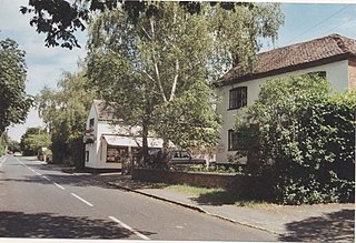
Norton-juxta-Kempsey is a civil parish to the south of Worcester in the United Kingdom. It contains the villages of Norton and Littleworth. The parish has a population of approximately 2,500. As the parish name suggest, it adjoins Kempsey to the west.

Bredon's Norton or Norton-by-Bredon is a village and civil parish 11 miles (18 km) south east of Worcester, in the Wychavon district, in the county of Worcestershire, England. In 2021 the parish had a population of 254. The parish touches Eckington, Bredon, Strensham and Kemerton.

