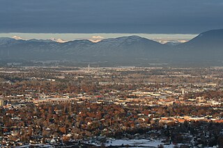
Wild Horse Island is the largest island on Flathead Lake, the largest freshwater lake in Montana. For centuries, the Salish-Kootenai used the island, approximately 2,164 acres (876 ha) in size, in order to pasture horses and keep them from being stolen by other tribes. The island was part of the Flathead Indian Reservation from the time of its creation in 1872 up until its dismantlement in 1904, when the island was divided into individual plots of land. A number of attempts were made on the island towards agricultural development, but none succeeded.

Benton Lake National Wildlife Refuge is a 12,459-acre (5,042 ha) National Wildlife Refuge (NWR) in the central part of the U.S. state of Montana. It lies in northern Cascade County, 12 mi (19 km) north of the city of Great Falls, Montana. Benton Lake NWR includes shortgrass prairie and seasonal wetlands, and is nearly surrounded by the Highwood Mountains to the east, Big Belt Mountains to the south, and the Rocky Mountains to the west. Benton Lake NWR is on the western edge of the northern Great Plains and much of the shallow lake is a 6,000-acre (2,400 ha) wetland.

Spring Meadow Lake State Park is a public recreation area covering 61 acres (25 ha) just west of Helena, Montana. Once the site of a gravel pit and factory, the state park centers around a man-made, spring-fed lake, which is used for swimming, fishing, non-motorized boating, and scuba diving. The park also offers picnicking, a mile-long trail around the lake, and ice fishing and ice skating in winter. Largemouth bass, westslope cutthroat trout, yellow perch, and pumpkinseed are the main catches. A fishing pier was added to 30-acre (12 ha) lake in 2011.

Medicine Lake National Wildlife Refuge is a 31,533-acre (12,761 ha) National Wildlife Refuge located in the northeastern region of the U.S. state of Montana. The refuge is part of the Medicine Lake National Wildlife Refuge Complex which also includes the Northeast Montana Wetland Management District (WMD) and Lamesteer National Wildlife Refuge. Medicine Lake is from the Assiniboine description of the lake, "Bda wauka". The refuge was established in 1935 to protect habitat for various wildlife and especially migratory birds. The refuge is managed by the U.S. Fish and Wildlife Service, an agency of the U.S. Department of the Interior. In 1980, the Medicine Lake Site was designated as a National Natural Landmark by the National Park Service.

Lake Malone State Park is a 338-acre (137 ha) state park located near Dunmor, Kentucky, in Muhlenberg County and extending into parts of Logan County and Todd County. In addition to the 788-acre (319 ha) Lake Malone, the natural features of the park include sandstone cliffs and a natural rock bridge.

Madison Buffalo Jump State Park is a Montana state park located seven miles south of the Interstate 90 interchange at Logan in Gallatin County, Montana in the United States. The park preserves a canyon cliff used by Native Americans as a buffalo jump, where herds of bison were stampeded over the cliff as an efficient means of slaughter. The main geographic features of the jump site remain largely unchanged since the days of the jumps. Archaeologists have found tons of bison bones buried at the base of the cliffs. They have also uncovered the remains of tipi villages.

Thompson Falls State Park is a public recreation area occupying 36 acres (15 ha) on the banks of the Clark Fork River, one mile northwest of Thompson Falls, Montana. The state park features a boat launch, children's fishing pond, and riverside trail with mature pine forests surrounding 17 campsites, a group use area, and picnicking facilities. Activities include boating, fishing, picnicking, birdwatching, and nature walks. The park is fully open from spring to fall and available for walk-in day use during the rest of the year.

Lake Elmo State Park is a public recreation area located on the northeast side of Billings, Montana. The state park occupies 123 acres (50 ha) and is at an elevation of 3,199 feet (975 m). It offers non-motorized boating on a 64-acre (26 ha) reservoir, three beach-front areas, fishing pier, grassed multi-use areas, two group-use shelters, playground, and fenced-in dog park on the lake's west side.
Cooney State Park is a public recreation area bordering Cooney Reservoir, fourteen miles (23 km) south of Columbus in Carbon County, Montana. The state park occupies 309 acres (125 ha) on three sides of the reservoir, a 1,078-acre (436 ha) impoundment of Red Lodge Creek completed in 1937. The park offers boating, fishing, swimming, picnicking, and camping.

Ackley Lake State Park is a public recreation area located four miles southwest of Hobson, Montana. The state park covers 290 acres (120 ha) centered around 160-acre (65 ha) Ackley Lake. The Little Belt Mountains and Snowy Mountains are visible on the horizon. The park is operated by the Montana Department of Fish, Wildlife and Parks on land leased from the Montana Department of Natural Resources and Conservation.
Brush Lake State Park is a public recreation area located four miles east of the community of Dagmar, Montana. The park surrounds three sides of the highly alkaline, 280-acre (110 ha), sixty-foot-deep Brush Lake.
Lone Pine State Park is a public recreation area on the southwest side of Kalispell, Montana, United States. The day-use state park's 270 acres (110 ha) include 7.5 miles (12.1 km) of trails for hiking, mountain biking, snowshoeing, and horseback riding.
West Shore State Park is a public recreation area occupying 129 acres on the western shore of Flathead Lake five miles south of Lakeside in Lake County, Montana. The state park offers boating, fishing, camping, swimming, hiking, and wildlife viewing.
Finley Point State Park is a 28-acre (11 ha) public recreation area located on the Finley Point peninsula at the southern end of Flathead Lake ten miles east of the community of Big Arm. The state park has RV and tent camping facilities as well as boat camping slips.
Frenchtown Pond State Park is a public recreation area located ten miles (16 km) northwest of Missoula in Frenchtown, Montana. The 41-acre (17 ha) day-use state park offers fishing, swimming, and non-motorized boating on a small, spring-fed lake with a maximum eighteen-foot (5.5 m) depth.

Hell Creek State Park is a public recreation area on the south side of Fort Peck Lake located twenty miles (32 km) due north of the community of Jordan, Montana. The state park's 337 acres (136 ha) sit on the western side of Hell Creek Bay and include a year-round marina, facilities for most water sports, camping, and fishing for walleye, northern pike, smallmouth bass, and spring lake trout.

Lake Mary Ronan State Park is a public recreation area located seven miles (11 km) northwest of the Flathead Lake community of Dayton, Montana. The state park occupies 120 acres (49 ha) on the east side of 1,500-acre (610 ha) Lake Mary Ronan. The lake is 47 feet deep at its deepest spot and is known for kokanee salmon and yellow perch. Twenty-five campsites and a boat ramp are found in the park.
Pirogue Island State Park is a public recreation area on the Yellowstone River, just north of Miles City, Montana. The 269-acre (109 ha) state park has 2.8 miles (4.5 km) of designated hiking trails.
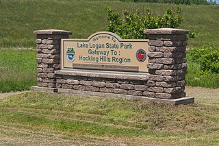
Lake Logan State Park is an Ohio state park in Hocking County, Ohio, United States. Lake Logan State Park is located in Falls Township, Hocking County, Ohio. Lake Logan Dam is directly accessible off State Route 664 just southwest of the county seat of Logan. Lake Logan State Park lies in the Hocking Valley, formed by the Hocking River. Lake Logan was created in 1955 with the construction of the Lake Logan Dam on Clear Fork Creek, a tributary of the Hocking River. Lake Logan is a 400-acre (160 ha) lake and is open to fishing, boating, ice fishing, ice boating and swimming.

Yellow Bay State Park is a public recreation area occupying 15 acres on the eastern shore of Flathead Lake twelve miles south of Bigfork in Lake County, Montana. The state park offers boating, fishing, camping, swimming, and wildlife viewing.