
The River Welland is a lowland river in the east of England, some 65 miles (105 km) long. It drains part of the Midlands eastwards to The Wash. The river rises in the Hothorpe Hills, at Sibbertoft in Northamptonshire, then flows generally northeast to Market Harborough, Stamford and Spalding, to reach The Wash near Fosdyke. It is a major waterway across the part of the Fens called South Holland, and is one of the Fenland rivers which were laid out with washlands. There are two channels between widely spaced embankments with the intention that flood waters would have space in which to spread while the tide in the estuary prevented free egress. However, after the floods of 1947, new works such as the Coronation Channel were constructed to control flooding in Spalding and the washes are no longer used solely as pasture, but may be used for arable farming.
The River Glen is a river in Lincolnshire, England with a short stretch passing through Rutland near Essendine.

Stamford is a town and civil parish in the South Kesteven District of Lincolnshire, England. The population at the 2011 census was 19,701 and estimated at 20,645 in 2019. The town has 17th and 18th-century stone buildings, older timber-framed buildings and five medieval parish churches. It is a frequent film location. In 2013 it was rated a top place to live in a survey by The Sunday Times. Its name has been passed on to Stamford, Connecticut, founded in 1641.

The A15 is a major road in England. It runs north from Peterborough via Market Deeping, Bourne, Sleaford and Lincoln along a variety of ancient, Roman, and Turnpike alignments before it is interrupted at its junction with the M180 near Scawby. The road restarts 10 miles (16 km) east, and then continues north past Barton-upon-Humber, crossing the Humber on the Humber Bridge before terminating at Hessle near Kingston upon Hull.

Maxey is a village in the Peterborough unitary authority, in the ceremonial county of Cambridgeshire, England, located between Peterborough and Stamford and southwest of The Deepings. It is home to nearly 700 residents.
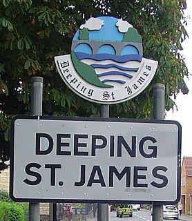
Deeping St James is a large village in the South Kesteven district of Lincolnshire, England. The population of the civil parish was reported as 7,051 at the 2011 census.

Downham Market railway station is on the Fen line in the east of England, serving the town of Downham Market, Norfolk. It is 86 miles 8 chains (138.6 km) measured from London Liverpool Street and is situated between Littleport and Watlington stations. Its three-letter station code is DOW.

Bainton is a village and civil parish in the Peterborough unitary authority area of Cambridgeshire, England. Bainton is on the southern edge of the Welland valley and lies 7.4 miles (11.9 km) north-west of Peterborough and 4 miles (6.4 km) east of Stamford. Ashton is a neighbouring hamlet and lies approximately 1 mile (1.6 km) south-east of Bainton within the same civil parish. At the time of the 2001 census, the parish's population was 305 people and by the 2011 census the parish's population was 290 people.

Peterborough was a rural district adjoining the city and municipal borough of Peterborough, England, from 1894 to 1974. The council offices were at 51 Priestgate, in the city of Peterborough.

Oakham railway station serves the town of Oakham in Rutland, England. The station is situated almost halfway between Leicester – 27 miles (43 km) to the west – and Peterborough – 25 miles (40 km) eastward on the Syston and Peterborough Railway, the line is the Birmingham to Peterborough Line.
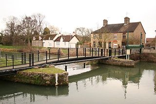
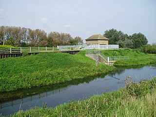
Stamford Canal, now disused, is one of the earliest post-Roman canals in England. It opened in 1670, around 100 years before the start of the Industrial Revolution which brought about the "golden age" for canals in Britain. Parts of the route can be traced on the ground, though only one lock survives intact. It was part of the Welland Navigation in Lincolnshire. First authorised in 1571, during the reign of Elizabeth I, construction did not start until 1664, under powers granted in 1620 and ratified by James I. It ran for 9.5 miles (15.3 km) from Stamford to Market Deeping and had 12 locks, two of which were on the river section at Deeping St James. No plans of its construction survive, although one of the locks was documented by a visiting water engineer in 1699. It contributed to the wealth of Stamford, allowing barley to be transported to the town for malting.

Shillingford a hamlet on the north bank of the River Thames in Warborough civil parish in South Oxfordshire, England. Its homes are not quite with Warborough by way of one residential road. It lies mostly on the A4074 between Oxford and Reading, at the junction with the A329.

Wincheap is a road and suburb in Canterbury, Kent, England. The road forms part of the A28 road, stretching for around 1 mile (1.6 km) from the city wall, close by Canterbury East railway station, to the over-crossing of the A2 and the parish of Thanington.
Cowbit is a village and civil parish in the South Holland district of Lincolnshire, England. The population of the civil parish at the 2011 census was 1,220. It is situated 3 miles (5 km) south from Spalding and 5 miles (8 km) north from Crowland.

Brooksby railway station was a former station serving the villages of Brooksby, Hoby and Rotherby in Leicestershire. The station was situated at a level crossing on the Brooksby to Hoby road.

Duddington is a small village in Northamptonshire, England. It is by the junction of the A47 and A43 roads, and is 9 kilometres (6 mi) southwest of the town of Stamford. The village is on the east bank of the River Welland which is the county boundary of Rutland.

The A1175 road is a public highway in south-west Lincolnshire, England within the United Kingdom.

Bywell Bridge is a 19th-century stone bridge across the River Tyne. It is a Grade II listed building.

John Clare Cottage is a cottage and literary museum in Helpston, Peterborough, United Kingdom. The cottage was the birthplace of English poet John Clare (1793-1864).
