Longworth, Lancashire

Last updated

Longworth
Lone pine - geograph.org.uk - 4776504.jpg
Area
  18911,654 acres (6.69 km2) [1]
Population
  1801249
  1891102
History
  Created Middle Ages
  Abolished1898
  Succeeded by Turton
Status Township (until 1866),
Civil parish (1866–1898)

Longworth was a township of the civil and ecclesiastical parish of Bolton le Moors in the Salford hundred of Lancashire, England. [2] In 1891 it had a population of 102.

Contents

History

The township was recorded as Longeworthe in 1254, Lunggewrthe in 1278 and Longeworth in 1290. The Old English suffix worth denotes an enclosure or enclosed settlement.

The manor was held of the lords of Manchester as two oxgangs of land by families which assumed the local surname. Longworths lived there from the Middle Ages until the mid 17th century. Matthew, son of Siward de Longworth, made a grant of land to Cockersand Abbey about the beginning of the 13th century. John de Longworth in 1288 successfully asserted his right to 100 acres of moor in Longworth. [3] Pedigrees were entered at the heraldic visitations in 1567 and 1613. Christopher Longworth died in 1608, holding land and a water mill. Thomas Longworth and Dorothy his wife made a settlement of the manor of Longworth in 1632. After that the manor was sold, probably to the Lacys who recorded a pedigrees in 1664. No house in the township had more than two hearths in 1666, except Thomas Lacy's, which had seven out of a total of twenty-one. In 1738 Longworth is named in a settlement of the estates of William Hulton of Over Hulton. [2]

In 1907 the township was purchased by the Bolton Corporation to build the Delph reservoir. There was a quarry and a cotton mill which was demolished by Bolton Corporation when they bought the land. [2]

Governance

Historically, Longworth formed part of the Hundred of Salford, a judicial division of southwest Lancashire. It was one of the townships that made up the ancient ecclesiastical parish of Bolton le Moors. [4]

Under provisions of the Poor Relief Act 1662, townships replaced parishes as the main units of local administration in Lancashire. [5] Longworth became one of the eighteen autonomous townships of the parish of Bolton le Moors. [2] [6] In 1837, Longworth became one of the townships of the Bolton Poor Law Union, which took over the responsibility for the administration and funding of the Poor Law in that area. [7] As with other townships in Lancashire in 1866, Longworth became a civil parish. For a short while, Longworth became part of the Bolton Rural District in 1894, however, that short lived rural district was dissolved in 1898. On 30 September 1898 the civil parish of Longworth was abolished and merged with Turton [8] and became part of Turton Urban District. [9]

Geography

Longworth was on the south west slope of Turton Moor and the lower land to the south east between the Longworth and Delph Brooks. [10] The area of the township was 1,654 acres (6.69 km2). There was a hall but there was no village or hamlet within the township boundary and the land was chiefly pasture. A road from Egerton passed near the south west border and the ancient road from Blackburn to Bolton through Tockholes crossed the township. [2]

Demography

Year1801181118211831184118511861187118811891
Population249226238179149152154113106102
Sources: Local population statistics. [11] Vision of Britain. [12]

Related Research Articles

<span class="mw-page-title-main">Farnworth</span> Human settlement in England

Farnworth is a town in the Metropolitan Borough of Bolton, Greater Manchester, England, 2 miles (3.2 km) southeast of Bolton, 4 miles south-west of Bury (7 km), and 8 miles (12.9 km) northwest of Manchester.

<span class="mw-page-title-main">Westhoughton</span> Town in Greater Manchester, England

Westhoughton is a town and civil parish in the Metropolitan Borough of Bolton, Greater Manchester, England, 4 miles (6 km) southwest of Bolton, 5 miles (8 km) east of Wigan and 13 miles (21 km) northwest of Manchester.

<span class="mw-page-title-main">Belmont, Lancashire</span> Human settlement in England

Belmont is a village and former civil parish, now in the parish of North Turton, in the unitary authority area of Blackburn with Darwen, in the ceremonial county of Lancashire, England. It is close to Darwen and has around 500 inhabitants.

<span class="mw-page-title-main">Turton Urban District</span> Historical government district in Lancashire, England

Turton Urban District was, from 1873 to 1974, a local government district centred on the historical area of Turton in the administrative county of Lancashire, England.

<span class="mw-page-title-main">Lostock, Bolton</span> Human settlement in England

Lostock is a residential district of Bolton, Greater Manchester, England, 3.5 miles (5.6 km) west of Bolton town centre and 13 miles (21 km) northwest of Manchester. Historically part of Lancashire, Lostock is bounded by Deane to the southeast, Markland Hill to the northeast, and Middlebrook to the west. Bolton Wanderers' football ground, the University of Bolton Stadium, is in nearby Horwich.

Westhoughton was a parliamentary constituency in Lancashire, England. Centred on the former mining and cotton town of Westhoughton, it returned one Member of Parliament (MP) to the House of Commons of the Parliament of the United Kingdom.

Bolton le Moors was a large civil parish and ecclesiastical parish in hundred of Salford in the historic county of Lancashire, England. It was administered from St Peter's Church, Bolton in the township of Great Bolton.

Heaton is mostly a residential district of Bolton, Greater Manchester, England. It lies about 2 miles (3 km) north west of Bolton town centre. It is bounded by Deane to the south, Markland Hill to the west, and Smithills and Halliwell to the north.

Bradshaw is a village of the unparished area of South Turton in the Metropolitan Borough of Bolton in Greater Manchester, England. It gives its name to the larger Bradshaw electoral ward, which includes Harwood. within the Historic County of Lancashire, Bradshaw lies on the southern edge of the West Pennine Moors.

<span class="mw-page-title-main">Little Hulton</span> Area of Greater Manchester, England

Little Hulton is an area in the City of Salford, Greater Manchester, England, 3.4 miles (5.5 km) south of Bolton, 7 miles (11.3 km) northwest of Salford, and 9 miles (14.5 km) northwest of Manchester. Within the boundaries of the historic county of Lancashire, Little Hulton is bordered by Farnworth to the north, Walkden to the east and Tyldesley to the south.

<span class="mw-page-title-main">Edgworth</span> Human settlement in England

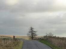
Edgworth is a small village in the civil parish of North Turton, in the borough of Blackburn with Darwen, Lancashire, England. It is between Broadhead Brook on the west and Quarlton Brook in the south east. The ground ranges from 650 feet (200 m) to 1,100 feet (340 m) above sea level.

Turton is a historical area in the North West of England. It is part of the ceremonial counties of Lancashire. The Turton area is located north of Bolton and south of Blackburn. The area historically formed a township in the ancient parish of Bolton le Moors. The principal village in the township is now known as Chapeltown.

<span class="mw-page-title-main">Entwistle, Lancashire</span> Human settlement in England

Entwistle is a village in the civil parish of North Turton, in the Blackburn with Darwen unitary authority area in the ceremonial county of Lancashire, England.

Middle Hulton was a township of the civil and ecclesiastical parish of Deane in the Salford hundred of Lancashire, England. It was located 3.5 miles (5.6 km) south-west of Bolton.

Great Bolton was a township of the civil and ecclesiastical parish of Bolton le Moors in the Salford hundred of Lancashire, England. Despite its name, Great Bolton had a smaller acreage than its northern neighbour Little Bolton from which it was separated by the River Croal.

<span class="mw-page-title-main">Little Bolton</span> Former township in Lancashire

Little Bolton was a township of the civil and ecclesiastical parish of Bolton le Moors in the Salford hundred of Lancashire, England. Besides the main part of Little Bolton, it had three detached parts which were separated by areas of Lower Sharples and Higher Sharples. Despite its name, Little Bolton had a larger acreage than its southern neighbour Great Bolton, from which it was separated by the River Croal.

Tonge with Haulgh was a township of the civil and ecclesiastical parish of Bolton le Moors in the Salford hundred of Lancashire, England.

<span class="mw-page-title-main">Quarlton</span>

Quarlton was a township of the civil and ecclesiastical parish of Bolton le Moors in the Hundred of Salford, Lancashire, England. It lay 4+12 miles (7.2 km) north east of Bolton. In 1891 the parish had a population of 251.

Sharples, a suburb of Bolton, was a township of the civil and ecclesiastical parish of Bolton le Moors in the Salford hundred of Lancashire, England. It lay 2+12 miles north of Bolton. It contained the smaller settlements of Banktop, Sweet-Loves, High-Houses, Gale, Folds, Belmont, Piccadilly, Water-Meetings, Old Houses and part of Astley Bridge.

<span class="mw-page-title-main">Westhoughton Urban District</span>

Westhoughton was, from 1872 to 1974, a local government district centred on the town of Westhoughton in the administrative county of Lancashire, England.

References

  1. Great Britain Historical GIS Project (2004). "Longworth CP/Tn through time. Population Statistics. Area (acres)". A vision of Britain through time. University of Portsmouth. Retrieved 26 August 2010.
  2. 1 2 3 4 5 Farrer, William; Brownbill, J., eds. (1911). "Longworth". A History of the County of Lancaster: Volume 5. British History Online. pp. 285–286. Retrieved 26 August 2010.
  3. Lindop, Roy (1978). Turton Tales: A Collection of Historical Family Stories. Turton Local History Society. p. 6. ISBN   978-1-904974-03-1.
  4. Lewis, Samuel, ed. (1848), "Bolton-Le-Moors (St. Peter)", A Topographical Dictionary of England, British History Online, pp. 295–302, retrieved 26 August 2010
  5. "Local Authority Records: Townships And Civil Parishes". Bolton Museum and Archive Service. Archived from the original on 29 May 2008. Retrieved 26 August 2010.
  6. "History of Longworth, in Blackburn with Darwen and Lancashire". A Vision of Britain through Time . Retrieved 16 May 2024.
  7. "Bolton, Lancashire". The Workhouse. Archived from the original on 5 June 2011. Retrieved 9 August 2010.
  8. "Relationships and changes Longworth CP/Tn through time". A Vision of Britain through Time. Retrieved 16 May 2024.
  9. "Greater Manchester Gazetteer". Greater Manchester County Record Office. Archived from the original on 18 July 2011. Retrieved 26 August 2010.
  10. Longworth Township Boundaries, GenUKI, retrieved 27 August 2010
  11. Tatton, Pauline. Local population statistics 1801–1986. Bolton: Bolton Central Library Archives.
  12. Great Britain Historical GIS Project (2004). "Longworth CP/Tn through time. Population Statistics. Total Population". A vision of Britain through time. University of Portsmouth. Retrieved 26 August 2010.

53°58′36″N2°52′29″W / 53.9767°N 2.8748°W / 53.9767; -2.8748