
Fresnillo is a city in north central Mexico, founded in 1554 by Francisco de Ibarra. It is the second largest city in Zacatecas state and the seat of Fresnillo municipality. As a rail and highway junction, Fresnillo is the center of a rich mining area known especially for silver, and the location of one of the world's richest silver mines, the Mina Proaño or Fresnillo Mine, which belongs to the Peñoles mining company. Other important economic activities include agriculture, cattle raising, and a mining school. Fresnillo is also the municipal seat of the municipality of the same name which surrounds it. The municipality had a population of 196,538 and an areal extent of 4,947 square kilometres (1,910 sq mi).

Asientos is a municipality in the Mexican state of Aguascalientes. It stands at 22°14′N102°05′W. The town of Real de Asientos serves as the municipal seat for the surrounding municipality of Asientos.

Zacatecas is a state in North Central Mexico that is divided into 58 municipalities. According to the 2020 Mexican census, it is the state that has the 7th smallest population with 1,622,138 inhabitants and the 8th largest by land area spanning 75,275.3 square kilometres (29,064.0 sq mi).

Loreto is a municipality in the Mexican state of Baja California Sur. It was created in 1992 from the partition of the neighboring Comondú Municipality. The municipal seat is in the town of Loreto, which was the former capital of Las Californias during Spanish colonial times.

Ojuelos de Jalisco is a colonial town and municipality in the state of Jalisco, Mexico. The town's 1990 population was 7,265, although by the year 2010 it had increased to 11,881.
Villa de Ramos is a municipality in the Mexican state of San Luis Potosi, Mexico.

San Luis de la Paz is a city, and the surrounding municipality of the same name, located in the northeastern part of the state of Guanajuato in Mexico. San Luis de la Paz was founded on August 25, 1552, as a defensive town on the Spanish Silver Road, which linked the Zacatecas mines with Mexico City during the Spanish domination. It owes its name to the peace treaty between Otomi Indians, who were Spaniard allies, and the native Chichimecas, on the day of Saint Louis of France, August 25. San Luis de la Paz is also known as the Chichimeca Nation.
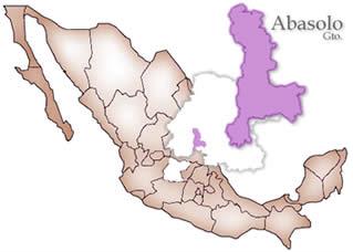
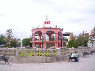
Abasolo is a Mexican city located in the Southwest region of the state of Guanajuato. The municipality has an area of 601.73 square kilometres, and is bordered to the north by Pueblo Nuevo and Valle de Santiago, to the south by the state of Michoacán and Huanímaro, and to the west by Pénjamo and Cuerámaro. The municipality had 79,093 inhabitants according to the 2005 census. The city was estimated to have 28,100 inhabitants in 2020.
Cuerámaro is a Mexican city located in Southwest region of the state of Guanajuato. The municipality has an area of 254.85 square kilometres and is bordered to the north by Romita, to the east by Abasolo, to the south by Pénjamo, and to the west by Manuel Doblado. The municipality had a population of 25,610 inhabitants according to the 2005 census.

Nochistlán is one of the 58 municipalities in the Mexican state of Zacatecas. Founded by the Caxcanes, it was also the first site of Guadalajara in Mexico.

Calera is one of the 58 municipalities in the Mexican state of Zacatecas. It is located on the central part of the state of Zacatecas and it is bounded by the municipalities of General Enrique Estrada, Fresnillo, Villa de Cos, Pánuco, Morelos and Zacatecas. The municipality covers a total surface area of 389 square kilometers (150 sq mi). The municipality makes up for 0.5% of the area of the state of Zacatecas.
The town of Tierra Blanca is located in the municipality of Loreto in the Mexican state of Zacatecas. It has 2137 inhabitants. Tierra Blanca is 2077 meters above sea level. It is also the birthplace of Benjamín "El Maestro" Galindo. Tierra Blanca is also the birthplace of Omar Ortiz, lead singer of Pequeños Musical. Tierra Blanca is a very quiet and rural town. People often emigrate to the United States, to cities such as Los Angeles, Chicago, and Denver. There is also a "Garden", which is also referred to as "El Jardin." This is the setting where concerts, firework shows, etc., take place.

Ahualulco is a town and municipality in the Mexican state of San Luis Potosí in central Mexico. As of 2010, the municipality had a total population of 4,492. It was the birthplace of composer Julián Carrillo.
Villa García Municipality is one of the 58 municipalities of the state of Zacatecas, Mexico. It is located 140 kilometers from the city of Zacatecas.

Angamacutiro is a municipality in the Mexican state of Michoacán. It is located in the far north portion of the state and its municipal seat is the city of Angamacutiro de la Unión. The name "Angamacutiro" originates from the Uapeani, Pauacume, and Tariácuri native indigenous languages, where it denotes "place on the edge of the canyon" or "lugar al borde de la barranca." This name highlights the region's proximity to a canyon's cliff edge, which is a reflection of its geographic features.
Río Grande is a municipality in the Mexican state of Zacatecas.
Saín Alto is a municipality in the Mexican state of Zacatecas, located approximately 110 kilometres (68 mi) northwest of the state capital of Zacatecas City.

Noria de Ángeles is a municipality in the Mexican state of Zacatecas, located approximately 75 kilometres (47 mi) southeast of the state capital of Zacatecas City.

Luis Moya is a municipality in the Mexican state of Zacatecas, located approximately 50 kilometres (31 mi) southeast of the state capital of Zacatecas City. It is named after Luis Moya (1855–1911), a colonel in the Mexican Revolution who was posthumously given the rank of brigadier general in 1939.

Susticacán is a municipality in the Mexican state of Zacatecas, located approximately 55 kilometres (34 mi) west of Zacatecas City, the state capital.


