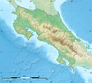
Costa Rica is located on the Central American Isthmus, surrounding the point 10° north of the equator and 84° west of the prime meridian. It has 212 km of Caribbean Sea coastline and 1,016 on the North Pacific Ocean.

A transboundary protected area (TBPA) is an ecological protected area that spans boundaries of more than one country or sub-national entity. Such areas are also known as transfrontier conservation areas (TFCAs) or peace parks.
National System of Conservation Areas is part of the Ministry of Environment and Energy (MINAE) of Costa Rica. It is the administrator for the nation's national parks, conservation areas, and other protected natural areas.

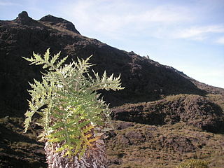
Tapantí - Cerro de la Muerte Massif National Park,, is a national park in the Central Conservation Area of Costa Rica located on the edge of the Talamanca Range, near Cartago. It protects forests to the north of Chirripó National Park, and also contains part of the Orosí River. The area known as Cerro de la Muerte Massif was added to the park on January 14, 2000.

The blue-sided leaf frog, also known as the orange-eyed leaf frog, is an endangered species of tree frog in the subfamily Phyllomedusinae native to the tropical rainforests of Costa Rica and Panama. The specific name annae honors Ann S. Duellman, the collector of the holotype and the describer's wife.

Santa Rosa National Park, is a national park, in Guanacaste Province, northwestern Costa Rica, it was created in 1966 by decree 3694.

The Cordillera de Talamanca is a mountain range that lies in the southeast half of Costa Rica and the far west of Panama. Much of the range and the area around it is included in La Amistad International Park, which also is shared between the two countries.
Maquenque Wildlife Refuge, is a protected area in Costa Rica, managed under the Arenal Huetar Norte Conservation Area, it was created in 2005 by decree 32405-MINAE.

Las Baulas de Guanacaste Marine National Park is a National Park of Costa Rica and a Ramsar Site. The park is managed by the Tempisque Conservation Area, and covers approximately a 167.3 square kilometres (64.6 sq mi) marine area of the Tamarindo Bay, next to the town of Tamarindo. It supports the largest nesting colony of leatherback sea turtles on the Pacific coast of the Americas. Female leatherbacks often come ashore at Playa Grande between October and May to lay their eggs.
Barbudal Hillocks Biological Reserve is a nature reserve of Costa Rica, part of the Arenal Tempisque Conservation Area, that covers an area of 6,536 acres (26 km2) in the Guanacaste Province, 15 kilometers southwest of Bagaces. The Barbudal hillocks are an ignimbritic plateaux which end in rocky cliffs that rise to 125 metres above the Tempisque River.

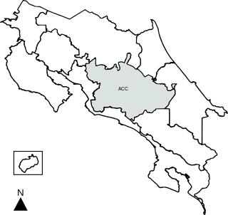
Central Conservation Area, is an administrative area which is managed by SINAC for the purposes of conservation in the central part of Costa Rica, notably the volcanic areas of the Cordillera Central. It contains six National Parks, several wildlife refuges and other types of nature reserves.

Chirripó National Park is a national park of Costa Rica, encompassing parts of three provinces: San José, Limón and Cartago. It was established in 1975.

The Talamancan montane forests ecoregion, in the tropical moist broadleaf forest biome, are in montane Costa Rica and western Panama in Central America.
The Protected areas of Portugal are classified under a legal protection statute that allows for the adequate protection and maintenance of biodiversity, while providing services for ecosystem that maintains the natural and geological patrimony.

The La Amistad International Park, or in Spanish Parque Internacional La Amistad, formerly the La Amistad National Park, is a transboundary protected area in Latin America, management of which is shared between Costa Rica and Panama, following a recommendation by UNESCO after the park's inclusion in the World Heritage Site list in 1983. The park and surrounding biosphere reserve is one of the most outstanding conservation areas in Central America, preserving a major tract of tropical forest wilderness. It is world-renowned for its extraordinary biodiversity and endemism.

Los Quetzales National Park, located 97 kilometers from San Isidro de El General, in Costa Rica, was created in 2006 by decree 32981-MINAE. It is managed under the Central Conservation Area of the National System of Conservation Areas.
Macho River Forest Reserve, is a protected area in Costa Rica, managed under the Central Conservation Area, it was created in 1964 by executive decree 3417.
Vueltas Hill Biological Reserve, is a protected area in Costa Rica, managed under the Central Conservation Area, it was created in 1994 by decree 23260-MIRENEM.
Jairo Mora Sandoval Gandoca-Manzanillo Mixed Wildlife Refuge, is a protected area in Costa Rica, managed under the Caribbean La Amistad Conservation Area, it was created in 1986 by decree. It protects both a land portion as well as a marine portion. In 2013 the refuge was renamed to honour the murdered environmentalist Jairo Mora Sandoval. In 2014 land along the coast containing a number of small towns was removed from the refuge, due to complaints from the local residents about evictions and destruction of property due to strict building codes. It is one of only two places in Costa Rica where manatees still occur. It is located in a coastal beach region, fronted by coral reefs and clothed in tropical forest, with 1950-3000mm yearly precipitation.


