
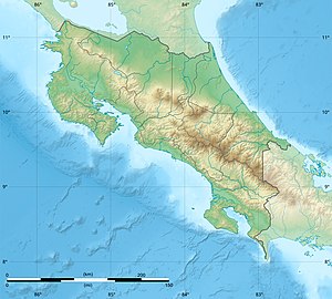
Costa Rica is located on the Central American Isthmus, surrounding the point 10° north of the equator and 84° west of the prime meridian. It has 212 km of Caribbean Sea coastline and 1,016 on the North Pacific Ocean.

A transboundary protected area (TBPA) is an ecological protected area that spans boundaries of more than one country or sub-national entity. Such areas are also known as transfrontier conservation areas (TFCAs) or peace parks.
National System of Conservation Areas is part of the Ministry of Environment and Energy (MINAE) of Costa Rica. It is the administrator for the nation's national parks, conservation areas, and other protected natural areas.

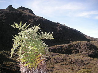
Tapantí - Cerro de la Muerte Massif National Park,, is a national park in the Central Conservation Area of Costa Rica located on the edge of the Talamanca Range, near Cartago. It protects forests to the north of Chirripó National Park, and also contains part of the Orosí River. The area known as Cerro de la Muerte Massif was added to the park on January 14, 2000.

The blue-sided leaf frog, also known as the orange-eyed leaf frog, is an endangered species of tree frog in the subfamily Phyllomedusinae native to the tropical rainforests of Costa Rica and Panama. The specific name annae honors Ann S. Duellman, the collector of the holotype and the describer's wife.

Santa Rosa National Park, is a national park, in Guanacaste Province, northwestern Costa Rica, it was created in 1966 by decree 3694.
Chirripó National Park is a national park of Costa Rica, encompassing parts of three provinces: San José, Limón and Cartago. It was established in 1975.

Cutervo National Park , established in 1961, is the oldest protected area in Peru. It is located in the northern Peruvian Andes, in the region of Cajamarca. The park was extended to 8,214 hectares (31.71 sq mi) and protects areas of Andean montane forests and paramo for headwater conservation. Moreover, those areas are the habitat of animal species like the spectacled bear, the mountain tapir, and the oilbird; and plant species like the Andean wax palms.

Lagoa do Peixe National Park is a national park in the state of Rio Grande do Sul, Brazil. It was created in 1986 to protect a wintering zone for migratory birds along the Lagoa dos Patos, the estuary of the Guaiba river or Guaíba Lake about 200 kilometres (120 mi) south of Porto Alegre.

La Marquesa National Park, with the official name Parque Nacional Insurgente Miguel Hidalgo y Costilla, is a National park in the State of Mexico, in central Mexico.

Anavilhanas National Park is a national park that encompasses a huge river archipelago in the Rio Negro in the state of Amazonas, Brazil. It is part of a World Heritage Site.
The Protected areas of Portugal are classified under a legal protection statute that allows for the adequate protection and maintenance of biodiversity, while providing services for ecosystem that maintains the natural and geological patrimony.

The La Amistad International Park, or in Spanish Parque Internacional La Amistad, formerly the La Amistad National Park, is a transboundary protected area in Latin America, management of which is shared between Costa Rica and Panama, following a recommendation by UNESCO after the park's inclusion in the World Heritage Site list in 1983. The park and surrounding biosphere reserve is one of the most outstanding conservation areas in Central America, preserving a major tract of tropical forest wilderness. It is world-renowned for its extraordinary biodiversity and endemism.

Laguna de la Restinga is a national park on the Isla Margarita, Nueva Esparta state, Venezuela. The main part of the park is a large salt lagoon, rich in fish and birdlife. It is on the Ramsar list of wetlands of international importance, and is classified as an Important Bird Area.
Protected areas of Panama include:
Los Santos Forest Reserve, is a protected area in Costa Rica, managed under the Central Conservation Area and Pacific La Amistad Conservation Area, it was created in 1975 by decree 5389-A.
Macho River Forest Reserve, is a protected area in Costa Rica, managed under the Central Conservation Area, it was created in 1964 by executive decree 3417.
Vueltas Hill Biological Reserve, is a protected area in Costa Rica, managed under the Central Conservation Area, it was created in 1994 by decree 23260-MIRENEM.

