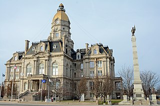
Lost Creek Township, Vigo County, Indiana

Last updated

Lost Creek Township
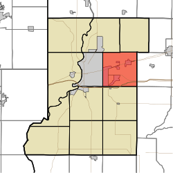
Map highlighting Lost Creek Township, Vigo County, Indiana.svg
Location in Vigo County
Coordinates: 39°28′38″N87°17′40″W / 39.47722°N 87.29444°W / 39.47722; -87.29444
Country United States
State Indiana
County Vigo
Government
  Type Indiana township
Area
  Total35.77 sq mi (92.6 km2)
  Land35.23 sq mi (91.2 km2)
  Water0.54 sq mi (1.4 km2)  1.51%
Elevation
564 ft (172 m)
Population
 (2020) [1]
  Total11,199
  Density297.9/sq mi (115.0/km2)
ZIP codes
47803, 47805, 47834
GNIS feature ID 453581

Lost Creek Township is one of twelve townships in Vigo County, Indiana, United States. As of the 2010 census, its population was 10,497 and it contained 4,236 housing units. [2] It contains Terre Haute, Indiana's eastern, suburban end, along with the affluent Hulman family ranch and the Terre Haute International Airport originally named after the family. Seelyville, the third largest city in the county, is also located there.

Contents

History

Lost creek township was founded in 1831

Vigo County Home for Dependent Children was listed on the National Register of Historic Places in 2000. [3]

Geography

According to the 2010 census, the township has a total area of 35.77 square miles (92.6 km2), of which 35.23 square miles (91.2 km2) (or 98.49%) is land and 0.54 square miles (1.4 km2) (or 1.51%) is water. [2]

Cities, towns, villages

Unincorporated communities

Adjacent townships

Cemeteries

The township contains at least these sixteen named cemeteries: Baker-Coltrin, Babtist-Moses, Calvary, Chamberlain, Cheek, Dickerson, Highland Lawn, Hobmeyer-Trueblood-Ladd-Habermeyer, Hoskins, Hyde, Mewhinney, Patterson, Roberts, Swalls, Turner-Shcolfield, and Wood. As well as at least four unnamed family plots.

Airports and landing strips

Lakes/ Reservoirs

Housing Developments

Demographics

According to the census [4] of 2000, there were 9,907 people and 3,968 households residing in the township. In the 2020 census, a recorded 11,199 people lived in Lost Creek township, showing a 13% increase from 2000. The population density was 281/mi2. The racial makeup of the township is 86.91% White, 2.61% Black or African American, 0.19% Native American, 4.42% Asian, less than 0.1% Pacific Islander, 0.91% from other races, and 4.97% from two or more races. 2.96% of the population were Hispanic or Latino of any race.

The average household size was 2.44 and the average family size was 2.98. The median age was 34.3 years. For every 100 females, there were 113 males.

The median income for a household in the township was $81,198, and the median income for a family was $109,358. The per capita income for the township was $43,000. 12.2% of the population was below the poverty line.

43.2% of the population has a bachelor's degree or higher, with 19% of the population having a graduate degree and 20.7% having no college education and 22.5% having some form of college education but no degree.

4.9% of the school-enrolled population is enrolled in Nursery School/ Preschool, 38.9% is enrolled in kindergarten to 12th Grade,5.8% is enrolled in graduate degree courses, and 50.4% of the school population is enrolled in undergraduate college courses.

57.4% of the population is employed, and the most common employment is Educational Services, Healthcare, and Social Services.

School districts

Political districts

Notable people

Related Research Articles

<span class="mw-page-title-main">Vigo County, Indiana</span> County in Indiana, United States

Vigo County is a county on the western border of the U.S. state of Indiana. According to the 2020 United States Census, it had a population of 106,153. Its county seat is Terre Haute.

<span class="mw-page-title-main">Vermillion County, Indiana</span> County in Indiana, United States

Vermillion County lies in the western part of the U.S. state of Indiana between the Illinois border and the Wabash River. As of the 2020 census, the population was 15,439. The county seat is Newport. It was officially established in 1824 and was the fiftieth Indiana county created. Vermillion County is included in the Terre Haute, Indiana, Metropolitan Statistical Area. The county contains seven incorporated towns with a total population of about 9,900. as well as several unincorporated communities; it is also divided into five townships which provide local services. An interstate highway, two U.S. routes, and five state roads cross the county, as does a major railroad line.

<span class="mw-page-title-main">Sullivan County, Indiana</span> County in Indiana, United States

Sullivan County is a county in the U.S. state of Indiana, and determined by the US Census Bureau to include the mean center of U.S. population in 1940. As of 2020, the population was 20,758. The county seat is Sullivan.

<span class="mw-page-title-main">Parke County, Indiana</span> County in Indiana, United States

Parke County lies in the western part of the U.S. state of Indiana along the Wabash River. The county was formed in 1821 out of a portion of Vigo County. According to the 2020 census, the population was 16,156. The county seat is Rockville.

<span class="mw-page-title-main">Terre Haute, Indiana</span> City in Indiana, United States

Terre Haute is a city in and the county seat of Vigo County, Indiana, United States, about 5 miles (8 km) east of the state's western border with Illinois. As of the 2020 census, the city had a population of 58,389 and its metropolitan area had a population of 168,716.

<span class="mw-page-title-main">Staunton, Indiana</span> Town in Indiana, United States

Staunton is a town in Posey Township, Clay County, Indiana, United States. The population was 534 at the 2010 census. It is part of the Terre Haute Metropolitan Statistical Area.

<span class="mw-page-title-main">Amo, Indiana</span> Town in Indiana, United States

Amo is a town in Clay Township, Hendricks County, Indiana, United States. The population was 408 at the 2020 census.

<span class="mw-page-title-main">Waveland, Indiana</span> Town in Indiana, United States

Waveland is a town in Brown Township, Montgomery County, in the U.S. state of Indiana. The population was 427 at the 2020 census.

<span class="mw-page-title-main">Perrysville, Indiana</span> Town in Indiana, United States

Perrysville is a town in Highland Township, Vermillion County, in the U.S. state of Indiana. The population was 456 at the 2010 census.

<span class="mw-page-title-main">North Terre Haute, Indiana</span> Census-designated place in Indiana, United States

North Terre Haute is a census-designated place (CDP) in Otter Creek Township, Vigo County, in the U.S. state of Indiana. The population was 4,305 at the 2010 census. It is part of the Terre Haute Metropolitan Statistical Area.
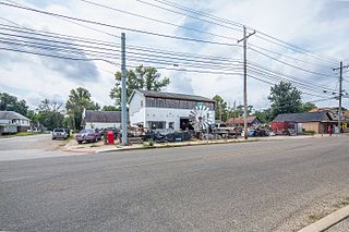
<span class="mw-page-title-main">Riley, Indiana</span> Town in Indiana, United States

Riley, once known as Lockport, is a town in Riley Township, Vigo County, in the U.S. state of Indiana. The population was 221 at the 2010 census. It is part of the Terre Haute Metropolitan Statistical Area.

<span class="mw-page-title-main">Seelyville, Indiana</span> Town in Indiana, United States

Seelyville is a town in Lost Creek Township, Vigo County, in the U.S. state of Indiana. The population was 1,029 at the 2010 census. It is part of the Terre Haute Metropolitan Statistical Area.

<span class="mw-page-title-main">West Terre Haute, Indiana</span> Town in Indiana, United States

West Terre Haute is a town in Sugar Creek Township, Vigo County, Indiana, on the western side of the Wabash River near Terre Haute. The population was 2,236 at the 2010 census. It is part of the Terre Haute Metropolitan Statistical Area. Bethany Congregational Church was placed on the National Register of Historic Places in 2003.

<span class="mw-page-title-main">Harrison Township, Vigo County, Indiana</span> Township in Indiana, United States

Harrison Township is one of twelve townships in Vigo County, Indiana, United States. As of the 2010 census, its population was 51,272 and it contained 22,940 housing units. It is entirely contained in Terre Haute's city limits, thus explaining why it is both the most densely populated and the most populated overall.

<span class="mw-page-title-main">Honey Creek Township, Vigo County, Indiana</span> Township in Indiana, United States

Honey Creek Township is one of twelve townships in Vigo County, Indiana, United States. As of the 2010 census, its population was 17,179 and it contained 6,509 housing units. It contains Terre Haute's main shopping district along U.S. Route 41 and is by far the most characteristically suburban of the twelve Vigo County townships. The population includes inmates from the Terre Haute Federal Penitentiary, located at its northwest corner.

<span class="mw-page-title-main">Otter Creek Township, Vigo County, Indiana</span> Township in Indiana, United States

Otter Creek Township is one of twelve townships in Vigo County, Indiana, United States. As of the 2010 census, its population was 9,069 and it contained 3,917 housing units.

<span class="mw-page-title-main">Prairieton Township, Vigo County, Indiana</span> Township in Indiana, United States

Prairieton Township is one of twelve townships in Vigo County, Indiana, United States. As of the 2010 census, its population was 1,222 and it contained 517 housing units.

<span class="mw-page-title-main">Riley Township, Vigo County, Indiana</span> Township in Indiana, United States

Riley Township is one of twelve townships in Vigo County, Indiana, United States. As of the 2010 census, its population was 3,123 and it contained 1,260 housing units.
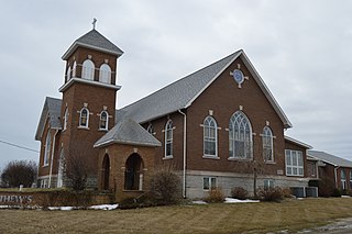
<span class="mw-page-title-main">Thorncreek Township, Whitley County, Indiana</span> Township in Indiana, United States

Thorncreek Township is one of nine townships in Whitley County, Indiana, United States. As of the 2020 census, its population was 4,159 and it contained 1,909 housing units.

<span class="mw-page-title-main">Swalls, Indiana</span> Unincorporated community in Indiana, United States

Swalls is an unincorporated community in Lost Creek Township, Vigo County, in the U.S. state of Indiana. It is part of the Terre Haute metropolitan area.
References

  1. "Census Bureau profile: Lost Creek Township, Vigo County, Indiana". United States Census Bureau. May 2023. Retrieved March 21, 2024.
  2. 1 2 "Population, Housing Units, Area, and Density: 2010 - County -- County Subdivision and Place -- 2010 Census Summary File 1". United States Census. Archived from the original on February 10, 2020. Retrieved May 10, 2013.
  3. "National Register Information System". National Register of Historic Places . National Park Service. July 9, 2010.
  4. "U.S. Census website". United States Census Bureau . Retrieved January 31, 2008.