Lydham Hall; Lydham; Lydham Hill; Lydham Hall Museum; Lydham Hall Historic House and Museum
Type
State heritage (built)
Designated
2 April 1999
Referenceno.
477
Type
House
Category
Museum
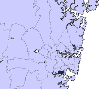
Location of Lydham Hall in Sydney
Show map of Sydney
Lydham Hall (Australia)
Show map of Australia
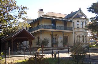
Lydham Hall is a state heritage-listed former rural residence at 18 Lydham Avenue, Rockdale in New South Wales, Australia. The house is currently used as a local museum holding a collection of furniture and objects dated from the 1860s. Run by the St George Historical Society, it is opened to the public on the first Sunday of every month.
The parcel of land where the house now stands was originally part of the 1200 acres named Bexley granted to James Chandler. Joseph Davis purchased the site in November 1859. The property was initially named Lidham Hill, but the house within the current land parcel later became known as Lydham Hall. The building was completed in 1878-1879.[1] It stands on the highest point of land between the Cooks River and the Georges River. The street previously known as Joseph Street was re-named Lydham Avenue in 1917 at the request of one of the neighbouring property owners. In 1970, Lydham Hall was purchased by the Rockdale Municipal Council. Since the 2016 council amalgamation, the property has been owned by the Bayside Council. Initially, Permanent Conservation Order No 477 in pursuance of section 44 of the Heritage Act 1977 was applied to the property on 20 August 1986.[2] Since the implementation of the New South Wales State Heritage Register in 1999, Lydham Hall has been included on the State Heritage Register[1]:5 and Council's Local Environmental Plan.[3]:31
History
The parcel of land on which Lydham Hall stands was part of the original 1200 acres of land granted to James Chandler which was named Bexley. Chandler's agricultural ventures were not successful and eventually the property was mortgaged, subdivided and sold.
On 1 November 1859, wealthy master butcher, Joseph Davis bought 67 acres of Chandler's original grant. Davis used the property for resting and fattening cattle before slaughtering them in his Arncliffe slaughter-house on land in Arncliffe he purchased six months earlier.[2]
Joseph Davis was born in the village of Brede in Sussex in 1826, came to New South Wales in 1847 and set up business in Newtown, possibly first as a publican and then as a butcher. On 28 October 1850, he married 17 year old Ellen Turner at Scots Church, Sydney. They had seven children, all born between 1851 and 1875.
Davis was also a prominent man in Bexley and a generous benefactor to Christ Church, Bexley. He was one of the petitioners who advocated in 1885 and 1886 for the establishment of a local school in the area.[1]:85,88–89[2]:20 The school, currently known as Bexley Public School, was open in 1887.[2]:21[3]:39
Davis engaged local Swedish stonemasons, the Benson brothers, to construct a house on the highest point of the estate to have sweeping views of Botany Bay. The house was built "sometime between 1872 and 1879 with its completion and opening taking place between 10 June 1878 and 10 June 1879 or very shortly afterwards".[1]
In 1882, Davis applied to convert the land to Torrens Title, and began to subdivide and sell his land. The streets formed as a result of this subdivision were named after Davis' two youngest sons, Frederick and Herbert, and his eldest grandson, Clarence.
After Joseph Davis' death, Ellen Davis finalised the subsequent subdivision and sold Lydham Hill to Frederick John Gibbins, a successful oyster merchant and trawling magnate, who lived nearby at Dappeto (now known as Macquarie Lodge). Ellen Davis moved to Newtown and died in her residence at Kensington House, 98 Wilson Street, Newtown, in 1906. Davis' second son, also Joseph Davis, ran the original butcher's shop at 255-257 King Street, Newtown.[2]
Gibbins leased out Lydham Hill up until 1907. When his daughter Ada married David George Stead, a widower and father of Australian writer Christina Stead,[4] the newly-weds and Christina settled in Lydham Hill, paying "a very small rent".[5]:8[2]:27
During the following ten years, Ada gave birth to six children. A great storyteller, young Christina would entertain her half brothers and sisters with tales and poems. A few of Christina's short stories and her most known and popular work, The Man Who Loved Children, were based on her experiences while living in Lydham Hall in 1910-1917.[2][5] Lydham Hall is the only house in Australia open to the public where Christina Stead lived.[5]
Gibbins died in 1917 and left no particular instructions for Lydham Hill. Sometime before the Steads moved out in 1917, the property became known as Lydham Hall. Dealings with all Gibbins' properties were left at the discretion of the executors of his will, oldest daughter Emma (Pattison) and son-in-law and accountant, husband of Gibbins' daughter Amy, William Thom. Thom and Pattison subdivided and sold both Dappeto and Lydham Hill. The Steads moved to Watsons Bay.
Lydham Hall was purchased by the Rockdale Municipal Council in 1970 in order "to preserve the building",[6] and was opened on 20 February 1971 to the public as a museum. The purchase and museum opening were part of the Rockdale Municipality centenary celebration.[2]:29 It became a home to the first and only local museum within the area.[3]:20 The Lydham Hall Historic House and Museum houses a collection consisting largely of items donated by the local and wider community,[3]:36 and displays furniture on loan from the National Trust of Australia (NSW).[3]:19[7][8] The establishment of the museum and its collection became the longest social project that combined the efforts of the local residents, the local council and the St George Historical Society.[2]:31
Description
The building of Lydham Hall commenced no earlier than 1875,[citation needed] and was completed no later than 1879.[1]:92 This well preserved example of the early Australian rural homestead contains four large rooms, each 14x20' with a 10' wide centrally placed hall. A narrow staircase at the southern side of the hall reaches two upper rooms, each 18' 6" square lit by near dormer windows. Full length windows face north, east and south to take advantage of the cool sea breezes whilst those facing west are conventionally smaller to keep the hot westerlies at bay.
A verandah once extended around all four sides of the house supported on open work cast iron columns. The hip roof of the house is covered with blue slates and there are a series of small decorated brackets beneath the narrow eaves. The two wide chimneys are of unusual design and each has a drip skirt placed above the flashing.
Related Research Articles
Christina Stead was an Australian novelist and short-story writer acclaimed for her satirical wit and penetrating psychological characterisations. Christina Stead was a committed Marxist, although she was never a member of the Communist Party. She spent much of her life outside Australia, although she returned before her death.
Beverly Hills is a southern suburb of Sydney, in the state of New South Wales, Australia. Beverly Hills is located 15 kilometres southwest of the Sydney central business district and is part of the St George area and is split between the local government areas of the Georges River Council and the City of Canterbury-Bankstown. The postcode is 2209, which it shares with neighbouring Narwee.
Hurstville is a suburb in Southern Sydney, New South Wales, Australia. It is 16 km (9.9 mi) south of the Sydney CBD and is part of the St George area. Hurstville is the administrative centre of the local government area of the Georges River Council.
Southern Sydney is the southern metropolitan area of Greater Sydney, in the state of New South Wales, Australia.
The City of Kogarah was a local government area in the St George region of southern Sydney, in the state of New South Wales, Australia. The centre of the city is located 14 kilometres (8.7 mi) south-west of the Sydney central business district and west of Botany Bay.
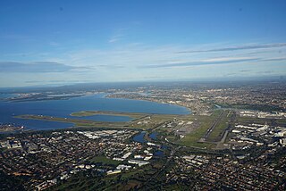
The St George region of Sydney is part of the southern suburbs of Sydney, in the state of New South Wales, Australia. The area includes all the suburbs in the local government area of Georges River Council and the part of Bayside Council which was Rockdale City prior to 2016. This is everything within the boundaries of Salt Pan Creek to the west, The Georges River to the south, Botany Bay to the east and the M5 Motorway and Wolli Creek to the north. This area corresponds to the southern portion of the cadastral Parish of St George, from which the region derives its name and the area was later covered by the St George County Council, the electricity supplier for the councils in this region. This southern portion of the parish below The M5 and Wolli Creek is the more contemporary definition of The St George Region that is considered part of Southern Sydney.
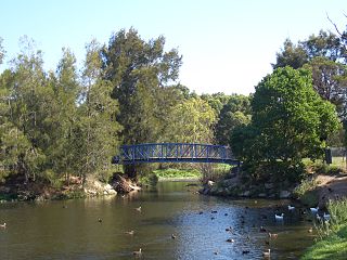
Rockdale is a suburb in southern Sydney, in the state of New South Wales, Australia. Rockdale is located 13 kilometres south of the Sydney central business district and is part of the St George area. Rockdale is one of the administrative centres for the local government area of the Bayside Council. Since 1985 Rockdale has been a twinned city with Bitola, in the Republic of Macedonia.
Turrella (;) is a suburb in southern Sydney, in the state of New South Wales, Australia. Turrella is located 10 km south-west of the Sydney central business district on the southern bank of Wolli Creek in the local government area of Bayside Council.
Bexley North is a suburb in southern Sydney, in the state of New South Wales, Australia, 13 kilometres south-west of the Sydney CBD. It is part of the St George area. Bexley North is in the local government area of the Bayside Council.
Banksia is a suburb in southern Sydney, in the state of New South Wales, Australia. Banksia is located 12 kilometres south of the Sydney central business district, in the local government area of the Bayside Council and is part of the St George area.
Bexley is a suburb in southern Sydney, in the state of New South Wales, Australia. Bexley is located 14 kilometres (8.7 mi) south-west of the Sydney central business district, in the local government area of the Bayside Council and is part of the St George area.
Rockdale is an electoral district of the Legislative Assembly in the Australian state of New South Wales.
St George was an electoral district of the Legislative Assembly in the Australian state of New South Wales, named after the St George district. It was originally created in 1894, when multi-member districts were abolished, and the four member Canterbury was largely divided between Ashfield, Burwood, Canterbury, Petersham and St George. In 1920, with the introduction of proportional representation, St George was expanded to a five-member district, absorbing the electoral districts of Canterbury and Hurstville. Proportional representation was abolished in 1927, and St George was divided into the single member electorates of St George, Canterbury, Hurstville, Oatley and Rockdale. St George was abolished in 1930, being partly replaced by Arncliffe.
John Francis McGrath was an Australian politician and a member of the New South Wales Legislative Assembly from 1941 until 1959. He was a member of the NSW Branch of the Australian Labor Party and held a number of ministerial positions including Minister for Housing.
Douglas Babbington Gardiner was an Australian architect active in the mid 20th century as a partner of Bates Smart & McCutcheon.
Georges River Council is a local government area located in the St George region of Sydney located south of the Sydney CBD, in New South Wales, Australia. The Council was formed on 12 May 2016 from the merger of the Hurstville City Council and Kogarah City Council.
Bayside Council is a local government area in Sydney, New South Wales, Australia. It is located around part of Botany Bay, 7 kilometres (4.3 mi) to 12 kilometres (7.5 mi) south of the Sydney CBD. It includes suburbs of Southern Sydney as well as a portion in the Eastern Suburbs. It comprises an area of 50 square kilometres (19 sq mi) and as at the 2016 census had a population of 156,058.
The Municipality of Bexley was a local government area in the St George region of Sydney, New South Wales, Australia. The municipality was proclaimed as the Borough of Bexley on 28 June 1900 when it formally separated from the Municipal District of Hurstville, and included the modern suburbs of Bexley, Bexley North and Kingsgrove, with parts of Carlton, Bardwell Park, Bardwell Valley, Rockdale and Kogarah. From 1 January 1949, the council was amalgamated into the Municipality of Rockdale, with the passing of the Local Government (Areas) Act 1948.
Dappeto is a heritage-listed residence at 171 Wollongong Road, Arncliffe, New South Wales, Australia. It was built in 1885 by Frederick Gibbins. It is also known as Macquarie Lodge and Dapetto. The property is owned by the Salvation Army. It was added to the New South Wales State Heritage Register on 2 April 1999.
Wikimedia Commons has media related to Lydham Hall.
Pelosi, Janette, Lydham Hall Heritage Listing Research, v2, June 2023, Unpublished
Lydham Hall. Bricks and Mortar, The Golden Jubilee Edition, 2021 Compiled by Olga Sedneva, Edited by Wesley Fairhall, Consultant Anne Field. ISBN978-0-909878-12-2
Sedneva, Olga, Lydham Hall, Beyond Bricks and Mortar. From Colonial Times to 2000. Editor Wesley Fairhall. Submission to 2021 Ron Rathbone Local History Prize. ISBN978-0-6487449-6-2
This page is based on this Wikipedia article Text is available under the CC BY-SA 4.0 license; additional terms may apply. Images, videos and audio are available under their respective licenses.