Lyndon Station, Wisconsin

Last updated

Lyndon Station, Wisconsin
Lyndon Station Wisconsin Downtown Looking north US12 WIS16.jpg
Looking north at Lyndon Station on US12 / WIS16
Juneau County Wisconsin Incorporated and Unincorporated areas Lyndon Station Highlighted.svg
Location of Lyndon Station in Juneau County, Wisconsin.
Coordinates: 43°42′42″N89°53′52″W / 43.71167°N 89.89778°W / 43.71167; -89.89778
Country Flag of the United States.svg  United States
State Flag of Wisconsin.svg  Wisconsin
County Juneau
Government
  Village PresidentLarry A. Whaley Jr.
Area
[1]
  Total2.11 sq mi (5.47 km2)
  Land2.11 sq mi (5.47 km2)
  Water0.00 sq mi (0.00 km2)
Elevation
[2]
902 ft (275 m)
Population
 (2010) [3]
  Total500
  Estimate 
(2019) [4]
484
  Density229.06/sq mi (88.42/km2)
Time zone UTC-6 (Central (CST))
  Summer (DST) UTC-5 (CDT)
Area code 608
FIPS code 55-46600 [5]
GNIS feature ID1568844 [2]
Website lyndonstationwi.org

Lyndon Station is a village in Juneau County, Wisconsin, United States. The population was 500 at the 2010 census.

Contents

Geography

Downtown Lyndon Station on County HH Lyndon Station Wisconsin Downtown Looking northeast County HH.jpg
Downtown Lyndon Station on County HH

Lyndon Station is located at 43°42′42″N89°53′52″W / 43.71167°N 89.89778°W / 43.71167; -89.89778 (43.711725, -89.897805). [6]

According to the United States Census Bureau, the village has a total area of 1.99 square miles (5.15 km2), all of it land. [7]

Religion

Lyndon Station is served by two religious institutions. St. Bridget's was established in 1851 by early Irish settlers in the area. The name was changed to St. Mary's in 1877, and the present edifice was built in 1899. It is one of the oldest parishes in the Diocese of La Crosse and because of this it is historically referred to as the Mother Church of the Dells Area. In 1877, the parish established a Parochial school which closed in 1968 due to the difficulty of finding Sisters to staff it.

A small Lutheran congregation, St. Luke's, has existed since about 1890. The church was built in 1897 and remains in use today.

Demographics

Historical population
CensusPop.Note
1880 164
1890 136−17.1%
1910 275
1920 2926.2%
1930 276−5.5%
1940 35428.3%
1950 3776.5%
1960 335−11.1%
1970 53359.1%
1980 375−29.6%
1990 47426.4%
2000 458−3.4%
2010 5009.2%
2019 (est.)484 [4] −3.2%
U.S. Decennial Census [8]

2010 census

As of the census [3] of 2010, there were 500 people, 220 households, and 137 families living in the village. The population density was 251.3 inhabitants per square mile (97.0/km2). There were 247 housing units at an average density of 124.1 per square mile (47.9/km2). The racial makeup of the village was 96.6% White, 0.2% African American, 0.4% Native American, 0.2% Asian, 1.6% from other races, and 1.0% from two or more races. Hispanic or Latino of any race were 3.2% of the population.

There were 220 households, of which 24.1% had children under the age of 18 living with them, 40.9% were married couples living together, 12.7% had a female householder with no husband present, 8.6% had a male householder with no wife present, and 37.7% were non-families. 30.5% of all households were made up of individuals, and 13.2% had someone living alone who was 65 years of age or older. The average household size was 2.27 and the average family size was 2.74.

The median age in the village was 43.8 years. 18.2% of residents were under the age of 18; 10.4% were between the ages of 18 and 24; 22.6% were from 25 to 44; 30% were from 45 to 64; and 18.8% were 65 years of age or older. The gender makeup of the village was 52.6% male and 47.4% female.

2000 census

Sign for Lyndon Station Lyndon Station Wisconsin Sign US12 WIS16.jpg
Sign for Lyndon Station

As of the census [5] of 2000, there were 458 people, 213 households, and 129 families living in the village. The population density was 229.8 people per square mile (88.9/km2). There were 235 housing units at an average density of 117.9 per square mile (45.6/km2). The racial makeup of the village was 95.63% White, 0.44% African American, 1.97% Native American, 0.87% Asian, 0.44% from other races, and 0.66% from two or more races. Hispanic or Latino of any race were 1.53% of the population.

There were 213 households, out of which 24.9% had children under the age of 18 living with them, 44.1% were married couples living together, 9.4% had a female householder with no husband present, and 39.4% were non-families. 33.8% of all households were made up of individuals, and 16.9% had someone living alone who was 65 years of age or older. The average household size was 2.15 and the average family size was 2.72.

In the village, the population was spread out, with 22.7% under the age of 18, 5.7% from 18 to 24, 26.4% from 25 to 44, 25.1% from 45 to 64, and 20.1% who were 65 years of age or older. The median age was 43 years. For every 100 females, there were 95.7 males. For every 100 females age 18 and over, there were 95.6 males.

The median income for a household in the village was $27,059, and the median income for a family was $32,404. Males had a median income of $28,000 versus $22,426 for females. The per capita income for the village was $16,127. About 6.9% of families and 9.7% of the population were below the poverty line, including 9.8% of those under age 18 and 6.7% of those age 65 or over.

Notable residents

Related Research Articles

<span class="mw-page-title-main">Pardeeville, Wisconsin</span> Village in Wisconsin, United States

Pardeeville is a village in Columbia County, Wisconsin, United States. The population was 2,115 at the 2010 census. It is part of the Madison Metropolitan Statistical Area.

<span class="mw-page-title-main">Poynette, Wisconsin</span> Village in Wisconsin, United States

Poynette is a village in Columbia County, Wisconsin, United States. The population was 2,575 at the 2022 United States census. It is part of the Madison Metropolitan Statistical Area.

<span class="mw-page-title-main">Rio, Wisconsin</span> Village in Wisconsin, United States

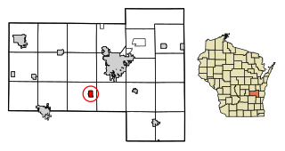
Rio is a village in Columbia County, Wisconsin, United States. The population was 1,133 at the 2022 United States Census. It is part of the Madison Metropolitan Statistical Area. The village rests primarily in the town of Otsego. The Village of Rio calls itself "Camper Country USA" due to several campgrounds located near the village. Rio is halfway between Columbus and Portage on Highway 16.

<span class="mw-page-title-main">Ferryville, Wisconsin</span> Village in Wisconsin, United States

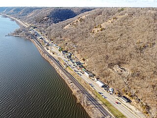
Ferryville is a village in Crawford County, Wisconsin, United States. The population was 176 at the 2010 census. It is located on Wisconsin Highway 35 along the Great River Road.

<span class="mw-page-title-main">Kekoskee, Wisconsin</span> Village in Wisconsin, United States

Kekoskee is a village in Dodge County, Wisconsin, United States. The population was 161 at the 2010 census.

<span class="mw-page-title-main">Neosho, Wisconsin</span> Village in Wisconsin, United States

Neosho is a village in Dodge County, Wisconsin, United States. The population was 574 at the 2010 census.

<span class="mw-page-title-main">Blue River, Wisconsin</span> Village in Wisconsin, United States

Blue River is a village in Grant County, Wisconsin, United States. The population was 434 at the 2010 census.

<span class="mw-page-title-main">Cleveland (village), Wisconsin</span> Village in Wisconsin, United States

Cleveland is a village in Manitowoc County, Wisconsin, United States. The population was 1,579 at the 2020 census.

<span class="mw-page-title-main">Boaz, Wisconsin</span> Village in Wisconsin, United States

Boaz is a village in Richland County, Wisconsin, United States. According to the 2010 census, the population of the village was 156.

<span class="mw-page-title-main">Lyndon, Sheboygan County, Wisconsin</span> Town in Wisconsin, United States

Lyndon is a town in Sheboygan County, Wisconsin. The population was 1,468 at the time of the 2000 census. It is included in the Sheboygan, Wisconsin Metropolitan Statistical Area. The ghost town of Winooski was located in the town.

<span class="mw-page-title-main">Waldo, Wisconsin</span> Village in Wisconsin, United States

Waldo is a village along the Onion River in Sheboygan County, Wisconsin, United States. The population was 503 at the 2010 census. It has a post office with ZIP code 53093. It is included in the Sheboygan, Wisconsin Metropolitan Statistical Area.

<span class="mw-page-title-main">Chaseburg, Wisconsin</span> Village in Wisconsin, United States

Chaseburg is a village in Vernon County, Wisconsin, United States. The population was 284 at the 2010 census.

<span class="mw-page-title-main">Ontario, Wisconsin</span> Village in Wisconsin, United States

Ontario is a village in Vernon County, Wisconsin, United States. The population was 554 at the 2010 census.

<span class="mw-page-title-main">Big Falls, Waupaca County, Wisconsin</span> Village in Wisconsin, United States

Big Falls is a village in Waupaca County, Wisconsin, United States. The population was 61 at the 2010 census.

<span class="mw-page-title-main">Viola, Wisconsin</span> Village in Wisconsin, United States

Viola is a village in Richland (mostly) and Vernon counties in the U.S. state of Wisconsin. The population was 699 at the 2010 census. Of this, 477 were in Richland County, and 222 were in Vernon County.

<span class="mw-page-title-main">Wyocena, Wisconsin</span> Village in Wisconsin, United States

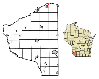
Wyocena is a village in Columbia County, Wisconsin, United States. The population was 768 at the 2010 census. The village is located within the Town of Wyocena. It is part of the Madison Metropolitan Statistical Area.

<span class="mw-page-title-main">Lowell, Wisconsin</span> Village in Wisconsin, United States

Lowell is a village in Dodge County, Wisconsin, United States, along the Beaver Dam River. The population was 340 at the 2010 census. The village is located within the Town of Lowell.

<span class="mw-page-title-main">Eden, Wisconsin</span> Village in Wisconsin, United States

Eden is a village in Fond du Lac County, Wisconsin, United States. The population was 875 at the 2010 census. The village is located within the Town of Eden.

<span class="mw-page-title-main">Oakfield, Wisconsin</span> Village in Wisconsin, United States

Oakfield is a village in Fond du Lac County, Wisconsin, United States. The population was 1,052 at the 2020 census. The village is located within the Town of Oakfield.

<span class="mw-page-title-main">Wilton, Wisconsin</span> Village in Wisconsin, United States

Wilton is a village in Monroe County, Wisconsin, United States. The population was 504 at the 2010 census. The village is located partially within the Town of Wilton and partially within the Town of Wellington.

References

  1. "2019 U.S. Gazetteer Files". United States Census Bureau. Retrieved August 7, 2020.
  2. 1 2 "US Board on Geographic Names". United States Geological Survey. October 25, 2007. Retrieved January 31, 2008.
  3. 1 2 "U.S. Census website". United States Census Bureau . Retrieved November 18, 2012.
  4. 1 2 "Population and Housing Unit Estimates". United States Census Bureau. May 24, 2020. Retrieved May 27, 2020.
  5. 1 2 "U.S. Census website". United States Census Bureau . Retrieved January 31, 2008.
  6. "US Gazetteer files: 2010, 2000, and 1990". United States Census Bureau. February 12, 2011. Retrieved April 23, 2011.
  7. "US Gazetteer files 2010". United States Census Bureau. Archived from the original on January 25, 2012. Retrieved November 18, 2012.
  8. "Census of Population and Housing". Census.gov. Retrieved June 4, 2015.
  9. "Frank Kreyer NASCAR statistics". Racing Reference. Retrieved April 28, 2011.
  10. 'Wisconsin Blue Book 1946,' Biographical Sketch of Pat E. Brunner, pg. 48