
M-78 is a state trunkline highway in the US state of Michigan. The western terminus is the intersection with M-66 north of Battle Creek in Pennfield Township. The roadway runs 10.744 miles (17.291 km) through rural farmland and the community of Bellevue as it approaches its eastern terminus at an interchange with Interstate 69 (I-69) near Olivet. The highway is used by between 3,100 and 5,300 vehicles on a daily basis.
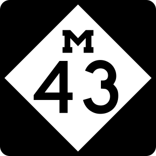
M-43 is a state trunkline highway in the southwestern and central parts of the US state of Michigan. The highway runs from South Haven to Webberville along an indirect path through both rural areas and larger cities. The trunkline follows five overall segments: a southeasterly track from South Haven to Oshtemo Township, a northerly path to Plainwell, a southeasterly route to Richland, a northeasterly course to the Hastings area and an easterly route through the Lansing area.
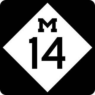
M-14 is an east–west state trunkline highway in the southeastern portion of the US state of Michigan. Entirely freeway, it runs for 22.250 miles (35.808 km) to connect Ann Arbor with Detroit by way of a connection with Interstate 96 (I-96). The western terminus is at a partial interchange with I-94 west of Ann Arbor. From there, the freeway curves around the north side of Ann Arbor and runs concurrently with US Highway 23 (US 23). East of that section, M-14 passes through woodlands and fields in Washtenaw County. In Wayne County, the freeway returns to a suburban area of mixed residential neighborhoods and light industrial areas. It crosses two different rivers and a pair of rail lines as it approaches Detroit's inner suburbs, where it terminates at an interchange between I-96 and I-275.

C-66 is a county-designated highway in the US state of Michigan running about 28 miles (45 km) across the northern tip of the Lower Peninsula. The roadway starts in the unincorporated community of Cross Village in Emmet County at an intersection with M-119 and C-77. It follows Levering Road through rural areas to an interchange with Interstate 75 (I-75) west of Cheboygan. The eastern terminus is at an intersection with US Highway 23 (US 23) and M-27 in downtown Cheboygan. The first roadways along what is now C-66 were in place by the early 20th century. Segments were paved by 1936, although some reverted to a gravel surface during World War II. The full roadway was paved by the mid-1950s, and the C-66 moniker was designated on the roadway in the early 1970s.
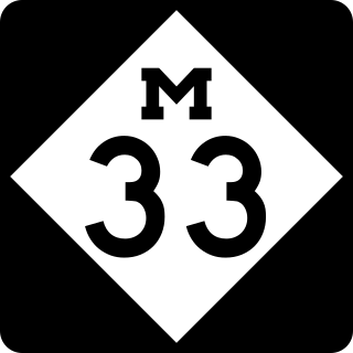
M-33 is a north–south state trunkline highway in the US state of Michigan that runs from Interstate 75 (I-75) at Alger in Arenac County north to M-27 near Cheboygan. In between, the trunkline runs through rural sections of the northeastern Lower Peninsula including state and national forest areas. M-33 connects to a handful of parks and crosses several of the rivers in that section of the state. It runs concurrently with three other state highways, sharing pavement to connect through several small communities of Northern Michigan.

M-11 is a state trunkline highway in the US state of Michigan in the Grand Rapids metropolitan area. The highway runs through the western and southern sides of the metro area, starting over the border in Ottawa County at an interchange with Interstate 96 (I-96). It runs through both rural woodlands and busy commercial areas before it terminates at another interchange with I-96 in Cascade Township. Locally known as Wilson Avenue and 28th Street, the trunkline is listed on the National Highway System. M-11 carries between 8,000 and 42,000 vehicles on average each day.

M-120 is a state trunkline highway in the US state of Michigan in the southwest Lower Peninsula. The highway runs northeast from Muskegon to Hesperia. In between, the road passes through suburban Muskegon, forests and farmland. Some 5,900–26,000 vehicles use the highway each day on average as it runs long a series of roads that follow county lines in the area.

M-119 is a 27.548-mile (44.334 km) state trunkline highway entirely within Emmet County in the US state of Michigan. The highway follows the shore of Lake Michigan and the Little Traverse Bay, with its southern terminus at US Highway 31 (US 31) near Bay View, about four miles (6.4 km) east of Petoskey; the northern terminus is at a junction with county roads C-66 and C-77 in Cross Village. North of Harbor Springs, the highway is known as the Tunnel of Trees Scenic Heritage Route. This section of highway lacks a centerline and is known for its scenic beauty. On an average day, between 2,000 and 15,000 vehicles use various parts of the highway.
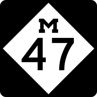
M-47 is a north–south state trunkline highway in the US state of Michigan. It runs near Saginaw and Midland in the Tri-Cities area of the Lower Peninsula. The highway runs through suburban and agricultural areas to connect the two cities with the airport in the area. The northernmost section of M-47 runs along a freeway to the terminus at US Highway 10 (US 10). M-47 runs for 14.328 miles (23.059 km), all of which has been listed as a part of the National Highway System.

M-91 is a largely north–south state trunkline highway in the Lower Peninsula of the US state of Michigan. It runs from Belding to south of Lakeview. Its 24-mile (39 km) length exists entirely within Ionia and Montcalm counties. It is all undivided surface route. Aside from the two Michigan state highways that are its termini, it has only one other intersection with any Michigan state highway, and that is with M-57 in Greenville.

M-57 is an east–west state trunkline highway in the US state of Michigan. The 105.377-mile (169.588 km) highway connects US Highway 131 (US 131) near Rockford on the west end to M-15 near Otisville in the Lower Peninsula. In between, the mostly rural highway passes through farmland and connects several highways and smaller towns together. Three of these highways are freeways: US 131, US 127 and Interstate 75 (I-75). Along the way, between 3,700 and 22,300 vehicles use the highway daily.
M-85, also known as Fort Street or Fort Road for its entire length, is a state trunkline highway in the U.S. state of Michigan. The highway serves several Downriver suburbs of Detroit, as well as neighborhoods in the city itself. From its southern terminus at exit 28 on Interstate 75 (I-75) to its second interchange with exit 43 on I-75 in southwest Detroit, M-85 is part of the Lake Erie Circle Tour. In between, it serves mostly residential areas running parallel to a pair of rail lines; the highway carries between 5,000 and 43,000 vehicles per day on average. Once in the city of Detroit, Fort Street runs parallel to I-75 for several miles before they separate near the Ambassador Bridge. The northern end of M-85 is at the intersection with Griswold Street in downtown Detroit, one block away from Campus Martius Park.

US Highway 27 (US 27) is a part of the US Highway System that now runs from Miami, Florida, to Fort Wayne, Indiana. In the US state of Michigan, it was a north–south state trunkline highway that entered the state south of Kinderhook and ended south of Grayling. Its route consisted of a freeway concurrency with Interstate 69 (I-69) from the state line north to the Lansing area before it followed its own freeway facility northward to St. Johns. From there north to Ithaca, US 27 was an expressway before continuing as a freeway to a terminus south of Grayling.
M-36 is a state trunkline highway in the Lower Peninsula of the US state of Michigan that runs in a west–east direction from Mason to Whitmore Lake. The trunkline connects US Highway 127 (US 127) south of Lansing and US 23 north of Ann Arbor. The highway connects several smaller communities in the rural areas along its route. M-36 also runs concurrently with two other roadways, sharing pavement with M-52 and County Road D-19. According to traffic surveys in 2010, between 650 and 15,300 vehicles used the highway on average each day.

M-65 is a 103.176-mile-long (166.046 km) state trunkline highway in the US state of Michigan. The highway runs between termini on US Highway 23 (US 23) near Omer and Rogers City in the northeastern Lower Peninsula of the state. M-65 runs inland through several small communities in the region, passing through forests and fields along its course. M-65 crosses several watercourses, including the Au Sable River where it runs along the River Road National Scenic Byway. The region also includes the Huron National Forest and the Mackinaw State Forest areas.
M-68 is an east–west state trunkline highway located in the northern part of the Lower Peninsula of the US state of Michigan. The western terminus of the highway begins four miles (6.4 km) east of the Little Traverse Bay of Lake Michigan and ends a few blocks from Lake Huron in Rogers City. M-68 skirts just south of Indian River and Burt Lake.

H-33 is a county-designated highway in the Upper Peninsula of the US state of Michigan between Gould City and McMillan that was previously M-135, a former state trunkline highway. The roadway follows Manistique Lakes Road from Gould City at a junction with US Highway 2 (US 2) near Lake Michigan north to M-28 near McMillan. The northern section of the highway is also called County Road 135 (CR 135) in Luce County.

US Highway 23 (US 23) is a north–south United States Numbered Highway that runs from Jacksonville, Florida, to Mackinaw City, Michigan. In the US state of Michigan, it is a major, 362-mile-long (583 km), north–south state trunkline highway that runs through the Lower Peninsula. The trunkline is a freeway from the Michigan–Ohio state line near Lambertville to the city of Standish, and it follows the Lake Huron shoreline from there to its northern terminus. Serving the cities of Ann Arbor and Flint, US 23 acts as a freeway bypass of the Metro Detroit area. Overall, the highway runs through rural areas of the state dominated by farm fields or woodlands; some segments are urban in character in the Ann Arbor, Flint and Tri-Cities areas. The section from Flint north to Standish also carries Interstate 75 (I-75) along a concurrency that includes a segment that carries almost 70,000 vehicles on a daily basis.


