
M-37 is a north–south state trunkline highway in the US state of Michigan. The southern terminus is near the border between Kalamazoo and Calhoun counties at exit 92 of Interstate 94 (I-94) southwest of Battle Creek. The northern terminus is at the Mission Point Light on Old Mission Point in Grand Traverse County. In between, the highway connects Battle Creek, Grand Rapids and Traverse City. Motorists will travel through agricultural land, forests, suburbs and large cities along the way. The section of M-37 on the Old Mission Peninsula was designated what is now a Pure Michigan Scenic Byway in 2008.

M-78 is a state trunkline highway in the US state of Michigan. The western terminus is the intersection with M-66 north of Battle Creek in Pennfield Township. The roadway runs 10.744 miles (17.291 km) through rural farmland and the community of Bellevue as it approaches its eastern terminus at an interchange with Interstate 69 (I-69) near Olivet. The highway is used by between 3,100 and 5,300 vehicles on a daily basis.

M-89 is an east–west state trunkline highway in the US state of Michigan that runs from near Ganges to Battle Creek. M-89 starts at an interchange with Interstate 196/US Highway 31 (I-196/US 31) and passes through Allegan, Kalamazoo County, Michigan, and Calhoun counties. The highway also briefly crosses the southwest corner of Barry County before it terminates an at intersection with Business Loop I-94 on the northwestern side of downtown Battle Creek. In between the trunkline runs parallel to the Kalamazoo River through rural southwestern Michigan farmlands while also running through the middle of several smaller towns in the area.
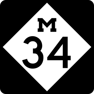
M-34 is an east–west state trunkline highway in the southeastern region of the US state of Michigan. It has a western terminus near Osseo on M-99 and runs through forest and farm lands to its eastern terminus at Business US Highway 223 and M-52 in Adrian. The highway serves a number of smaller communities in the area and intersects two US Highways while carrying between 4,200 and 11,300 vehicles on a daily basis.

M-96 is a state trunkline highway in the US state of Michigan that runs between Kalamazoo and Marshall. Its termini are both on business routes of Interstate 94 (I-94); the eastern one coincides with an intersection with I-69. Between Kalamazoo and Marshall it passes through Comstock, Galesburg, Augusta, and Battle Creek intersecting I-194/M-66 in Battle Creek and I-94 in Emmett Township.
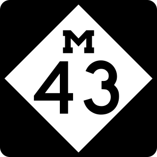
M-43 is a state trunkline highway in the southwestern and central parts of the US state of Michigan. The highway runs from South Haven to Webberville along an indirect path through both rural areas and larger cities. The trunkline follows five overall segments: a southeasterly track from South Haven to Oshtemo Township, a northerly path to Plainwell, a southeasterly route to Richland, a northeasterly course to the Hastings area and an easterly route through the Lansing area.
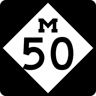
M-50 is a state trunkline highway in the US state of Michigan. Although designated as an east–west highway, it is nearly a diagonal northwest–southeast route. The western terminus is at exit 52 along Interstate 96 (I-96) near Alto a few miles east of the metro Grand Rapids area, and its eastern terminus is in downtown Monroe at US Highway 24. In between the trunkline runs through seven counties of the southern part of the Lower Peninsula mostly through rural farm fields and small communities. The highway also runs through downtown Jackson to connect between two freeway sections of US 127. In the Irish Hills area of the state southeast of Jackson, M-50 runs next to Michigan International Speedway.
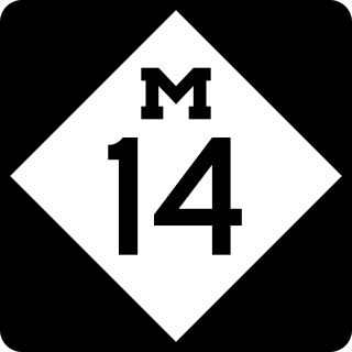
M-14 is an east–west state trunkline highway in the southeastern portion of the US state of Michigan. Entirely freeway, it runs for 22.250 miles (35.808 km) to connect Ann Arbor with Detroit by way of a connection with Interstate 96 (I-96). The western terminus is at a partial interchange with I-94 west of Ann Arbor. From there, the freeway curves around the north side of Ann Arbor and runs concurrently with US Highway 23 (US 23). East of that section, M-14 passes through woodlands and fields in Washtenaw County. In Wayne County, the freeway returns to a suburban area of mixed residential neighborhoods and light industrial areas. It crosses two different rivers and a pair of rail lines as it approaches Detroit's inner suburbs, where it terminates at an interchange between I-96 and I-275.
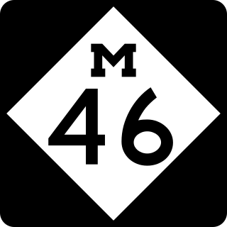
M-46 is an east–west state trunkline highway in the US state of Michigan between Muskegon and Port Sanilac, terminating near Lake Michigan and Lake Huron on each end. Except for the north–south segment that corresponds with the US Highway 131 (US 131) freeway between Cedar Springs and Howard City, M-46 is practically a due east–west surface highway. The road runs through rural sections of the Lower Peninsula connecting several freeways including US 31, US 131, US 127 and Interstate 75 (I-75).

M-75 is a 11.768-mile-long (18.939 km) segment of state trunkline highway located in Charlevoix County in the U.S. state of Michigan. This highway serves as a loop off US Highway 131 (US 131), providing access to Boyne City. The highway happens to be geographically close to Interstate 75 (I-75), but they are not related.

C-66 is a county-designated highway in the US state of Michigan running about 28 miles (45 km) across the northern tip of the Lower Peninsula. The roadway starts in the unincorporated community of Cross Village in Emmet County at an intersection with M-119 and C-77. It follows Levering Road through rural areas to an interchange with Interstate 75 (I-75) west of Cheboygan. The eastern terminus is at an intersection with US Highway 23 (US 23) and M-27 in downtown Cheboygan. The first roadways along what is now C-66 were in place by the early 20th century. Segments were paved by 1936, although some reverted to a gravel surface during World War II. The full roadway was paved by the mid-1950s, and the C-66 moniker was designated on the roadway in the early 1970s.

M-59 is an east–west state trunkline highway that crosses the northern part of Metropolitan Detroit in the US state of Michigan. It runs between Howell at Interstate 96 (I-96) and I-94 on the Chesterfield–Harrison township line near the Selfridge Air National Guard Base. While primarily a multi-lane surface highway, it is a full freeway from just east of downtown Pontiac near Opdyke Road to just east of the Mound Road/Merrill Road exit in Utica. The various surface highway segments are named either Highland Road, Huron Street or Hall Road, with the latter known as an area for shopping and dining. The rural sections west of Pontiac pass through Oakland County lake country, passing through two state recreational areas.
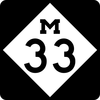
M-33 is a north–south state trunkline highway in the US state of Michigan that runs from Interstate 75 (I-75) at Alger in Arenac County north to M-27 near Cheboygan. In between, the trunkline runs through rural sections of the northeastern Lower Peninsula including state and national forest areas. M-33 connects to a handful of parks and crosses several of the rivers in that section of the state. It runs concurrently with three other state highways, sharing pavement to connect through several small communities of Northern Michigan.

M-11 is a state trunkline highway in the US state of Michigan in the Grand Rapids metropolitan area. The highway runs through the western and southern sides of the metro area, starting over the border in Ottawa County at an interchange with Interstate 96 (I-96). It runs through both rural woodlands and busy commercial areas before it terminates at another interchange with I-96 in Cascade Township. Locally known as Wilson Avenue and 28th Street, the trunkline is listed on the National Highway System. M-11 carries between 8,000 and 42,000 vehicles on average each day.
M-331 was an unsigned state trunkline highway in the U.S. state of Michigan located within the city of Kalamazoo. It ran from the southern city limits north into downtown Kalamazoo. This was one of many highways to be established or realigned as a result of a rationalization process initiated in 1998 during the tenure of Governor John Engler. M-331 used streets in Kalamazoo that were once part of US Highway 131 (US 131) before a freeway was built that bypassed the downtown area. In 2019, the City of Kalamazoo and the Michigan Department of Transportation (MDOT) agreed to transfer control of various streets from state to city jurisdiction, and M-331 was decommissioned as a result.

There are currently eight business routes of Interstate 94 (I-94) in the US state of Michigan. These business routes connect I-94 to the downtown business districts of neighboring cities. Seven of the eight routes are business loops which bear the Business Loop I-94 designation while one is a business spur that bears the Business Spur I-94. These loops are former routings of I-94's two predecessors in Michigan: US Highway 12 (US 12) or US 25. The westernmost BL I-94 runs through the twin cities of Benton Harbor and St. Joseph along the former routing of US 12 and US 31/US 33 that now includes a section of the Lake Michigan Circle Tour in the state. The loops in Kalamazoo, Battle Creek, Marshall, Albion, and Jackson were also formerly segments of US 12 which were later designated as separate version of Business US Highway 12 through their respective cities before becoming BL I-94s in 1960. The BL I-94 in Kalamazoo was converted into BS I-94 in 2019. The route of the business loop through Ann Arbor was previously US 12 and then later M-14 before receiving its current moniker. The BL I-94 through Port Huron was previously US 25 and then Business US Highway 25.
There have been six business routes of Interstate 96 (I-96) in the US state of Michigan. There are two business loops designated Business Loop Interstate 96 : one through Lansing and one through Howell. Both follow the old route of US Highway 16 (US 16), with appropriate connections to I-96. There are three former business spurs that were designated Business Spur Interstate 96. One connected to the carferry docks in Muskegon, running concurrently with part of Business US 31 along former US 16, but it has been eliminated. The second spur ran into downtown Portland until it was decommissioned in 2007. Two routes in the Detroit area—a loop through Farmington and a spur into Detroit—both using Grand River Avenue, and meeting at the temporary end of I-96 near Purdue Avenue, were eliminated when I-96 was moved to the completed Jeffries Freeway in 1977. The Farmington business route is still state-maintained as an unsigned highway, while the Detroit business route remained unsigned until it was decommissioned in 2016 and replaced by an extension of M-5.

There have been 10 business routes of US Highway 127 in the state of Michigan. The business routes are all sections of state trunkline highway that run through the central business districts of their respective towns connecting them to the mainline highway outside of those downtown areas. These various business routes were formerly part of the routing of US Highway 127 (US 127) or its predecessor in Central Michigan, US 27, before the construction of highway bypasses. The southern two, in Jackson and Mason were previously parts of US 127, while seven of the northern eight were originally part of US 27, a highway which was replaced on its northern end by US 127 in 2002. The business loop through Alma was once numbered US 27A.


