M-55 (Michigan highway)

Last updated

M-55.svg

M-55

M-55 (Michigan highway)
M-55 highlighted in red
Route information
Maintained by MDOT
Length150.944 mi [1]  (242.921 km)
Existedc.July 1, 1919–present
Major junctions
West endUS 31.svg US 31 near Manistee
Major intersections
East endUS 23.svg US 23 in Tawas City
Location
Country United States
State Michigan
Counties Manistee, Wexford, Missaukee, Roscommon, Ogemaw, Iosco
Highway system
M-54.svg M-54 M-56 1948.svg M-56

M-55 is a state trunkline highway in the northern part of the US state of Michigan. M-55 is one of only three state highways that extend across the Lower Peninsula from Lake Huron to Lake Michigan; the others are M-46 and M-72. The highway crosses through rural forest and farmlands to connect Manistee with Tawas City. M-55 crosses two of the major rivers in the state. Two sections of the highway follow along freeways near Cadillac and West Branch. Running for 150.944 miles (242.921 km) through the state, M-55 is maintained by the Michigan Department of Transportation (MDOT).

Contents

The highway was first designated by July 1, 1919 along a portion of the current roadway. In a series of extensions, M-55 was lengthened to connect its current endpoints by the early 1930s. The trunkline has been rerouted in sections since that time resulting in the modern roadway alignment. One set of changes produced a business loop in the Houghton Lake area.

Route description

M-55 starts at a three-way intersection with US Highway 31 (US 31) north of Manistee. The trunkline runs southeast on Caberfae Highway over the Manistee River and through the Peters and Highpoint bayous. The highway passes near the community of Eastlake before turning eastward through forest land. In eastern Manistee County, the roadway crosses the Pine River south of the Tippy Dam Pond in Wellston. M-55 intersects M-37 in western Wexford County southwest of the Caberfae Peaks Ski & Golf Resort. The roadway turns northeasterly along the south shore of Lake Mitchell where it then curves southeasterly to run concurrently along M-115 along the south shore of Lake Cadillac and through the south side of Cadillac. At the interchange with the US 131 freeway, M-55 merges north along the freeway, bypassing downtown Cadillac. [2] [3]

On the east side of town, M-55 leaves the freeway and turns east again running through the Pere Marquette State Forest along Watergate Road. When the highway meets M-66, M-55 joins M-66 and runs north through farmland. As the two highways approach Lake City, they run along the shore of Lake Missaukee and through downtown. M-55 turns east again along Houghton Lake Road, separating from M-66 north of the central business district. This section of trunkline passes through mixed farm and wood lands that transitions to mostly forests near Merritt. The road crosses the Muskegon River and follows Lake City Road into the outskirts of Houghton Lake. M-55 passes over the US 127 freeway and enters Houghton Lake Heights. There the highway runs southeasterly along the shores of Houghton Lake into downtown Houghton Lake. M-18 briefly joins M-55 through Prudenville on the east side of the lake, and M-55 follows West Branch Road as it continues east toward Interstate 75 (I-75). [2] [3]

M-55 in Logan Township, Ogemaw County, looking westbound M-55 logan.jpg
M-55 in Logan Township, Ogemaw County, looking westbound

M-55 follows I-75 between exits 227 and 215, a distance of about 12 miles (19 km). [2] This section is the only part of M-55 that has been listed on the National Highway System, [4] a system of roads important to the nation's economy, defense, and mobility. [5] From the end of the freeway concurrency, M-55 follows Business Loop I-75 (BL I-75) into downtown West Branch. After leaving town, the highway runs through farm lands in rural Ogemaw and Iosco counties. The highway curves southeast into Tawas City. The eastern end of M-55 is at an intersection with US 23 along the shores of the Tawas Bay of Lake Huron. [2] [3]

History

M-55 passing over US 131 as it joins the Cadillac bypass M-55 overpass on US 131.jpg
M-55 passing over US 131 as it joins the Cadillac bypass

M-55 had its beginning by July 1, 1919 when it was designated from Cadillac to Merritt. [6] In 1926, M-55 was extended eastward to Houghton Lake over a section of the former M-14 that was not used for the then-new US 27. At the same time, another segment of the highway was designated between M-76 at West Branch and US 23 at Whittemore. [7] The next year, M-55 was routed along sections of US 27 and M-76 between the two communities. [8] A western extension was added from Cadillac to US 31 near Manistee in 1932 while the eastern end was shifted from Whittemore to Tawas City when US 23 was rerouted through the area. [9] [10]

Segments of M-55 have been relocated in the years since the basic routing was completed in the early 1930s. A more direct route from West Branch eastward was created in 1938. [11] [12] Prior to the construction of present-day Hemlock Road through Tawas City, M-55 entered Tawas City via present-day Plank Road, Second Street, Fifth Avenue, and Mathews Street, ending at the present-day intersection of US 23 and Mathews Street. [13] [14] In 1949, US 27 was moved to run to the west of Houghton and Higgins lakes. M-55 was shifted to run concurrently southward along the former M-169 which was replaced by US 27. At the intersection with the former US 27, M-55 was routed east, and the former route of M-55 was designated as a new M-169. [15] [16] In 1950, this M-169 was redesignated Business M-55 (Bus. M-55). [17] M-55 was rerouted off US 27 when the US 27 freeway was completed in the area. In rerouting M-55, it was shifted back to its former routing through Houghton Lake Heights, replacing Bus. M-55 in late 1961. [18] [19]

The last gravel segments were paved in Iosco County between late 1958 and early 1960. [20] [21] Another segment east of Cadillac to M-66 south of Lake City was realigned in 1973. At the same time, M-55 was co-signed with a portion of the newly opened stretch of I-75 between M-157 and West Branch. [22] [23] The last routing change was made in November 2000 when the southern segment of the Cadillac bypass was opened. M-55 was moved out of downtown Cadillac and along the freeway and M-115. [24] US 131 joined M-55 on the bypass the next October when the northern half of the bypass was completed in 2001. [25]

Major intersections

CountyLocationmi [1] kmExitDestinationsNotes
Manistee Manistee Township 0.0000.000US 31.svgLake Michigan Circle Tour.svg US 31  / LMCT  Traverse City, Manistee Western terminus of M-55
Wexford South Branch Township 25.80341.526M-37.svg M-37  Traverse City, Grand Rapids
Cadillac 43.81470.512West plate.svg
M-115 rectangle.svg
M-115 west Frankfort
Western end of M-115 concurrency
44.27671.255Sunnyside DriveFormer routing of M-55
Clam Lake Township 46.77375.274176South plate.svg
US 131.svg
US 131 south Grand Rapids
East plate.svg
M-115 rectangle.svg
M-115 east Clare
Eastern end of M-115 concurrency; M-55 joins US 131 concurrency, exit numbers correspond to US 131 mileage
48.03977.311177North plate.svg
Business plate.svg
US 131.svg
Bus. US 131 north Cadillac
Clam LakeHaring township line50.89881.912180North plate.svg
US 131.svg
US 131 north Petoskey
Northern end of US 131 concurrency
Missaukee LakeReeder township line58.73294.520South plate.svg
M-66.svg
M-66 south McBain
Western end of M-66 concurrency
Lake City 63.796102.670North plate.svg
M-66.svg
M-66 north Kalkaska
Eastern end of M-66 concurrency
Roscommon LakeRoscommon township line84.004–
84.022
135.191–
135.220
US 127.svg US 127  Clare, Grayling Exit 194 on US 127
Denton Township 92.851149.429South plate.svg
M-18.svg
M-18 south Gladwin
Western end of M-18 concurrency
93.644150.705North plate.svg
M-18.svg
M-18 north Roscommon
Eastern end of M-18 concurrency
Backus Township 95.021152.921North plate.svg
M-157 rectangle.svg
M-157 north Roscommon
Southern terminus of M-157
99.937160.833To plate county.svg
County F-97.svg
Old 55 (West Branch Road) to F-97
Former routing of M-55
100.773162.178227North plate blue.svg
I-75.svg
I-75 north Grayling, Mackinac Bridge
Western end of I-75 concurrency; exit numbers follow I-75 numbering
Richfield Township 105.318169.493222Old 76 St. Helen Former M-76
Ogemaw Ogemaw Township 112.374180.848215South plate blue.svg
I-75.svg
I-75 south Saginaw
South plate green.svg
Business Loop 75.svg
BL I-75 south West Branch
Eastern end of I-75 concurrency; western end of BL I-75 concurrency; northern terminus of BL I-75
West Branch 114.197183.782South plate.svg
M-30.svg
M-30 south Gladwin
Northern terminus of M-30
115.295185.549South plate green.svg
Business Loop 75.svg
BL I-75 south
Eastern end of BL I-75 concurrency
Churchill Township 120.197193.438M-33.svg M-33  Cheboygan, Standish
Iosco Reno Township 136.183219.165M-65.svg M-65  Hale, Whittemore
Tawas City 150.944242.921US 23.svgLake Huron Circle Tour.svg US 23  / LHCT  Standish, Alpena Eastern terminus of M-55
1.000 mi = 1.609 km; 1.000 km = 0.621 mi

Business loop

Business plate 1948.svg

M-55 1948.svg

Business M-55

Location Houghton Lake Heights
Length2.898 mi [1]  (4.664 km)
ExistedEarly 1950 [16] [17] –Late 1961 [18] [19]

Business M-55 (Bus. M-55) was a business loop designated for just over a decade in Houghton Lake Heights. Bus. M-55 ran for 2.898 miles (4.664 km) along Houghton Lake Drive between US 27 and Federal Drive next to the Houghton Lake. M-55 was shifted off the road when several highways in the Houghton Lake area were rerouted. US 27 was moved to the west side of the lakes in the area, and M-55 was moved follow US 27, replace the original M-169 in the area and replace a section of the former routing of US 27 in Houghton Lake in 1949. [15] [16] By early 1950, the former route of M-55 through Houghton Lake Heights was designated Bus. M-55. This business loop existed until the US 27 freeway was built in the area in late 1961. At that time, M-55 was moved back to its pre-1949 routing, replacing Bus. M-55. [18] [19]

See also

Related Research Articles

<span class="mw-page-title-main">M-66 (Michigan highway)</span> State highway in Michigan, United States

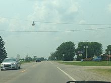
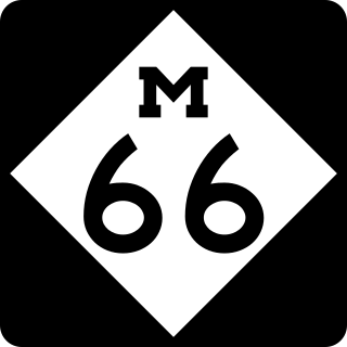
M-66 is a north–south state trunkline highway on the Lower Peninsula of the US state of Michigan. It runs from the Indiana state line in the south to Charlevoix in the north. M-66 is the only state highway to run the north–south distance of the Lower Peninsula. It starts as a continuation of State Road 9 (SR 9), which provides access to the Indiana Toll Road. The total length is approximately 272.9 miles (439.2 km), which includes almost 3.4 miles (5.5 km) of freeway between Interstate 94 (I-94) and downtown Battle Creek designated as I-194. A section of the highway immediately south of I-94 is an expressway, a type of divided limited-access highway, while the section along I-194 is a full freeway; otherwise M-66 is a two-lane rural highway. Two sections are listed on the National Highway System.

<span class="mw-page-title-main">M-78 (Michigan highway)</span> State highway in Michigan, United States

M-78 is a state trunkline highway in the US state of Michigan. The western terminus is the intersection with M-66 north of Battle Creek in Pennfield Township. The roadway runs 10.744 miles (17.291 km) through rural farmland and the community of Bellevue as it approaches its eastern terminus at an interchange with Interstate 69 (I-69) near Olivet. The highway is used by between 3,100 and 5,300 vehicles on a daily basis.

<span class="mw-page-title-main">M-46 (Michigan highway)</span> State highway in Michigan, United States

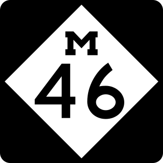
M-46 is an east–west state trunkline highway in the US state of Michigan between Muskegon and Port Sanilac, terminating near Lake Michigan and Lake Huron on each end. Except for the north–south segment that corresponds with the US Highway 131 (US 131) freeway between Cedar Springs and Howard City, M-46 is practically a due east–west surface highway. The road runs through rural sections of the Lower Peninsula connecting several freeways including US 31, US 131, US 127 and Interstate 75 (I-75).

<span class="mw-page-title-main">M-76 (Michigan highway)</span> Former state highway in Michigan, United States

M-76 is a former state trunkline highway designation in the Lower Peninsula of the US state of Michigan. The highway's designation was decommissioned when the last section of it was converted to freeway as a part of the present-day Interstate 75 (I-75). At that time, M-76 extended from US Highway 23 (US 23) near Standish northwesterly to I-75 south of Grayling. Two sections of the route followed freeways with a two-lane highway in between to connect them. The former routing of M-76 through West Branch before that city was bypassed was initially redesignated Business M-76. The highway itself ran through mixed fields and forests bypassing several other towns in the region.

<span class="mw-page-title-main">M-33 (Michigan highway)</span> State highway in Michigan, United States

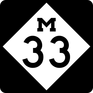
M-33 is a north–south state trunkline highway in the US state of Michigan that runs from Interstate 75 (I-75) at Alger in Arenac County north to M-27 near Cheboygan. In between, the trunkline runs through rural sections of the northeastern Lower Peninsula including state and national forest areas. M-33 connects to a handful of parks and crosses several of the rivers in that section of the state. It runs concurrently with three other state highways, sharing pavement to connect through several small communities of Northern Michigan.

<span class="mw-page-title-main">M-20 (Michigan highway)</span> State highway in Michigan, United States

M-20 is a state trunkline highway in the US state of Michigan that runs from New Era to Midland. It crosses through rural Lower Peninsula forest land between the two ends. The highway serves the college towns of Big Rapids and Mt. Pleasant, home of the main campuses of Ferris State University and Central Michigan University, both located near the trunkline.

<span class="mw-page-title-main">M-115 (Michigan highway)</span> State highway in Michigan, United States

M-115 is a state trunkline highway in the northwestern part of the Lower Peninsula of the US state of Michigan. The highway takes a generally southeast-to-northwest direction between Frankfort on Lake Michigan and Clare in the central part of the state. The northwestern end is at M-22 next to Betsie Lake; the southeastern end in downtown Clare is at an intersection with Business US Highway 127 and Bus. US 10. In between, the trunkline runs about 96+12 miles (155.3 km) through woodlands, including areas that are a part of either the Manistee National Forest or the Pere Marquette State Forest. The highway also passes agricultural areas, several lakes in the region and a state park near Cadillac.

<span class="mw-page-title-main">M-85 (Michigan highway)</span> State highway in Wayne County, Michigan, United States

M-85, also known as Fort Street or Fort Road for its entire length, is a state trunkline highway in the U.S. state of Michigan. The highway serves several Downriver suburbs of Detroit, as well as neighborhoods in the city itself. From its southern terminus at exit 28 on Interstate 75 (I-75) to its second interchange with exit 43 on I-75 in southwest Detroit, M-85 is part of the Lake Erie Circle Tour. In between, it serves mostly residential areas running parallel to a pair of rail lines; the highway carries between 5,000 and 43,000 vehicles per day on average. Once in the city of Detroit, Fort Street runs parallel to I-75 for several miles before they separate near the Ambassador Bridge. The northern end of M-85 is at the intersection with Griswold Street in downtown Detroit, one block away from Campus Martius Park.

<span class="mw-page-title-main">U.S. Route 27 in Michigan</span> Former U.S. Highway in Michigan

US Highway 27 (US 27) is a part of the US Highway System that now runs from Miami, Florida, to Fort Wayne, Indiana. In the US state of Michigan, it was a north–south state trunkline highway that entered the state south of Kinderhook and ended south of Grayling. Its route consisted of a freeway concurrency with Interstate 69 (I-69) from the state line north to the Lansing area before it followed its own freeway facility northward to St. Johns. From there north to Ithaca, US 27 was an expressway before continuing as a freeway to a terminus south of Grayling.

<span class="mw-page-title-main">M-18 (Michigan highway)</span> State highway in Michigan, United States

M-18 is a north–south state trunkline highway in the Lower Peninsula of the US state of Michigan. It runs for 77.530 miles (124.772 km) through the central region of the state connecting US Highway 10 (US 10) near North Bradley with M-72 in rural Crawford County near the community of Luzerne. In between, the roadway connects several smaller communities while running through woodlands in both state and national forest areas. Two segments of M-18 run along sections of county boundaries, and one part of the highway forms a component of the business loop for the village of Roscommon.

<span class="mw-page-title-main">M-65 (Michigan highway)</span> State highway in Michigan, United States

M-65 is a 103.176-mile-long (166.046 km) state trunkline highway in the US state of Michigan. The highway runs between termini on US Highway 23 (US 23) near Omer and Rogers City in the northeastern Lower Peninsula of the state. M-65 runs inland through several small communities in the region, passing through forests and fields along its course. M-65 crosses several watercourses, including the Au Sable River where it runs along the River Road National Scenic Byway. The region also includes the Huron National Forest and the Mackinaw State Forest areas.

<span class="mw-page-title-main">U.S. Route 31 in Michigan</span> U.S. Highway in Michigan

US Highway 31 (US 31) is a part of the United States Numbered Highway System that runs from Alabama to the Lower Peninsula of the US state of Michigan. In Michigan, it is a state trunkline highway that runs from the Indiana–Michigan state line at Bertrand Township north to its terminus at Interstate 75 (I-75) south of Mackinaw City. Along its 355.2-mile-long (571.6 km) route, US 31 follows the Michigan section of the St. Joseph Valley Parkway as well as other freeways and divided highways northward to Ludington. North of there, the trunkline is a rural undivided highway through the Northern Michigan tourist destinations of Traverse City and Petoskey before terminating south of Mackinaw City. Along its route, US 31 has been dedicated in memory of a few different organizations, and sections of it carry the Lake Michigan Circle Tour (LMCT) moniker. Four bridges used by the highway have been recognized for their historic character as well.

<span class="mw-page-title-main">U.S. Route 23 in Michigan</span> U.S. Highway in Michigan

US Highway 23 (US 23) is a north–south United States Numbered Highway that runs from Jacksonville, Florida, to Mackinaw City, Michigan. In the US state of Michigan, it is a major, 362-mile-long (583 km), north–south state trunkline highway that runs through the Lower Peninsula. The trunkline is a freeway from the Michigan–Ohio state line near Lambertville to the city of Standish, and it follows the Lake Huron shoreline from there to its northern terminus. Serving the cities of Ann Arbor and Flint, US 23 acts as a freeway bypass of the Metro Detroit area. Overall, the highway runs through rural areas of the state dominated by farm fields or woodlands; some segments are urban in character in the Ann Arbor, Flint and Tri-Cities areas. The section from Flint north to Standish also carries Interstate 75 (I-75) along a concurrency that includes a segment that carries almost 70,000 vehicles on a daily basis.

<span class="mw-page-title-main">Business routes of U.S. Route 131</span> Routes of a highway in Michigan

There are five business routes of US Highway 131 in the state of Michigan, and previously there was one bypass route and an additional business route. All of the business routes are former sections of US Highway 131 (US 131). These former sections of the mainline highway, along with the necessary connecting roads, allow traffic to access the downtowns business districts of cities bypassed by sections of US 131 built since the 1950s. The extant business loops connect to Constantine, Three Rivers, Kalamazoo, Big Rapids, Cadillac, and Manton. The former bypass route in Grand Rapids allowed traffic to bypass that city's downtown at a time when US 131 still ran through the heart of the city, and the later business route connected through downtown while US 131 ran on a freeway bypassing the central business district.

<span class="mw-page-title-main">Business routes of Interstate 75 in Michigan</span> Highways in Michigan

There have been nine business routes for Interstate 75 in the US state of Michigan. Numbered either Business Loop Interstate 75 or Business Spur Interstate 75 depending if they are a full business loop or a business spur, these highways are former routings of I-75's predecessor highways in the state. They were designated as I-75 was completed through the various areas of Michigan. The business loop in Pontiac runs through that city's downtown along a section of Woodward Avenue and a segment of roadway formerly used by M-24. The former Saginaw business loop was once a part of US Highway 23 (US 23), as was most of the original Bay City business loop. The roadways that make up the business loops in West Branch and Roscommon were previously part of M-76, I-75's predecessor through that part of the state. In Northern Michigan, the Grayling and Gaylord BL I-75s were part of US 27, and the two business routes in St. Ignace and Sault Ste. Marie in the Upper Peninsula of Michigan were part of US 2. A tenth business route, a loop through Indian River has been proposed. Each of the business loops connects to I-75 on both ends and runs through their respective cities' downtown areas. The two business spurs only connect to I-75 on one end and run into the appropriate downtown.

<span class="mw-page-title-main">U.S. Route 10 in Michigan</span> U.S. Highway in Michigan

US Highway 10 (US 10) is a part of the United States Numbered Highway System that runs from West Fargo, North Dakota, to the Lower Peninsula of the US state of Michigan. The highway enters Michigan on SS Badger, which crosses Lake Michigan between Manitowoc, Wisconsin, and Ludington. As the highway crosses the state, it is a two-lane undivided highway between Ludington and Farwell and a freeway from Farwell east to the highway's terminus in Bay City. US 10 runs concurrently with US 127 in the Clare area along a section of freeway that includes a welcome center in the median. Outside of the Clare and Midland areas, US 10 runs through rural areas of West and Central Michigan in a section of the Manistee National Forest as well as farmfields.

<span class="mw-page-title-main">U.S. Route 127 in Michigan</span> U.S. Highway in Michigan

US Highway 127 (US 127) is a part of the United States Numbered Highway System that runs from Chattanooga, Tennessee, to the Lower Peninsula of Michigan. In Michigan, it is a state trunkline highway that runs for 212.2 miles (341.5 km), entering from Ohio south of Hudson and ending at a partial interchange with Interstate 75 (I-75) south of Grayling. US 127 is the primary route connecting Lansing and Central Michigan to Northern Michigan and the Mackinac Bridge. From the south side of Jackson northerly, it is mostly a four-lane freeway. A notable exception is a 16-mile (26 km) stretch from north of St. Johns to just south of Ithaca, where the highway is built as an expressway and speed limits are lower. South of Jackson to the state line, the trunkline is a two-lane, undivided highway with access from adjacent properties.

References

  1. 1 2 3 Michigan Department of Transportation (2021). Next Generation PR Finder (Map). Michigan Department of Transportation. Retrieved October 11, 2021.
  2. 1 2 3 4 Michigan Department of Transportation (2010). Uniquely Michigan: Official Department of Transportation Map (Map). c. 1:975,000. Lansing: Michigan Department of Transportation. §§ H8–H12. OCLC   42778335, 639960603.
  3. 1 2 3 Google (January 19, 2011). "Overview Map of M-55" (Map). Google Maps . Google. Retrieved January 19, 2011.
  4. Michigan Department of Transportation (April 23, 2006). National Highway System, Michigan (PDF) (Map). Lansing: Michigan Department of Transportation. Archived from the original (PDF) on October 4, 2012. Retrieved October 7, 2008.
  5. Natzke, Stefan; Neathery, Mike & Adderly, Kevin (June 20, 2012). "What is the National Highway System?". National Highway System. Federal Highway Administration . Retrieved July 1, 2012.
  6. Michigan State Highway Department (July 1, 1919). State of Michigan (Map). Scale not given. Lansing: Michigan State Highway Department. Lower Peninsula sheet. OCLC   15607244 . Retrieved October 17, 2019 via Michigan History Center.
  7. Michigan State Highway Department (December 1, 1926). Official Highway Condition Map (Map). [c. 1:823,680]. Lansing: Michigan State Highway Department.
  8. Michigan State Highway Department (December 1, 1927). Official Highway Service Map (Map). [c. 1:810,000]. Lansing: Michigan State Highway Department. OCLC   12701195, 79754957.
  9. Michigan State Highway Department & Rand McNally (October 1, 1931). Official Highway Service Map (Map). [c. 1:840,000]. Lansing: Michigan State Highway Department. §§ H8–H9, H11–H12. OCLC   12701053.
  10. Michigan State Highway Department & Rand McNally (October 1, 1932). Official Michigan Highway Map (Map). [c. 1:840,000]. Lansing: Michigan State Highway Department. §§ H8–H9, H11–H12. OCLC   12701053.
  11. Michigan State Highway Department & Rand McNally (May 1, 1938). Official Michigan Highway Map (Map) (Spring ed.). [c. 1:850,000]. Lansing: Michigan State Highway Department. §§ H11–H12. OCLC   12701143 . Retrieved October 17, 2019 via Michigan History Center.
  12. Michigan State Highway Department & Rand McNally (December 1, 1938). Official Michigan Highway Map (Map) (Winter ed.). [c. 1:850,000]. Lansing: Michigan State Highway Department. §§ H11–H12. OCLC   12701143 . Retrieved October 17, 2019 via Michigan History Center.
  13. Iosco County Road Commission (1940). 1940 Iosco County Map (Map). Scale not given. Tawas City, MI: Iosco County Road Commission.
  14. Mobil & Rand McNally (1934). Mobilgas Map of Michigan: North Eastern Michigan, Zone 5 (Map). Mobil. Reverse side. § O10–O11.
  15. 1 2 Michigan State Highway Department (April 1, 1949). Michigan Official Highway Map (Map). [c. 1:918,720]. Lansing: Michigan State Highway Department. § H10. OCLC   12701120 . Retrieved October 17, 2019 via Michigan History Center.
  16. 1 2 3 Michigan State Highway Department (July 1, 1949). Michigan Official Highway Map (Map). [c. 1:918,720]. Lansing: Michigan State Highway Department. § H10. OCLC   12701120.
  17. 1 2 Michigan State Highway Department (April 15, 1950). Michigan Official Highway Map (Map). [c. 1:918,720]. Lansing: Michigan State Highway Department. § H10. OCLC   12701120.
  18. 1 2 3 Michigan State Highway Department (1961). Official Highway Map (Map). [c. 1:918,720]. Lansing: Michigan State Highway Department. § H10. OCLC   12701120, 51857665 . Retrieved October 17, 2019 via Michigan History Center. (Includes all changes through July 1, 1961)
  19. 1 2 3 Michigan State Highway Department (1962). Official Highway Map (Map). [c. 1:918,720]. Lansing: Michigan State Highway Department. § H10. OCLC   12701120, 173191490 . Retrieved October 17, 2019 via Michigan History Center.
  20. Michigan State Highway Department (1958). Official Highway Map (Map). [c. 1:918,720]. Lansing: Michigan State Highway Department. § H12. OCLC   12701120, 51856742 . Retrieved October 17, 2019 via Michigan History Center. (Includes all changes through July 1, 1958)
  21. Michigan State Highway Department (1960). Official Highway Map (Map). [c. 1:918,720]. Lansing: Michigan State Highway Department. § H12. OCLC   12701120, 81552576 . Retrieved October 17, 2019 via Michigan History Center. (Includes all changes through July 1, 1960)
  22. Michigan Department of State Highways (1973). Michigan, Great Lake State: Official Highway Map (Map). c. 1:918,720. Lansing: Michigan Department of State Highways. §§ H9, H11. OCLC   12701120, 81679137 . Retrieved October 17, 2019 via Michigan History Center.
  23. Michigan Department of State Highways and Transportation (1974). Michigan, Great Lake State: Official Transportation Map (Map). c. 1:918,720. Lansing: Michigan Department of State Highways and Transportation. §§ H9, H11. OCLC   12701177, 83138602 . Retrieved October 17, 2019 via Michigan History Center.
  24. Bauza, Margarita (November 15, 2000). "Cadillac Hears Sounds of Silence Thanks to Bypass". Grand Rapids Press. p. D1.
  25. Bornheimer, Hank (October 27, 2001). "Temporary Recreation Trail Ready for Traffic—You Can Walk, Run, Skate or Bike the Cadillac Bypass—until Tuesday". Grand Rapids Press. p. A1.
Template:Attached KML/M-55 (Michigan highway)
KML is from Wikidata