Madera Canyon (Arizona)

Last updated
Madera Canyon
White House Canyon
Madera Canyon Arizona 2012.jpg
The canyon floor.
USA Arizona location map.svg
Red pog.svg
Madera Canyon
Location in the state of Arizona.
Floor elevation3,562 feet (1,086 m)
Geography
Location Santa Rita Mountains, Arizona, US
Coordinates 31°43′33″N110°52′49″W / 31.72583°N 110.88028°W / 31.72583; -110.88028 Coordinates: 31°43′33″N110°52′49″W / 31.72583°N 110.88028°W / 31.72583; -110.88028
Topo map USGS Mount Hopkins, AZ
RiversMadera Creek

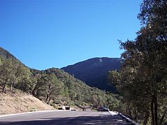
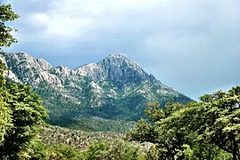
Madera Canyon is a canyon in the northwestern face of the Santa Rita Mountains, twenty-five miles southeast of Tucson, Arizona. As part of the Coronado National Forest, Madera Canyon has campsites, picnic areas, and miles of hiking trails. The canyon is also used as a resting place for migrating birds, and it is thus known as a premier birdwatching area. Madera Canyon was originally named White House Canyon, after a prominent white adobe house was built there in the late 19th century. The canyon was renamed sometime in the early 1900s, although some locals still use the original name. [1] [2]

Contents

Flora and fauna

Bat houses in the canyon Bat Houses Madera Canyon Arizona 2014.jpg
Bat houses in the canyon

Madera Canyon is located in the Santa Rita Mountains, which is one of the largest of the Madrean Sky Islands. The canyon and its immediate surroundings are therefore home to wide variety of flora and fauna, ranging from cactus covered desert in the lower reaches of the canyon to aspen and fir forest on Mount Wrightson. [1]

With fifteen species of hummingbird, elegant trogon, sulphur-bellied flycatcher, black-capped gnatcatcher, flame-colored tanager, thirty-six species of wood warblers, and over 256 species of birds documented in total, Madera Canyon is rated the third best birding destination in the United States. Other animals that can be found in Madera Canyon include black bear, mountain lion, bobcats, white-tailed and mule deer, foxes, coatis, ring-tailed cats, raccoons, wild turkeys, squirrels, and rabbits. Sixteen species of bats have also been recorded in the canyon. [1]

Life Zones

Madera Canyon is a bowl-shaped watershed. Side-canyons funnel water from springs and runoff in seasonal streams that feed Madera Creek. This stream system and the abundant plants along its banks form a riparian corridor. The corridor descends through all of the canyon's four life zones and creates excellent wildlife habitat. [3]

History

USGS map of southeastern Arizona including Madera Creek, c.1910. USGS Map of Santa Rita and Patagonia Mts 1910.jpg
USGS map of southeastern Arizona including Madera Creek, c.1910.
A bedrock mortar along Madera Creek. Bedrock Mortar Madera Canyon Arizona 2014.jpg
A bedrock mortar along Madera Creek.

The Santa Rita Mountains were filled with prospectors in the early 1900s, with over a dozen mines operating in Madera Canyon alone. One was owned by a colorful character named Ben Daniels, who had once served as a marshal in Dodge City, Tombstone, and other rough Western towns, and had fought in the Spanish–American War with the Rough Riders. Daniels later built a home in Madera Canyon and was elected sheriff of Pima County in 1920. His wife became the Pima County Superintendent of Schools. [4] [5] [6]

The Pennington family lived in the area in the 1870s [7] and a daughter, Larcena Pennington Page, was kidnapped by Apaches, tortured, and left for dead. She survived and made it back to her family. [8] [7] Josephine Peak is named for another daughter, Josephine Pennington. [9] [7] Other well-known places are named after miners, ranchers, and settlers. Sprung Spring was named after the Sprung family, for it is thought that it was they who first improved it. Mount Wrightson was originally named 'Old Baldy' after Captain Richard Ewell, who bore the same name, and was stationed at Ft. Buchanan in the 1850s. But his service in the CSA[ clarification needed ] denied his name being attached to the peak. William Wrightson, who brought Arizona's first press around South America, and who later ventured in mining, was killed alongside of Gilbert Hopkins in 1865. It was their names which were assigned to the two prominent mountains nearby.

In 1905, Madera Canyon and the Santa Rita Mountains became a part of the new National Forest System. In 1911, a Tucson businessman formed a group of backers who built several cabins in the canyon on land leased from the United States Forest Service (USFS). Over the next few years, the roads were improved, automobiles came into use and Madera Canyon became a popular summer destination. Moreover, under the 1915 Occupancy Permits Act, the USFS had encouraged construction of recreational residences (summer cabins). In 1922, the Santa Rita Trails Resort was built. The original lodge later burned down, but in 1929 it was rebuilt as a year-round resort with cottages, cabins, a restaurant, a general store, a gas station and a post office. In the 1930s, Madera Canyon was home to a Civilian Conservation Corps camp. Many of the rock walls they built still exist. [4]

The USFS continued to develop utilities and improve roads, but in the 1960s, ceased issuing new building permits. Some of the privately built summer cabins had become year-round homes, increasingly for retirees. There was concern that the impact of homes in the canyon led to erosion, sewage, and water supply problems. However, the unimproved picnic areas were also considered a source of pollution. Entering the 1970s, USFS policy shifted further to public use, repurposing and "re-wildernessing" the canyon for camping and hiking. Over fifty private cabins on public land were evacuated and demolished between 1984 and 1991. The few remaining homes in Madera Canyon are on private land. [4] [10] [11] [12]

The White House in the late 1880s. White House Madera Canyon Arizona Late 1880s.jpg
The White House in the late 1880s.
The White House
The remains of the White House in 2014. White House Ruins Last Wall Madera Canyon Arizona 2014.jpg
The remains of the White House in 2014.

The White House was one of the "first permanent structures" built in Madera Canyon. It is thought to have been constructed by a sheepherder named Walden in the late 1870s or early 1880s. Walden left around 1882 and the two or three room house was taken over by Theodore Wellish and his family as a summer retreat. Wellish owned the White House Mercantile Company in Tucson, and thus it was assumed that he was the one who whitewashed the adobe building, giving it its name. The White House was well known and easily recognizable, and so it became a landmark for determining the location of the many different mining claims in and around the area. [13]

Two brothers named Atondo and Rufino Paz also lived at the White House at different times around the turn of the century. After their marriage in 1911, the sixty-one-year-old Alcaro Morales, and his twenty-seven-year-old bride named Benita, moved into the house. Alcaro delivered their five children in the home. Tragically, both Benita and her fifth child died during childbirth in 1921. She and her newborn son were buried together in a small plot near the house. The rest of the family continued to live in the house until Alcaro's death in 1940 at the age of ninety. [13]

In 2002, the USFS and the non-profit organization Friends Of Madera Canyon conducted an archeological dig at the site of the house. Only a small portion of one wall remains standing, but they were able to determine where the outside walls and the house's front door had been. The site of the house is near the Proctor Road crossing in Madera Canyon, and can be accessed by a short, paved pathway. [13]

See also

Related Research Articles

<span class="mw-page-title-main">Tucson, Arizona</span> City in Arizona, United States

Tucson is a city in and the county seat of Pima County, Arizona, United States, and is home to the University of Arizona. It is the second-largest city in Arizona behind Phoenix, with a population of 542,629 in the 2020 United States census, while the population of the entire Tucson metropolitan statistical area (MSA) is 1,043,433. The Tucson MSA forms part of the larger Tucson-Nogales combined statistical area. Both Tucson and Phoenix anchor the Arizona Sun Corridor. The city is 108 miles (174 km) southeast of Phoenix and 60 mi (97 km) north of the United States–Mexico border. Tucson is the 34th-largest city and the 53rd-largest metropolitan area in the United States (2014).

<span class="mw-page-title-main">Larcena Pennington Page</span> American pioneer (1837–1913)

Larcena Pennington Page, born Larcena Ann Pennington, was an American pioneer known for surviving a kidnapping by Apache as a young married woman of 23 years old in present-day Arizona. Left for dead and unable to stand, she crawled 15 miles (24 km) over the next sixteen days to reach safety.

<span class="mw-page-title-main">Santa Rita Mountains</span> Landform in Pima and Santa Cruz counties, Arizona

The Santa Rita Mountains, located about 65 km (40 mi) southeast of Tucson, Arizona, extend 42 km (26 mi) from north to south, then trending southeast. They merge again southeastwards into the Patagonia Mountains, trending northwest by southeast. The highest point in the range, and the highest point in the Tucson area, is Mount Wrightson, with an elevation of 9,453 feet, The range contains Madera Canyon, one of the world's premier birding areas. The Smithsonian Institution's Fred Lawrence Whipple Observatory is located on Mount Hopkins. The range is one of the Madrean sky islands.
<span class="mw-page-title-main">Coronado National Forest</span> Managed forest in southern Arizona and New Mexico

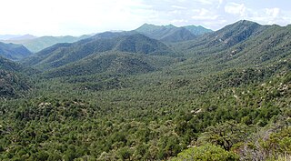
The Coronado National Forest is a United States National Forest that includes an area of about 1.78 million acres (7,200 km2) spread throughout mountain ranges in southeastern Arizona and southwestern New Mexico.

<span class="mw-page-title-main">Santa Catalina Mountains</span> Mountain range in Pima and Pinal counties, Arizona, United States

The Santa Catalina Mountains, commonly referred to as the Catalina Mountains or the Catalinas, are north and northeast of Tucson in Arizona, United States, on Tucson's north perimeter. The mountain range is the most prominent in the Tucson area, with the highest average elevation. The highest point in the Catalinas is Mount Lemmon at an elevation of 9,157 feet (2,791 m) above sea level and receives 18 inches (46 cm) of precipitation annually.

<span class="mw-page-title-main">Tucson Mountains</span> Landform in Pima County, Arizona

The Tucson Mountains are a minor mountain range west of Tucson, Arizona, United States. The Tucson Mountains, including Wasson Peak, are one of four notable mountain ranges surrounding the Tucson Basin. The Santa Catalina Mountains lie to the northeast, the Rincon Mountains are to the east of Tucson, and the Santa Rita Mountains lie to the south. Additionally, the Sierrita Mountains lie due south, the Roskruge Mountains lie to the west across Avra Valley, the Silver Bell Mountains lie to the northwest, and the Tortolita Mountains lie to the north across the Santa Cruz Valley.

<span class="mw-page-title-main">Tortolita Mountains</span> Landform in Pinal and Pima Counties, Arizona

The Tortolita Mountains are a modest mountain range northwest of Tucson, Arizona, USA, at the northern boundaries of Oro Valley and Marana, two suburbs of Tucson. Peak elevation is 4,696 feet. Much of the mountain range is protected within the Tortolita Mountain Park, established in 1986 by Pima County, which plans to expand its territory.

<span class="mw-page-title-main">Summerhaven, Arizona</span> CDP in Pima County, Arizona

Summerhaven is a small unincorporated community and census-designated place (CDP) on Mount Lemmon in the Santa Catalina Mountains north of Tucson in Pima County, Arizona, United States. As of the 2010 census it had a permanent population of 40. Summerhaven sits at an elevation of approximately 7,600 to 8,200 feet above sea level. Summerhaven is accessed via the Catalina Highway from suburban northeast Tucson, and it is about 24.5 miles (39.4 km) from the base of the mountains to Summerhaven.

<span class="mw-page-title-main">Mount Wrightson</span> Landform, Santa Rita Mountains, southern Arizona

Mount Wrightson is a 9,456-foot (2,882 m) peak in the Santa Rita Mountains within the Coronado National Forest, in southern Arizona, United States.

The Catalina Highway, officially the General Hitchcock Highway, is the popular name for a Forest Highway and scenic route located in Pima County in southern Arizona. Also known as the Sky Island Scenic Byway, the Mount Lemmon Highway and Arizona Forest Highway 39, the Catalina Highway is the only paved roadway providing access to the resort village of Summerhaven as well as various recreational and scientific facilities located near the summit of Mount Lemmon. Ascending from the desert floor in Tucson to near the summit of Mount Lemmon, the short highway gains over 6,000 ft (1.8 km), showcasing a variety of climates ranging from lowland desert to alpine forests. The name sky island comes from the analogy of these mountains being like islands of forest in a sea of desert. It is designated as a scenic byway by the National Scenic Byways Program. and an Arizona Scenic Road by the Federal Highway Administration.

<span class="mw-page-title-main">Kentucky Camp, Arizona</span> United States historic place

Kentucky Camp is a ghost town and former mining camp along the Arizona Trail in Pima County, Arizona, United States, near the community of Sonoita. The Kentucky Camp Historic District is listed on the National Register of Historic Places and has been since 1995. As it is located within Coronado National Forest, the United States Forest Service is responsible for the upkeep of the remaining buildings within the Kentucky Camp Historic District.

<span class="mw-page-title-main">Geography of Arizona</span> Geographical features of Arizona

Arizona is a landlocked state situated in the southwestern region of the United States of America. It has a vast and diverse geography famous for its deep canyons, high- and low-elevation deserts, numerous natural rock formations, and volcanic mountain ranges. Arizona shares land borders with Utah to the north, the Mexican state of Sonora to the south, New Mexico to the east, and Nevada to the northwest, as well as water borders with California and the Mexican state of Baja California to the southwest along the Colorado River. Arizona is also one of the Four Corners states and is diagonally adjacent to Colorado.

Rosemont Copper is a proposed large open pit copper mine project by the Canadian mining corporation Hudbay Minerals. The project site is located within the Santa Rita Mountains and Coronado National Forest, in Pima County of southern Arizona. It has undergone a permitting review process under the direction of the United States Forest Service and the U.S. Army Corps of Engineers and has been delayed by legal judgements and suspension of its operating permit by the US Army Corps of Engineers.

<span class="mw-page-title-main">Santa Rita Experimental Range and Wildlife Area</span> Experimental Rangeland and Research Station in Pima County, Arizona

The Santa Rita Experimental Range and Wildlife Area is the longest continuously active rangeland research facility and among the five oldest biological field stations in the United States. Located south of Tucson in Pima County, Arizona, the 52,000 acre Santa Rita Experimental Range (SRER) was founded in 1903 and administered by the United States Forest Service until 1987, when the University of Arizona College of Agriculture took over administration of the site. The mission at the SRER is "to advance research and education on the ecology and management of desert rangelands through the secure, long-term access to research areas, state-of-the-art facilities, new discoveries, and research legacies."

<span class="mw-page-title-main">Continental, Arizona</span> Populated place in Arizona, United States

Continental is a populated place located about 25 mi (40 km) south of Tucson, in Pima County, Arizona, near the town of Sahuarita and the retirement community of Green Valley. Once a center for cotton production, Continental is now nearly surrounded by large pecan orchards and Green Valley subdivisions. It is also the closest town to Madera Canyon, a premier birdwatching area and tourist attraction located in the Santa Rita Mountains.

<span class="mw-page-title-main">Ciénega Creek</span> Intermittent stream in southern Arizona

Ciénega Creek is an intermittent stream located in the Basin and Range region of southern Arizona, and is one of the most intact riparian corridors left in the state. It originates in the Canelo Hills and continues northwest about 50 miles (80 km) to an area just outside Tucson, where it becomes known as Pantano Wash. Pantano Wash continues through Tucson and eventually connects with the Rillito River.
<span class="mw-page-title-main">Molino Canyon</span> Valley in Pima County, Arizona

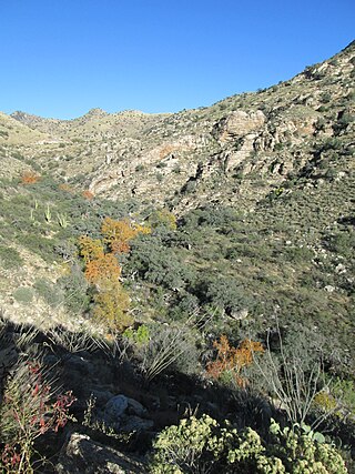
Molino Canyon is a steep-sided, boulder-strewn canyon in the Santa Catalina Mountains northeast of Tucson, Arizona, next to the Molino Basin Campground. The canyon is located within the Coronado National Forest, and encompasses a wide variety of flora and fauna, ranging from lush pine forest in the canyon's upper reaches to Sonoran Desert cactus forest in the lower reaches. Catalina Highway was cut into the western side of the lower part of the canyon.

Madera Canyon is a populated place situated in the Santa Rita Mountains of Santa Cruz County, Arizona, United States. It has an estimated elevation of 4,911 feet (1,497 m) above sea level. It is located within a canyon of the same name, Madera Canyon, in the Coronado National Forest.

References

  1. 1 2 3 "Welcome to Friends of Madera Canyon". Archived from the original on 2014-03-09. Retrieved 2014-03-08.
  2. "Madera Canyon, AZ" . Retrieved 2014-03-08.
  3. "Welcome to Friends of Madera Canyon – Sky Islands" . Retrieved 2014-03-08.
  4. 1 2 3 "Welcome to Friends of Madera Canyon – Cultural History" . Retrieved 2014-03-08.
  5. Scott Dyke. "Scott Dyke: Rich history in Madera Canyon, Santa Ritas, Part 2" . Retrieved 2014-03-08.
  6. "Pima County Sheriff's Department – Keeping the Peace Since 1865: Sheriffs Then and Now" (PDF). Archived from the original (PDF) on 2012-03-23. Retrieved 2014-03-08.
  7. 1 2 3 David Rookhuyzen (10 July 2017). "History at Sopori: Pioneers helped write state's story". Green Valley News. Retrieved 9 September 2021.
  8. "Tread softly". AZ: The History of Arizona Podcast (Podcast). 30 May 2021. Event occurs at 19:45. Retrieved 9 September 2021.
  9. "Josephine Peak" (PDF). Green Valley Recreation Hiking Club. June 2019. Retrieved 8 September 2021.
  10. Cline, Harry (25 Nov 1972). "The Coronado is Losing Its Cool". Tucson Daily Citizen : 13–14. Retrieved 2023-01-13. With the increasing demand [for public recreation] it is becoming increasingly evident that the same things that make the sites attractive for summer homes make it equally attractive for camping or picnic sites.
  11. "75 Still Facing Eviction from Madera Canyon". Arizona Daily Star : 17. 22 May 1974. Retrieved 2023-01-13. For the second time, Coronado National Forest officials have told 75 Madera Canyon residents that they must leave their homes by 1983 to make room for public recreation and to preserve the canyon's environment.
  12. "Cabin owners seek to halt Madera Canyon evictions". Tucson Daily Citizen : 17. 31 Mar 1973. Retrieved 2023-01-13. In announcing the eviction deadline, Forest Service spokesmen said that the land now occupied by cabins would be needed to allow room for projected increases in public use of the recreation area. ... Perkins blamed most pollution on picknickers who use an area upstream from the summer home area.
  13. 1 2 3 "Welcome to Friends of Madera Canyon – White House". Mark Staples. Retrieved 2014-03-08.