
The Sardar Sarovar Dam is a concrete gravity dam built on the Narmada River near the town of Kevadiya, in Narmada District, in the Indian state of Gujarat. The dam was constructed to provide water and electricity to the Indian states of Gujarat, Madhya Pradesh, Maharashtra and Rajasthan.

Madhav National Park is situated in Shivpuri District of Gwalior division in northwest Madhya Pradesh, India. Two national highways pass through the park, the Agra to Bombay former National Highway 3 and the Jhansi to Shivpuri National Highway 27.

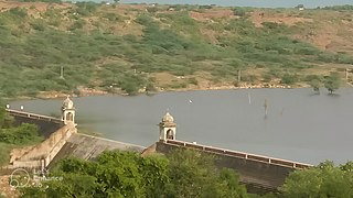
Anuppur District (अनूपपुर) is an administrative district in Shahdol Division of Madhya Pradesh state in central India.

Rajgarh district is a district of Madhya Pradesh in central India. The city of Rajgarh is the administrative headquarters of the district. The old name of Rajgarh was Jhanjhanipur. Rajgarh in Madhya Pradesh is one of the aspirational districts selected by Government of India. The district has an area of 6,154 km² and the population is 1,545,814. The district lies on the northern edge of the Malwa plateau, and the Parbati River forms the eastern boundary of the district, while the Kali Sindh River forms the western boundary. The district has seven tehsils, Rajgarh, Khilchipur, Jirapur, Biaora, Narsinghgarh, Sarangpur and Pachore. The district is bounded by Rajasthan state to the north, and by the districts of Guna to the northeast, Bhopal to the east, Sehore to the southeast, and Shajapur to the south and west. It is part of Bhopal Division. There are 1728 villages in Rajgarh.

Shivpuri District is a district of Madhya Pradesh state of India. The town of Shivpuri is the district headquarters. National Highway 3 (NH-3) runs through the district.

Sehore District is a district of Madhya Pradesh state in central India. The town of Sehore is the district headquarters. The district is part of Bhopal Division.
The Indira Sagar Dam is the largest dam in India, in terms of volume of water stored in the reservoir. It is located on the Narmada River at the town of Narmada Nagar, Punasa in the Khandwa district of Madhya Pradesh in India. The foundation stone of the project was laid by the prime minister of India Indira Gandhi on 23 October 1984. The construction of the main dam started in 1992. The downstream projects of ISP are Omkareshwar, Maheshwar, and Sardar Sarovar Project. To build it, a town of 22,000 people and 100 villages was displaced.
Karera is a municipality or Nagar Parishad in the Shivpuri district of the Indian state of Madhya Pradesh.

Mundi is a city and Tehsil in the Khandwa district of Nimar region the Indian state of Madhya Pradesh. It is situated in North Side of East Nimar District.
Sabalgarh is a municipality in Morena district in the Indian state of Madhya Pradesh.

The Kingdom of Haihaiyavansi, ruled by the Kalachuris of Raipur was a Garh Under Garha Kingdom which consisted of the central part of the present-day state of Chhattisgarh located in India.
Ratangarh is a village in the district of Datia, in Madhya Pradesh, India. The village is located in Tehsil Seondha near the Sindh river. The village is located about 60 km from Datia city.

Puadh is a historic region in north India that comprises parts of present-day Punjab, Haryana, Uttar Pradesh, Himachal Pradesh and the U.T. of Chandigarh, India. It has the Sutlej river in its north and covers the regions immediately south of the Ghaggar river. The people of the area are known as Puadhi and speak the Puadhi dialect of Punjabi. The capital cities of Puadh region are Rupnagar, Fatehgarh Sahib, Mohali, Patiala, Sangrur, Mansa Chandigarh, Nalagarh, Panchkula, Baddi, Ambala, Yamunanagar.

The Matatila Dam is a dam in district Lalitpur, Uttar Pradesh, India, that was built in 1958 on the Betwa River. Situated 50 km from Jhansi and 93 km away from Deogarh, this earthen dam is 35 m high. The dam has 23 Spillway gates. The catchment area is around 20 km2 with a maximum storage capacity of 1132 million cubic metres.

The Upper Wardha Dam is an earthfill straight gravity dam across the Wardha River, a tributary of the Godavari River, near Simbhora village in Morshi taluk in Amravati district in the Indian state of Maharashtra. The dam provides multipurpose benefits of irrigation, drinking water supply, flood control and hydropower generation.

Dewas State was a territory within Central India, which was the seat of two Maratha princely states during the British Raj. After the Maratha conquest of Central India, Dewas was divided into two states - Dewas Junior ruled by Jivaji Rao Puar and Dewas Senior ruled by Tukoji Rao Puar. On 12 December 1818, the 2 Dewas States became British protectorates.
Dewas Junior was established by Jivaji Rao I Puar in 1728 during the Maratha conquest of Central India. It was a 15-gun salute Maratha princely state. On 12 December 1818, it became a British protectorate.

Raghogarh State, also known as Raghugarh and as Khichiwara, was a princely state of the Gwalior Residency, under the Central India Agency of the British Raj. It was a Thikana state of about 109 km2 with 19,446 inhabitants in 1901. The Parbati River marked the western border of the state. The capital was at Raghogarh in the present-day Guna district of Madhya Pradesh.

Bakhatgarh is a town and former princely state in the Dhar district, Madhya Pradesh, India. The royal family of Bakhatgarh belongs to Mahipawat sub-clan of Paramara Rajputs. They are descendants of King Bhoja.
Mohan Singh was the last ruler of the Haihaiyavanshi Kingdom, the dynasty which ruled Chhattisgarh for over 700 years. He ruled Chhattisgarh under the suzerainty of the Bhonsles of Nagpur Kingdom.
Local sources and Archeological surveys of India .

