
Shelby County Airport is a public use airport located four nautical miles (7 km) southeast of the central business district of Alabaster, a city in Shelby County, Alabama, United States. It is owned by the Shelby County Commission. The airport is situated in the city of Calera.

Bessemer Airport is a city-owned public-use airport located three nautical miles southeast of the central business district of Bessemer, a city in Jefferson County, Alabama, United States. According to the FAA's National Plan of Integrated Airport Systems for 2009–2013, it is categorized as a reliever airport for the Birmingham-Shuttlesworth International Airport.

Henderson Executive Airport is a public use government airport located in Henderson, Nevada, 13 miles south of Las Vegas, in Clark County, Nevada. The airport is owned by the Clark County Commission and operated by the Clark County Department of Aviation. The FAA's National Plan of Integrated Airport Systems for 2009-2013 categorized it as a reliever airport. It was originally Sky Harbor Airport, but was renamed in 1996 when the Clark County Commission bought it to be a reliever airport for McCarran International Airport.
Charlotte–Monroe Executive Airport is a public use airport located five nautical miles (9 km) northwest of the central business district of Monroe, a city in Union County, North Carolina, United States. It is owned by the City of Monroe and was formerly known as Monroe Regional Airport.
Person County Airport, also known as Raleigh Regional Airport at Person County, is a county-owned, public-use airport in Person County, North Carolina, United States. It is located six nautical miles (11 km) south of the central business district of Roxboro.
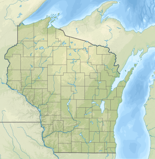
Taylor County Airport is a county-owned public-use airport located three nautical miles southeast of the central business district of Medford, a city in Taylor County, Wisconsin, United States.

Jack Edwards Airport is a public use airport in Baldwin County, Alabama, United States. It is owned by Gulf Shores Airport Authority and located two nautical miles (4 km) north of the City of Gulf Shores. Also known as Jack Edwards National Airport, it is included in the National Plan of Integrated Airport Systems for 2011–2015, which categorized it as a general aviation facility.
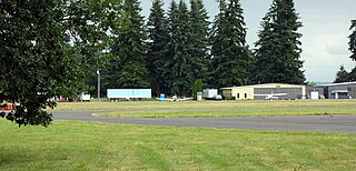
Bend Municipal Airport is six miles (9.7 km) northeast of Bend, in Deschutes County, Oregon. The FAA's National Plan of Integrated Airport Systems for 2009–2013 categorizes it as a general aviation facility. Bend is home to Epic Aircraft and X-Air.

Grant County Regional Airport - GCRA is in Grant County, Oregon, a mile southwest of John Day, Oregon. The National Plan of Integrated Airport Systems for 2011–2015 categorized it as a general aviation facility.
Scappoose Airport is a public use airport located one nautical mile (1.85 km) northeast of the central business district of Scappoose, in Columbia County, Oregon, United States. It is owned and operated by the Port of Columbia County, an Oregon port district and municipal corporation, on behalf of district residents. According to the FAA's National Plan of Integrated Airport Systems for 2009–2013, it is categorized as a general aviation airport.

Tillamook Airport is a public use airport located 3 miles (4.8 km) south of the central business district of Tillamook, a city in Tillamook County, Oregon, United States. It is owned by the Port of Tillamook Bay. According to the FAA's National Plan of Integrated Airport Systems for 2009–2013, it is categorized as a general aviation facility.

Monticello Municipal Airport, also known as Ellis Field, is a public-use airport located two nautical miles east of the central business district of Monticello, in Drew County, Arkansas, United States. It is owned by the City of Monticello.

Philadelphia Municipal Airport is a public use airport in Neshoba County, Mississippi, United States. It is owned by the City of Philadelphia and located two nautical miles (4 km) northwest of its central business district. This airport is included in the National Plan of Integrated Airport Systems for 2011–2015, which categorized it as a general aviation facility.
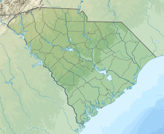
Beaufort Executive Airport is a county-owned, public-use airport in Beaufort County, South Carolina, United States. The airport is located on Lady's Island, 3 nautical miles southeast of the central business district of Beaufort, South Carolina. It is also known as Frogmore Island Airport or Frogmore Intranational Airport.
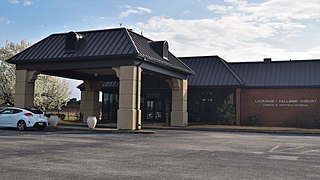
LaGrange Callaway Airport is a public airport three miles southwest of LaGrange, in Troup County, Georgia. The FAA's National Plan of Integrated Airport Systems for 2009-2013 called it a general aviation airport.

Bentonville Municipal Airport is a city-owned, public-use airport located two nautical miles (3.7 km) south of the central business district of Bentonville, a city in Benton County, Arkansas, United States. It is also known as Louise M. Thaden Field or Louise Thaden Field, a name it was given in 1951 to honor Louise McPhetridge Thaden (1905–1979), an aviation pioneer from Bentonville.

Red Oak Municipal Airport is a city-owned public-use airport located two nautical miles (3.7 km) west of the central business district of Red Oak, a city in Montgomery County, Iowa, United States. According to the FAA's National Plan of Integrated Airport Systems for 2009–2013, it is categorized as a general aviation facility.

Bruce Brothers Huntsville Regional Airport, also known as Huntsville Municipal Airport, is a city-owned, public-use airport located two nautical miles (4 km) northwest of the central business district of Huntsville, a city in Walker County, Texas, United States. It is included in the National Plan of Integrated Airport Systems for 2011–2015, which categorized it as a general aviation facility.

Madison Municipal Airport is a city-owned public use airport located one nautical mile northeast of the central business district of Madison, a city in Lake County, South Dakota, United States. This airport is included in the FAA's National Plan of Integrated Airport Systems for 2009–2013, which categorized it as a general aviation facility.
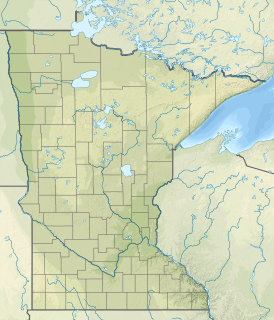
Lac qui Parle County Airport is a public use airport in Lac qui Parle County, Minnesota, United States. Also known as Bud Frye Field, it is located two nautical miles (4 km) southeast of the central business district of Madison. The airport opened in 2001 and it is owned by Lac qui Parle County and the cities of Madison and Dawson.
