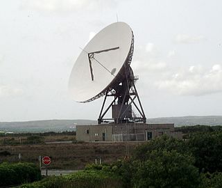
Goonhilly Satellite Earth Station is a large radiocommunication site located on Goonhilly Downs near Helston on the Lizard peninsula in Cornwall, England. Owned by Goonhilly Earth Station Ltd under a 999-year lease from BT Group plc, it was at one time the largest satellite earth station in the world, with more than 30 communication antennas and dishes in use. The site also links into undersea cable lines.

A satellite dish is a dish-shaped type of parabolic antenna designed to receive or transmit information by radio waves to or from a communication satellite. The term most commonly means a dish which receives direct-broadcast satellite television from a direct broadcast satellite in geostationary orbit.

The McMurdo Station is a United States Antarctic research station on the south tip of Ross Island, which is in the New Zealand–claimed Ross Dependency on the shore of McMurdo Sound in Antarctica. It is operated by the United States through the United States Antarctic Program, a branch of the National Science Foundation. The station is the largest community in Antarctica, capable of supporting up to 1,258 residents, and serves as one of three year-round United States Antarctic science facilities. All personnel and cargo going to or coming from Amundsen–Scott South Pole Station first pass through McMurdo. By road, McMurdo is 3 kilometres (1.9 mi) from New Zealand's smaller Scott Base.

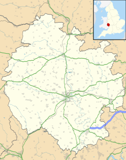
Herefordshire is a county in the West Midlands of England, governed by Herefordshire Council. It is bordered by Shropshire to the north, Worcestershire to the east, Gloucestershire to the south-east, and the Welsh counties of Monmouthshire and Powys to the west.

The Goldstone Deep Space Communications Complex (GDSCC), commonly called the Goldstone Observatory, is a satellite ground station located in the Mojave Desert near Barstow in the U.S. state of California. Operated by NASA's Jet Propulsion Laboratory (JPL), its main purpose is to track and communicate with interplanetary space missions. It is named after Goldstone, California, a nearby gold-mining ghost town.

A radome is a structural, weatherproof enclosure that protects a radar antenna. The radome is constructed of material that minimally attenuates the electromagnetic signal transmitted or received by the antenna, effectively transparent to radio waves. Radomes protect the antenna from weather and conceal antenna electronic equipment from view. They also protect nearby personnel from being accidentally struck by quickly rotating antennas.
Satellite Internet access is Internet access provided through communication satellites. Modern consumer grade satellite Internet service is typically provided to individual users through geostationary satellites that can offer relatively high data speeds, with newer satellites using Ku band to achieve downstream data speeds up to 506 Mbit/s. In addition, new satellite internet constellations are being developed in low-earth orbit to enable low-latency internet access from space.

A ground station, Earth station, or Earth terminal is a terrestrial radio station designed for extraplanetary telecommunication with spacecraft, or reception of radio waves from astronomical radio sources. Ground stations may be located either on the surface of the Earth, or in its atmosphere. Earth stations communicate with spacecraft by transmitting and receiving radio waves in the super high frequency (SHF) or extremely high frequency (EHF) bands. When a ground station successfully transmits radio waves to a spacecraft, it establishes a telecommunications link. A principal telecommunications device of the ground station is the parabolic antenna.

The Canberra Deep Space Communication Complex (CDSCC) is a satellite communication station, part of the Deep Space Network of NASA's Jet Propulsion Laboratory (JPL), located at Tidbinbilla in the Australian Capital Territory. Opened in 1965, the complex was used for tracking the Apollo Lunar Module, and along with its two sister stations at Goldstone, California and Madrid, Spain is now used for tracking and communicating with NASA's spacecraft, particularly interplanetary missions. Its DSS-43 antenna is the only antenna on Earth that can send commands to Voyager 2. It is managed in Australia by the Commonwealth Scientific and Industrial Research Organisation (CSIRO).

Argos is a satellite-based system which collects, processes and disseminates environmental data from fixed and mobile platforms worldwide. Besides satellite data collection, the Argos system's main feature is the ability to geographically locate the data source from any location on Earth using the Doppler effect.

The BT Tower, formerly known as the Post Office Tower and the GPO Tower, is a landmark and telecommunications tower in Birmingham, England. It is the tallest structure in the city. Its post office code was YBMR.

Martlesham Heath village is situated 6 miles (10 km) east of Ipswich, in Suffolk, England. This was an ancient area of heathland and latterly the site of Martlesham Heath Airfield. A "new village" was established there in the mid-1970s and this has developed into a modern community, based on a traditional village pattern. The population is still included in that of Martlesham. The village is also part of the wider Ipswich Built-up area.

The concept of television was the work of many individuals in the late 19th and early 20th centuries, with its roots initially starting from back even in the 18th century. The first practical transmissions of moving images over a radio system used mechanical rotating perforated disks to scan a scene into a time-varying signal that could be reconstructed at a receiver back into an approximation of the original image. Development of television was interrupted by the Second World War. After the end of the war, all-electronic methods of scanning and displaying images became standard. Several different standards for addition of color to transmitted images were developed with different regions using technically incompatible signal standards. Television broadcasting expanded rapidly after World War II, becoming an important mass medium for advertising, propaganda, and entertainment.

For people with the surname, see Madley (surname).

Adastral Park is a science campus based on part of the old Royal Air Force Station at Martlesham Heath, near Ipswich in the English county of Suffolk.

Satellite television is a service that delivers television programming to viewers by relaying it from a communications satellite orbiting the Earth directly to the viewer's location. The signals are received via an outdoor parabolic antenna commonly referred to as a satellite dish and a low-noise block downconverter.

Umuwa is an Aboriginal community in Anangu Pitjantjatjara Yankunytjatjara in South Australia, serving as an administrative centre for the six main communities on "The Lands", as well as the outlying communities.

Royal Air Force Madley, or more simply RAF Madley, was a Royal Air Force station situated 6.2 miles (10 km) south west of Hereford in Herefordshire, England. The station was in use during the Second World War as a training base and was located between the villages of Kingstone and Madley.

BT Research is the research arm of BT Group, formerly part of the British Post Office. The company was first established in 1921 as the Post Office Research Station at Dollis Hill, London. In 1968 BT moved of its research to the new site at Martlesham Heath based on part of the old Royal Air Force Station at Martlesham Heath near Ipswich in the English county of Suffolk, which was later renamed Adastral Park.

Telstar is the name of various communications satellites. The first two Telstar satellites were experimental and nearly identical. Telstar 1 launched on top of a Thor-Delta rocket on July 10, 1962. It successfully relayed through space the first television pictures, telephone calls, and telegraph images, and provided the first live transatlantic television feed. Telstar 2 launched May 7, 1963. Telstar 1 and 2—though no longer functional—still orbit the Earth.


