Maillardville

Last updated

Maillardville
Our Lady of Lourdes on Laval Square in Maillardville, B. C..JPG
Notre Dame de Lourdes Church on Laval Square
15 Metro Vancouver Regional District British Columbia.svg
Red pog.svg
Location of Maillardville within Metro Vancouver
Coordinates: 49°14′15″N122°52′01″W / 49.2374°N 122.867°W / 49.2374; -122.867
CountryFlag of Canada (Pantone).svg  Canada
ProvinceFlag of British Columbia.svg  British Columbia
Region Lower Mainland
Regional district Metro Vancouver
City Coquitlam
Named for Edmond Maillard
Government
   Mayor Richard Stewart
   MP (Fed.) Bonita Zarrillo (NDP)
   MLA (Prov.) Selina Robinson (NDP)
Population
 (2016) [1] [2] [3]
  Total14,975
Time zone UTC−8 (PST)
  Summer (DST) UTC−7 (PDT)
Postal code span
V3K
Area codes 604, 778, 236, 672
Website maillardville.com

Maillardville is a community on the south slope of the city of Coquitlam, British Columbia, Canada.

Contents

History

In 1889, Frank Ross and James McLaren opened what would become Maillardville, a $350,000, modern lumber mill on the north bank of the Fraser River. By 1908, a mill town of 20 houses, a store, post office, hospital, office block, barber shop, pool hall and a Sikh temple [4] had grown around the mill. A mill manager's residence was built that later became Place des Arts. [5] A second mill manager's residence was built in 1909 and is now known as Mackin House, a historic house museum operated by the Coquitlam Heritage Society.

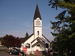
In 1909, Ross and McLaren, in search of workers for the Canadian Western Lumber Company, recruited a contingent of 110 French Canadian mill workers from Eastern Ontario and Quebec. [6] Approximately 40 French Canadian families settled in present-day Maillardville in 1909, with another contingent arriving in June 1910. [6] Named for Father Edmond Maillard, a young Oblate from France, it became the largest Francophone centre west of Manitoba. [7] Similarly, in the early 1900s, many Punjabis came to work in the mills and settled on the south slope of Coquitlam. [4]

In 1971, the City of Coquitlam and the Village of Fraser Mills were amalgamated, which gave the city a larger tax base. The mill closed in 2001, and is now rezoned into a residential area. [5] Maillardville's past is recognized today in street names, the Francophone education system and French immersion programs, French-language guides and scouts, and celebrations such as Festival du Bois. [8]

Maillardville celebrated its 100th birthday in 2009. [9]

In 2014, the City of Coquitlam updated the Maillardville neighbourhood plan. The city anticipates a population growth of 6,000 over the next two decades. [10]

Geography

Maillardville is bordered by Austin Avenue to the north and Lougheed Highway to the south. To the west it is flanked by Blue Mountain Street, while to the east it is bordered by Mundy Road. The town centre of Maillardville is situated in the southwest corner of the neighbourhood, on Brunette Avenue between Lougheed Highway and Woolridge Street. [11]

Demographics

Population

Population history
YearPop.±%
2006 14,014    
2011 14,500+3.5%
2016 14,975+3.3%
Source: Statistics Canada [12] [13] [1] [2] [3]

Ethnicity

Ethnic groups in Maillardville (2016) [14] [15] [16]
Ethnic groupPopulation %
European 8,055
East Asian 2,825
Southeast Asian 1,275
South Asian 980
Aboriginal 620
Middle Eastern 475
Latin American 280
Black 245
Other295
Total population14,975

Language

Languages spoken in Maillardville (2016) [17] [18] [19]
Language %
English 59.5%
Korean 5.1%
Mandarin 4.7%
Cantonese 4.7%
Tagalog 4.1%
Punjabi 3.2%
Persian 2.4%
French 1.8%
Other14.6%
Total %100%

Media

They Dream, a Canadian feature-length film, set in and around Maillardville, including Place des Arts and Mackin House Museum, was shot over the summer of 2012. Written and directed by Vancouver filmmaker Gord Stanfield, They Dream is the story of a 20-year-old art student, David Dubois, his love affair with a mysterious woman Lisa Reese, and his tragic past. Jean Ory reminds David he can't escape the truth. Lisa and Jean were lifetime residents of Maillardville. They Dream's lead cast includes Jason Mireau, Delia Tatiana and Moishe Teichman.

Notable people

See also

Related Research Articles

<span class="mw-page-title-main">Lower Mainland</span> Region in British Columbia, Canada

The Lower Mainland is a geographic and cultural region of the mainland coast of British Columbia that generally comprises the regional districts of Metro Vancouver and the Fraser Valley. Home to approximately 3.05 million people as of the 2021 Canadian census, the Lower Mainland contains sixteen of the province's 30 most populous municipalities and approximately 60% of the province's total population.

<span class="mw-page-title-main">Port Coquitlam</span> City in British Columbia, Canada

Port Coquitlam is a city in British Columbia, Canada. It is one of 21 municipalities comprising Metro Vancouver. Located 27 km (17 mi) east of Vancouver, it is on the north bank of the confluence of the Fraser River and the Pitt River. Coquitlam borders it to the north and west. Pitt Meadows lies across the Pitt River from it. Port Coquitlam is bisected by Lougheed Highway and the Canadian Pacific Kansas City railway. Port Coquitlam is often referred to as "PoCo". It is Canada's 93rd-largest municipality by population.

Campbell River is a city in British Columbia, Canada, on the east coast of Vancouver Island at the south end of Discovery Passage, which lies along the 50th parallel north along the important Inside Passage shipping route. Campbell River has a population of 32,588 and has long been touted as the "salmon capital of the world." Campbell River and Region are near the communities of Quadra and the Discovery Islands, Sayward, Oyster River, Gold River, Tahsis and Zeballos.

<span class="mw-page-title-main">Greater Vancouver</span> Metropolitan area in British Columbia, Canada

Greater Vancouver, also known as Metro Vancouver, is the metropolitan area with its major urban centre being the city of Vancouver, British Columbia, Canada. The term "Greater Vancouver" describes an area that is roughly coterminous with the region governed by the Metro Vancouver Regional District (MVRD), though it predates the 1966 creation of the regional district. It is often used to include areas beyond the boundaries of the regional district but does not generally include wilderness and agricultural areas that are included within the MVRD.

<span class="mw-page-title-main">Visible minority</span> Canadian demographic category

A visible minority is defined by the Government of Canada as "persons, other than aboriginal peoples, who are non-Caucasian in race or non-white in colour". The term is used primarily as a demographic category by Statistics Canada, in connection with that country's Employment Equity policies. The qualifier "visible" was chosen by the Canadian authorities as a way to single out newer immigrant minorities from both Aboriginal Canadians and other "older" minorities distinguishable by language and religion, which are "invisible" traits.

<span class="mw-page-title-main">Cowichan Valley Regional District</span> Regional district in British Columbia, Canada

The Cowichan Valley Regional District is a regional district in the Canadian province of British Columbia that is on the southern part of Vancouver Island, bordered by the Nanaimo and Alberni-Clayoquot Regional Districts to the north and northwest, and by the Capital Regional District to the south and east. As of the 2021 Census, the Regional District had a population of 89,013. The regional district offices are in Duncan.

<span class="mw-page-title-main">South Asian Canadians</span> Ethnic group

South Asian Canadians are Canadians who were either born in or can trace their ancestry to South Asia or the Indian subcontinent, which includes the nations of India, Pakistan, Bangladesh, Afghanistan, Nepal, Bhutan, Sri Lanka and the Maldives. The term also includes immigrants from South Asian communities in East and South Africa, Guyana, Trinidad and Tobago, Fiji, Mauritius and the rest of the world.

<span class="mw-page-title-main">New Westminster—Burnaby</span> Federal electoral district in British Columbia, Canada

New Westminster—Burnaby is a federal electoral district in British Columbia, Canada, that was represented in the House of Commons of Canada from 1988 to 1997 and since 2015.

<span class="mw-page-title-main">Port Moody—Coquitlam (federal electoral district)</span> Federal electoral district in British Columbia, Canada

Port Moody—Coquitlam is a federal electoral district in British Columbia, Canada, that was represented in the House of Commons of Canada from 1997 to 2004 and since 2015.

<span class="mw-page-title-main">Westwood Plateau</span> Neighbourhood of Coquitlam in Lower Mainland, British Columbia, Canada

Westwood Plateau is a neighbourhood in the northern region of Coquitlam, British Columbia.

The demographics of Metro Vancouver indicate a multicultural and multiracial region. Metro Vancouver is a metropolitan area, with its major urban centre being Vancouver, British Columbia, Canada. The Vancouver census metropolitan area, as defined by Statistics Canada, encompasses roughly the same territory as the Metro Vancouver Regional District, a regional district in British Columbia. The regional district includes 23 local authorities. Figures provided here are for the Vancouver census metropolitan area and not for the City of Vancouver.

<span class="mw-page-title-main">Queensborough, New Westminster</span> Neighbourhood of New Westminster in Lower Mainland, British Columbia, Canada

Queensborough is a neighbourhood in the city of New Westminster, British Columbia, Canada. It is on the eastern tip of Lulu Island on the Fraser River.

<span class="mw-page-title-main">Demographics of British Columbia</span>

British Columbia is a Canadian province with a population of about 5.6 million people. The province represents about 13.2% of the population of the Canadian population. Most of the population is between the ages of 15 and 49. About 60 percent of British Columbians have European descent with significant Asian and Aboriginal minorities. Just under 30% of British Columbians are immigrants. Over half of the population is irreligious, with Christianity and Sikhism being the most followed religions.

<span class="mw-page-title-main">Pakistani Canadians</span> Community of Canadians of Pakistani descent or with Pakistani citizenship

Pakistani Canadian refers to the community in Canada of Pakistani heritage or descent. It can also refer to people who hold dual Pakistani and Canadian citizenship. Categorically, Pakistani Canadians comprise a subgroup of South Asian Canadians which is a further subgroup of Asian Canadians.

<span class="mw-page-title-main">Demographics of Ottawa</span>

In 2021, the population of the city of Ottawa was 1,017,449. The population of the census metropolitan area, Ottawa-Gatineau, was 1,488,307.

<span class="mw-page-title-main">Coquitlam—Port Coquitlam</span> Federal electoral district in British Columbia, Canada

Coquitlam—Port Coquitlam is a federal electoral district in British Columbia. It encompasses a portion of the former electoral district of Port Moody—Westwood—Port Coquitlam.

South Asian Canadians in Metro Vancouver are the third-largest pan-ethnic group in the region, comprising 369,295 persons or 14.2 percent of the total population as of 2021. Sizable communities exist within the city of Vancouver along with the adjoining city of Surrey, which houses one of the world's largest South Asian enclaves.

<span class="mw-page-title-main">South Asian Canadians in British Columbia</span> Ethnic group

The South Asian community in British Columbia was first established in 1897. The first immigrants originated from Punjab, British India, a northern region and state in modern-day India and Pakistan. Punjabis originally settled in rural British Columbia at the turn of the twentieth century, working in the forestry and agricultural industries.

<span class="mw-page-title-main">Sikhism in Greater Vancouver</span> Religious community

Sikhism in Greater Vancouver is one of the main religions across the region, especially among the Indo-Canadian population. The Sikh community in Vancouver is the oldest, largest and most influential across Canada, having begun in the late 19th century.

Edmonds is a neighbourhood in the southeast of Burnaby, British Columbia, Canada. It is one of the city's four officially designated town centres.

References

  1. 1 2 Government of Canada, Statistics Canada (8 February 2017). "Census Profile, 2016 Census - 9330282.01 [Census tract], British Columbia and Vancouver [Census metropolitan area], British Columbia". www12.statcan.gc.ca. Archived from the original on 31 July 2021. Retrieved 15 November 2022.
  2. 1 2 Government of Canada, Statistics Canada (8 February 2017). "Census Profile, 2016 Census - 9330282.02 [Census tract], British Columbia and Vancouver [Census metropolitan area], British Columbia". www12.statcan.gc.ca. Archived from the original on 31 July 2021. Retrieved 15 November 2022.
  3. 1 2 Government of Canada, Statistics Canada (8 February 2017). "Census Profile, 2016 Census - 9330281.02 [Census tract], British Columbia and Vancouver [Census metropolitan area], British Columbia". www12.statcan.gc.ca. Retrieved 15 November 2022.
  4. 1 2 Eagland, Nick (7 April 2019). "Sikh Heritage Month: The South Asian pioneers of Fraser Mills". Vancouver Sun . Archived from the original on 12 April 2019. Retrieved 18 April 2019.
  5. 1 2 Fraser Mills: History Archived 13 October 2008 at the Wayback Machine Retrieved 15 February 2009
  6. 1 2 Kenny, Nicolas (14 June 2019). "Francophones of British Columbia". In Cooper, Celine (ed.). The Canadian Encyclopedia . Historica Canada. Archived from the original on 27 April 2020. Retrieved 23 April 2020.
  7. City of Coquitlam: History and Heritage Archived 23 February 2009 at the Wayback Machine Retrieved 15 February 2009
  8. CitySoup.ca: Coquitlam Regional History Archived 5 August 2009 at the Wayback Machine Retrieved 15 February 2009
  9. Maillardville100.com: 100 Years of History Archived 28 February 2009 at the Wayback Machine Retrieved 22 February 2009
  10. "Maillardville Neighbourhood Plan". City of Coquitlam. Archived from the original on 30 November 2022. Retrieved 15 November 2022.
  11. "Maillardville Community Profile". City of Coquitlam. Archived from the original on 15 November 2022. Retrieved 15 November 2022.
  12. "Tri-Cities Community Profile" (PDF). Archived (PDF) from the original on 18 April 2019. Retrieved 18 April 2019.
  13. "Census tract profile for 0282.00 (CT), Vancouver (CMA) and British Columbia". www12.statcan.gc.ca. Archived from the original on 31 July 2021. Retrieved 15 November 2022.
  14. Government of Canada, Statistics Canada (8 February 2017). "Census Profile, 2016 Census - 9330282.01 [Census tract], British Columbia and Vancouver [Census metropolitan area], British Columbia". www12.statcan.gc.ca. Archived from the original on 31 July 2021. Retrieved 15 November 2022.
  15. Government of Canada, Statistics Canada (8 February 2017). "Census Profile, 2016 Census - 9330282.02 [Census tract], British Columbia and Vancouver [Census metropolitan area], British Columbia". www12.statcan.gc.ca. Archived from the original on 31 July 2021. Retrieved 15 November 2022.
  16. Government of Canada, Statistics Canada (8 February 2017). "Census Profile, 2016 Census - 9330281.02 [Census tract], British Columbia and Vancouver [Census metropolitan area], British Columbia". www12.statcan.gc.ca. Retrieved 15 November 2022.
  17. Government of Canada, Statistics Canada (8 February 2017). "Census Profile, 2016 Census - 9330282.01 [Census tract], British Columbia and Vancouver [Census metropolitan area], British Columbia". www12.statcan.gc.ca. Archived from the original on 31 July 2021. Retrieved 15 November 2022.
  18. Government of Canada, Statistics Canada (8 February 2017). "Census Profile, 2016 Census - 9330282.02 [Census tract], British Columbia and Vancouver [Census metropolitan area], British Columbia". www12.statcan.gc.ca. Archived from the original on 15 November 2022. Retrieved 15 November 2022.
  19. Government of Canada, Statistics Canada (8 February 2017). "Census Profile, 2016 Census - 9330281.02 [Census tract], British Columbia and Vancouver [Census metropolitan area], British Columbia". www12.statcan.gc.ca. Archived from the original on 15 November 2022. Retrieved 15 November 2022.